

dryslot
-
Posts
58,715 -
Joined
-
Last visited
Content Type
Profiles
Blogs
Forums
American Weather
Media Demo
Store
Gallery
Posts posted by dryslot
-
-
22/20F, SN, 3.0”
-
Its real, And not amazing.
-
Beware the...............

-
 2
2
-
-
11 minutes ago, Jebman said:
CONGRATS! Super happy and elated for you all up there! Enjoy it!
I'm jeb walking right at the storms height.
-
 1
1
-
4
-
-
3 hours ago, klw said:
Have you installed?
I was happy to see this in BTV's more recent discussion:
The one change to the forecast is the expected ptype
across Rutland/Windsor counties where guidance has trended colder in
regard to a warm nose moving in aloft, with now only a small section
of southeast Windsor county forecast to see a changeover to a wintry
mix of snow, sleet, and rain from about noon through 6PM before
going back to all snow. This led to slightly higher snowfall
amounts, and less ice accretion as the probability for freezing rain
is much lower now.
The keg in the kegarator?
-
1
-
2
-
-
2 minutes ago, AstronomyEnjoyer said:
Still have the wreckage of mine in the backyard.
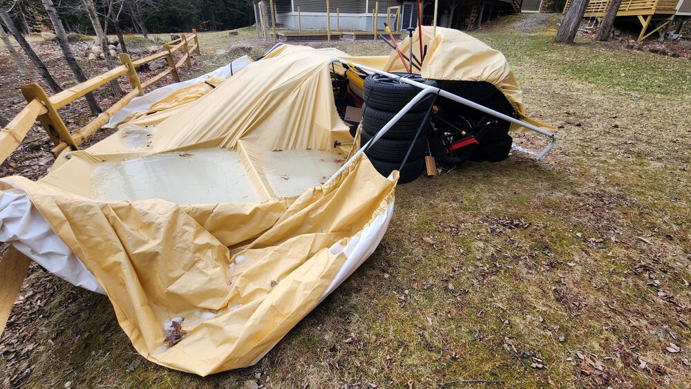
God is that ugly, I’m just gonna camp out in mine put a heater in there lol.
-
1 minute ago, HIPPYVALLEY said:
I never discount the NAM mid-level furnace surge. Somebody is getting a lot of sleet with this storm.
I should take bets on how long i can keep this upright tomorrow..........


-
3
-
2
-
 2
2
-
-
Just now, powderfreak said:
Every model stealing my snow now
 .
.
They have stole all mine since 02/16.
-
2
-
-
7 minutes ago, tunafish said:
Mid-levels cooling at all?
Not really.
-
 1
1
-
-
A bit torched aloft still, I wouldn't discount it.
-
1
-
-
1 minute ago, Typhoon Tip said:
It looks from that animation that it's not colder thermodynamic -wise but is output colder due to being earlier. The whole thing is sped up. You can see because the event exist the western half of the domain earlier. If the system speeds up, it can avail of what cold air there is more proficiently.
The sensible result is colder but the why-for is precisely colder in the physics. interesting..
Dews here are right at 0°F today.
-
The 18z HRRR is colder then the 12z run, Pretty bullish, A couple more tics south again.

-
1
-
-
I'll go 8-12" here, Will probably be on the high end of that scale, Looks like they cut back on zr.

-
-
WSW here now for 7-14”
-
4
-
-
Quite a bit of pellets and zr on there.
-
1 minute ago, CoastalWx said:
Yeah, that’s what I figured. I was ready for someone to yell dance boy and start shooting at my feet.
Did someone start playing a banjo? Thats when you should be concerned.
-
3
-
-
2 minutes ago, CoastalWx said:
Is it the type of station where you walk in, music stops, and everyone looks at you? I remember getting that look up in Errol, and then once when my buddy and I were up in the Forks area. I guess being 18 with a backwards RedSox hat did not go over with LL Bean and Carhatts being worn. The whole pub stared at us.
The whole pub was thinking look at these two massholes.
-
3
-
-
These are the zones that are still wildcards
MEZ018>022-NHZ007>010-230200-
/O.CON.KGYX.WS.A.0007.240323T0400Z-240324T0900Z/
Interior York-Central Interior Cumberland-Androscoggin-Kennebec-
Interior Waldo-Sullivan-Merrimack-Belknap-Strafford-
Including the cities of Windsor, Hooksett, Durham, Charlestown,
Augusta, Goshen, Claremont, Newport, Jackson, Liberty, Dunbarton,
Meredith, Livermore Falls, Gray, Dover, China, Laconia,
Montville, Cornish, Waterville, Madbury, Wales, Palermo, Knox,
Hollis, Berwick, New Gloucester, Gilford, Lebanon, Grantham,
Barrington, Concord, Rochester, Rollinsford, Limington,
Canterbury, Brooks, Gorham, Sanford, Vassalboro, Goodwins Mills,
Winterport, Lempster, Loudon, Turner, Lewiston, Morrill, Auburn,
Croydon, Sidney, Buxton, Sabattus, Minot, Boscawen, Greene,
Unity, Alfred, Somersworth, North Windham, and Waldo
958 AM EDT Fri Mar 22 2024
...WINTER STORM WATCH REMAINS IN EFFECT FROM LATE TONIGHT THROUGH
LATE SATURDAY NIGHT...
* WHAT...Heavy mixed precipitation possible. Total snow
accumulations greater than 6 inches, sleet accumulations up to one
quarter of an inch, and ice accumulations up to one quarter inch
possible. Winds could gust as high as 35 mph.
* WHERE...Portions of southwest Maine and central New Hampshire.
* WHEN...From late tonight through late Saturday night.
* IMPACTS...Periods of moderate and heavy snow will combine with low
visibility to create dangerous driving conditions.
PRECAUTIONARY/PREPAREDNESS ACTIONS...
Monitor the latest forecasts for updates on this situation.
&&
$$
ARNOTT -
7 minutes ago, CoastalWx said:
No closed H7 low gives me pause for over 20". Usually those exotic solutions without a closed H7 low get tamer...but it is a good dump of moisture.
This whole setup is pretty unique actually.
-
Just now, Ginx snewx said:
Deep deep Arctic cold so hard to displace. Look for more Messenger moves. I called for snow for Hunchie and Ray so I am hoping it continues to expand snow area.
27/2°F here, Dews are tanked.
-
1
-
-
Just now, Ginx snewx said:
Let's get Ray a half foot
If Ray gets half a foot, Jeff gets 20"+
-
2
-
-
Alrighty then.

-
1
-
-
16 minutes ago, dendrite said:
RGEM is cold
Hasn't wavered, So when it goes down its going to fall flat.


The Congrats Dendrite Deck Destroyer 3/23-3/25 obs discussion
in New England
Posted
Eyeballing around 4" out there, Sill have steady +SN, 22/20°F