Stormlover74
-
Posts
24,211 -
Joined
-
Last visited
Content Type
Profiles
Blogs
Forums
American Weather
Media Demo
Store
Gallery
Everything posted by Stormlover74
-
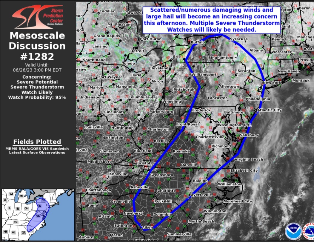
Hrrr has a nice line this evening It dies quickly after this
.thumb.png.acdc0d4ca67f88ecc5aa4bff87b3d59b.png)
-
The stuff around the turnpike should make it to parts of the city
-
Cool and showery
-
Radar blossoming over the same areas again. Not as heavy thankfully
-
Hopefully the gfs is wrong about this weekend
-
Nw nj getting slammed again
-
HRRR takes that batch in PA up thru the city and LI
-
It's warned but seems to be weakening
-
That's what I hit on 22 from readington to green brook. At one point could only see 10 feet and had to pull over. Several traffic lights were out as well
-
Yeah but the area that was in enhanced has seen very little
-
So far a bust for south jersey for sure
-
22 in bound brook just nuts right now
-
Had to pull over on 22 on the readington area it got so bad
-
Lots of lightning in that storm past bridgewater
-
Well July is known for its cool and comfortable weather
-
-
A slight shift with the update
-
Some more developing to your sw
-
Crushed again .4", closing in on 2" since Friday
-
Hrrr keeps everything north and west
-
This could be the main show for the city and north jersey
-
-
Nice cell just east of ewr

.png.adcb3fd642481e8c41a8bc5656ea7aa4.png)