

backedgeapproaching
-
Posts
3,816 -
Joined
-
Last visited
Content Type
Profiles
Blogs
Forums
American Weather
Media Demo
Store
Gallery
Everything posted by backedgeapproaching
-
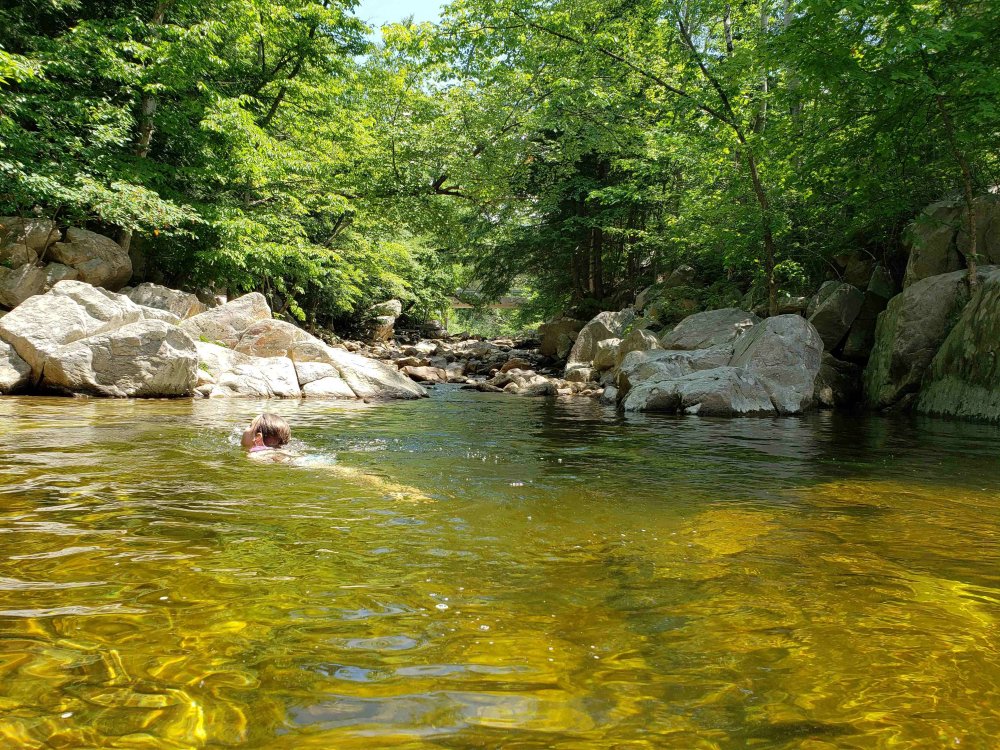
All water holes nice and warm with the pretty much sustained sun and warmth..felt like mid 70s maybe..kids enjoyed a nice dip
-

The 2020 Lesco & Lawn Thread
backedgeapproaching replied to Damage In Tolland's topic in New England
I know this is a broken record at this point, but what the hell is going on there? Looks like a plowed field ready for some crop planting. At this point maybe just hope weeds grow and fill in the all the bare spots? -
Some serious bad luck Gene to only have 3/4 of inch in 6 weeks. Think you will score some decent rains the next few days. Picked up around .60" or so today through 3 or 4 different cells rotating through from the north. Much needed.
-
The 2020 Lesco & Lawn Thread
backedgeapproaching replied to Damage In Tolland's topic in New England
Anybody ever use Cedar Oil as insect /bug repellent on the yard? Thinking about doing a blanket spray around the yard, but wasnt sure if it wouldn't actually do anything and I have alot of area to spray. -
Just got back home and see .48" in gauge. Not sure how much of that actually went into the rock hard ground, but will take it.
-
Deck getting close to completion, water is a ridiculous 81F for June.
-
Meanwhile another 0.0 in the books here. Hopefully we can get something more widespread today and tonight.
-
Duxbury cocorahs came in at 3.09" @powderfreak So right on the money with radar estimates.
-
I think a little under 1" for June precip so far. I was peeking at my cocorahs and I dont see any summer months lower than 2.55". Small sample size, but that was the lowest back to 2015. Most summer months are 4-7" going back to 2015. Guess that's why I have never seen the lawn so brown.
-
The 2020 Lesco & Lawn Thread
backedgeapproaching replied to Damage In Tolland's topic in New England
Yes, I do. Just keep watering, but not over water it. It's already stressed, adding N will only stress it more IMO. -
The 2020 Lesco & Lawn Thread
backedgeapproaching replied to Damage In Tolland's topic in New England
I'm also getting expanding and growing brown spots every day. Lava approved. -
The 2020 Lesco & Lawn Thread
backedgeapproaching replied to Damage In Tolland's topic in New England
Depends on the type of grass you have. Kentucky blue grass will just go dormant and then bounce back with rain and somewhat cooler temps. With fescue and perennial rye grass you could actually lose some if it stays dry long enough and hot enough. I dont know what you type you have, but I think most will bounce back. Now, if somehow July is a roaster and dry, then obviously higher likelihood of some grass not coming back. But I mean you would need almost no rain for another 3-4 weeks I think to lose amounts you would notice. -
The 2020 Lesco & Lawn Thread
backedgeapproaching replied to Damage In Tolland's topic in New England
With no rain in sight for at least a week and temps rising toward the end of the end of next week going to let my my lawn grow a little and probably cut at the highest mower setting. Most of my lawn gets 10 hours of sun, so going to try to shade out the soil a bit. -
The 2020 Lesco & Lawn Thread
backedgeapproaching replied to Damage In Tolland's topic in New England
Dropped some fert over my acre+ of lawn this evening. Solid drink as a cell just moved through to water in. We take. -
The 2020 Lesco & Lawn Thread
backedgeapproaching replied to Damage In Tolland's topic in New England
Looks good. Surprised that fescue patch has survived and looks that good in what looks like deep deep shade. -
The 2020 Lesco & Lawn Thread
backedgeapproaching replied to Damage In Tolland's topic in New England
Weather has been great, but 10 straight days of sun and no rain means my lawn is starting brown a bit in spots. 86-87F today and another wall to wall sunny day and a few more torch days to come still. I would guess by Friday lawn will be worse its looked since I moved to VT. Dont recall an almost 2 straight weeks with no rain here. -
Headed over to the Daks today to work on the building the deck on the family lake house..absolutley glorious out and almost no bugs working near waters edge.
-
May 8-9 mid-spring rain, snow, cold, wind obs
backedgeapproaching replied to CT Valley Snowman's topic in New England
Like Coastal mentioned, looks like they lucked out getting the deform with upslope combo. But your right, most "normal" synoptic snow events with E/Se flow Bennington VT over into Cambrige NY struggle and normally end up with lower totals. But they do sneak in some good events with blocked flow upslope. In that big NOV 2016 upslope event Shaftsbury VT had 16-20" IIRC, I had I think 8"-9" -
May 8-9 mid-spring rain, snow, cold, wind obs
backedgeapproaching replied to CT Valley Snowman's topic in New England
Damn--crushed 12" in ENY. I think ALY had 1-2" forecast there. Getting a foot when NWS call is for 1-2"--epic positive bust -
May 8-9 mid-spring rain, snow, cold, wind obs
backedgeapproaching replied to CT Valley Snowman's topic in New England
Sun peeked out just long enough to squeeze in some nice shots, some squalls going through now. -
May 8-9 mid-spring rain, snow, cold, wind obs
backedgeapproaching replied to CT Valley Snowman's topic in New England
4.1" total here, bottom couple inches pretty wet with some drier May fluff on top from this mornings upslope. -
May 8-9 mid-spring rain, snow, cold, wind obs
backedgeapproaching replied to CT Valley Snowman's topic in New England
That area can do OK at times with NW wind as the Taconics are right to their east, but that is a big precip discrepancy in all directions. But there are 4 separate reports of 8-9" in that area, so its legit. -
May 8-9 mid-spring rain, snow, cold, wind obs
backedgeapproaching replied to CT Valley Snowman's topic in New England
Yep, check out weathernet, 2 more reports of 8+ in Washington county NY -
May 8-9 mid-spring rain, snow, cold, wind obs
backedgeapproaching replied to CT Valley Snowman's topic in New England
Whoa, about 15 miles southeast of here in West Arlington VT reported almost 9". That's not some weenie elevation spot near Mitch, maybe like 300-500ft and they are always near the bottom of snow totals in SVT--impressive. Most have been some type of nice banding at some point over night. -
May 8-9 mid-spring rain, snow, cold, wind obs
backedgeapproaching replied to CT Valley Snowman's topic in New England
Probably close to Mod SN here now. May accum in the books with .4" on the board.


