

ILSNOW
-
Posts
1,644 -
Joined
-
Last visited
Content Type
Profiles
Blogs
Forums
American Weather
Media Demo
Store
Gallery
Everything posted by ILSNOW
-
little over 3 in buffalo grove as of 10pm
-
Just out with the puppy would call it light snow and it is windy at this point it is not a wet snow.
-
that is a definite issue here now after the initial burst
-
Same here
-
Snow has begun
-
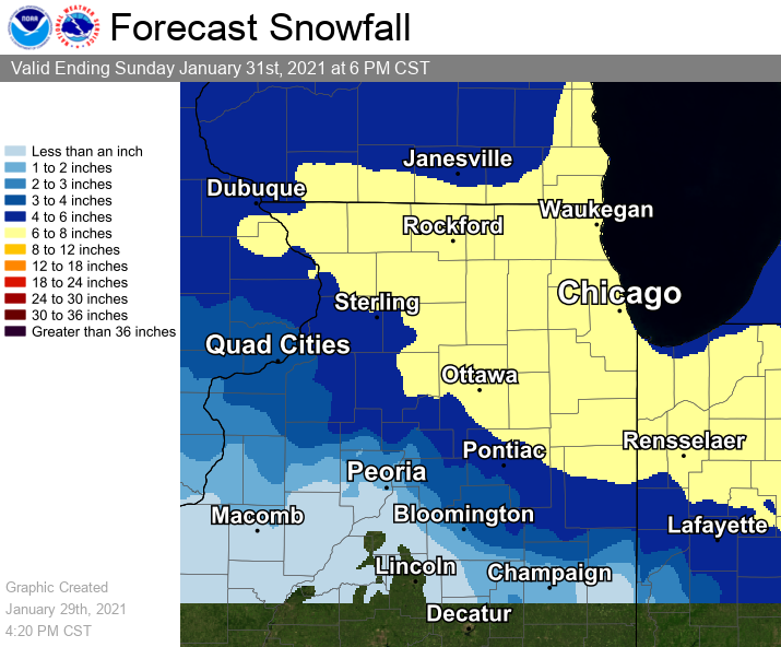
KLOT staying with 5-9 here while Milwaukee bumped up their southeast zones to 7-10.
-
18z HRRR dropping 16-17 inches in lake county near lake michigan no way its right but can always dream. It was way to high for the last storm with additional lake enhancement/lake effect.
-
12z ukie precip
-
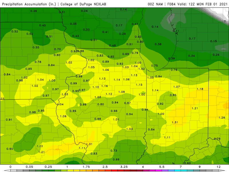
12z NAM
-
ukie
-
GFSv16 nice and wet basically 1 inch+ area wide Kuchera 10:1
-
as is our favorite wet model the 0z GFSv16 thru 36 hours
-
you buy it or toss it?
-
18z 0z
-
They fixed it
-
At first i thought the 8-12 map was from early but it is time stamped 3:20 CST. No where in the forecast discussion or zone forecasts does it state 8-12. Has to be wrong .
-
I will take ARN3 please
-
KLOT updated map
-
12z UKIE 10:1 snow map prolly little overdone
-
GFS v16 still wetter then the other models
-
Oz NAM total precip
-
yep pretty much every other model has at least 1 inch of precip with our friend the GFS para printing 1.6 for downtown Chicago. Doesnt hurt to start conservative and increase as we get closer I guess.
-
KLOT
-
-
12z Euro precip


