

Silas Lang
-
Posts
696 -
Joined
-
Last visited
Content Type
Profiles
Blogs
Forums
American Weather
Media Demo
Store
Gallery
Posts posted by Silas Lang
-
-
1 hour ago, PowellVolz said:
I don’t see how schools are going to go back at all this week. I work for Knox Co school, HVAC department and I’ve been out a lot. I’m at Central High now. Back roads are like concrete. School parking lots are the same. Was at Fulton last night. My jeep will go anywhere but getting into Fulton was an adventure. Lol.
.Honestly even Monday could be another day or at least a delay. That's the first real "warm" day, but it is still supposed to be very cold in the morning.
Anyway, secondary roads are awful all over Knox. I live in the city proper and still no plow. Not that it would do much with all the compacted snow and ice.
-
 1
1
-
-
12 minutes ago, Holston_River_Rambler said:
12z RGEM:
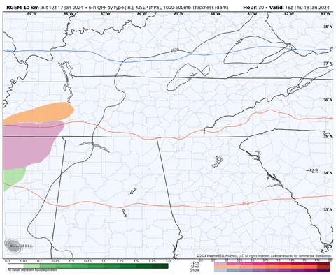
4 run trend of RGEM is less qpf and a tick south:
Yeah, I noticed the GFS went a little north. Almost like RGEM and GFS have met in the middle. If I had to guess, I assume places with a thick snowpack will hover just at or below freezing, resulting in freezing rain or snow. The valleys may fair better since they will pool cold air.
Wondering if MRX will pull the trigger on an advisory. I think it's needed if for precaution if nothing else. People may falsely believe that their roads are clear and not realize that it's just a sheet of ice. Temps should fall on Friday too.
-
3
-
-
Just now, Silas Lang said:
Speaking of models and temps, I noticed the NAM was about 10 degrees warmer than RGEM for this morning. I think the RGEM is doing better with temps and picking up snowpack. For this reason, I think I trust it more than the NAM for this event. Now, looks like for some areas that will be freezing rain, but still frozen. NAM wants cold rain for all.
Also, would this event register for an advisory? Friday will have dropping temps even if they manage to get above freezing in the morning. I can imagine it will be a huge mess, even if precip is limited and rain...
-
1
-
-
11 hours ago, Wurbus said:
Someone updated the snow depth on the GFS to show a lot less than what is on the ground. Probably because of the feedback issues. 18z had Knoxville around -15 tonight and 00z is showing 3 tonight.
Speaking of models and temps, I noticed the NAM was about 10 degrees warmer than RGEM for this morning. I think the RGEM is doing better with temps and picking up snowpack. For this reason, I think I trust it more than the NAM for this event. Now, looks like for some areas that will be freezing rain, but still frozen. NAM wants cold rain for all.
-
1
-
-
-5 is what my thermometer shows.
-
2
-
-
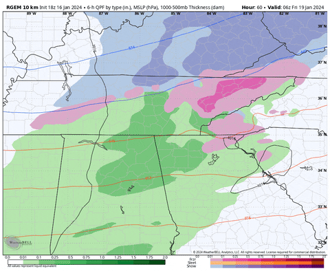
0z GFS essentially the same as 18z. A hair north and less precip, but still shows snow.
-
2
-
-
Looks like the RGEM has been trending south with that snow line.
-
2
-
-
Man, a solid hit. Regardless of totals, even a half inch would feel big on top of this snow pack.
So it's GFS vs the world? lol
-
5
-
-
9 minutes ago, PowellVolz said:
I ended up with 9.25”. This is on top of my Jeep which probably had no melting since I hadn’t driven it for 1/2 a day.
Lots of cars and some 4x4’s in ditches like this.
.Yeah I measured 8 to 9 in places in the yard, though hard to tell since some sleet and rain had compacted it. Also found some deep pockets of 10 to 11. Drifts?
Anyway, Pretty cool storm. Ended up with a final half inch last night to recoat what I had cleaned up too.
-
4
-
-
Not really sure what to think of this one. Models showing rain, but with a thick snowpack and frigid air and more coming behind this system, one has to think we have shot a frozen precipitation regardless of what the models spit out. I just don't know how the cold can retreat so easily.
-
3
-
-
Measured 9 inches at the peak of the goose feather flakes. Probably a little more compacted with the sleet and rain from earlier. All snow here again. Tiny flakes, but a lot. Everything has a fresh coat of snow. A great winter day.
-
3
-
-
Yeah, an icy mix here now at 24. Rain, flakes, and sleet.
-
5 minutes ago, PowellVolz said:
It’s pouring again but when it slacks up, lots of sleet mix in.
Also I completely forgot about how bright it is at night with snow on the ground. It’s like a full moon.
.Yeah, I noticed some sleet or ice mixing in when I went outside. I say ice, because rain is probably cold enough to freeze before hitting the ground!
-
3
-
-
4 minutes ago, Stovepipe said:
Biggest flakes of the event hitting here now. Got dimes, nickels, and even a quarter or two mixing in with those heavy returns. My gut tells me this is the last blast but who knows. Again, very very very grateful.
I don't know man, radar looks healthy. Futurecast shows returns continuously until midnight at least.
-
3
-
-
Just measured 8 in the yard. Biggest flakes I have ever seen in my life. Snowballs falling here. 24 degrees.
-
2
-
-
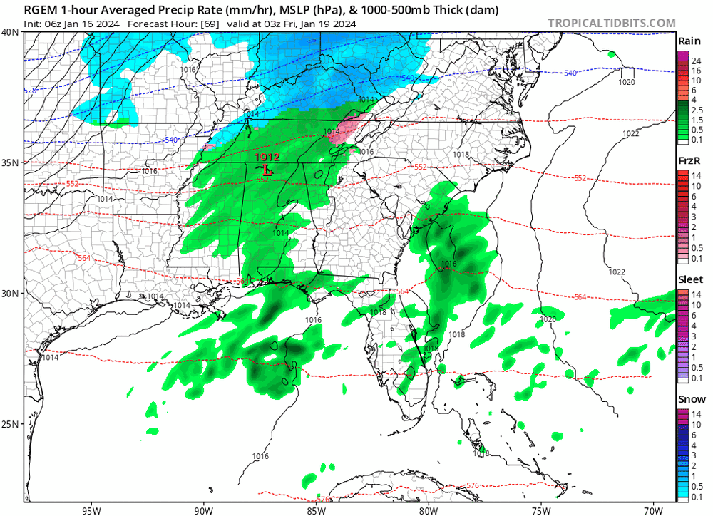
Every run of HRRR seems to prolong this event. This is 1am.
-
2
-
-
3 minutes ago, fountainguy97 said:
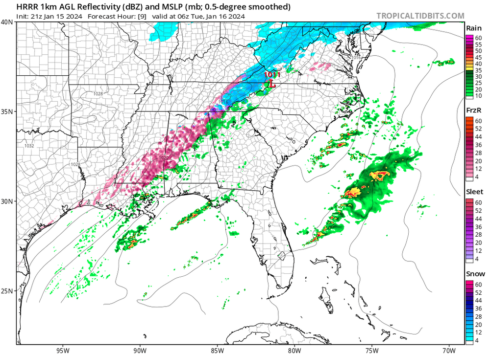
Clearly some form of warm nose has remained anchored over the mid-valley. Notice how that bright banding (blue which indicates melting aloft) hits a wall and changes to white across NE TN. Pretty neat to watch unfold.
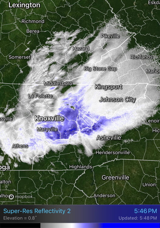
What a weird barrier I-40 is. An odd look overall.
-
Over 7 inches now. 25 degrees.
-
5
-
 1
1
-
-
Temps dropping down to 27. Snowing hard. Measured 6 about an hour ago.
-
Hardest snow all day. Fully expect over 6 inches on the next measurement. It is pouring. Temps falling to 28.
-
2
-
-
Man, the radar is still looking beefy too. What a day!
-
2
-
-
Pouring snow now. Dropped to 28 degrees.
-
4
-
-
Snow really started picking up in intensity now.
-
3
-
-
Just dropped back down to 29 degrees.
-
1
-


Cold Shot: Part Duex - January 18-20th Arctic Blast and Freezing Rain/Snow Event
in Tennessee Valley
Posted
I think that even if we make it to the mid 30s the ground is so cold and frozen, it could still freeze up in spots.
My road is nasty. Compacted snow several inches thick. I think they tried to plow it, but it just made it solid? Anyway, rain will not help that glacier.