
JasonOH
-
Posts
797 -
Joined
-
Last visited
Content Type
Profiles
Blogs
Forums
American Weather
Media Demo
Store
Gallery
Everything posted by JasonOH
-
Whoops. Misinterpreted what kind of fusion you were talking about. Thought you were referencing lightning for some reason.
-
Another reminder, MIMIC doesn’t update without additional polar satellite passes. With a storm that’s rapidly evolving (like this) and with the latest pass being 8 hours ago, it’s useless.
-
FWIW the energy from fusion due to lighting is orders of magnitude lower than that of the storm as a whole and has no effect on strengthening. It’s a symptom of strengthening and microphysics processes, not a cause.
-
VDM went in as 957mb. Drop had 957 with 25kt wind though.
-
This link will work for any office. https://www.weather.gov/jan/dat_redirect
-
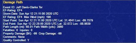
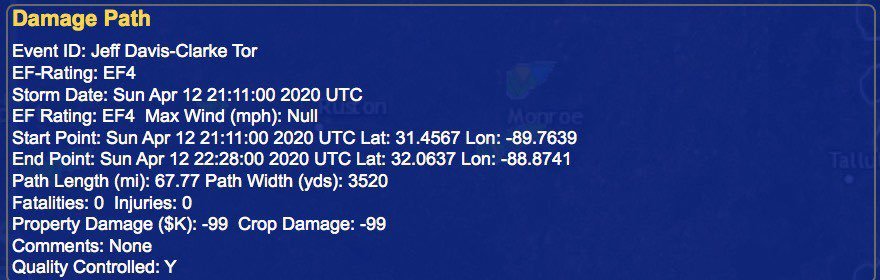
TDLR: Officially prelim 190 mph on the EF4 and 150mph on the EF3. More detailed info tomorrow. Adjustments are possible over the coming weeks.
-
That puts it as the third widest on record behind El Reno 2013 (2.6 miles wide) and Hallam, NE (2.5 miles wide).
-
This was the strongest tornado since Rochelle in 2015.
-
Up to 190mph and 3960 yards based on the viewer.
-
Reverse image search yielded nothing on that tree damage pic. I think we can say it’s likely legit.
-
Walthall county tornado rated 170mph EF4.
-
I wonder if they can only do the lower bound of DOD10 without a review to determine the actual wind speed. More info from a friend: EF4 and above and they typically need to call in a Special team to make the final determination. That would explain the lower bound usage and why it’s being checked again.
-
From the damage assessment toolkit. Bassfield EF4 was 2 miles wide
-
Great twitter thread about the NWS warning process for at embedded supercell that produced the crazy radar imagery last night in SC.
-
Since I was confused earlier here is a tweet with the tracks
-
Bassfield is a prelim EF4. The trailing tornado is prelim EF3. (Thanks to Andy for the correction. I got my counties all messed up)
-
Tweet about the house that slid. Looks like it was unanchored on cinder blocks.
-
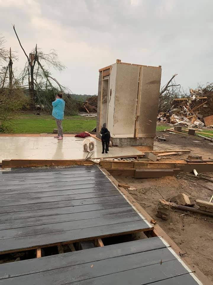
I’m going with not at all well built. I see strait nails on the bottom right and it looks like the whole thing is on cinder blocks not anchored to the ground in any way. I don’t see a concrete pad anywhere in the higher res image. There’s a chances they only rate it EF3 depending on the evidence on the ground.

-
The cars that were pushed into the basement may have been a factor in the collapse. Could be EF4 but NWS will definitely consider whether those cars contributed to the collapse.
-
There is research that shows it can be estimated by VROT and CC depth. My friend does research on it and posts some stuff on twitter. He will probably be posting about this tor at some point. https://twitter.com/ou_sams
-
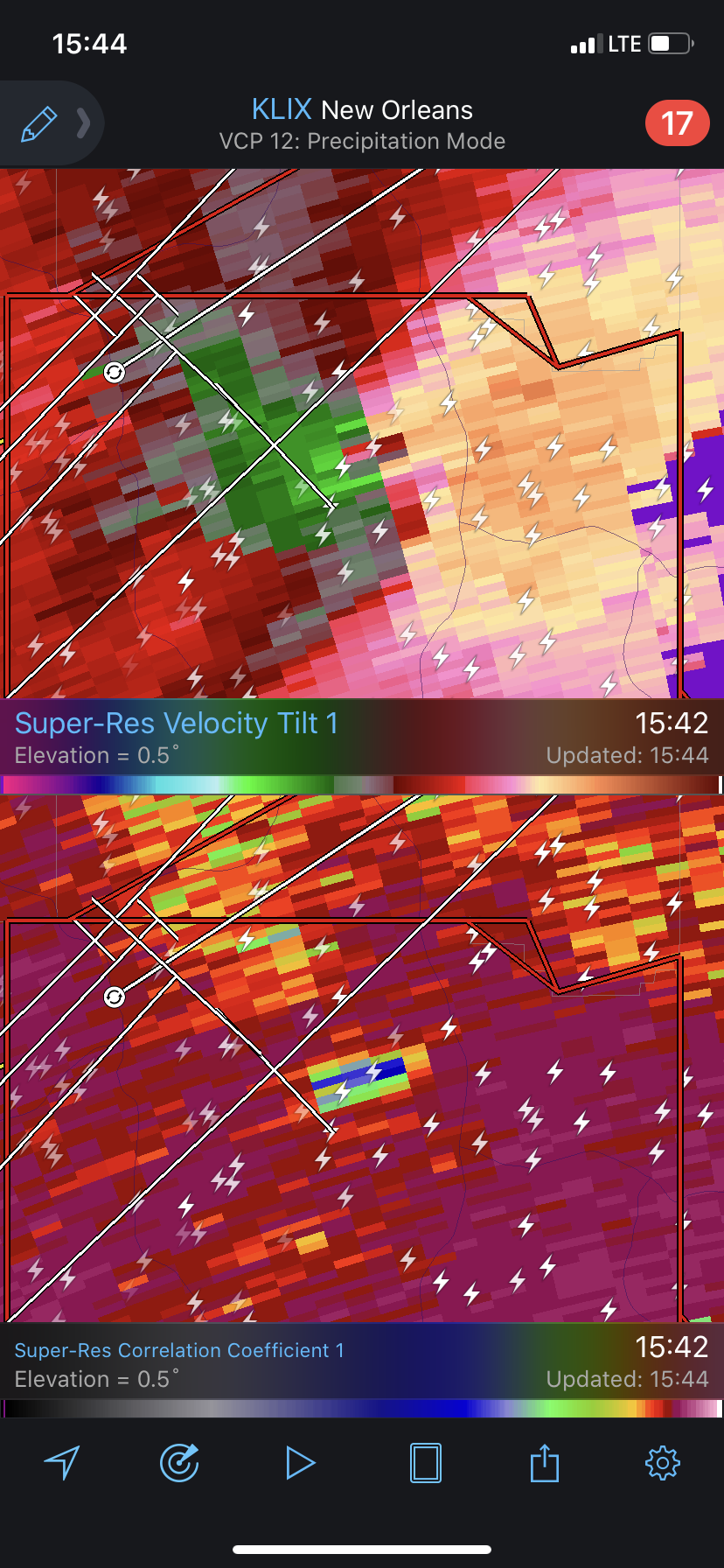
Here’s the CC drop.

-
McComb, MS storm is moving hard right. Looks like it will move directly toward Hattiesburg.
-
You don’t need low level lapse rates typically, but if there’s a cap storms won’t get organized if they even initiate. In this case we need them to overcome the cap that’s evident in the 18z JAN sounding.