

T. August
-
Posts
4,612 -
Joined
-
Last visited
Content Type
Profiles
Blogs
Forums
American Weather
Media Demo
Store
Gallery
Everything posted by T. August
-
Looks pretty damn close to Jan 6 orientation. Really wish it could be more widespread.
-
18z euro good for maybe a few inches on the front, then we most likely lose thermals. edit: obviously it stops at 144, so just speculation. It might end up closer to 4ish inches.
-
35/18 in Havre de Grace
-
say it
-
What an idiot… 24 hour mean below. Looks “keyed in on”
-
My only “complaint” would be that there’s no specific wave it’s keying in on. It’s just a big mess of precip for 4 days.
-
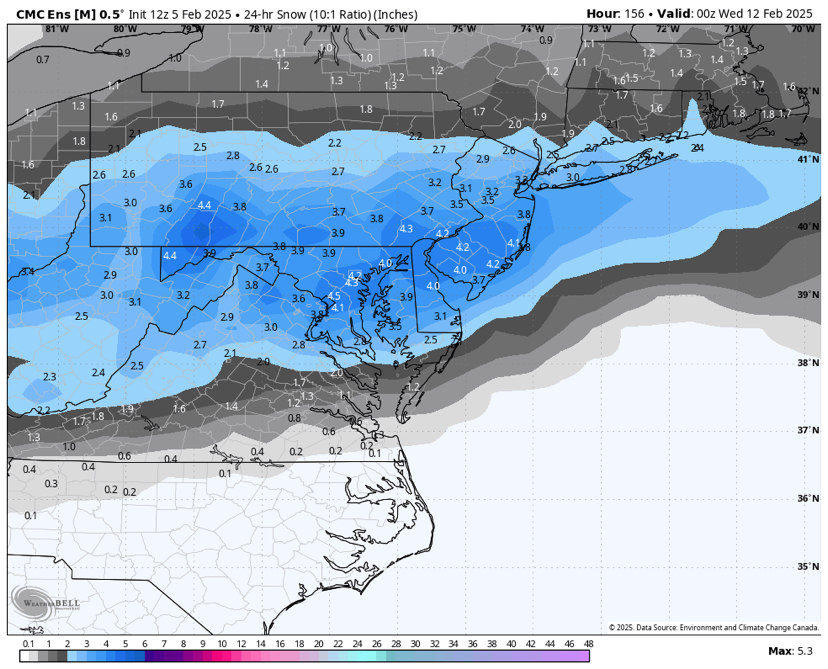
CMC ens not bad - more snow after this hour but figured this captured our threat window next week.
-
Snowfall is behind precip at least for now. 500 is fastest so far
-
I just looked. Not enthused
-
Good news - the OP is on the southern edge of its ens. Bad news - quite a few warm misses to the north.
-
Gefs is north through 129… there’s still hope lol.
-
So far cmc not looking hot. It’s about 12 hours slower and definitely south.
-
It’s a general 5-7” through the area with a little more to come. I feel like we should be happy with that lol.
-
From what I can tell. There could be a little more at the end but we do get close to losing 850s
-
Icon is a hit. Looks like 6”+. Not done yet. edit: like 6-10”
-
18z gefs looking healthy. Not quite done running.
-
North of Bmore fringed. Sound the @North Balti Zen alarm.
-
Lol Kuchera is 18” in DC
-
Are we looking at the same thing?? Gfs looks fine
-
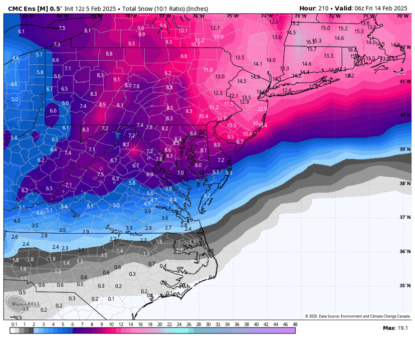
Still good… 10-16”
-
Snow maps are out to 216
-
Big hit. Looks like 12-18
-
Mitch responsible for The Wire = confirmed
-
I got hr 2
-
GEFS a step back from 6z for the 12th. Hard to tell but snowfall mean looks cut in half. Probably warmer. Not suppressed like the op. edit: some members are similar to the op. Overall the storm is just weaker.


