HVSnowLover
-
Posts
2,952 -
Joined
-
Last visited
Content Type
Profiles
Blogs
Forums
American Weather
Media Demo
Store
Gallery
Everything posted by HVSnowLover
-
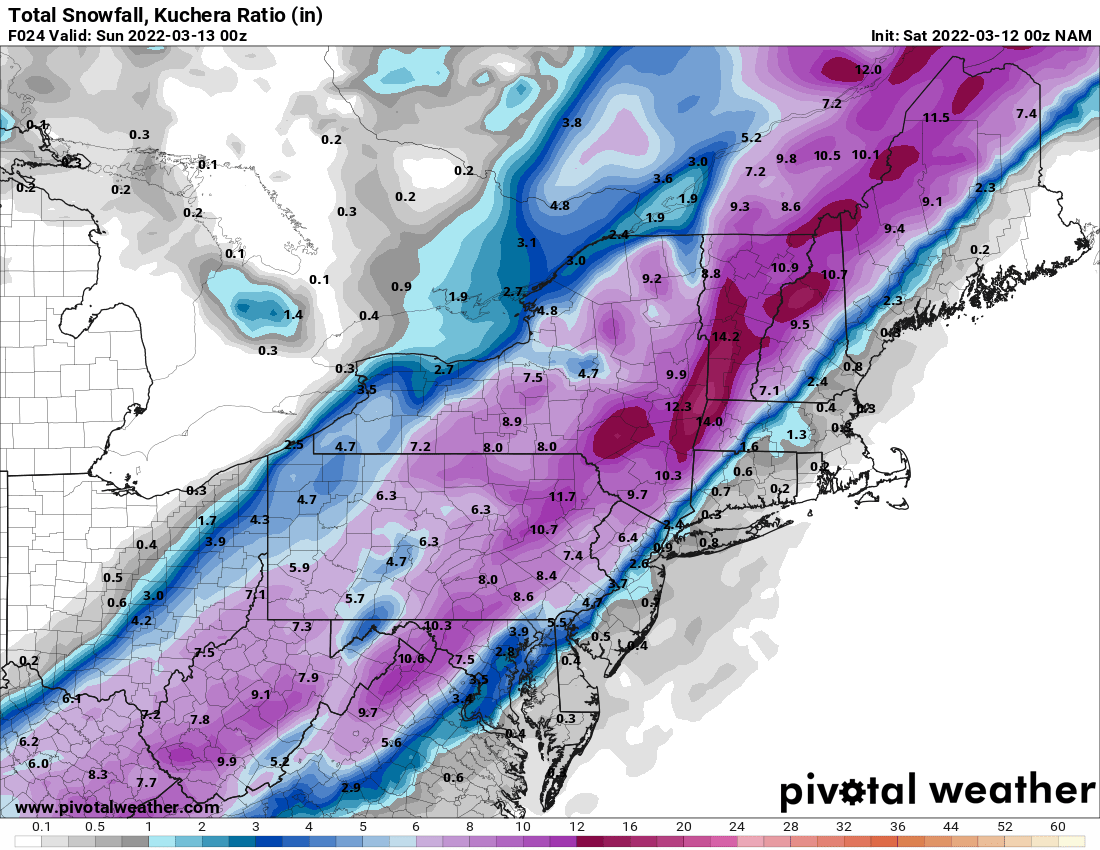
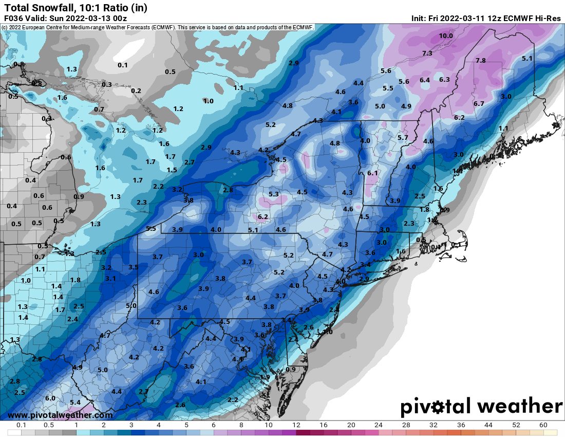
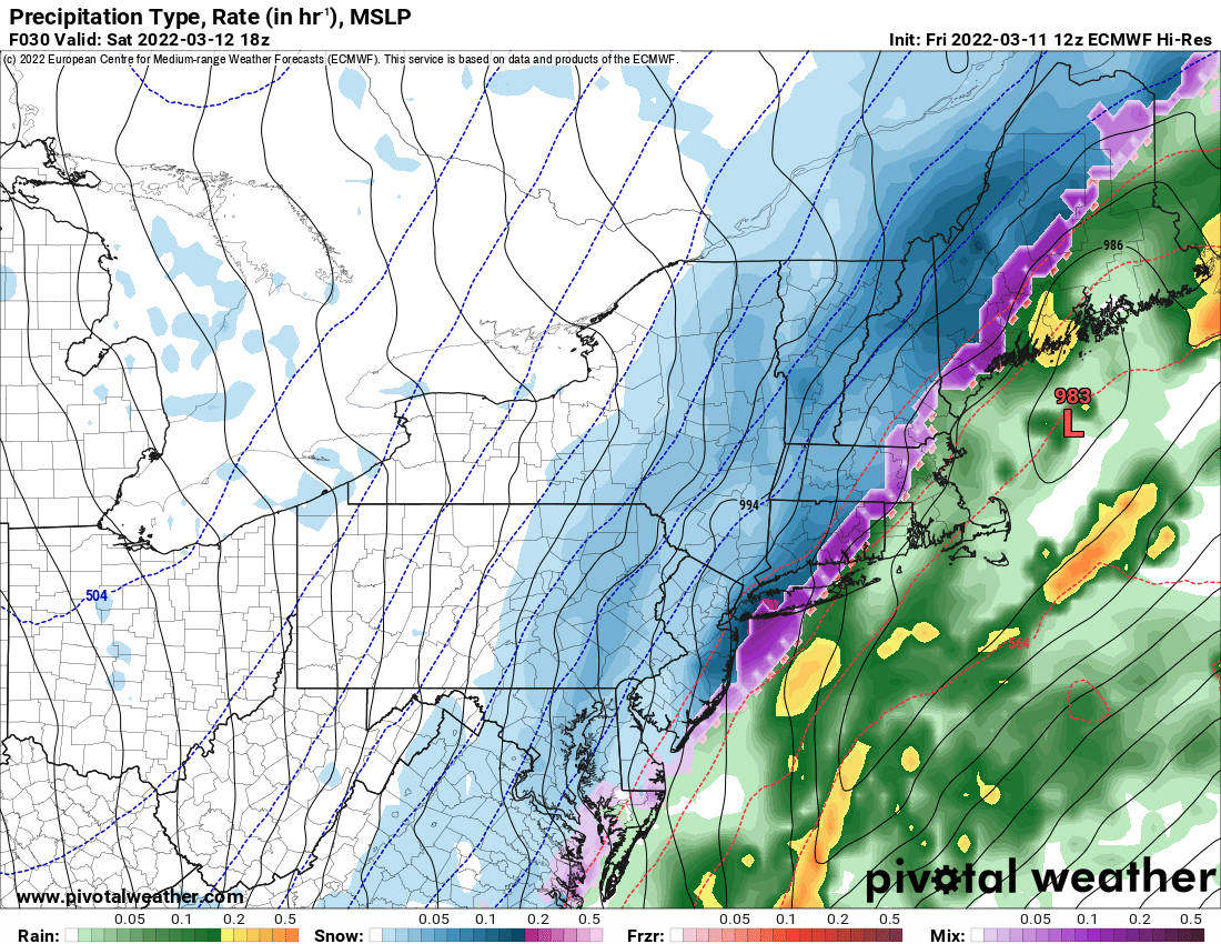
Euro did well overall though leading the way with the offshore track instead of inland runner most other models were showing. It was too likely cold in the short range.
-
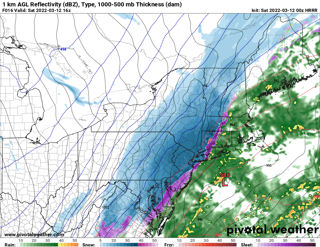
The coast may have more problems due to the track, clearly no issue with cold air moving in with this one as we see how fast the interior is cooling.
-
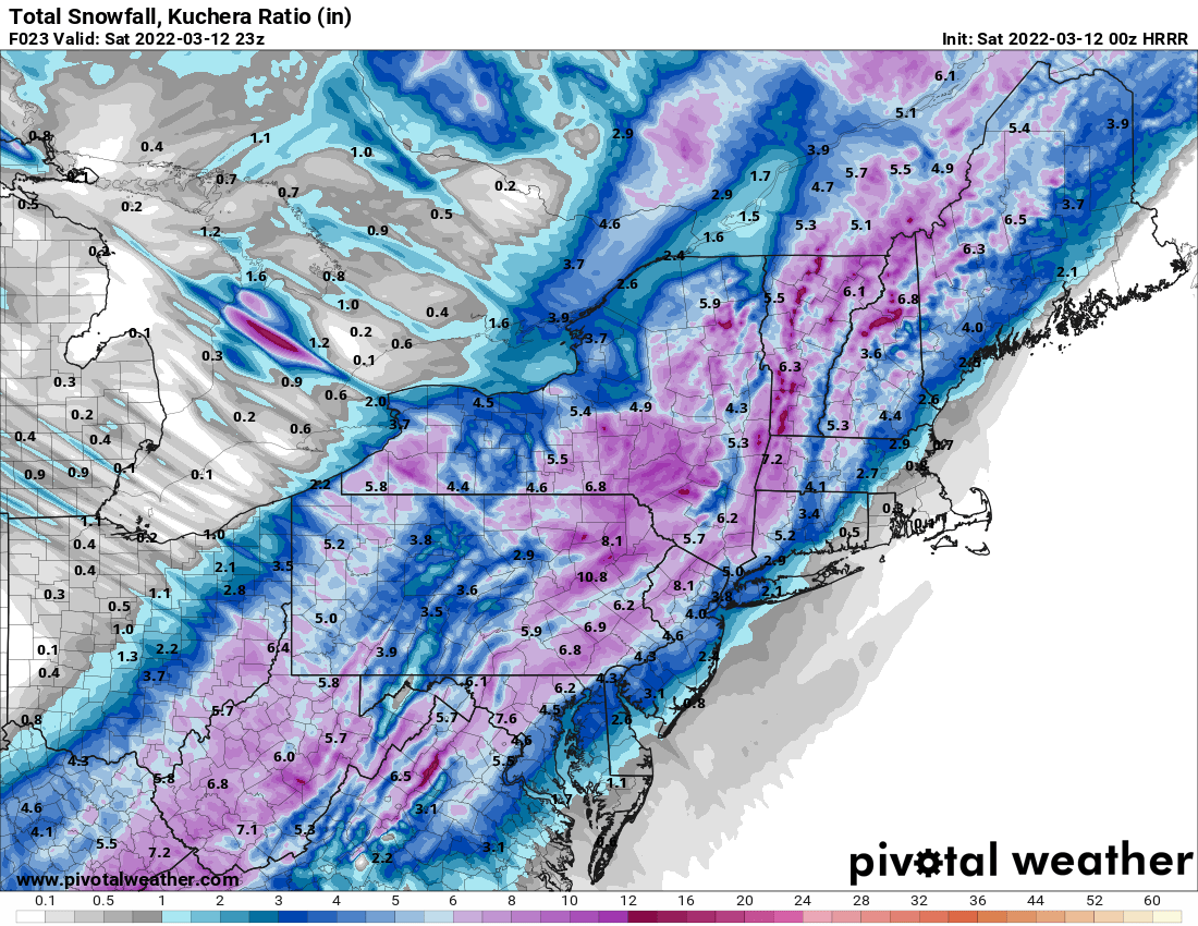
Rain/snow line does look further SE than RGEM had it at this time.
-
Storm not over yet but agree it's looking that way for the coast.
-
The 0Z RGEM still doesn't flip the city until 18Z (1 pm) and NYC seems to barely go to all snow before precip lightens up.
-
Final Call (definitely a tricky forecast but with so much uncertainty have to go with climo) Most of NYC/LI <1 North and West of the GWB 1-3 North and West of TPZ- 3-6 Near I84- 6-8
-
Thats 3 models now showing 6+ for sloatsburg.
-
NAM still thumps interior hard although backed down near the coast

-
I'm really confused how the two strongest Mesos this winter (RGEM and HRRR) are so far apart on this right now.
-
Yep and DC/Philly could get more snow than NYC in this type of setup
-
Depends what you mean by we. If you are in the poconos than definitely, if you are in Long Island then Philly would hit freezing before NYC/LI in this setup.
-
Could be a model glitch especially since it's the gfs lol but the gradient could also be that tight.
-
Unfortunately thats the model I trust most right now but I do think it might be a bit overdone with how long the warm air hangs on.
-
It will warm up on the initial SE wind before it cools back down.
-
He also treats it as if everyone is expecting a blizzard. I think most people know this is a 1-3 inch event for NYC and immediate suburbs at best but we still track because we like snow and it's the last winter storm of the season.
-
Weren't you hugging the 18Z NAM yesterday that was showing like no snow anywhere SE of the catskills.
-
I actually deleted my post because I realize it was off topic but thanks for clarifying. I guess if we are counting snow inside of a park I could see that. Also last Feb was a bit unusual as we had a very active pattern and multiple snowstorms in the city in Feb.
-
I only have access to Euro 10:1 snowmaps, would imagine ratios would be higher inland as Euro is very cold.
-
Euro not backing down from the colder solution

-
I have a different take, most places south or east of NYC are at or above seasonal averages. NYC could get closer to seasonal averages if they can get a few inches out of this.