All Activity
- Past hour
-
I still stand with 910-920mb and 170-180mph winds for my bet on the northeast quadrant reading. Any final bets or adjustments to previous bets?
-
I think very few of us in here actually look at TWC for tropical weather insight. Melissa is likely in the 170-180mph range right now. Just need the northeast quadrant eyewall measured to confirm.
-
TWC has it hitting Jamaica with 160 MPH winds.
-
Historic and likely one for the record books. Top-5 or Top-10 reading inbound.
-
This is probably going to be a really impressive SW to NE pass.
-
Wilma is the GOAT. At least we never got to witness Wilma’s peak on landfall.

-
Understand Dvorak is an estimate and it should be used as a tool. Typically when you see those sub 900 estimates on Dvorak, add 20 to get an accurate estimate. In the case of Melissa, Dvorak was pretty much spot-on if you added 20 to the pressure estimates.
-
Wilma is one of one.
-
Nothing to say, really. Wilma had recon support for its peak.
-
What about Wilma? Hurricane Wilma - Wikipedia
-
Still a cat 4 with 150 MPH winds but cat 5 pressure at 926 MB.
-
Let me get it out of the way first. Melissa is definitely a Category 5 right now based on initial recon. But clearly there is something to be said about inflated ADT numbers due to CT temperatures. ADT is spitting out sub 900 hPa estimates and we're no where near that. I think while recon is out there they will sample in the 910s range before they leave. But we're going to start having to curb CT temps based on background characteristics of the Autumn tropopause height. A ring of sub -80 to -90°C is still impressive regardless of date. But it is becoming quite apparent that given the later months (late Oct, Nov., Dec.) that the tropopause height in the deep tropics allows tops to get colder than the Summer and late Summer months. It inflates dvorak numbers. We have had suspicions for years that WPAC deep tropic super typhoons may have been over estimated. Again, it doesn't take away from the fact highest-end TCs are Category 5s on the Saffir Simpson. But the later the seasonal date, ADT is estimating too low a pressure. 895 versus operational ~20 hPa off is ridiculous.
-
Keeping in mind the whole SFMR accuracy thing that I discussed last season, but still, very impressive. Would like to see a clean NE—SW pass.
-
Not even the strongest quadrant. Absolutely insane
-
-
Definitely Category 5, just need NE quad sampled to confirm
-
There you go, Cat-5.
-
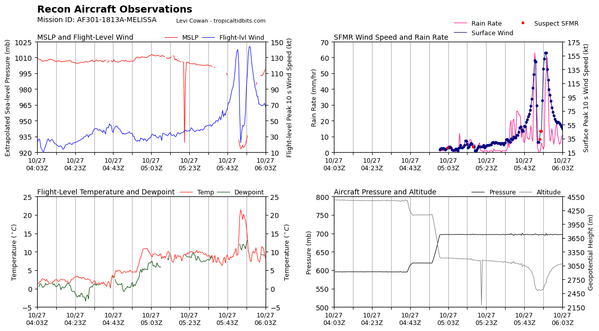
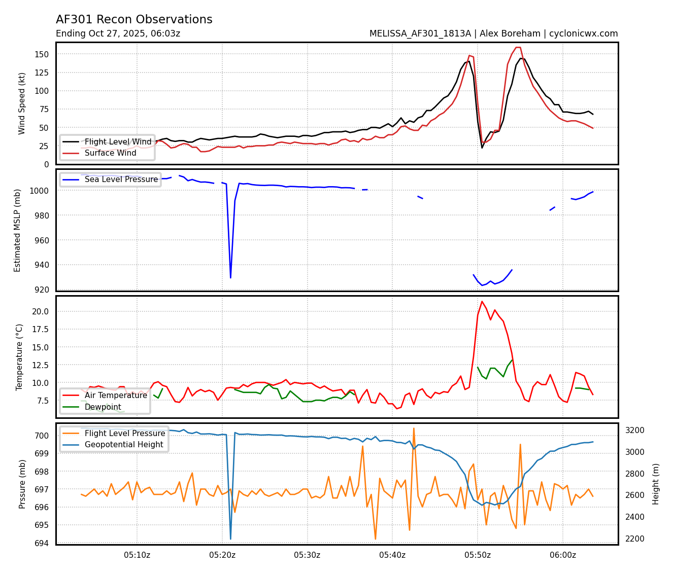
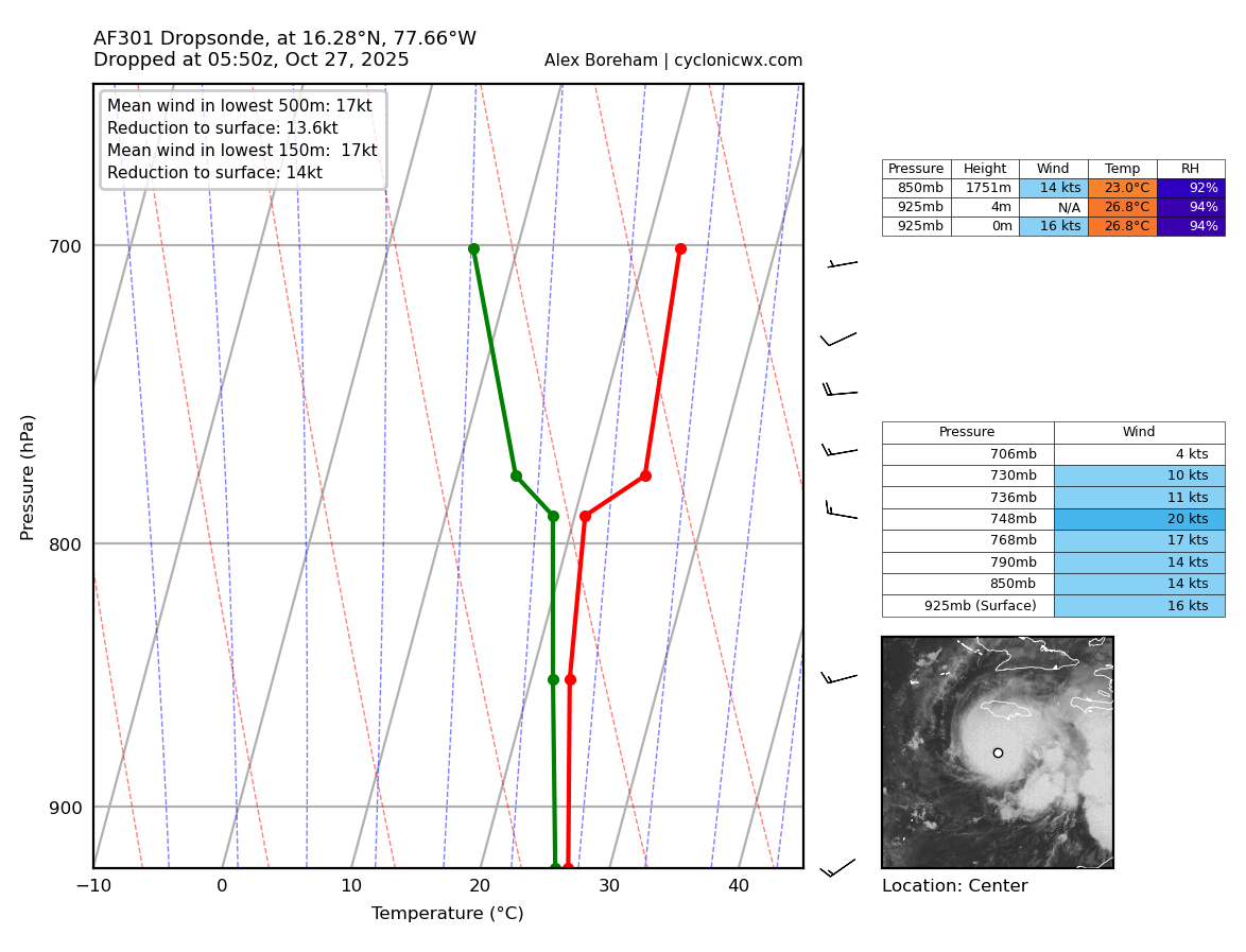
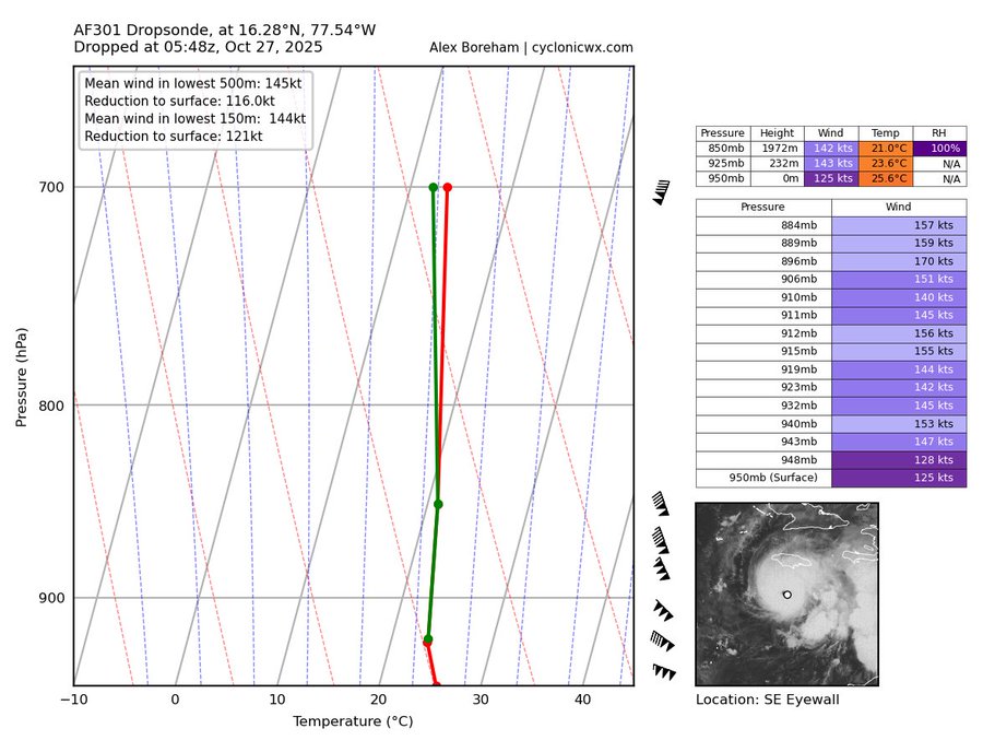
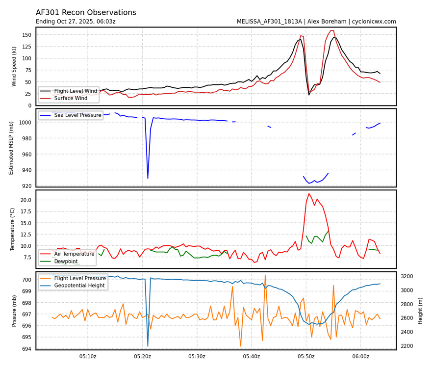
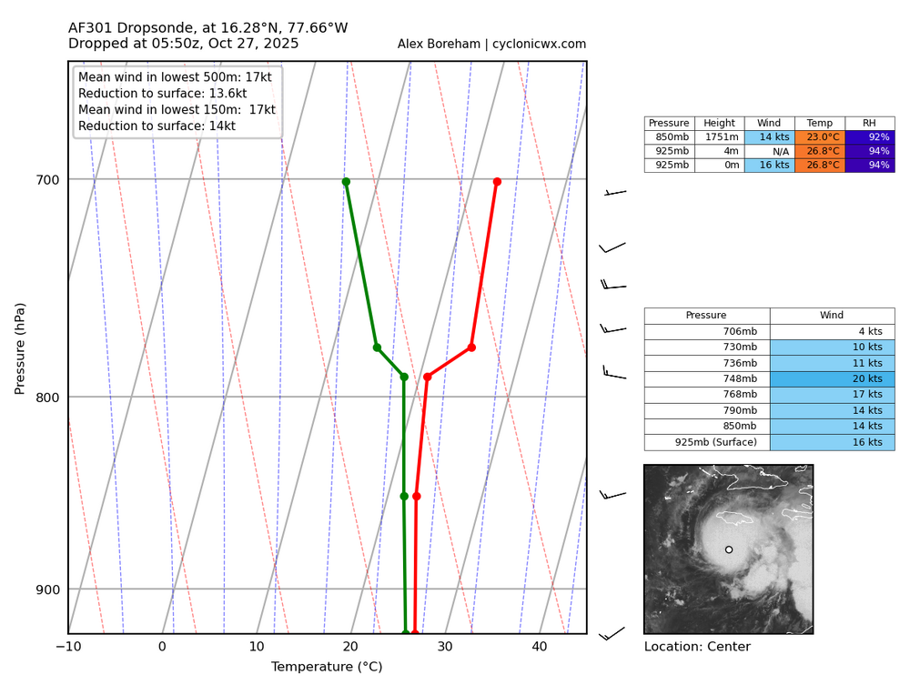
Dropsonde says 924 mb
-
Zero doubt this is a 5 to me. Batch of 143-144 FL and unflagged SFMR of 135, 150, and 159kt.
-
Looks like a cat 5 to me.
-
Definitely eager to see that data and hopefully they get a good pass through the eye
-
Recon just started measuring, give them time. This reading is, again, from the southeast quadrant of the eyewall. The highest winds in a hurricane reside in the northeast quad where the lowest pressure also resides. We are minutes away from finding out what the NE quad measures.
-
Is this the plane that will issue the 5am advisory or will another flight follow this?
-
I don’t think the NHC could pull the trigger on a C5 with that little center data. Recon needs time to confirm imo.
-
I really thought this was going to be a cat 5 now especially given the satellite estimates and what data they're getting now. So confused.