baroclinic_instability
-
Posts
7,869 -
Joined
-
Last visited
Content Type
Profiles
Blogs
Forums
American Weather
Media Demo
Store
Gallery
Everything posted by baroclinic_instability
-

Alaska/Western Canada obs and discussion
baroclinic_instability replied to patrick7032's topic in Central/Western States
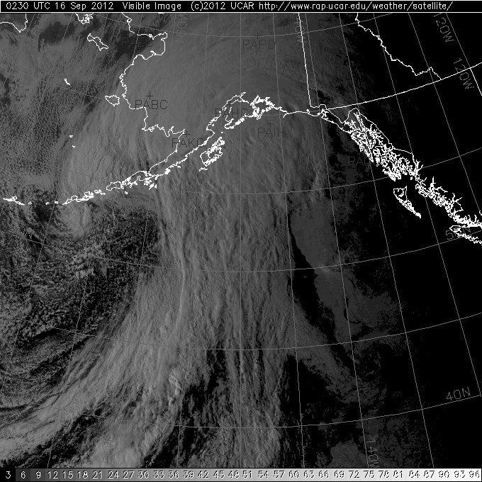
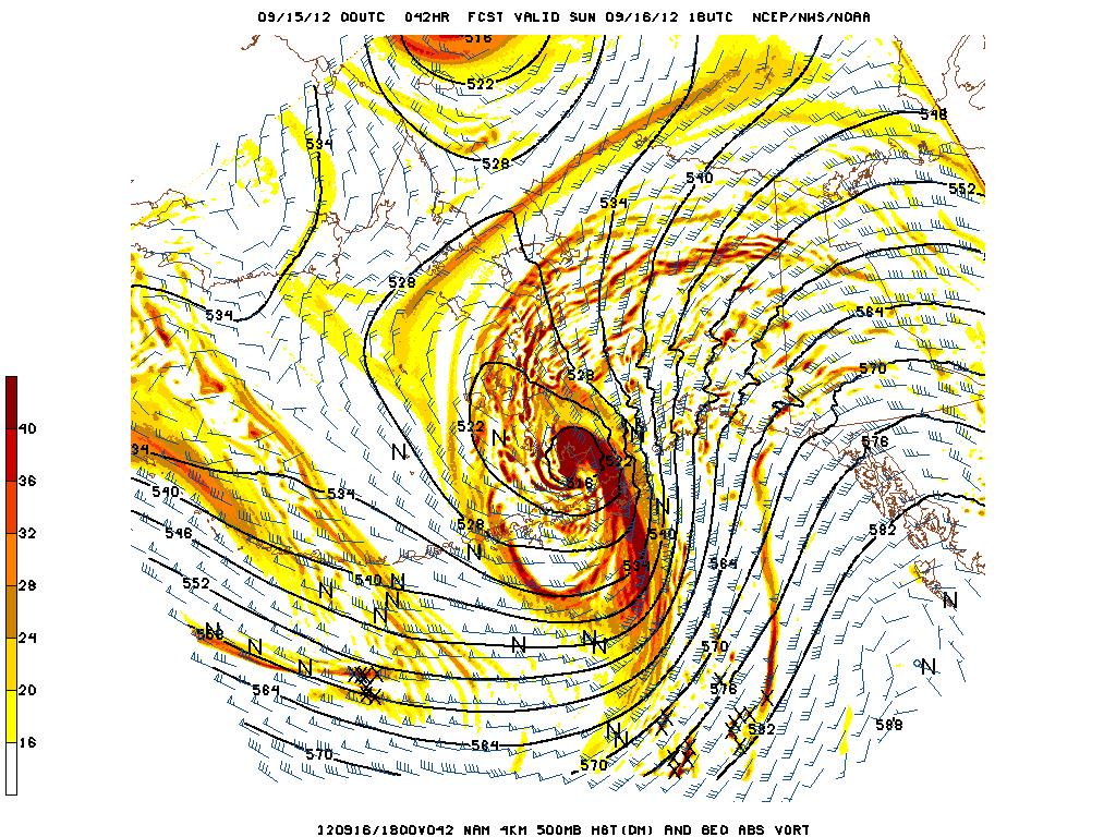
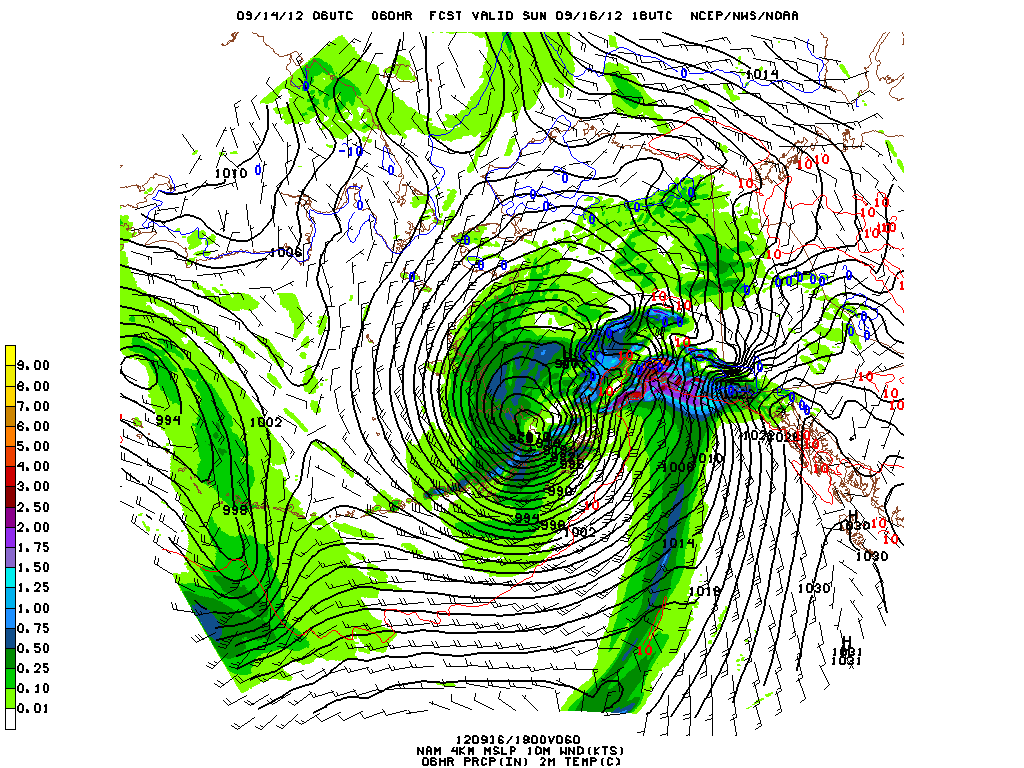
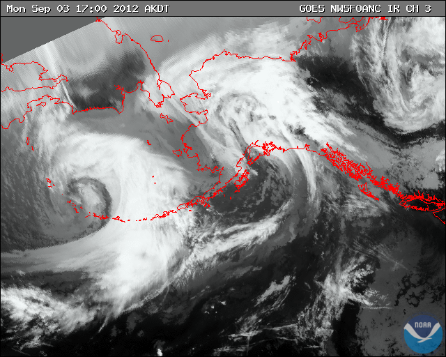
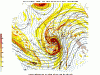
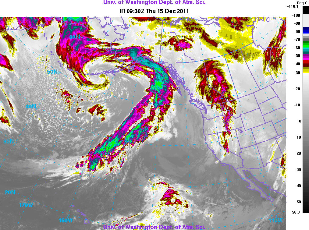
Storm in rapid intensification mode, down to 981 based on surface obs near the Ak Pen, will drop into the upper 960s before all is said and done. NWS Anchorage has unleashed the hurricane strength wind warning for portions of the marine zones. Looking like a Miller A Nor'easter on satellite....similar setup as those storms.
-
Alaska/Western Canada obs and discussion
baroclinic_instability replied to patrick7032's topic in Central/Western States
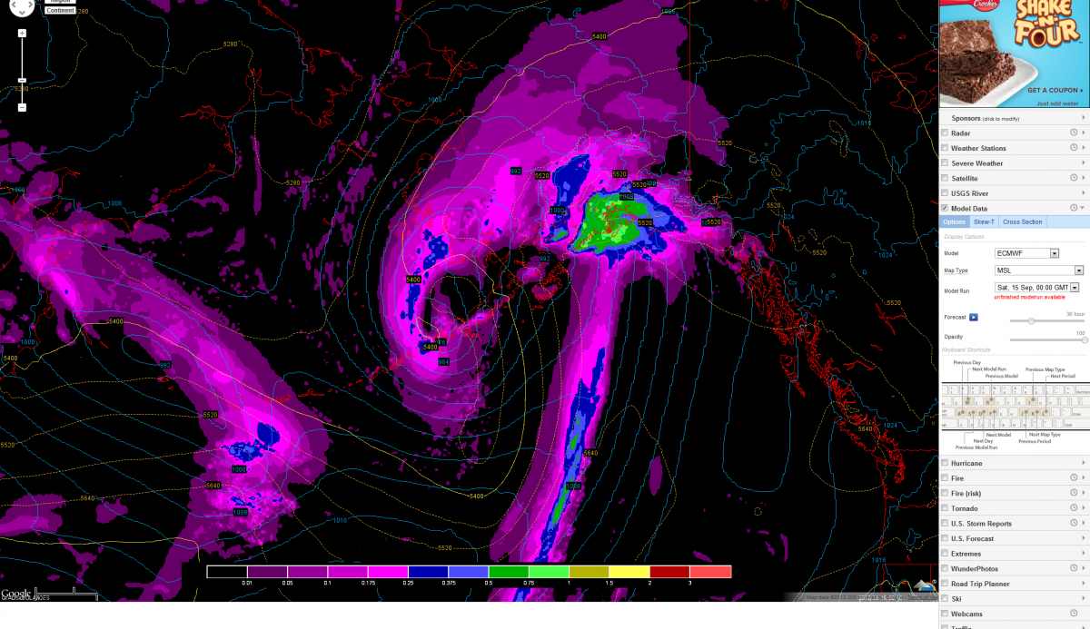
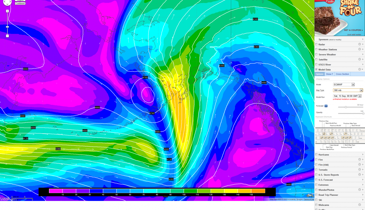
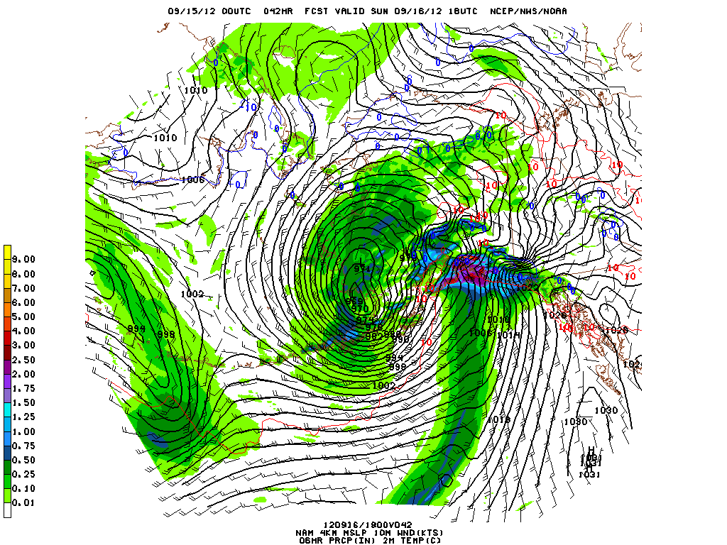
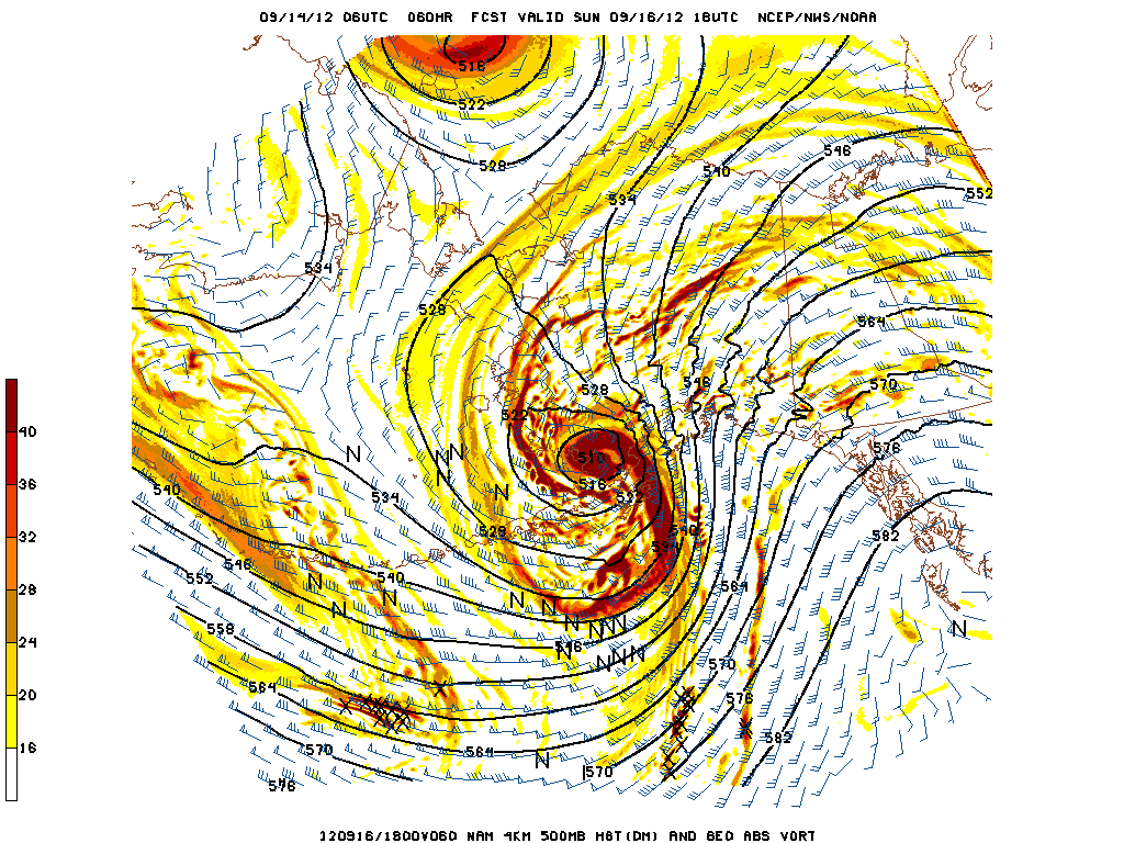
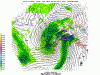
Weather pron, ECMWF caves to NCEP guidance, deepens a strong bent-back surface occlusion in Bristol Bay. NAM Hi-res 4 km backs it up. Even tiny track differences yield massive pressure changes/wind field changes that can completely screw up local terrain influences. Doesn't get much better than this. Great way to start fall, can't wait for the true beasts pushing 940 hpa.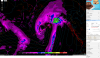

-
Alaska/Western Canada obs and discussion
baroclinic_instability replied to patrick7032's topic in Central/Western States
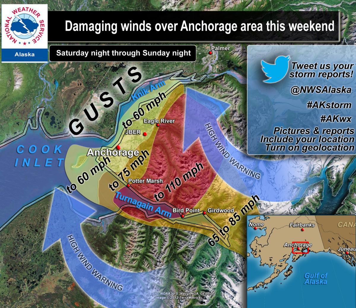
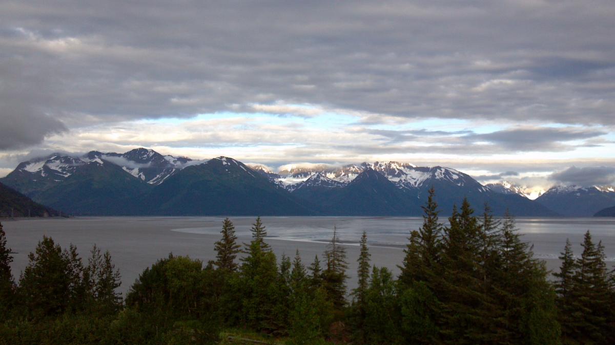
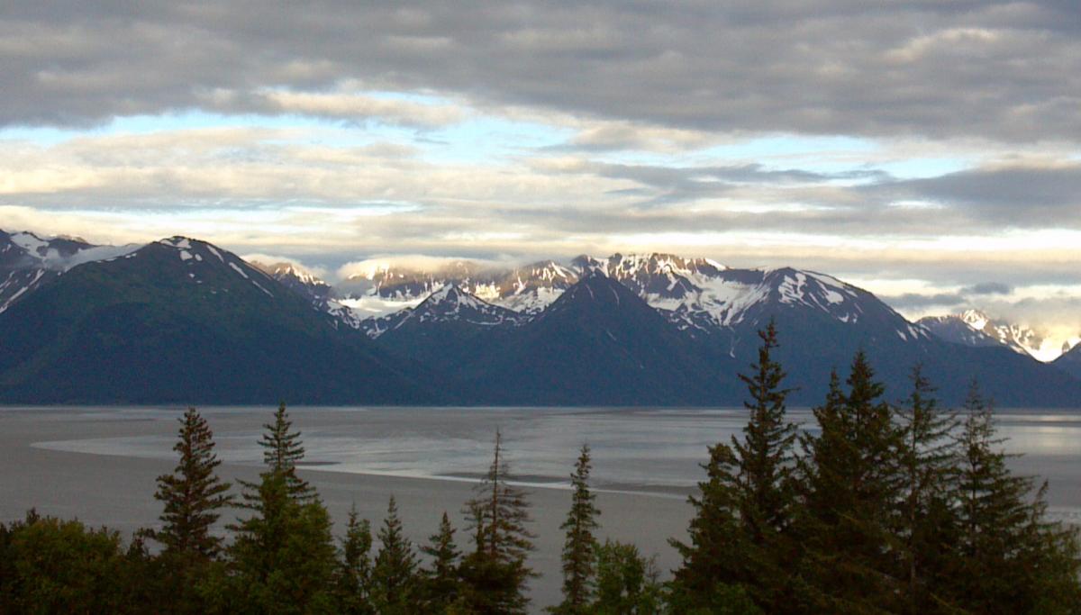
Haha, Turnagain Arm winds are awesome. Classic true gap wind where, in SE flow, the air mass literally is blocked on the windward side of the very dense and large coastal ranges/Chugach Range, creating high pressure and accelerating down the inlet, reaching peak wind status at the end. It just so happens the end of the inlet is 5 miles SE of Anchorage, so the wind will go from 30 MPH to 90 MPH in literally less than 5 miles. You can see the Turnagain Arm in the image above with the graphics. -
Alaska/Western Canada obs and discussion
baroclinic_instability replied to patrick7032's topic in Central/Western States
Another hurricane force wind event in and around Anchorage. This one will mostly be relegated to the mountains, but still, a great opportunity to chase some winds!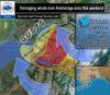
-
Alaska/Western Canada obs and discussion
baroclinic_instability replied to patrick7032's topic in Central/Western States
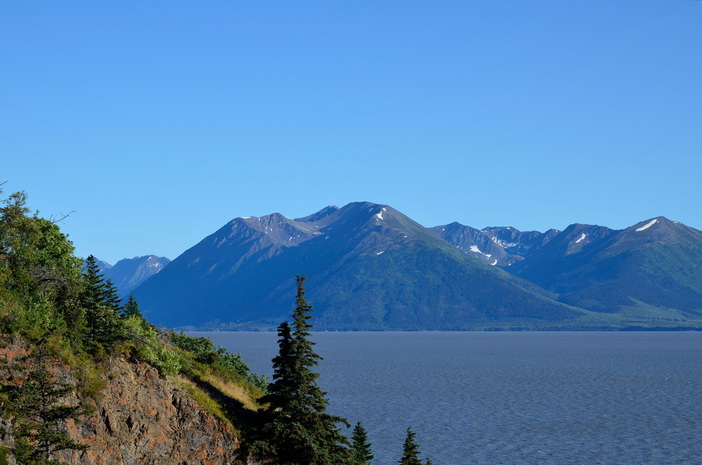
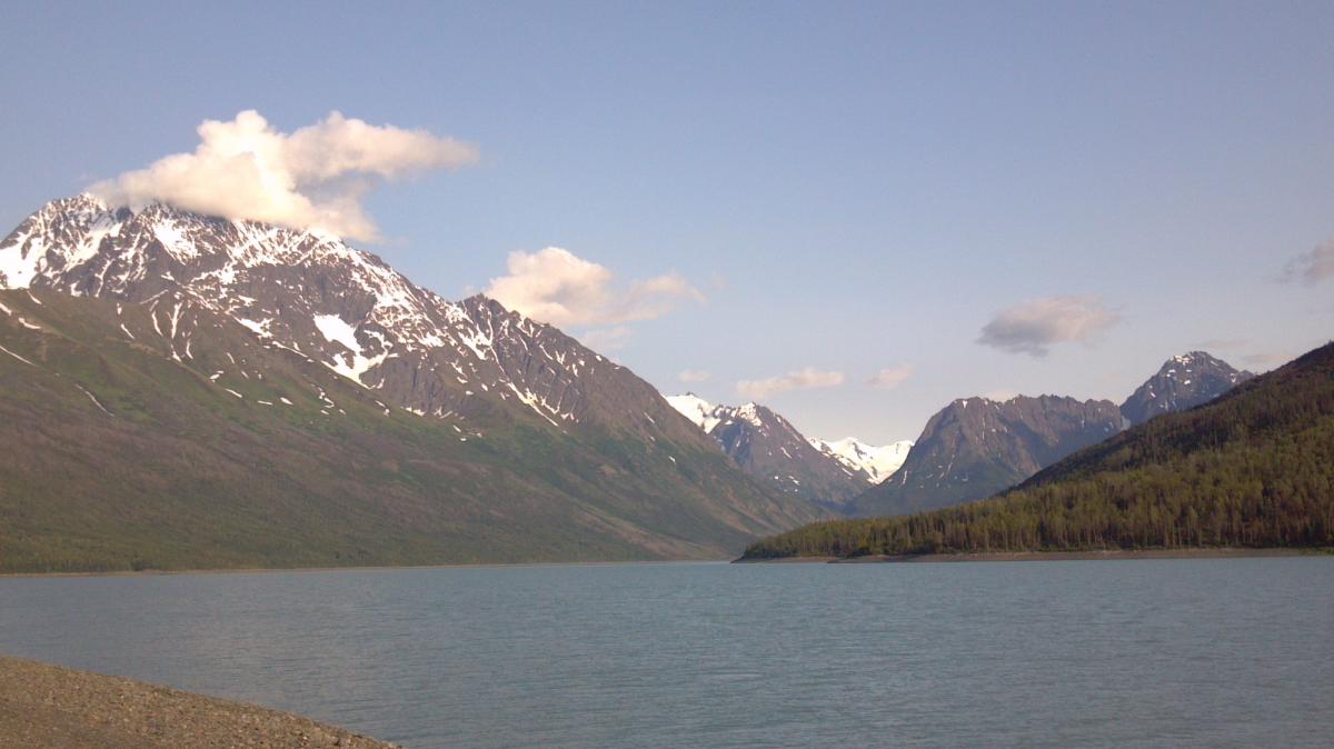
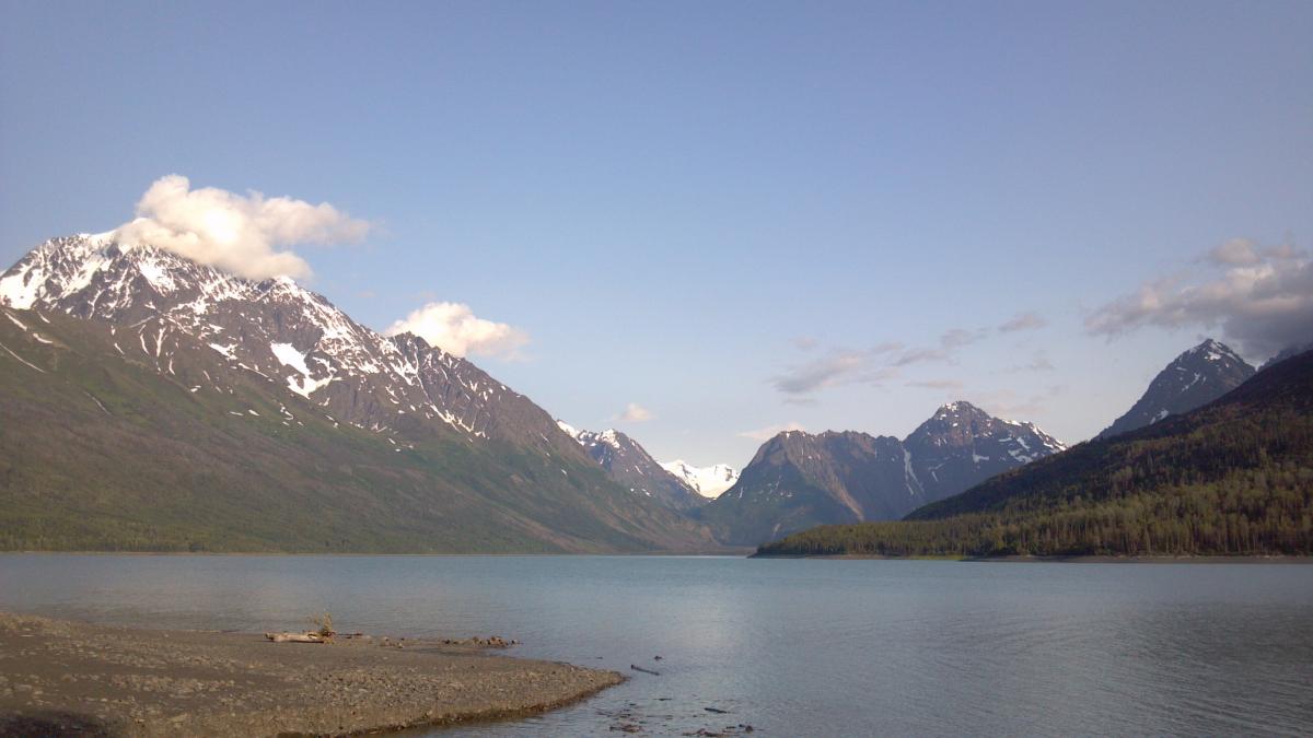
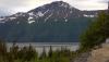
Turnagain Arm near Anchorage during a rare bluebird day.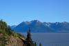
-
Alaska/Western Canada obs and discussion
baroclinic_instability replied to patrick7032's topic in Central/Western States
Another day, another storm in AK. 975 lows up here are a walk in the park it seems. I have a love/hate relationship with weather up here. I love the constant action and the extreme challenges, but it always seems to rain on my days off.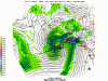
-
Alaska/Western Canada obs and discussion
baroclinic_instability replied to patrick7032's topic in Central/Western States
Definitely early October...the longer you wait the worse it gets storm wise. Even Fairbanks will get socked in with clouds in the interior for long periods of time. -
Alaska/Western Canada obs and discussion
baroclinic_instability replied to patrick7032's topic in Central/Western States
Not yet here, but the mtns have seen snow down to 4500 feet. By the end of this storm...snow levels will drop below 3500 feet! -
Alaska/Western Canada obs and discussion
baroclinic_instability replied to patrick7032's topic in Central/Western States
The pain comes early in AK. Gorgeous WCb stretching all the way back to Japan.
-
Alaska/Western Canada obs and discussion
baroclinic_instability replied to patrick7032's topic in Central/Western States
It has been wonderful overall. The weather has been exceptionally cool and somewhat wet since I have been here (the last 5 weeks), but I can't complain coming from Nebraska where it was a daily torchfest full of 90 and 100 degree days. As for wanting to get away, I totally understand. I am not a big fan of masses of humanity, and I need to get away on occasion. Anchorage itself is not all that great (a lot of people and traffic), but you are so close to wilderness that it is totally worth it. I lived in SLC, UT for a bit, and I didn't like it at all since the urban corridor is so populated and confined to a small valley. You can indeed get "away" into wilderness, but even there it is hard to find seclusion unless you drive quite aways from SLC (the Uintas, for instance). Farther south is better, but still quite a few tourists. CO is nice too, but if you truly want to get away, you need to go deep into the mountains. The Front Range itself is very crowded since so many people are trekking west, and Denver is an obvious choice. If you have any questions about AK, give me a message. -
Alaska/Western Canada obs and discussion
baroclinic_instability replied to patrick7032's topic in Central/Western States
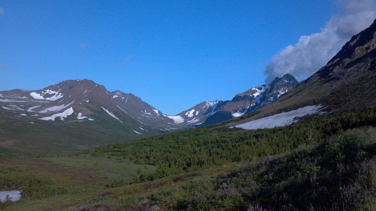
Amazing weekend around anchorage, taking advantage of the rare nice days we get this summer. We are losing almost 6 mins of light a day, and we are entering the wettest part of the year climatologically. Picture from Blacktail Rock Peaks near Eagle River.
-
Alaska/Western Canada obs and discussion
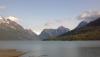
baroclinic_instability replied to patrick7032's topic in Central/Western States
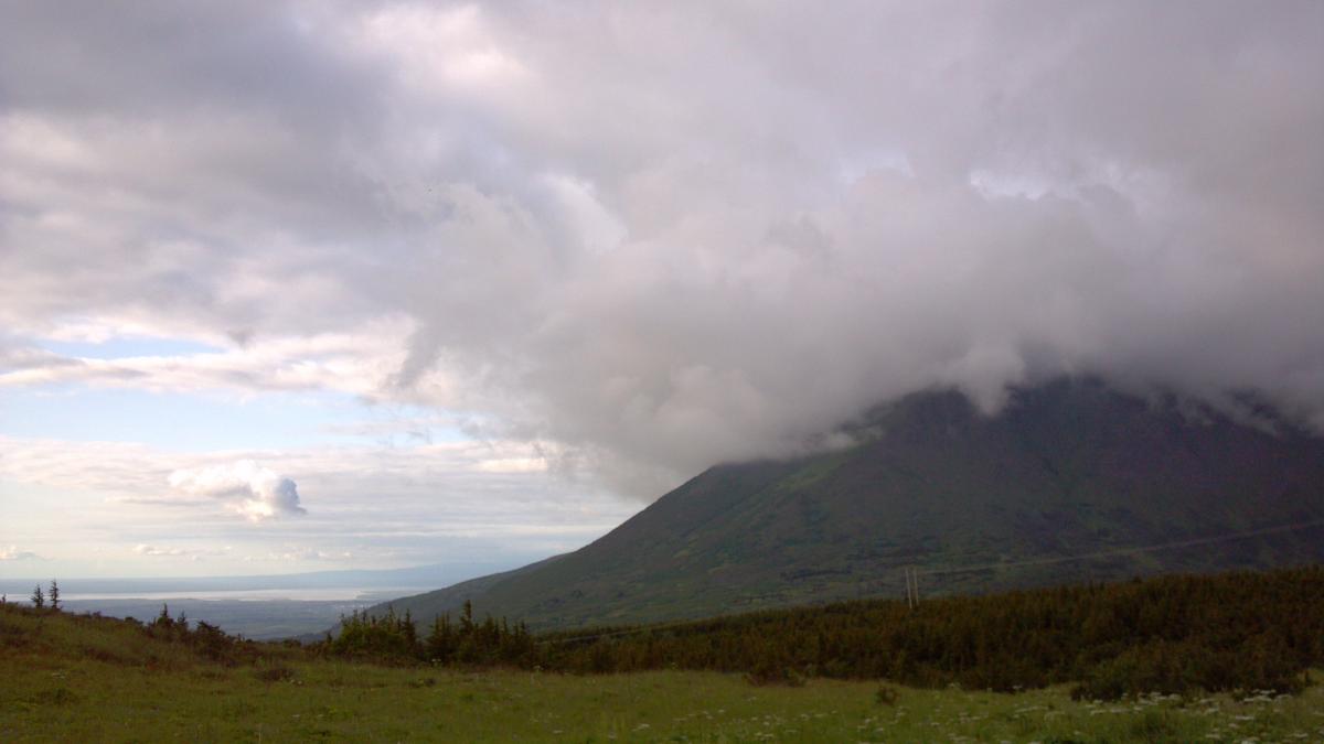
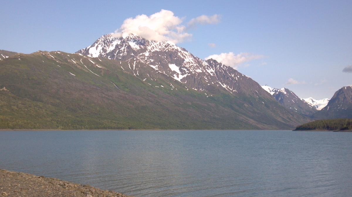
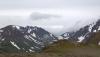
Still been a cool summer, but had a gorgeous day today, bluebird in Anchorage. Heading back into the Chugach along the Seward Highway, it is seemingly always cloudy back there as Pacific moisture ascends the coastal ranges in east/southeast flow. Still a beautiful evening.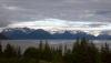

-
Alaska/Western Canada obs and discussion
baroclinic_instability replied to patrick7032's topic in Central/Western States
You are in Vancouver now? Post some pics from the area, I always wanted to go there. -
Alaska/Western Canada obs and discussion
baroclinic_instability replied to patrick7032's topic in Central/Western States
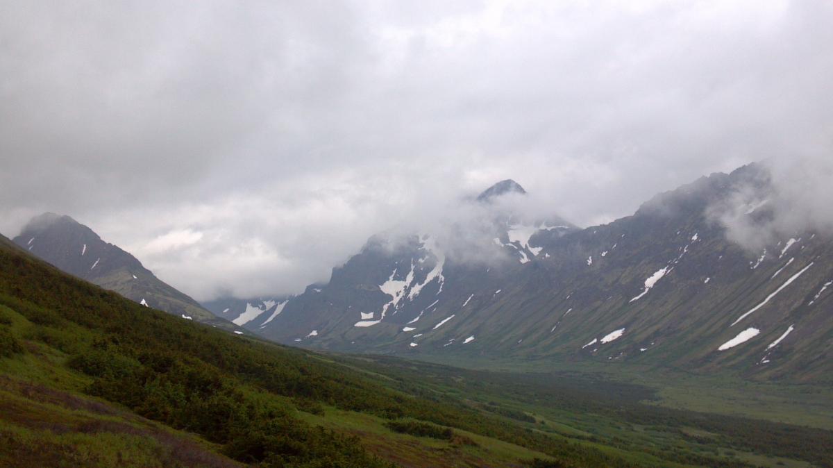
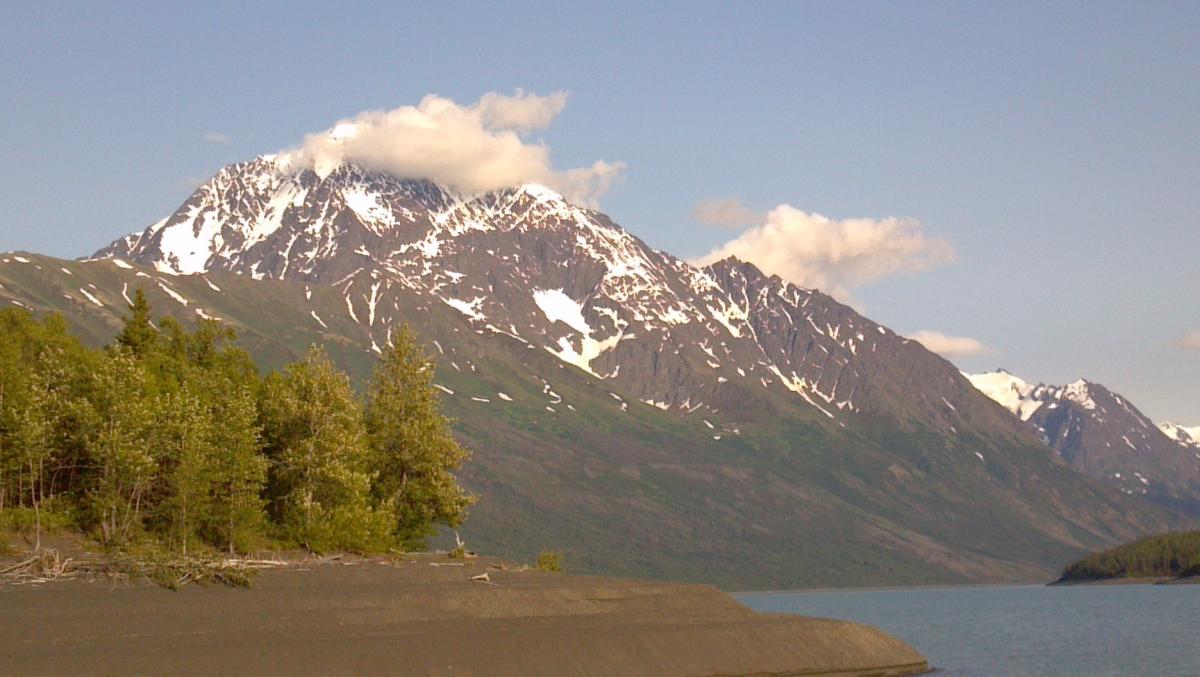
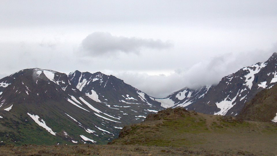
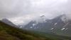
After 3 days of gloom and clouds, finally a break this evening. Was out hiking in the Chugach front range when the final bit of marine layer moisture pushed inland.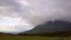
-
Alaska/Western Canada obs and discussion
baroclinic_instability replied to patrick7032's topic in Central/Western States
Thanks! I am happy to be here. Don't worry, once I get settled in here I will be posting more again. It doesn't help there hasn't been anything to talk about anyways with the craptastic weather pattern across the lower 48. -
Alaska/Western Canada obs and discussion
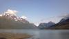
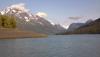
baroclinic_instability replied to patrick7032's topic in Central/Western States
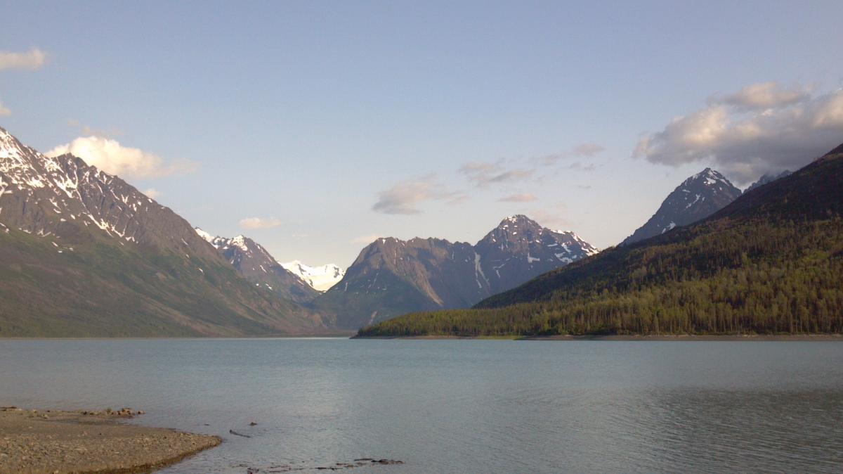
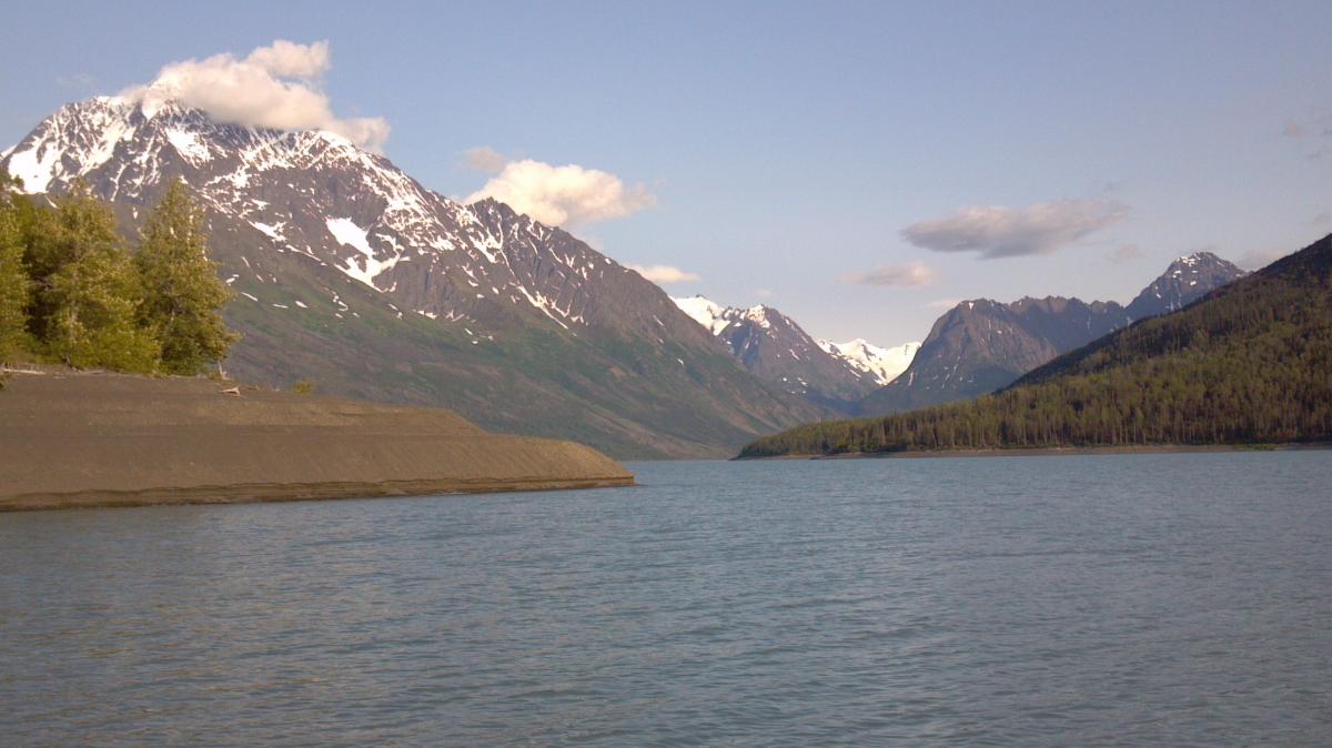
Took a hike near Lake Eklutna this afternoon. It is a glacial lake that actually is used for city water in Anchorage. Just a gorgeous day in Alaska today, the lake wasn't too shabby either.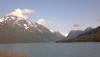
-
Alaska/Western Canada obs and discussion
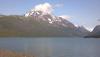
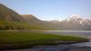
baroclinic_instability replied to patrick7032's topic in Central/Western States
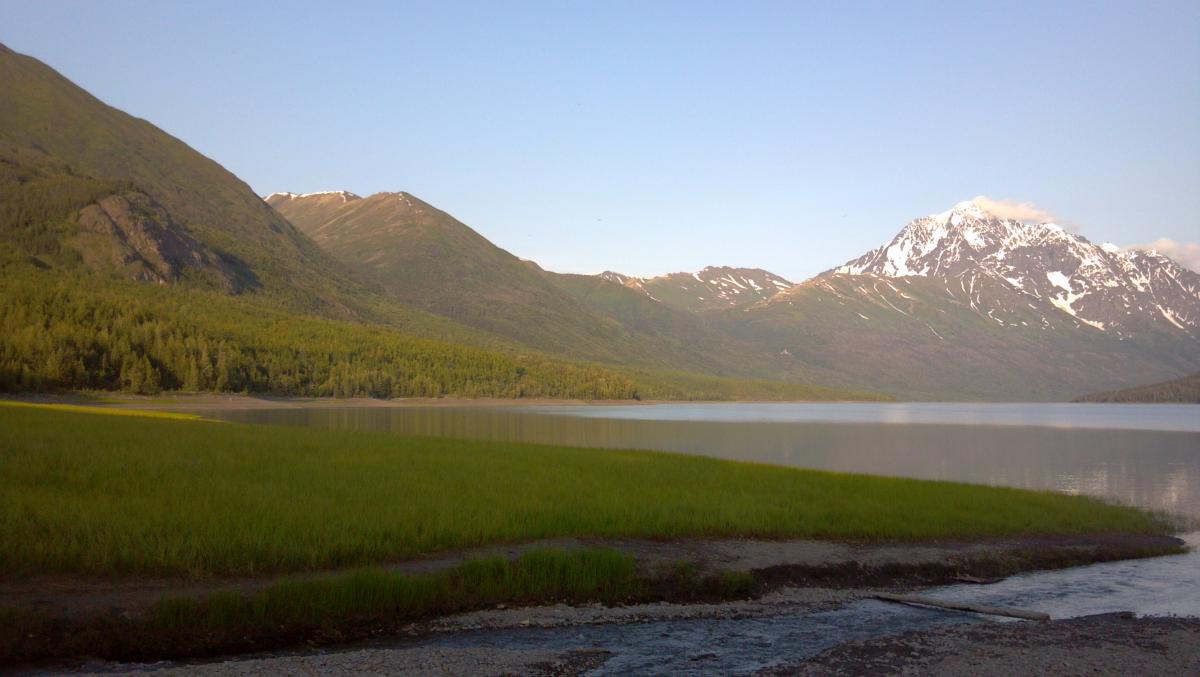
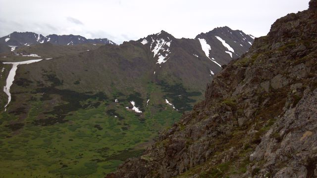
Still touring the area around Anchorage. A few pics from my phone. First pic from the Eagle River Valley northeast of ANC, the second from the Chugach along the eastern edge of the Anchorage bowl. Still getting used to full light at 10 PM.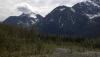

-
Alaska/Western Canada obs and discussion
baroclinic_instability replied to patrick7032's topic in Central/Western States
How is the heat treating you? I was glad to leave the 100+ degree heat, lol. 60s here feels like heaven. -
Alaska/Western Canada obs and discussion
baroclinic_instability replied to patrick7032's topic in Central/Western States
I moved here as a journey met. Will be here for a while, excited and incredibly intimidated. All the pattern recognition of the lower 48 is gone. Fells like starting all over again -
Alaska/Western Canada obs and discussion
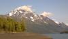
baroclinic_instability replied to patrick7032's topic in Central/Western States
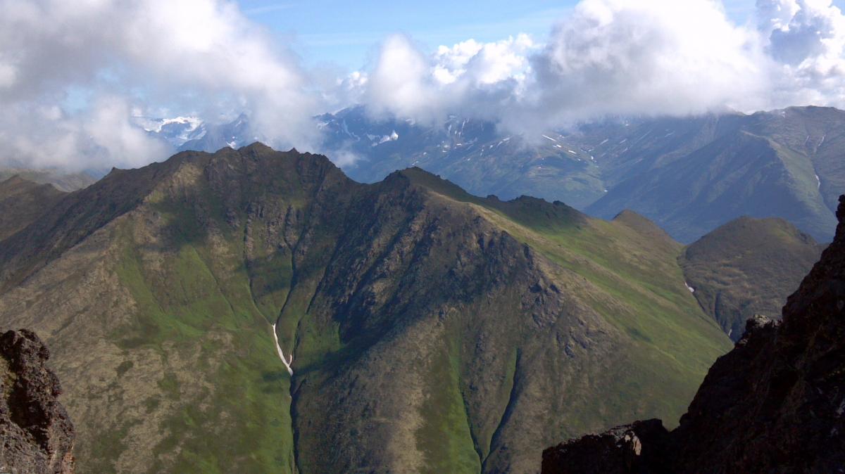
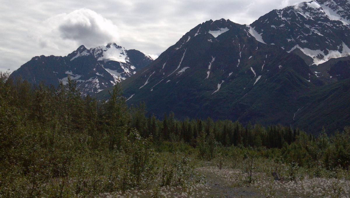
Well I am officially in Alaska now. About time to revive this thread. I would say something weather savvy, but I know nothing about Alaska weather. It is going to be a process. A couple pictures from the Chugach.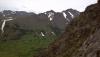
-
Alaska/Western Canada obs and discussion
baroclinic_instability replied to patrick7032's topic in Central/Western States
CIMMS has a nice blog article on the December 21st GOA bomb. http://cimss.ssec.wisc.edu/goes/blog/archives/9427 -
Alaska/Western Canada obs and discussion
baroclinic_instability replied to patrick7032's topic in Central/Western States
Hope you had a great Christmas! Keep posting the great pictures for us. -
Alaska/Western Canada obs and discussion
baroclinic_instability replied to patrick7032's topic in Central/Western States
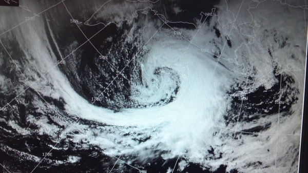
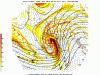
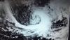
Just noticed that the Aleutian storm bombed into the low 940s. I bet you had a fun balloon launch Pat (if you were working).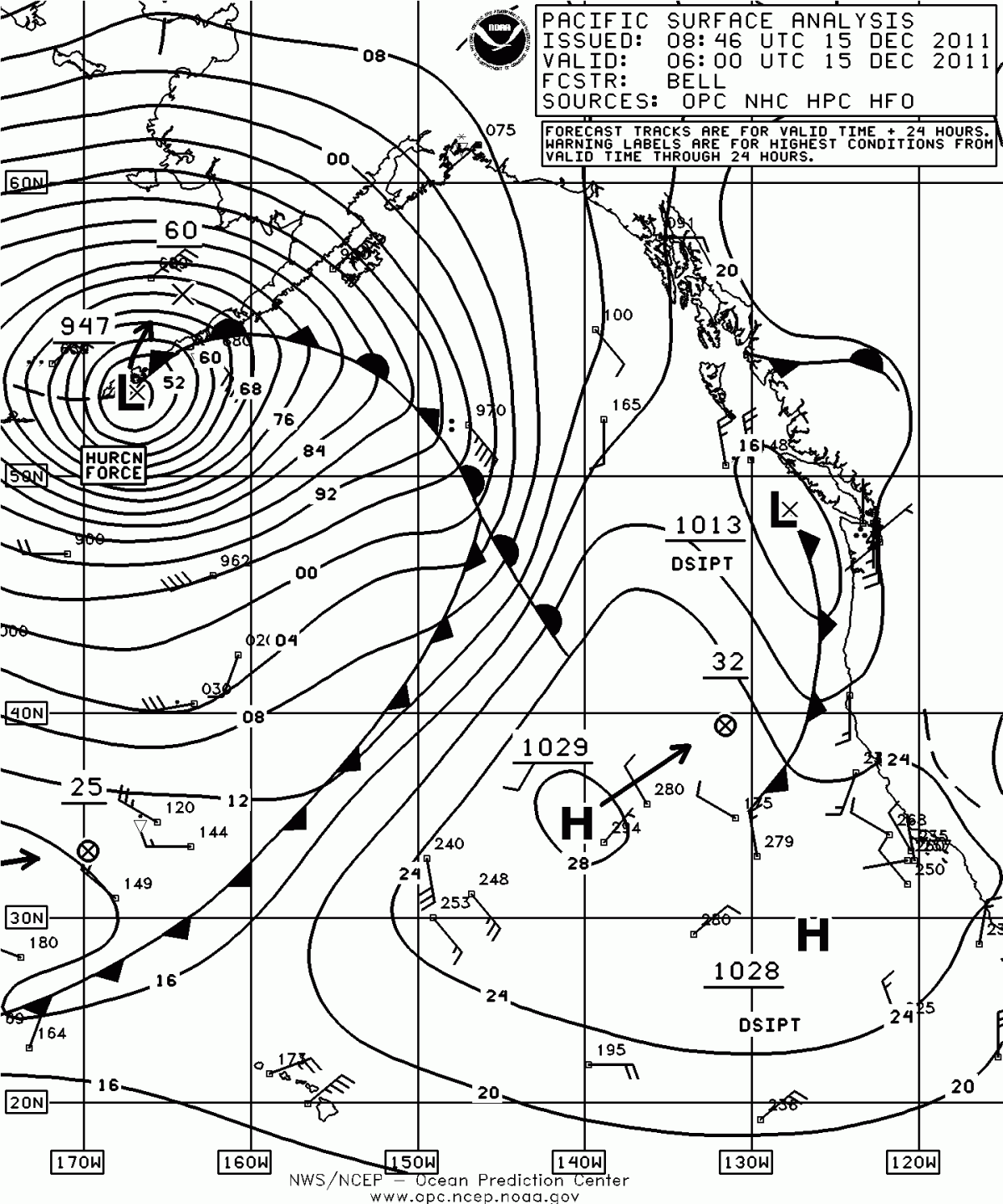
-
It is still 35 minutes before midnight in CST, so Happy Thanksgiving Diane

-
I never like it when the veteran subject comes up because it is a very sensitive subject. How can anyone argue against someone who has put their life on the line for their country? I have friends who have died in the military (one a good friend who died at age of 20) in Iraq. What I dislike is this often devolves into a veteran vs. non-veteran discussion, something it was never meant to be. Veterans performed a special purpose very few can ever claim, but I do believe the job should go to the best qualified. Is a Ph.D the most qualified? An experienced and trained meteorologist? A veteran? The hiring process is far from perfect, and it never will be, but I hope non-vets will consider the sacrifice of vets, and I hope vets will consider the sacrifice of long-term students/graduate students who have advanced meteorology to where it is today (compare it to 50 years ago). Life is unfair for everyone and there isn't much we can do but try the best we can.