
baroclinic_instability
-
Posts
7,869 -
Joined
-
Last visited
Content Type
Profiles
Blogs
Forums
American Weather
Media Demo
Store
Gallery
Posts posted by baroclinic_instability
-
-
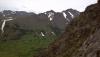
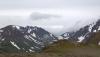
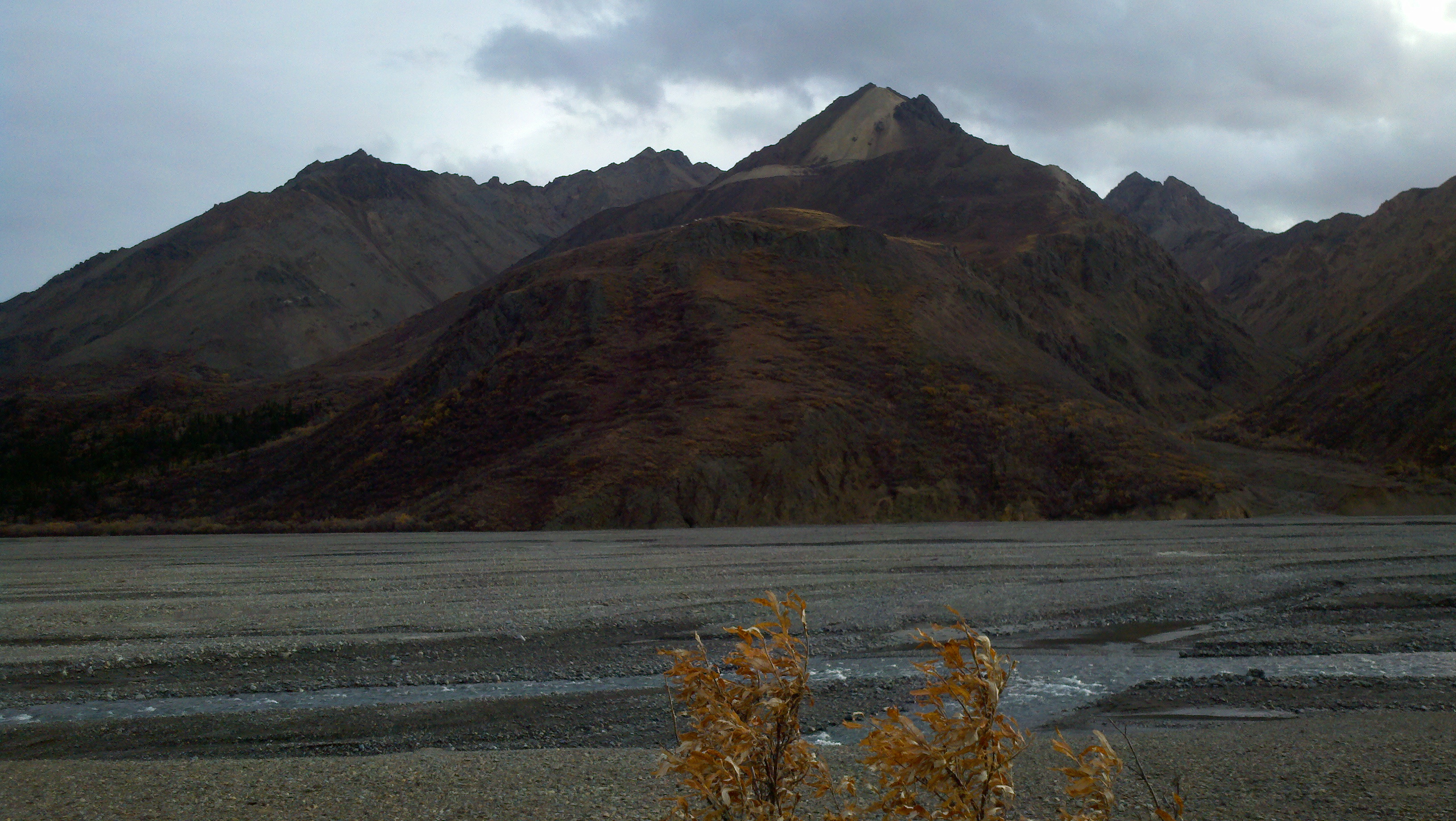
Well I am officially in Alaska now. About time to revive this thread. I would say something weather savvy, but I know nothing about Alaska weather. It is going to be a process. A couple pictures from the Chugach.
-
CIMMS has a nice blog article on the December 21st GOA bomb. http://cimss.ssec.wisc.edu/goes/blog/archives/9427
-
Thanks Patrick and thebigrombalski,
Merry Christmas to you and all the members of american weather !
Thanks for visiting and posting !
North Yukon will experience colder temperatures, but here in South Yukon, it will be colder but not too far from the normals.
-3.2C for now and some snow.
Hope you had a great Christmas! Keep posting the great pictures for us.
-
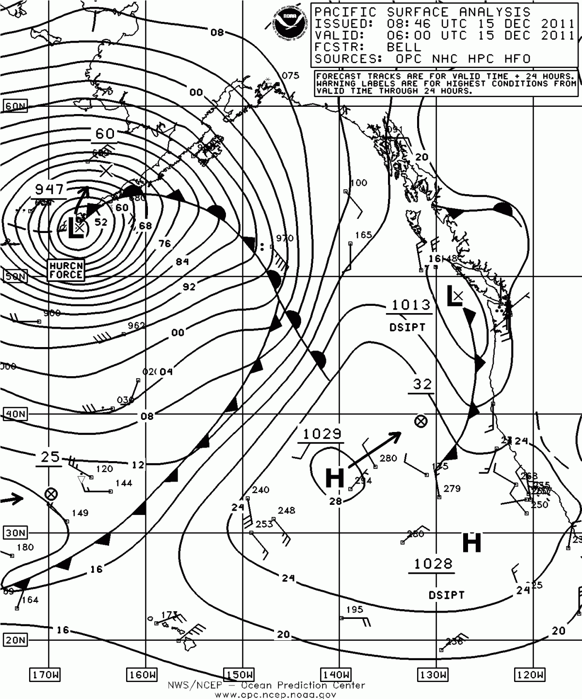
Just noticed that the Aleutian storm bombed into the low 940s. I bet you had a fun balloon launch Pat (if you were working).
-
I never like it when the veteran subject comes up because it is a very sensitive subject. How can anyone argue against someone who has put their life on the line for their country? I have friends who have died in the military (one a good friend who died at age of 20) in Iraq. What I dislike is this often devolves into a veteran vs. non-veteran discussion, something it was never meant to be. Veterans performed a special purpose very few can ever claim, but I do believe the job should go to the best qualified. Is a Ph.D the most qualified? An experienced and trained meteorologist? A veteran? The hiring process is far from perfect, and it never will be, but I hope non-vets will consider the sacrifice of vets, and I hope vets will consider the sacrifice of long-term students/graduate students who have advanced meteorology to where it is today (compare it to 50 years ago). Life is unfair for everyone and there isn't much we can do but try the best we can.
-
it has been that way for all govt jobs, for a long time...this is nothing new...two applicants, with equal schooling, and equal experience, pitted sided by side...the one who is a Vet will get the job...
what i'm trying to dispel is the myth that the govt hands jobs to Vets without taking into consideration whether or not the Vet has the necessary qualifications...that is false
besides, any person who signs their life over to the govt for a certain amount of years, should have extra preference when it comes to govt jobs...
Of course, but I didn't see anyone here saying that. If you have an undergrad degree in met with vet experience you should definitely be applying (if you want a red tag let me know...you can read all about it in the meteorologist only threads where we have discussed this for 40+ pages).
-
In terms of the private sector more, do you guys think it benefits a lot to have a masters? Or could that make you over-qualified?
See the post above. In private met, I hate to say it, but experience is the most desired. What is pretty pathetic these days, however, is all met companies want experienced forecasters. That said, there are still companies that will hire non experienced mets because they can pay them less, and there simply isn't a huge pool of experienced mets applying for entry level jobs. Try road weather companies like Meridian (where I started) or NW Weathernet. There are many others as well.
-
So, long-time lurker here. Doesn't say this on the profile, but I'm a meteorologist.
I think these days it's strongly preferable to have an advanced degree for most parts of the field. If you're doing broadcasting, there seems to be a bias against advanced degrees (they're looking for a communicator, so an advanced science degree is an overqualifier for most stations). But generally, a master's degree makes you a stronger prospect for job openings, and will allow you to advance further.
It's a double-edged sword with PhDs, however. The education is a plus. But, many private companies recognize that PhDs expect to be paid that much more, and that doesn't fit with a lot of bottom lines. If you're doing a PhD, it might make it harder to find an opening, as you're overqualified for the entry-levels.
I opted to stop at master's level and followed some of the other recent masters' grads from my program into the energy industry. Most of my colleagues who did PhDs are in some combo of research/academia, and the ones who stuck with the bachelor's either did broadcasting or left the field. That's been my experience anyway.
P.S. On another note, for NWS, I believe 15% of their hires had advanced degrees in 1985. today, the number is more like 85%. Unless you're a SCEP or something, you'll likely need a master's to get a job offer from the NWS.
Depends on the office. 3 folks from this board alone in the last 9 months all managed to be hired by the NWS without M.S. degrees, including me. In this insane market, there really is no such thing as a "perfect candidate", and there is no foolproof or simple way to get in these days whether it be the NWS or private meteorology. It sounds cliche, but the best thing to do is diversify and get a lot of various experiences on your resume.
-
not a big deal in the sense I'm not going to b**ch about those who served in war getting preference.
several hundred is a little bit of a stretch..the most i've heard is 430...and those tend to be highly sought after east coast locations. Buffalo had 116 last winter.
I actually haven't been blocked from the last several applications I've sent in. The downsizing of the Iraq and Afghanistan operations could be concerning for the non-vets trying to get in over the next couple years, though.
In the end, the hope is the job goes to the most qualified applicant, vet or not.
And several hundred isn't a stretch. Most now have 100-200 applicants per intern opening, even smaller offices.
-
One thing about the NWS, I think a lot of mets are drawn to it in part because the pay and benefits are currently a lot better than most private sector met jobs. I think in the future though that this difference may be less as there is talk of scaling back benefits and pay of federal workers.
Not even close. Most private sector jobs in meteorology (not energy) pay 1/3rd and sometimes 1/4th the pay. I know because I started in private weather too where you weren't going to make more than 25-30k a year with minimal benefits.
-
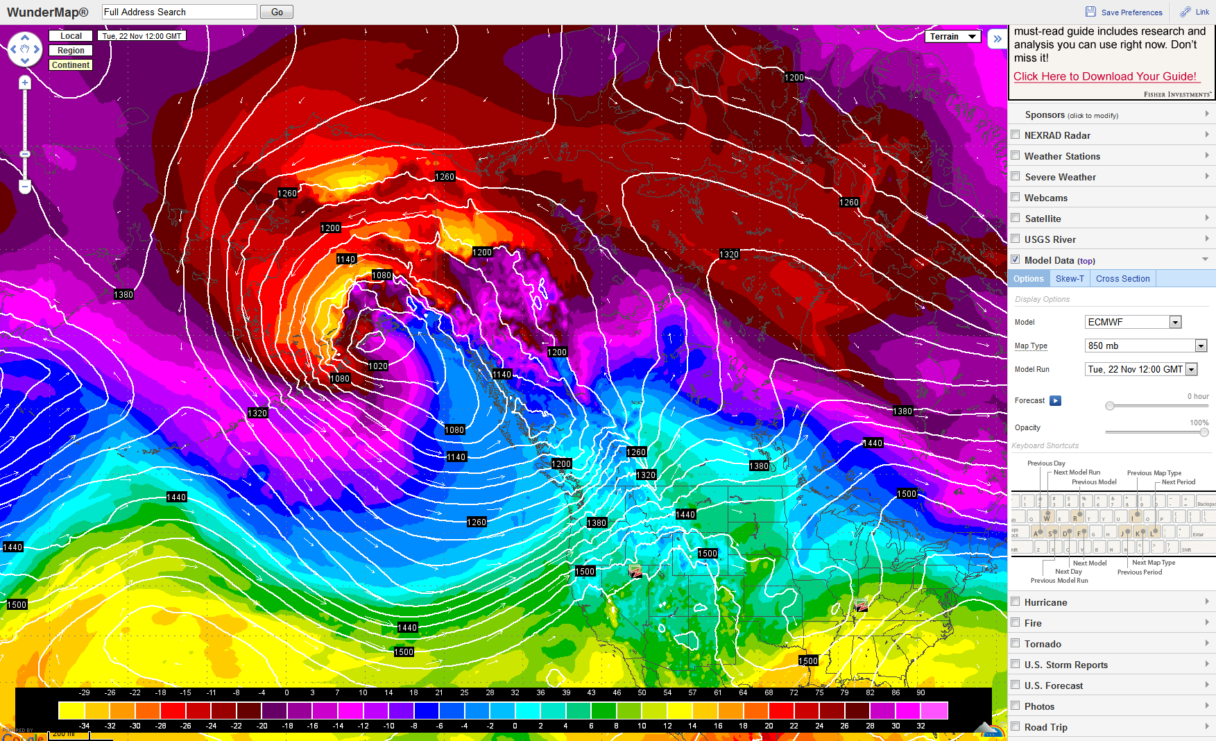
Check out those 500mb heights!
12Z ECMWF analysis. Those 850 temps are incredible. Polar Vortex of pain and gnashing of teeth.
-
As promised, here are some pictures I took this afternoon (by -30/-31):


This evening, a lot of temperatures are already below -30C, here we have -29.5C at 6:30.
The night may be frigid if the sky stays clear.
Awesome pictures. You can tell how cold it is. In ND we would get cold stuff like that all the time..I am used to it. I love it when the ice crystals would fill the sky with all sorts of neat optical phenomena.
-
Observations from Palmer AK last evening. They were sitting at -5F at 153Z by 553z they had jumped up to 13F. Mixing anyone?
PAAQ 160705Z AUTO 03030G45KT 2 1/2SM BLSN CLR M11/M19 A2973 RMK AO2 PK WND 02045/0659 TSNO
PAAQ 160653Z AUTO 03027G49KT 4SM BLSN CLR M11/M19 A2973 RMK AO2 PK WND 05049/0651 SLP070 T11061194 TSNO
PAAQ 160605Z AUTO 03029G42KT 5SM BLSN CLR M11/M19 A2974 RMK AO2 PK WND 03042/0604 TSNO
PAAQ 160553Z AUTO 03028G42KT 2SM BLSN CLR M11/M19 A2975 RMK AO2 PK WND 03045/0542 VIS 1 3/4V3 SLP074 T11061189 11106 21211 58023 TSNO
PAAQ 160453Z AUTO 03023G33KT 7SM CLR M14/M19 A2977 RMK AO2 PK WND 01037/0442 SLP081 T11391194 TSNO
PAAQ 160353Z AUTO 13005KT 10SM CLR M19/M22 A2980 RMK AO2 SLP092 T11941217 TSNO
PAAQ 160253Z AUTO VRB03KT 10SM CLR M20/M22 A2982 RMK AO2 SLP098 T12001217 56012 TSNO
PAAQ 160153Z AUTO VRB04KT 10SM CLR M21/M22 A2982 RMK AO2 SLP099 T12061217 TSNO
The mixing out of valleys in mountainous regions can be a major pain in the arse since it can result in temp swings in excess of 20-40 degrees. Not to mention how "deep" does the mixing occur.
-
Whose decision was this? I want to know who to be pissed off at.
The MIC of LOT explained the hiring system, from the application to the points to the "gold group" to the interview and whatnot and it sounds nearly impossible to get in unless it's through SCEP. So it really sucks that SCEP is going away.
It actually came from President Obama, it was not an NWS decision. Obama completely overhauled the hiring system across the government. The NWS actually lobbied to keep it since it has been determined by the NWS that SCEP is a very beneficial program for the NWS.
-
I'm a computer moron, what is GIS? I see and hear about it all the time, I want to say its the NWS comp system deal but isn't that GFE?
Geographic Information Systems. It is an entire degree field in itself. It is becomingly increasingly common for mets to either minor in it or dual major in it. It is a good route to go since it really increases your value. We use quite a bit of GIS in the NWS, and I personally wish I had more experience than my one course. It comes in handy in a number of situations.
-
I'm sure it varies greatly by University...but Iowa State did a good job of keeping things realistic when it came to future employment discussions. Our professors always harped on us that competition was stiff in met and you need to really do all you can at any given time to make yourself competitive. They'd joke about it...saying some of us would end up working at the Union selling books after a bad test. That motivated me. I didn't exactly want to waste all the money I was paying for a noble, yet service job. I'm pretty sure we all got it.
Yeah we had a similar experience at University of North Dakota as well, and our professors were very up front regarding the poor job market. They were pretty aggressive at placing students in volunteer/internship programs, and they put quite a bit of effort into preparing the students for the next step in their career whether it be TV met, grad school, forecasting, etc. It is really why I strongly suggest to all potential mets that they pursue a "smaller" program where they can get to know their advisers/professors and vice versa.
-
I couldn't believe the high number of my classmates that didn't have a specific employment goal after college.
That or the folks who simply didn't have a backup goal. It certainly is a problem in meteorology given the relative lack of jobs. I would like to see universities more aggressively prepare undergrads for the reality of meteorology, but I have heard all too often of undergrads/grad students thinking they had guaranteed jobs out of college, so it is obvious students are unprepared. Of course, much responsibility falls onto the students themselves, but the university plays a major role as well.
-
I wasn't sure which thread to put this in, but Yahoo news came out with a list of 10 college majors with the lowest unemployment rates. Ironically, atmospheric sciences and meteorology was 9 on the list with a 1.6% unemployment rate. Where or how they came up with this information, I have absolutely no idea. This practically seems blasphemous to me given the number of unemployed mets out there. I'd be more than willing to bet that the actual figure is much higher than 1.6% and that this is simply an example of shoddy journalism. This piece is about as bad as the article US News came out with a while ago stating that mets had an average (or was it median?) salary of 85K, something we all now isn't true. Link to the article:
Yeah, I agree, I think a more representative number would be closer to 60-70% not working in the field of met/energy/other related fields. In terms of mets with no job at all (in any field), I am sure it is much lower, but still not 1.6%.
-
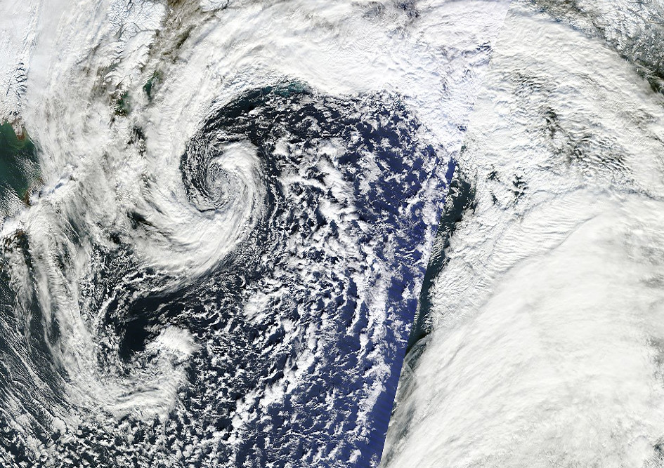
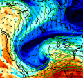
Wow that is pretty awesome. Dual baroclinic seahorses.
-
-
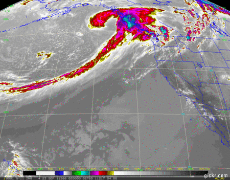
Absolutely wicked looking system. The last 6 hours on this satellite loop are sick.
-
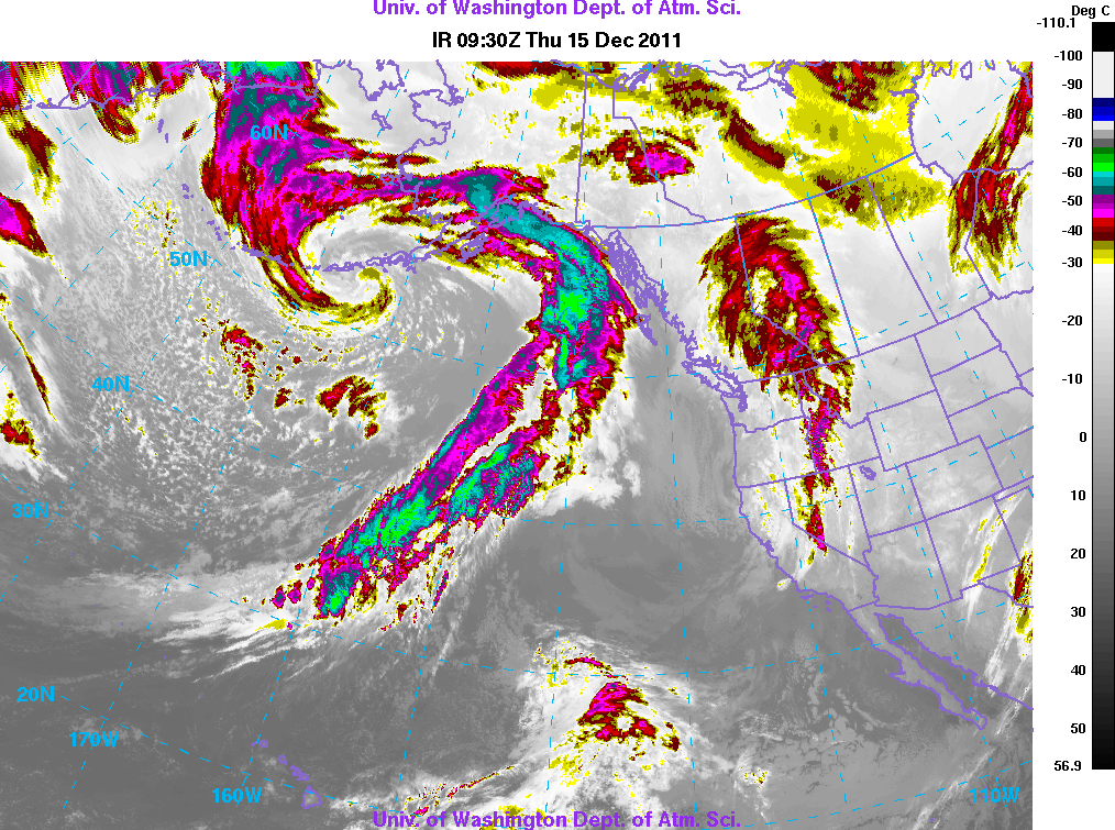
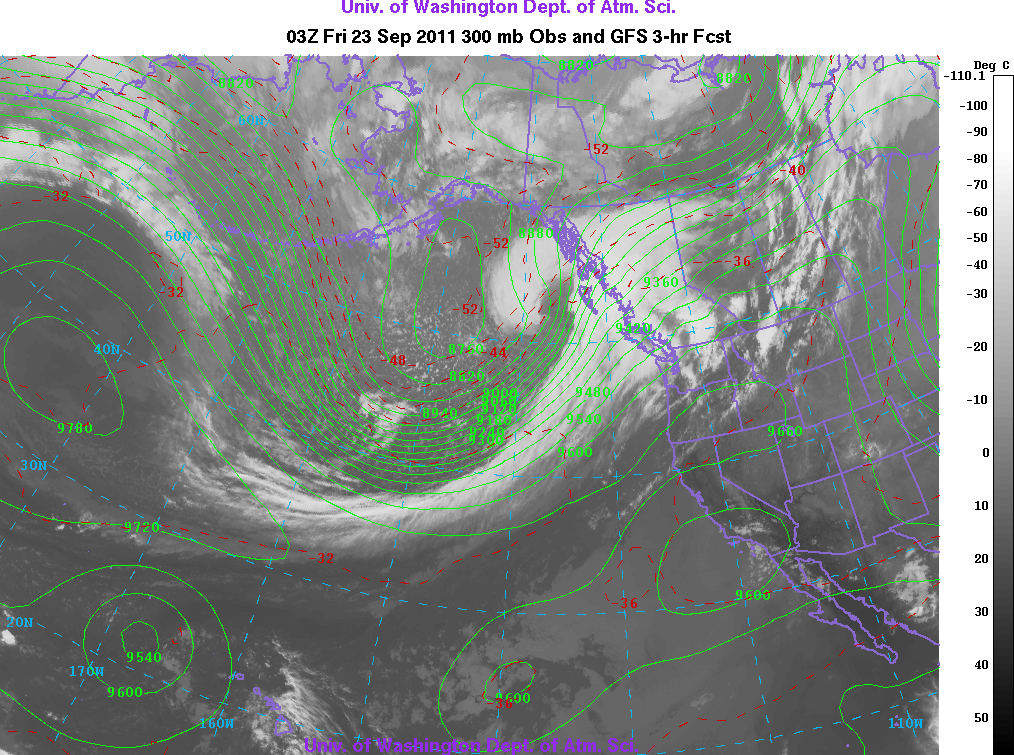
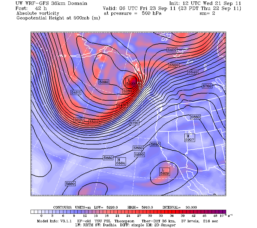
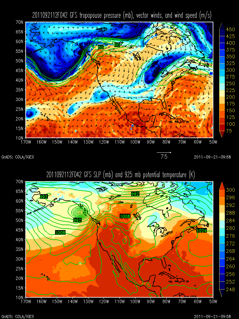
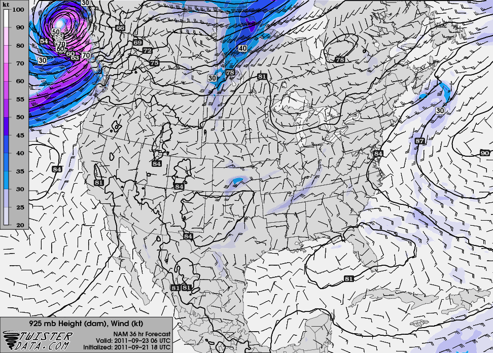
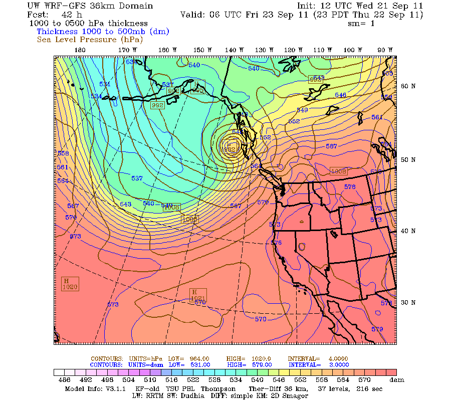
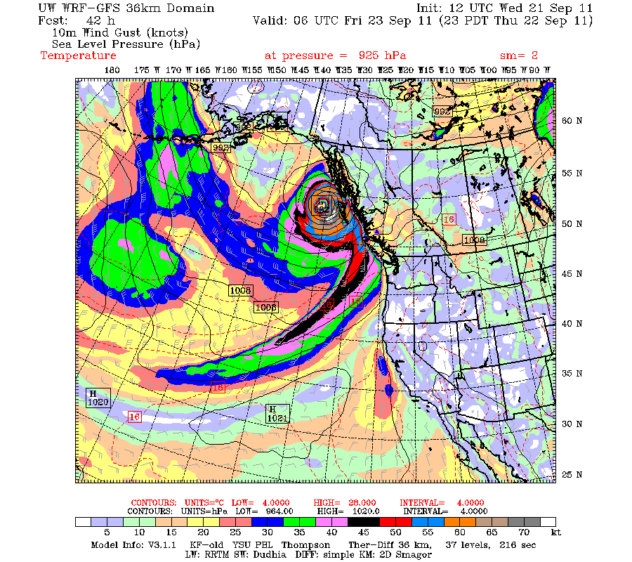
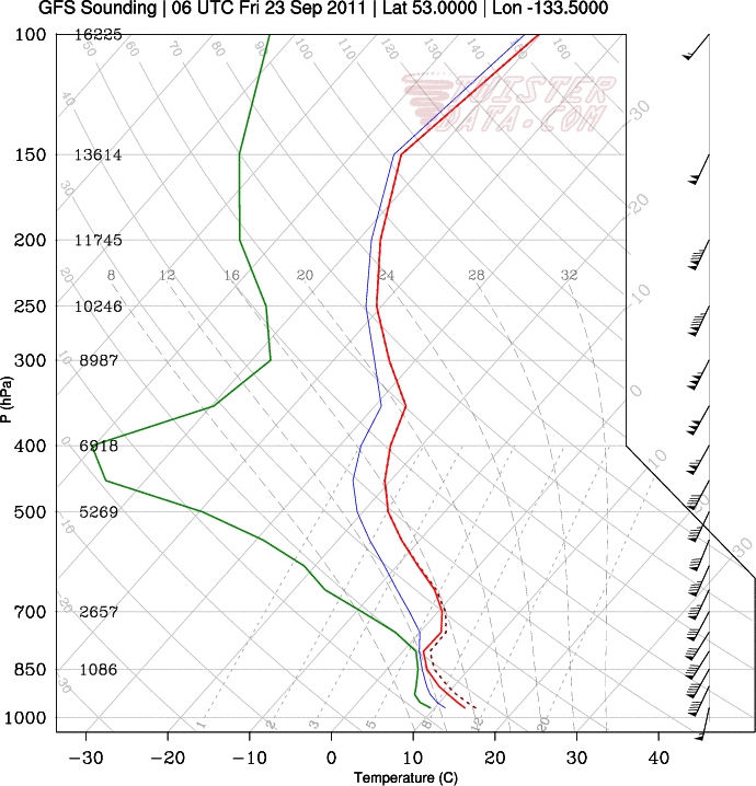
Very impressive bomb about to go off in the GOA near the BC coast. Incredible jet streak, but the very impressive part is both the rapid intensification and extreme low level baro zone. Even more impressive is the rather unimpressive PV. This is being driven nearly solely by a highly divergent jet maxima aloft.
Straight unidirectional 90 knot low level winds and progged nearly dry adiabatic lapse rates. Going to be some possible 100 MPH wind gusts.
-
Those high wind launches are always your best stories, and the ones you'll remember. Though I can honestly say I never had the pleasure of even approaching 65 mph.
Oh I already have all sorts of stories. Best launch yet was a balloon that got caught in the downstream eddy of the UA building and essentially knocked straight into the ground 2-3 times (including one full revolution). The sonde was slammed into the ground, but the flight was still successful.
-
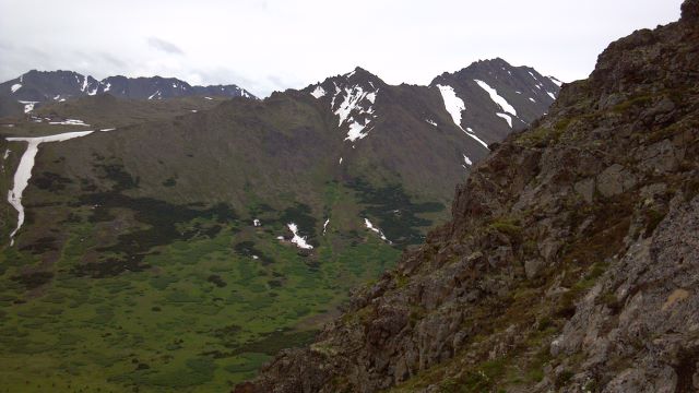
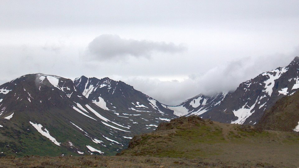
A couple pics from Denali yesterday.
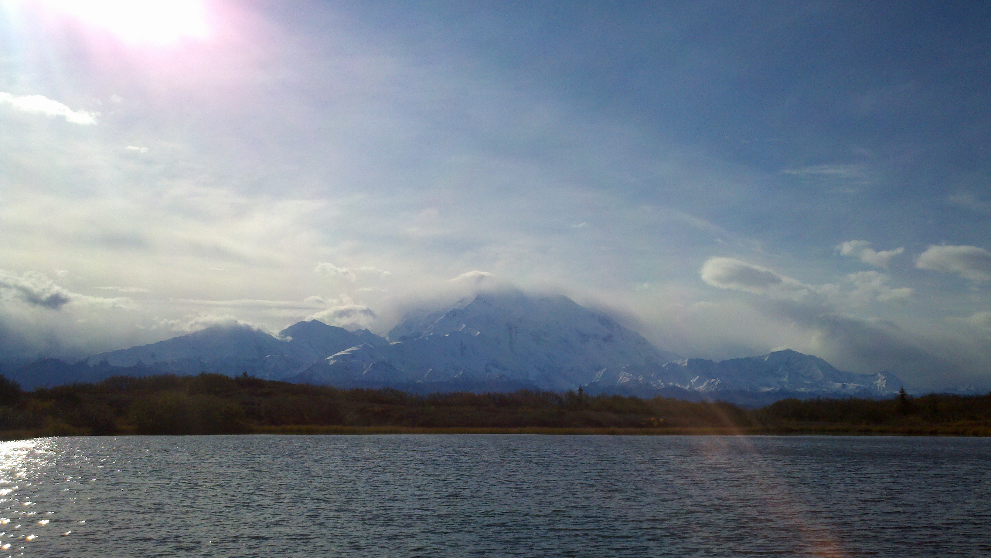
Snow levels look insanely low on Denali (Mckinley).
What is the height of the bottom mountain? 4-5000 feet?
Alaska/Western Canada obs and discussion
in Central/Western States
Posted
I moved here as a journey met. Will be here for a while, excited and incredibly intimidated. All the pattern recognition of the lower 48 is gone. Fells like starting all over again