

aggiegeog
-
Posts
1,145 -
Joined
-
Last visited
Content Type
Profiles
Blogs
Forums
American Weather
Media Demo
Store
Gallery
Posts posted by aggiegeog
-
-
I had tons of lightning at my house this morning. The front looks to be moving into Tyler now so the rain is about to be over here and temps will fall to around 60.
Signs are clearly pointing towards a cold December. If the EPO stays close to neutral I expect cool to cold with regular storms coming across our region. If the EPO dives then I expect bitter cold, but less storminess. I'll happily take either.
-
8 minutes ago, DoctorMu said:
Think we'll see a warm and dry winter. However, there should be occasional polar blasts as Siberia is already in the deep freeze with a mammoth snow pack.
Just curious why do you say that? At least for December, it looks cold with lots of blocking over the top setting up a parade of southern stream cold storms. Very cold air is possible if we can get a NE Pac ridge.
-
1 hour ago, bubba hotep said:
FWD has the point forecast low at 33 for the areas around me. So it wouldn't take much more for some in the northern areas to see the 1st freeze of the season. Also, maybe a rumble of thunder tonight!?
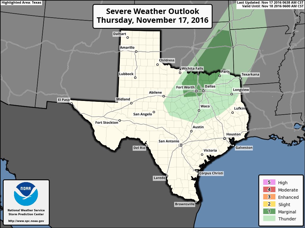
It does appear that there could be enough instability for a few storms of some intensity late today.
-
Today will be very windy across NM and W TX with winds gusting to near 60 mph and even higher in the mountains. This system looks to come through dry out there outside of high elevation snow showers above the resorts. The front will move into N and E TX tonight bringing showers followed by falling temps through the day tomorrow. Temps could fall into the low 50s by tomorrow evening. The weekend looks cool with highs in the upper 50s to near 60. Saturday morning will likely be in the 37-45 range (the less wind the colder it will get). Sunday morning will likely feature widespread frost with some spots below freezing.
-
23 hours ago, Roy said:
I am usually of the mind to wait to call winter cancel, but this is getting alarming. Still plenty of time to turn around though.
The first shot of solid chilly air will be here this weekend with frost possible in rural areas. This week looks pretty warm though until Friday or so when the front flips us to chilly air and a brisk N wind. I really hope we get some rain though eventually, the SE ridge is nosing a bit too far west for my liking.
-
On 11/8/2016 at 11:30 AM, DFWWeather said:
DFW Airport sets another unprecedented record today. It still has not fallen below 50°F officially. Last year set the latest record of doing so on November 8, 2015. Unless we can manage to do so in the next couple of days (and it might be close), this is really going to be some record of being the latest ever to fall below 50°F. On top of which, when is it going to get colder? I thought for sure the drop of the SOI at the end of October would have forced the pattern change. GFS is on board for later next week for a real cold front, but the ECMWF has been waffling back and forth with the latest runs deflecting all the cold air to the east. My hopes for any winter a really going down with each passing day.
Today matched the seasonal low at my house with 43. We have been in the 40s 6 or 7 times already. All of East Texas down to Lufkin fell into the 40s with some 30s this morning.
-
We have had very little rain out of all of this, maybe a quarter inch, it has all been north or south of I-20 in East Texas.
-
It looks like the first big snow of the season is going to occur late this week for the mountains of NM. Significant snow levels may stay above 10,000 feet though it could drop to 9,000 or so feet. Upper portions of TSV and SSF could see over a foot from this. The other resorts may be too low for significant accumulations, but it will be close temperature wise and in the mountains you can usually bet that if close it will snow. More snow is likely with next week's storm.
-
It looks like near normal temperatures will finally return by late this week and a decent shot a rain returns early next week courtesy of a SW cutoff low as long as it makes it far enough east to affect E TX. Late next week could turn pretty chilly with highs in the 60s and maybe even cooler. The 1983 analog is looking pretty good, SSTs in the Atlantic and Pacific are very similar and Arctic Sea ice was a bit less then but pretty similar. We all know how it continued to get colder through November and by mid December we had our coldest multi-week stretch in modern history back 33 years ago.
-
Models are starting to see the flip. My 11/8 freeze date may be a tad early but likely not by much. As long as the cold does not set up over the Lakes we look to be in good shape for the winter. The bigtime snow buildup over NW Canada seems to bode well for Arctic highs sliding down the lee of the Rockies this winter.
-
The weather station nearest my house has averaged 83.9/60.3 so far this month. Normal at Tyler to date is 79/57.2. The lack of precip is partly to blame with only about 2" so far this month which is the difference between a strong El Nino last year and a cool neutral this year.
Above average snow pack in Asia and NW Canada and a building snowpack in Alaska should allow cold air to begin building and very weak Polar Vortex this year will keep the cold from being bottled up this winter. The lack of a STJ should prevent much overrunning moisture over the shallow -EPO fronts this winter so I expect rapid swings between mild and cold. My concern for this winter will be that the cold gets focused on the Great Lakes and we have a strong SE ridge that tries to nose into eastern Texas preventing the backdoor fronts from making it here.
-
43 this morning for a new low for this Fall season. I think we are on track for an area wide frost around Nov. 8-12th and an overall cold start to winter. The GoA is warm and will lead to a predominately -EPO winter plus the -AO continues and will stick with the rapid snow growth in Asia and NA supporting an early breakup of the PV which is very weak in the first place this Fall. The La Nada should prevent much of a STJ this winter so look for storms to come out of the NW so big cold but lacking in precip. Our big precip will come from lows that develop on the lee of the Rockies and move across Texas, these seem likely to provide some severe weather this winter also. So overall I expect periodic cold with below normal precip though a few winter storms seem likely and if they time out with a big -AO then snow is likely otherwise our standard sleet and freezing rain. Should be am interesting winter with no dominant player in the atmosphere.
-
We made it down to the low 50s this morning, it felt great.
-
15 hours ago, cstrunk said:
I didn't have high hopes for rain since they lowered the rain chances to 30% in Tyler, but we got lucky and picked up somewhere between 1-1.5" or so. I'm looking forward to the 80's this week.
Same in Hideaway, got around 1.5" with some very heavy downpours yesterday. Now enjoying the cool, cloudy weather. Wondering if upper 40s may be reached this week in the cold spots. Sure looks like Fall has finally arrived with no 90s in sight.
-
Cool weather and rain is becoming increasingly likely early next week. Wonder if we can get a day with a sub 70 high. Our first sub 60 lows look likely.
For NM, the ski resorts could see snow with this weekend's storm down to base level (8-9,000 feet).
Angel Fire, NM always amazes me with its temperature swings. On Monday, they fell to 23 around 5 am and the temp rose to a high of 79 in the afternoon.
-
After a couple morning of mid 60s we are back to more summer like temperatures this week. Fall looks to show its face around mid month with lows dropping into the 50s possibly.
-
Looking forward to a cool (relative) and dry weekend. Tomorrow morning will be my first sub 70 low this season and it could fall into the low 60s.
-
11 hours ago, raindancewx said:
It's apparently fall here in New Mexico, with snow last night at 12,000 feet, and temperatures in the 70s all afternoon in Albuquerque.
I was wondering if the peaks would get any snow out of this. I'll have to ask my grandparents if they see any on Jicarita if they are still at their cabin.
-
Never made it out of the mid 70s with 73 most of the day in Tyler. Steady light to moderate rain all day. Nice to finally get some rain.
-
Storms building in E TX. Hearing lots of thunder here in downtown Tyler, but the storms are staying just south of me for now.
-
Apparent tornado hit a subdivision in my town of Lindale in E TX.
Texas/New Mexico/Louisiana/Mexico Obs And Discussion Thread Part 8
in Central/Western States
Posted
Looks like the first real snow for the NM mountains just in time for some powder for TWeek skiing. This looks to bring the first decent rain in a long time to E TX tomorrow. The post TDay storm looks to bring the first real storms of the Fall followed by chilly air. Then our first winter weather threat of the season comes in early December with -EPO, -NAO and severe -AO.