

1900hurricane
-
Posts
1,004 -
Joined
-
Last visited
Content Type
Profiles
Blogs
Forums
American Weather
Media Demo
Store
Gallery
Posts posted by 1900hurricane
-
-
-
Outflow reinforced cold front looks like it'll quickly clear most of SE TX out of the threat area.
-
26 minutes ago, wotan said:
A picture of the Franklin tornado.
Sent from my Pixel 3 XL using Tapatalk
-
 1
1
-
-
Very badly rain wrapped.
. -
Wouldn't be surprised to see a tornado warning with that one soon. Velocity is beginning to tighten up as it crosses US 77 south of Rockdale.
-
The cell near the KGRK radar site looks like it's getting together. That one looks right on the warm front.
-
Anyone have a good surface ob page? The one I usually use has been down since yesterday.
-
San Antonio cell is tornado warmed again. Looks like it might end up passing just north of the main city.
-
I'm not chasing in the classical sense today, since I have something something going on in Houston this evening. However, the HRRR has been rather persistent in dragging a strong triple point cell very near me around 18Z. I might see how that plays out before leaving College Station.
-
There is already a tornado warned cell approaching San Antonio.
-
 1
1
-
-
06Z is moderate risk.
-
1
-
-
Good lord at that Experimental HRRR run, from start to end. Maybe too many storms scrunched up together, but that is a very intimidating simulated reflectivity.
-
Just now, yoda said:
Do you have a link to that? That doesn't look good at all
That's the SPC's HREF page. You can get there from the main SPC page through the Forecast Tools menu. Alternatively, here's the link.
-
 1
1
-
-
Anything that goes up early along I-45 is going to have just about the same type of volatile parameter space seen in Louisiana in the afternoon. The 00Z HRRR actually takes a UH streak over my apartment between 14-15Z.
-
Earlier runs of the NAMs expanded the threat back to the west a bit too, but have come more in line with the globals/SPC recently. It'll be interesting to see if some of the CAMs like the TTU WRF do the same.
-
That's quite a volatile warm sector as depicted on the 00Z NAM, especially around 21Z. Anything out in the open warm sector could have a field day should that come close to verifying.
-
1
-
-
5 hours ago, David Reimer said:
Based off your tornado report I'm going to assume you did indeed go chasing

That I did. Wasn't expecting much, but I did manage to see a brief rope just north of Calvert today! All my pictures of the tornado suck (thanks old iPhone), so here's someone else's photo from basically the same viewpoint that doesn't suck.
https://twitter.com/arianaelena97/status/1114682945103593477
-
1
-
-
Might consider a local chase today.
https://twitter.com/1900hurricane/status/1114568005915152384
-
1
-
-
-
-
1
-
-
I don't know if they're going to be able to stay rooted at the surface with nightfall, but I don't see why not if they can. The 00Z sounding from Midland had very impressive low level shear.

That being said, capping increases considerably just to the east, so that might snuff them out pretty quickly.
-
That one cell the HRRR keeps developing in SE NM around 21Z certainly is interesting. That's probably where I'd target if I were out today. It's somewhat on an island with that cell though.
-
Even given a supercellular mode, storm vectors are to the NNE in excess of 50 kt. That's not exactly friendly to anyone.
-
As of today's 12Z model cycle, the GFS and ECMWF are actually pretty similar for next week's storm system. The ECMWF is a tad slower and deeper with the trough wrt the GFS, but that's a fairly normal bias between the two. I bet the SPC gives Tuesday a risk area in the next 4-8 day outlook.
https://twitter.com/1900hurricane/status/1103749722609717248
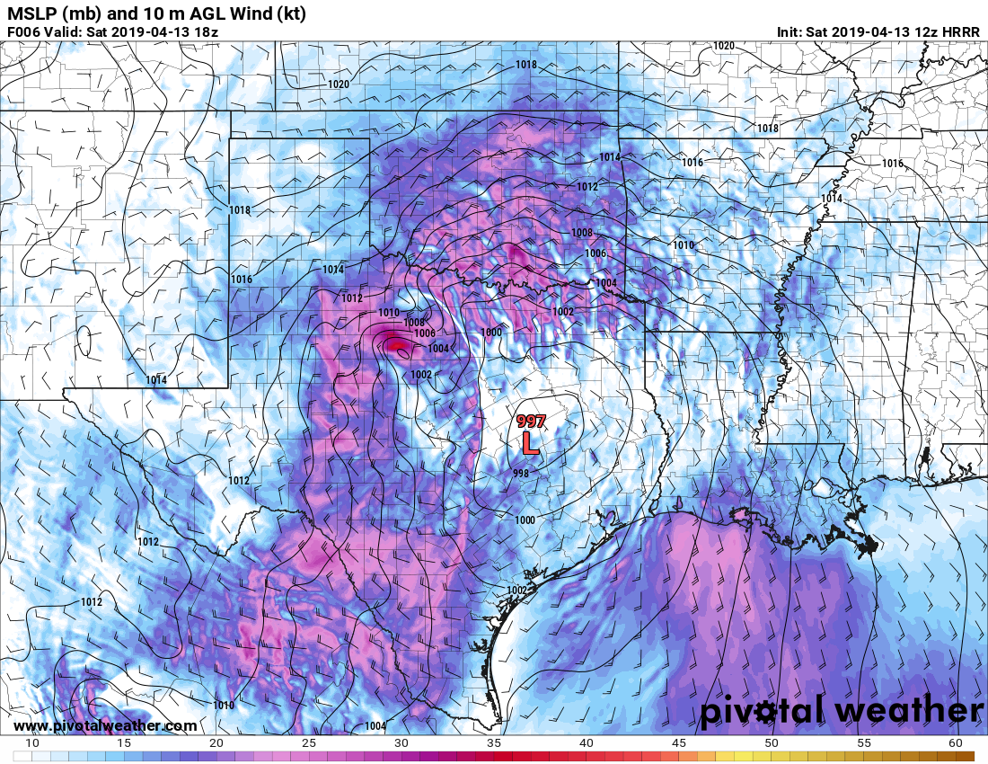
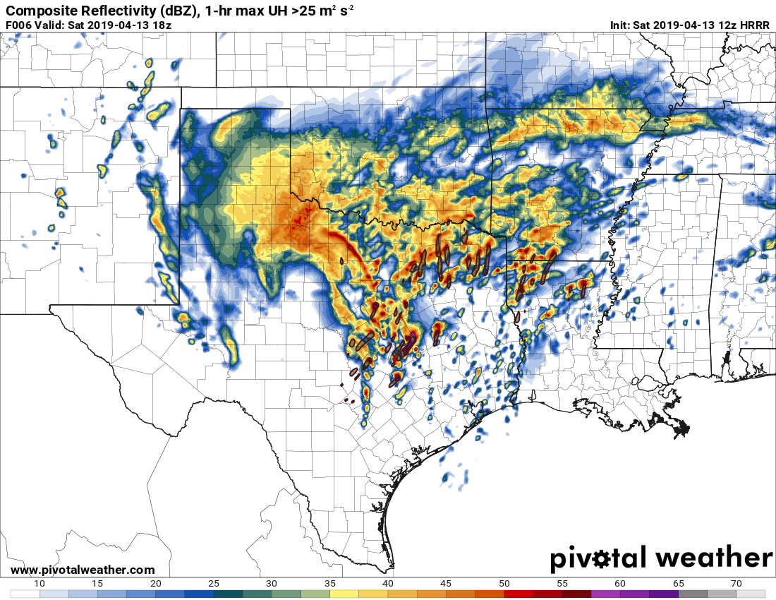
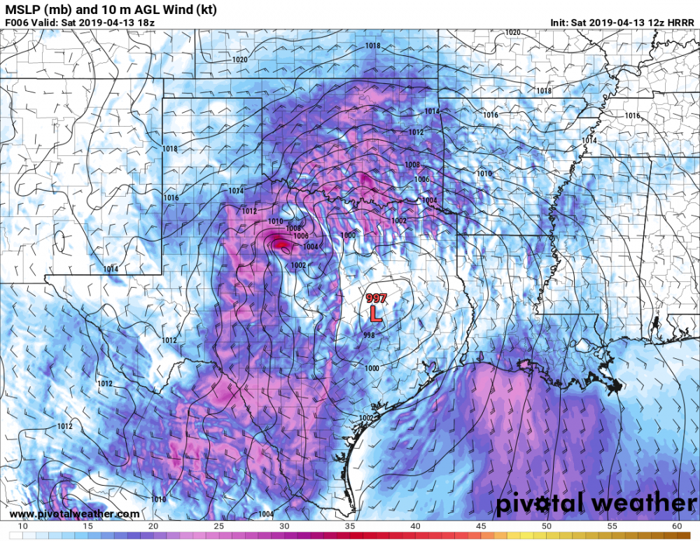
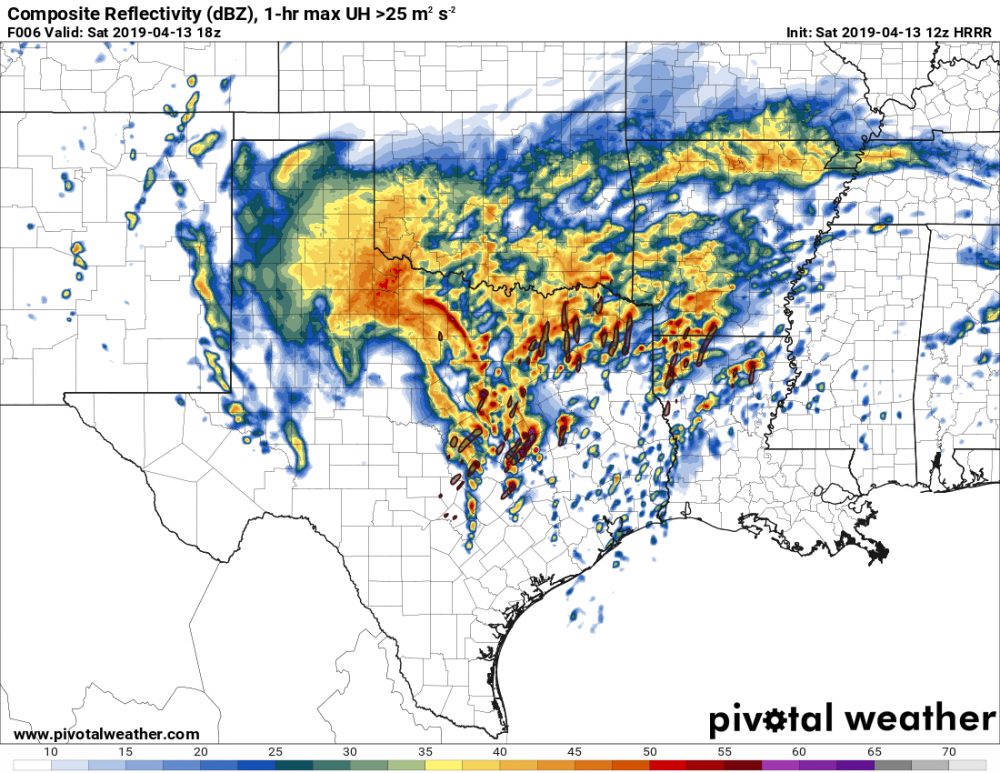
April 13th-14th Severe Threat
in Central/Western States
Posted
The cell departing Alexandria looks quite a bit like the Hearne/Franklin cell when it was first getting its legs near Rockdale: big cell semi-isolated with plenty of precipitation on the flanking line. Wouldn't be surprised to see it evolve similarly.