

bristolri_wx
-
Posts
1,477 -
Joined
-
Last visited
Content Type
Profiles
Blogs
Forums
American Weather
Media Demo
Store
Gallery
Posts posted by bristolri_wx
-
-
Snow mixing with sleet here in Bristol.
-
7 minutes ago, weathafella said:
Dryslot entering the south coast. Racing north.
It looks worse on Taunton radar. If you switch over to Upton it's filling in as it gets closer....
-
4 hours ago, DFRI said:
Local area mets thinking the temps could get into the 50's here in RI. Is that really possible????
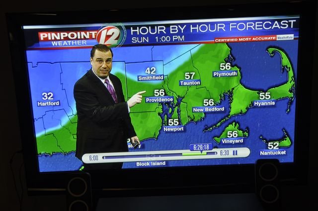
TJ is going to be embarrassed he put up that map. I'll take the under on that all the way to Newport. Probably ends up something like 38 in Smithfield and 45 in Newport. Definitely above freezing but not that high... "certified most accurate"

-
HRRR a tick colder again at the surface. Seems like every hour the 32 degree line sinks a little farther south for maximum extent inland...
-
46 minutes ago, tiger_deF said:
Newest full HRRR shows the sleet line penetrating deep into central new England, large warm shift
Those extended HRRR runs aren’t the greatest outside the normal 18 HR range. Just an observation...
-
Graupel falling now In Providence...
-
I'm surprised I'm still getting 3"
Also a cool new product I haven't seen before:
https://www.wpc.ncep.noaa.gov/wwd/wssi/wssi.php?id=BOX

-
32/23 very light snow/flurries falling in Providence.
-
I posted this Thursday morning on Memebook. Looks like a bust out on the Cape. Ranges are probably 1" too high everywhere else. Not a fan of these slop storms...

-
1 minute ago, OceanStWx said:
You don't need northerly components at 850 to hold the cold. You need easterly components below the tops of the mountains.
But models can struggle at times with the depth of the cold air. If it's deeper than modeled, sometimes that modeled +5C ends up closer to 1C and it's sleet rather than freezing rain.
Ahh, that makes sense. Thanks for that explanation. Doesn't look like we're getting that easterly component needed either, at least on the GFS as modeled...
-
1 hour ago, Typhoon Tip said:
In trying to analyze if this arctic boundary is trying to jilt us ...
if it's backing off in subtle amounts it might account for this warming profile.
Is this the problem?
Using GFS here, but at 850 winds are already either west or south west, and this is at 18Z Sat. Wouldn't we need a little more of a more northerly component, at least up in northern New England, to prevent the warmup?
I honestly don't have the skill set to understand if what is depicted (it might not even be the right map to illustrate this) is either a cause or an effect as to why the models keep churning out more warmth than expected. But it seems that arctic high is more strung out west to east in terms of influence on the models, and that's why that low is allowed to barrel farther north than what we would normally expect.
I'll be honest I agree that things "just don't look right" compared to what we would normally see but I couldn't tell you why, lol.
-
32 minutes ago, Cold Miser said:
Ray,
What do the arrows represent?
Judging by the looks of the arrows, they represent Ray's limited skill in the Apple Preview app he uses to make the maps.
-
1 minute ago, Typhoon Tip said:
Just to poke the hornets here ... I almost think that the base-line is above normal do to incredible hockey stick GW that no one in here admits is really and happening because it may admit to cutting some day into snow chances for their grandkids...
haha
All joking aside, I'm 40 and I feel that my adult life has been much snowier than my childhood ever was. And I've been interested in weather since a very young age. If the cause is cyclical, or GW, there's definitely been a difference in the last 20 years, especially with the number bigger storms of 12+... Of course this observation is anecdotal and judged by my location in RI...
-
24 minutes ago, Baroclinic Zone said:
I'd side with your logic. There are a couple mitigating factors in my mind. There is the background "winter" that we have been having in SNE that's been warmer then normal and we also don't have any snowpack to speak of in SNE which would have helped facilitate the SLP sliding along that denseer cold.
Are we really having a warmer than normal winter? We definitely have less snow, but I attribute that to $hit pattern/bad luck than above normal temps... I remember warmer winters where we have had more snow by this point.
-
1 minute ago, sbos_wx said:
It looked really bad at the beginning stages but appears to have trended SE with the track. Still on the warmer side of things.
GFS definitely starting to catch on that it can't ram that surface low up into that cold press as others have been alluding too. It's still not sure what to do earlier in the run...
-
1 minute ago, ORH_wxman said:
GFS is a terrible model. Completely on an island now....for two runs in a row. I don't think there is a single OP model agreeing with it now. Even the obscure WWII models.
Now I know where my NWS forecast is coming from... can't trust the Government F!@#$% Shutdown model at the moment...
-
-
I know I'm not getting 2' of snow, but I have a hard time believing the NWS forecast for Bristol, RI at the moment... are they just using the GFS? 46 and heavy rain...


-
Just now, NeonPeon said:
Bristol normally doubles our snowfall in these liminal situation, so you could well be right. If you think 6-12 is a fair bet for you, I'd say we'd be at 3-6. I'll take the low end.
This sort of detail is very premature. But this whole thing is not a great look for the coast.
Agreed, this is the way many of these storms go. We're smack dab in the legendary snow hole that always shows up, for whatever reason. It's going to be a lot of slop for sure, but thankfully it's just not just rain like previous have been.
-
16 minutes ago, NeonPeon said:
3" then 2" of rain during prime winter... meanwhile I've had 3 colds and now the flu. I may remember this winter for the wrong reasons the way it is going.
I think we'll do better than that in East Bay, RI. 6-12" with sleet mixing would be a safe call. Maybe closer to 6" due to more sleet would be safer for Newport. I don't think this storm has a lot of rain in it for us.
-
11” total in Bristol. If the first 6” was a higher ratio rather than cement we would have been over a foot.

-
16 minutes ago, henry1978 said:
I can't figure out why wpri 12-15 miles to your north on the Seekonk/east pvd state line is only reporting 5-6.
Because they have 5-6”, and I have 9”. Probably wasn’t in the good band this morning as long. I was already at 5-6” by 10 AM.
-
26 minutes ago, henry1978 said:
Disagree. Lots of models had all of eastern rhode island getting hammered. East PVD at the top of the bay only has 5-6 inches and Narragansett 10 miles to your south really got porked.
I’m at 9” in Bristol. Unusually, we were in a good band for a while. Picking up again too. Confident we can get close to a foot here.
-
1 minute ago, NeonPeon said:
It's a sweet antidote to the last one, that's for sure. You should sail past a foot.
Yes the heavy band have been over us most of the morning. May have lost an inch to melting bottom layer is very slushy.


Super, Duper SWFE
in New England
Posted
Sleet and rain now in Bristol. 33/32. Looks like I have about 2.5" that will be washed away by morning...