
gman
-
Posts
223 -
Joined
-
Last visited
Content Type
Profiles
Blogs
Forums
American Weather
Media Demo
Store
Gallery
Posts posted by gman
-
-
Why does someone in Orangeburg get to start a thread about a snow event?
-
 2
2
-
-
2 minutes ago, CaryWx said:
Question for the board. Does anyone really see any sustainable cold air coming in? I see transient progressive stuff and not any real -nao.
Will be fighting the calendar in about 3 weeks and running out of time.
Is there such a thing as sustainable cold in the south?
-
The NWS is forecasting a high of 51 today. It’s already 55.
-
It's 41 with moderate sleet coming down near Paris Mtn. State Park.
-
1
-
-
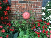
Glad to see this image.
-
 2
2
-
1
-
-
Interesting rain totals from Walhalla State Fish Hatchery in Oconee County. http://digital.olivesoftware.com/Olive/ODN/PostCourier/TranslateArticle.aspx?doc=POCO%2F2019%2F01%2F03&entity=ar00305&ts=20190103063911&uq=20181102125203
Corner of SC received 10 feet of rain last year
BY BO PETERSEN
[email protected]2018 might not have been the rainiest year in Charleston, but a year of downpours left a possible record in a corner of South Carolina.
More than 123 inches — 10 feet — fell at the Walhalla State Fish Hatchery near Lake Jocassee, according to preliminary data by the National Weather Service office in Greenville.
That would be more rain than ever fell in the state at a station of record.
Weather Service personnel could not comment on the possible record Wednesday because of the federal shutdown.
The former record apparently was a little more than 119 inches, recorded at Hogback Mountain near the state line with North Carolina, north of Landrum, according to Melissa Griffin, the assistant state climatologist.
A federal committee will review the Jocassee data and, if approved, it becomes the new record, she said in a tweet.
In Charleston, the official rainfall for the year was 57.69 inches, well short of the 78.89 inches record set in the flood year of 2015.
The mountains tend to be the rainiest part of the state, with an average 70 to 80 inches falling year to year, according to the S.C. Climate Office.
Caesars Head is the rainiest spot, with an average of nearly 80 inches.
In the coastal plain, the average is 50 to 52 inches, so 2018 was a rainier year.
Reach Bo Petersen Reporter at Facebook, @bopete on
Twitter or 1-843-937-5744.
-
1
-
-
13 minutes ago, SnowDeac said:
Any Atlanta/Athens folks gonna see a burst of snow here? Radar looks pretty juicy, but unsure on temps.
Local Mets saying future radar shows snow in the Upstate tonight around 9:00. Temps need to drop drastically for that to happen.
-
47 minutes ago, tazaroo said:
I have 5 inches of snow/sleet here in ne Randolph county. I am right on the line inbetween the good stuff toward Greensboro and the big 0 25 miles below me. Looked better last night the NWS had me in the 8-10 band but could be worse for sure. I feel bad for the upstate SC, Se Charlotte and Moore county folks were also supposed to get a lot more and got warmed nosed worse than me.
Praying the zr stays away. Heavy pingers now.
Don’t feel bad for the Upstate. It was a good storm especially for early December. Greenville County has 2 to 10 inches of snow and sleet. I ended with 6 inches at my house. I’ll take that kind of snow storm any day of the winter!
-
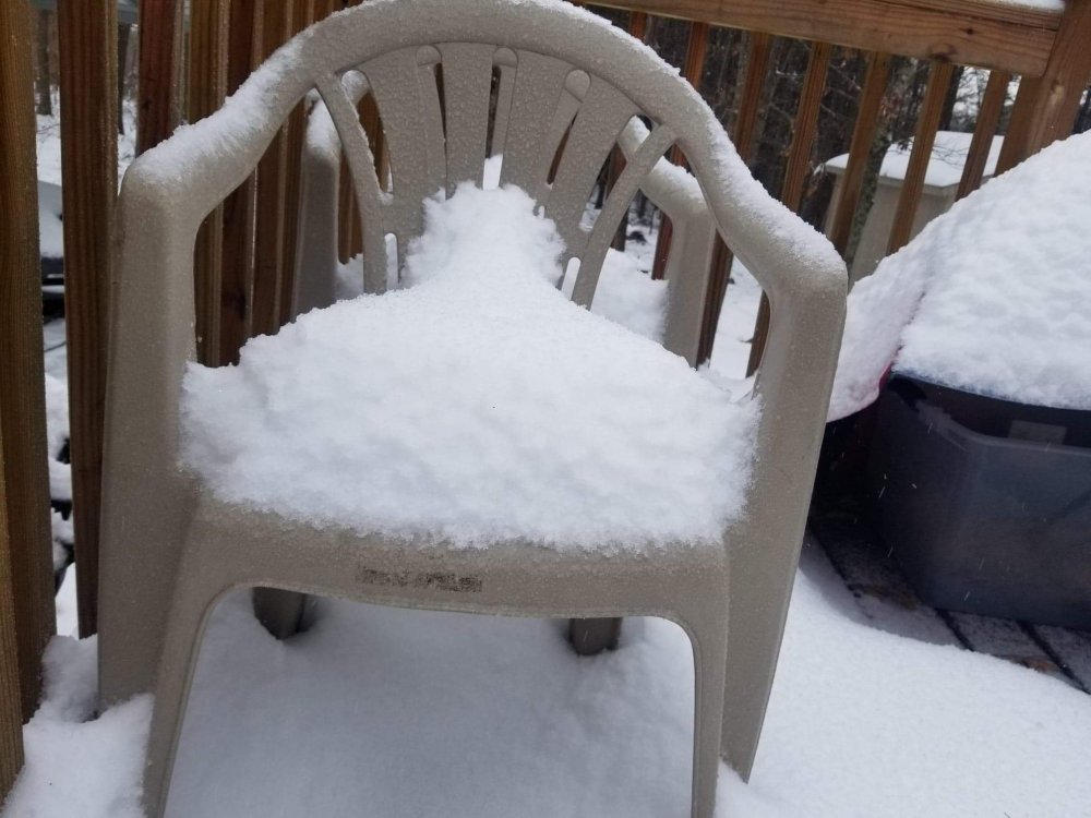
5” snow now reduced to 4.5” because of the sleet.
-
Snowing hard. Roads turning white. Dropped to 33 degrees.
-
3 minutes ago, pbrown85 said:
If you get 2" of sleet in Simpsonville I'll be happy with my 4" of snow in Easley!
And I’ll be happy with my 8” near Paris Mtn. State Park!
-
1
-
-
17 minutes ago, lilj4425 said:
Warm nose, soil temps, lack of qpf due to convection along the coast...which one will ruin my weekend?

Poor guy.
-
GSP NWS just issued this Special Weather Statement.
...WINTER WEATHER POSSIBLE ACROSS THE WESTERN CAROLINAS AND
NORTHEAST GEORGIA THIS WEEKEND...

Confidence is increasing that a winter storm will develop this
weekend across the region as low pressure tracks across the deep
south and moves off the southeast coast on Sunday. The storm has
the potential to produce a significant amount of snow across parts
of western North Carolina, the northern Upstate of South
Carolina, and the mountains of northeast Georgia. Precipitation
could begin as early as daybreak Saturday over southwest North
Carolina and northeast Georgia, spreading northeast through the
day. Conditions may deteriorate from southwest to northeast during
Saturday afternoon and evening across the area north of
Interstate 85. The precipitation is most likely to fall as snow
across most of the mountains, with a heavy accumulation possible
Saturday night and Sunday. Snow amounts are still uncertain, but
amounts in excess of six inches are possible across the mountains,
foothills, and northwest Piedmont of North Carolina. Some sleet
and freezing rain could mix in across the Little Tennessee River
Valley and along the I-85 corridor. The potential also exists for
a corridor of significant ice accumulation across the area south
of Interstate 85 Saturday night and Sunday morning. The wintry
precipitation may persist across parts of the region through
Monday. People with travel plans across the area this weekend
should monitor the latest weather forecasts. Future developments
will determine when and where a Winter Storm Watch will be issued
-
8 minutes ago, Waiting on snow said:
He usually hypes and fails miserably. I guess he's tired of getting burned.
Chris and John do a great job for our area. Quite frankly, I’m tired of those that say they hype too much and fail often. We are lucky to have these two in the Upstate.
-
This one reminds me of the storm of 1988.
-
2
-
-
13 minutes ago, PackGrad05 said:
True, but I could see some snow and then changeover to rain that washes it all away.
It’s Dec. 4th. I’ll take that scenario right now!
-
16 minutes ago, yotaman said:
I, for the first time ever, is hoping for no snow for NC. Why you ask? My wife and I are heading to Asheville Sunday for the Biltmore Candlelight Christmas. I have non-refundable hotel rooms as well as the tickets. I hate driving in snow.
Hamilton is in Greenville beginning tomorrow night. I am sure the Peace Center and the folks holding those precious tickets are hoping for no snow.
-
 1
1
-
-
Notice the last couple of sentences from the GSP NWS discussion.
”LONG TERM /SUNDAY NIGHT THROUGH THURSDAY/... As of 140 PM Thursday: Starting at 00Z Monday with the 500mb pattern showing a broad trough across the nation with axis from the Dakotas to Texas or New Mexico. An upper low moves from the Dakotas Sunday evening to Missouri on Monday afternoon to Ohio Tuesday afternoon. This creates a tight height gradient over the SE States with strong jet stream flow overhead. Waves of energy pass through the 500mb flow from the upper Plains to the mid Atlantic coast through mid week although the models are not in the best agreement on timing and strength of these waves. At the surface, the GFS has our area mostly dry except for occasional NW Flow for the NC mountains. The ECMWF develops low pressure at the inflection point on the east side of the upper trough along the stalled front over the northern Gulf Coast Sunday night. The EC moves this low to the SC coast Tuesday morning then off the NC coast Tuesday night. Cool high pressure builds in from the west late in the week. The EC seems to be performing best in the later periods recently. We will lean heavily toward the EC. Max Temperatures will be 5 to 8 degrees above normal on Monday then dropping behind the low with Maxes around 10 degrees below normal Wednesday and Thursday. Mins around 10 above normal Sunday night then around 8 degrees below normal into late week. The EC and GFS have an interesting feature to watch for the end of the week. The models show a low reaching our region on Saturday from Texas. This will be watched closely for consistency.”
-
45 minutes ago, AsheCounty48 said:
You should probably read his tweet... they're flip flopping back and forth with no reliable solution yet.
I did read it, but to me blowtorch means warm (hot). I read it as going from warm back to cold.
-
29 minutes ago, Northern Foothills Snowman said:
https://mobile.twitter.com/BigJoeBastardi/status/1067012888756396033
so much for the blowtorch Christmas
So, it’s going to be colder for Christmas?
-
I heard Joe Bastardi say there is a direct correlation between fall Gulf hurricanes and cold/wet winters for the southeast. Is that true?
-
It’s a beautiful day at N. Myrtle Beach, 81 degrees with low humidity. The ocean is a rusty and brownish color. There is no way I would get in that water. Also, coming down from Greenville, we passed over the Pee Dee at Galivants Ferry and on 22 over the Waccamaw River. The stench was terrible, almost sickening. I guess that’s from all the contaminates in the water.
-
-
Our high today is only 71. It’s been an overcast and drizzly day. Wonderful!

Southeast Sanitarium - A Place to Vent
in Southeastern States
Posted
I’m sick of cold and wet. Bring on spring!