mimillman
-
Posts
3,615 -
Joined
-
Last visited
Content Type
Profiles
Blogs
Forums
American Weather
Media Demo
Store
Gallery
Everything posted by mimillman
-
1/30-1/31 Lake Effect Snow Threat - SE WI, NE IL, and NW IN
mimillman replied to A-L-E-K's topic in Lakes/Ohio Valley
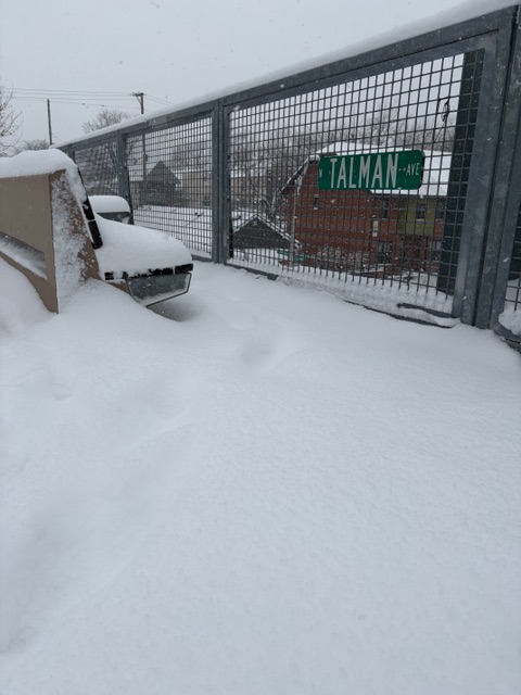
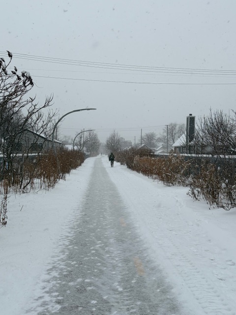
Obligatory 606 pic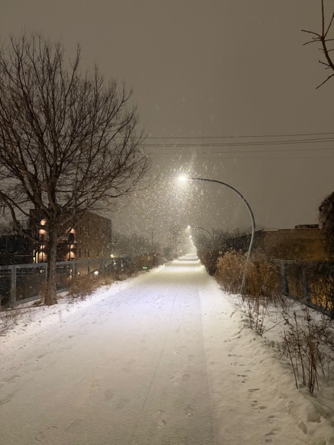
-
1/30-1/31 Lake Effect Snow Threat - SE WI, NE IL, and NW IN
mimillman replied to A-L-E-K's topic in Lakes/Ohio Valley
Evanston getting it -
1/30-1/31 Lake Effect Snow Threat - SE WI, NE IL, and NW IN
mimillman replied to A-L-E-K's topic in Lakes/Ohio Valley
12z euro liking eastern cook -
1/30-1/31 Lake Effect Snow Threat - SE WI, NE IL, and NW IN
mimillman replied to A-L-E-K's topic in Lakes/Ohio Valley
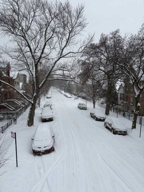
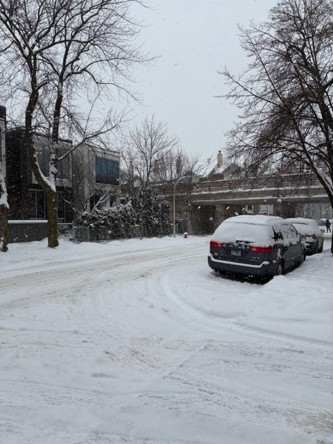
Proper snowglobe action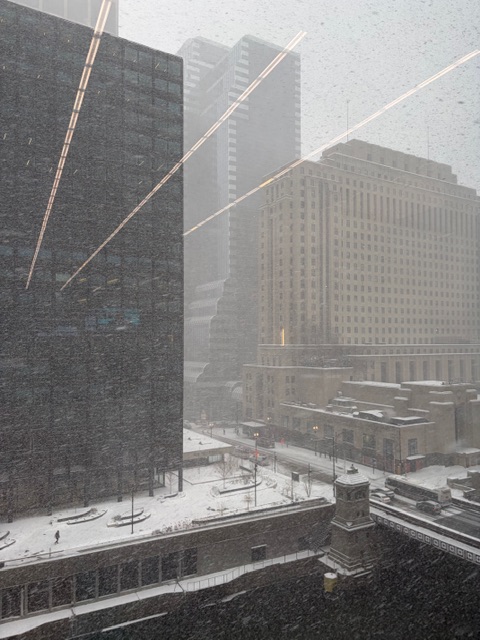
-
1/30-1/31 Lake Effect Snow Threat - SE WI, NE IL, and NW IN
mimillman replied to A-L-E-K's topic in Lakes/Ohio Valley
HRRR looking real close -
1/30-1/31 Lake Effect Snow Threat - SE WI, NE IL, and NW IN
mimillman replied to A-L-E-K's topic in Lakes/Ohio Valley
Looks like gonna crank in a bit -
Saw tiny bits of ice forming on the river by my office this morning which is exceptionally rare
-
1/30-1/31 Lake Effect Snow Threat - SE WI, NE IL, and NW IN
mimillman replied to A-L-E-K's topic in Lakes/Ohio Valley
Think you’re reading things too verbatim and not fully appreciating the run to run -
1/30-1/31 Lake Effect Snow Threat - SE WI, NE IL, and NW IN
mimillman replied to A-L-E-K's topic in Lakes/Ohio Valley
Im not going to make GIFs but 3km NAM and HRRR both have trended towards a more significant front end push with slightly higher residence time over NE IL and have trended further west with the wobble of the band on Saturday. ECMWF has also subtly been trending this way though not hi-res. -
1/30-1/31 Lake Effect Snow Threat - SE WI, NE IL, and NW IN
mimillman replied to A-L-E-K's topic in Lakes/Ohio Valley
Not hating these hi res trends for NE IL -
Winter 2025-26 Medium/Long Range Discussion
mimillman replied to michsnowfreak's topic in Lakes/Ohio Valley
Con: it’s the GFS -
1/30-1/31 Lake Effect Snow Threat - SE WI, NE IL, and NW IN
mimillman replied to A-L-E-K's topic in Lakes/Ohio Valley
I’m confused by the two headlines -
Got asked today if a “cyclone bomb” was going to hit the east coast
-
1/30-1/31 Lake Effect Snow Threat - SE WI, NE IL, and NW IN
mimillman replied to A-L-E-K's topic in Lakes/Ohio Valley
Time for the crazy HRRR runs -
1/30-1/31 Lake Effect Snow Threat - SE WI, NE IL, and NW IN
mimillman replied to A-L-E-K's topic in Lakes/Ohio Valley
GGEM:
-
1/30-1/31 Lake Effect Snow Threat - SE WI, NE IL, and NW IN
mimillman replied to A-L-E-K's topic in Lakes/Ohio Valley
I think reasonable, my plan is to road trip on Saturday/Sunday to where band sets up better residence time -
Winter 2025-26 Short Range Discussion
mimillman replied to SchaumburgStormer's topic in Lakes/Ohio Valley
Lake effect event getting thread worthy for SE WI - NW IN -
Whoever popularized the term "bomb cyclone" for the media to describe every nor’easter deserves a special place in hell
-
1/24-1/25 Major Winter Storm - S. IL, IN, and OH
mimillman replied to A-L-E-K's topic in Lakes/Ohio Valley
I’ve been commenting about it in the medium range thread until we get a bit closer -
Winter 2025-26 Medium/Long Range Discussion
mimillman replied to michsnowfreak's topic in Lakes/Ohio Valley
The main focus during the end of the week and into the upcoming weekend remains on the potential for another round of accumulating lake effect snow (potentially a long-duration event) as another sprawling ~1050 mb arctic high descends out of Saskatchewan and Manitoba late Thursday night into Friday. As this occurs, 850 mb temperatures are forecast to drop to around minus 20 C, which in turn will result in building inversion heights over the lake. LES parameters certainly look sufficient to support periods of more intense lake effect snow, with lake- induced ELs nearing 9-10 kft at times, especially through Friday with 850 mb temps forecast to warm through Saturday. Initial LES looks to develop late Thursday night into early Friday morning. It`s possible that this initial activity has a somewhat difficult time organizing given some degree of wind shear in the boundary layer as a synoptic scale trough pivots southwest out of the Upper Great Lakes. By later Friday night and Saturday, however, guidance depicts generally lessening shear as the bulk of the atmospheric flow shifts northeasterly. Guidance then depicts LES organizing into a single dominant band during this time as low-level convergence maximizes down the long axis of the lake. During this time, ELs are forecast to fall a bit as 850 mb temps warm, which may have a bit of a modulating effect on LES intensity. That said, given the progged increasing convergence, even 6-7 kft ELs will be more than sufficient to support periods of heavier snowfall. At this point, it remains too early to hone in on specifics, but guidance trends continue towards an impactful period of lake effect snow in our area, including Chicago, parts of NE and east-central Illinois, and NW Indiana from late Thursday night through Saturday night, and possibly even through Sunday. Guidance at this time does indicate the potential for quite a bit of band wobbling, which in turn could limit residence times and overall totals, but a more quasistationary north-south oriented band is also advertised (CMC, UKMET for example). Temperatures in the teens and single digits will have the potential to exacerbate impacts due to a very light/fluffy snow and lessened effectiveness of road treatments. -
Winter 2025-26 Medium/Long Range Discussion
mimillman replied to michsnowfreak's topic in Lakes/Ohio Valley
I thought this set up typically favors N Central IN -
1/24-1/25 Major Winter Storm - S. IL, IN, and OH
mimillman replied to A-L-E-K's topic in Lakes/Ohio Valley
Bro don’t you live in Florida -
1/24-1/25 Major Winter Storm - S. IL, IN, and OH
mimillman replied to A-L-E-K's topic in Lakes/Ohio Valley
Pats/broncos snow should cheer you up -
1/24-1/25 Major Winter Storm - S. IL, IN, and OH
mimillman replied to A-L-E-K's topic in Lakes/Ohio Valley
Starting to wind down as the LE rotates into southern Cook. I wasn’t here for the thanksgiving weekend storm so this is definitely a treat. Plus seeing the split band LE this side of the lake was a big highlight -
1/24-1/25 Major Winter Storm - S. IL, IN, and OH
mimillman replied to A-L-E-K's topic in Lakes/Ohio Valley
In Chicago they plow the 606 before the roads. And yes I saw 4 runners