alexanderhall
-
Posts
24 -
Joined
-
Last visited
Content Type
Profiles
Blogs
Forums
American Weather
Media Demo
Store
Gallery
Everything posted by alexanderhall
-
Magic Run. NAM is a pinch more amplified with the 4 corners wave, but it does not shuffle its feet traversing TX and sling effing shotting into the SE. Its a pinch further along vs. 18z over Alabama, which baaarely slows down the N. Plains wave and esp the 3rd impulse coming out of the UP. This spacing allows all 3 waves to do work ampifying the trough. BING BONG.
-
12z GFS seems to be a bit too hesitant to allow the Four Corners Wave to escape east once the SoCal wave shears out. 12z NAM allows the N. Plains energy to coax the Four Corners wave out a little further east. It looks a bit more realistic? Maybe? I think the GFS is pulling back the rubber band a little too hard in TX.

-
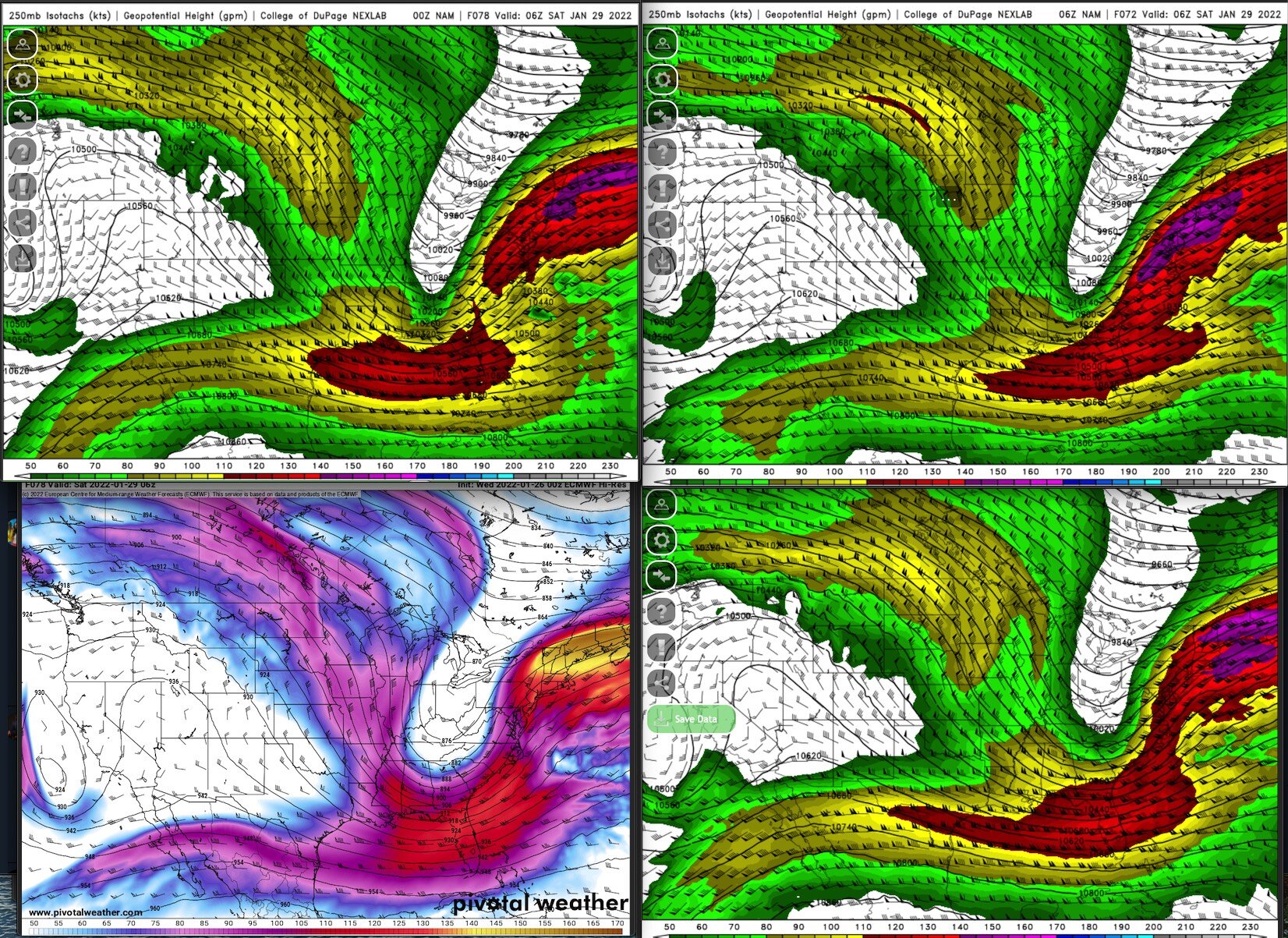
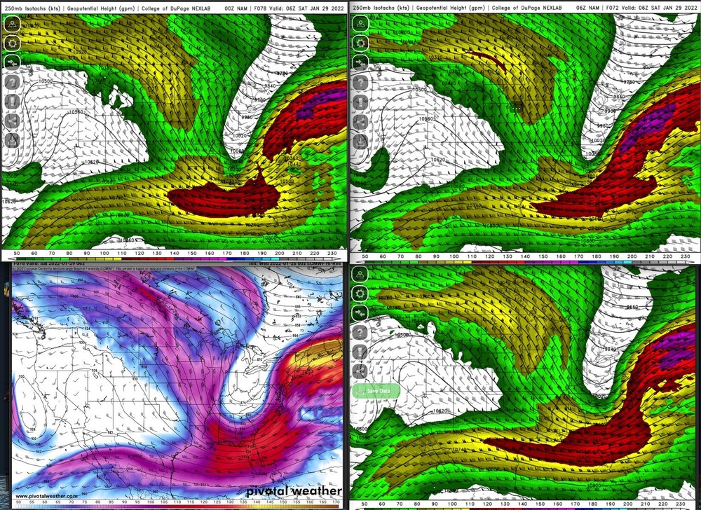
Seeing two camps tonight: 00z NAM + 00Z EURO (west) vs. 00z 06z GFS + 06z NAM (east) The differences might begin with the way that the models handle a small shortwave that splits off and dives into Southern California by Friday 00z. NAM/EURO left, GFS 06z NAM R. Euro and NAM show the wave shearing out to the west, while GFS and 06z NAM shows the shortwave consolidated on the CA/MX AZ/MX border. the more sheared out camp ends up with a Four-Corners wave that is a little bit quicker to eject/a little further east, while the more consolidated wave on the GFS/06z NAM tugs at this larger shortwave a bit. for one reason or another, it seems that (in model world) if the CA/AZ shortwave shears out, it tends to allow the eventual trough to align more meridionally, with two seperate upper level speed maxes surrounding a weakeness, and allows for the further NW track. maybe the phase is more effecient, or happens more in more of a negative tilt, or its a timing thing, not sure. here are the two camps at 250mb midnight Saturday, with strikingly similar looks, depending on what the model did with that first shortwave. thought this was interesting, will be fun to keep an eye on.

-
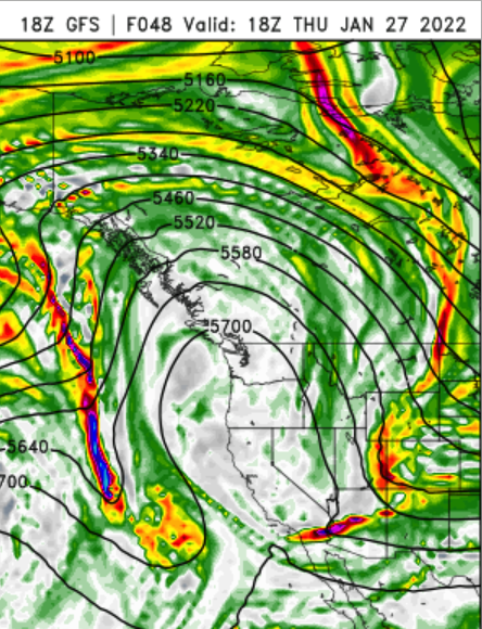
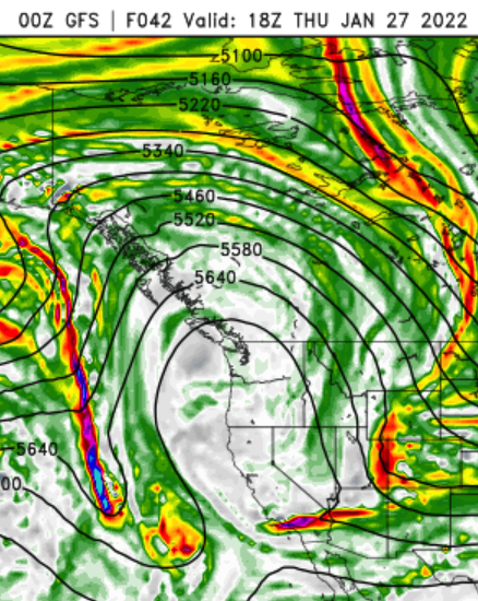
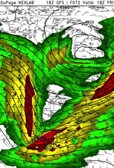
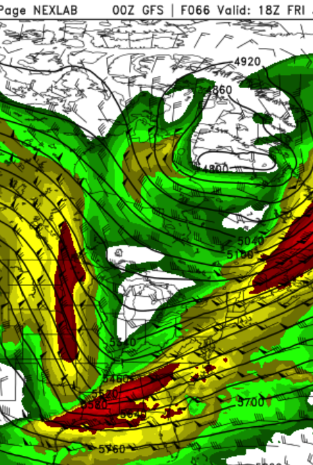
18z GFS vs 00z... 1) the placement of the vort max currently west of BC seems to ever so slightly nudge west on the 00z GFS vs 18z. 2) ...which seems to slightly nudge west / slow down / shear things out a bit more as it digs into the SW and interacts with the 4-corners wave. 3)...which seems to slow down / very subtly temper the early stages of the phase with the N. Plains wave, leading to a slightly less amplified (early on), slightly more progressive eastward track. if there is recon data in this run, maybe it has sniffed something out...but yeah, v complex so would seem a ways to go yet.
-
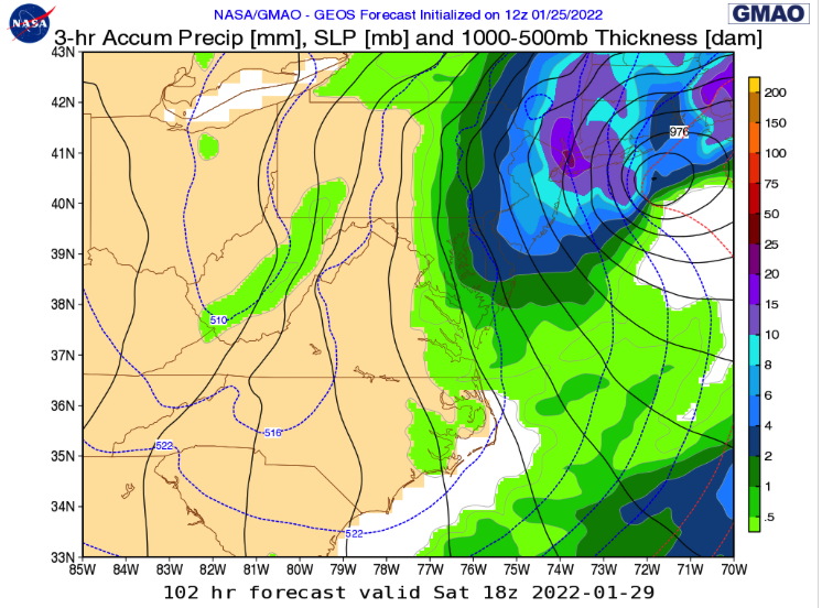
h/t ryans_wx on twitter, but just for fun/FWIW -- NASA's GEOS model at 12z has a big hit for NYC https://fluid.nccs.nasa.gov/weather/