stormtracker
-
Posts
64,400 -
Joined
-
Last visited
Content Type
Profiles
Blogs
Forums
American Weather
Media Demo
Store
Gallery
Everything posted by stormtracker
-
thirty fo' and dark.
-
 I've been looking for that one too...and there's a parody of DT's maps I made too.
 -
Ha..one of my better creations. I've been looking for that
-
Simmer down
-
Lol Alexandria schools folded already. @mattie g
-
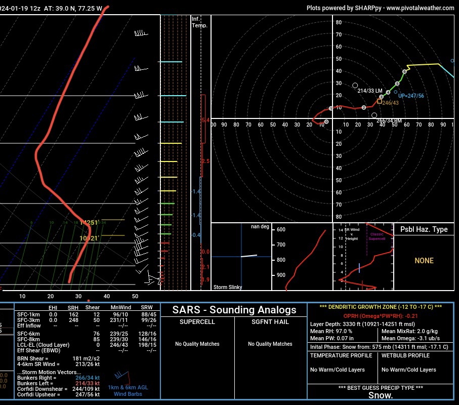
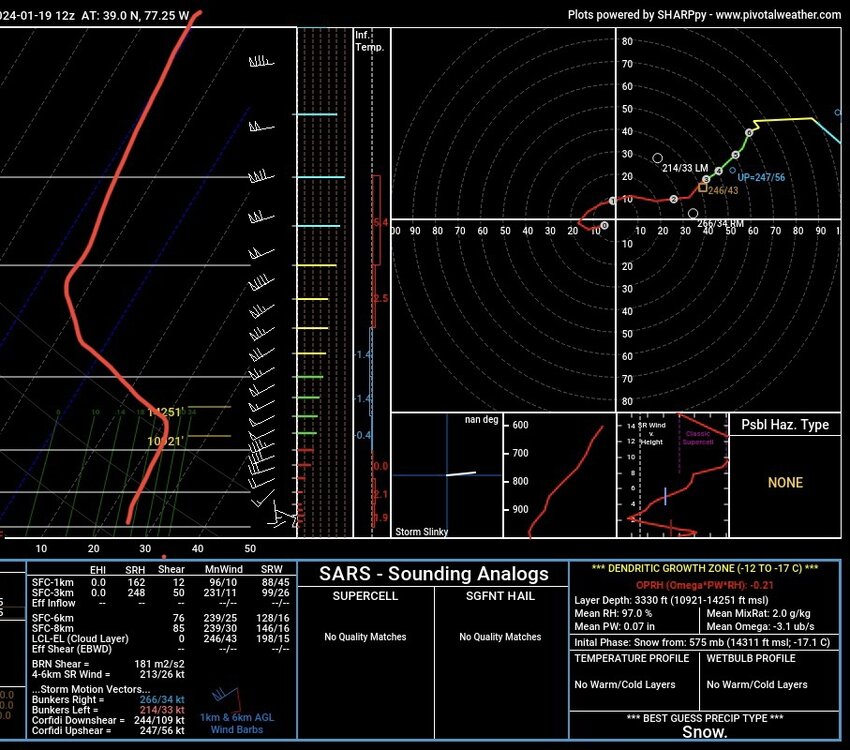
I pulled the KGTWN sounding. Disaster
-
Well, good luck for GFS...i'll be on the train heading home so somebody good do the pbp. @Deck Pic
-
Shit. I know, right?
-
This one got on my nerves. I was just over it last night and crashed. I dunno. I'm still weary
-
I hope the Grindr Forecast System is probably gonna hold. It never gets this excited. Blend the snowiest model with the other snowiest model and go from there.
-
Eh, i guess. SV has precip in the area until 23z
-
I'm seeing 6pm
-
Bring out the clowns
-
Booooo
-
It's going to be a better run
-
Yeah, vort is noticeably souther maybe by 50-75 miles
-
Looks like a slightly wetter run. Nobody get pumped. Should be the same general out come. Vort is a bit souther
-
Nah. just interesting. It's probably gonna be a hold. But the vort pass is still south
-
It's that bali folder
-
I knew somebody would catch that. Thank God I wasn't home and had my usual tabs open.
-
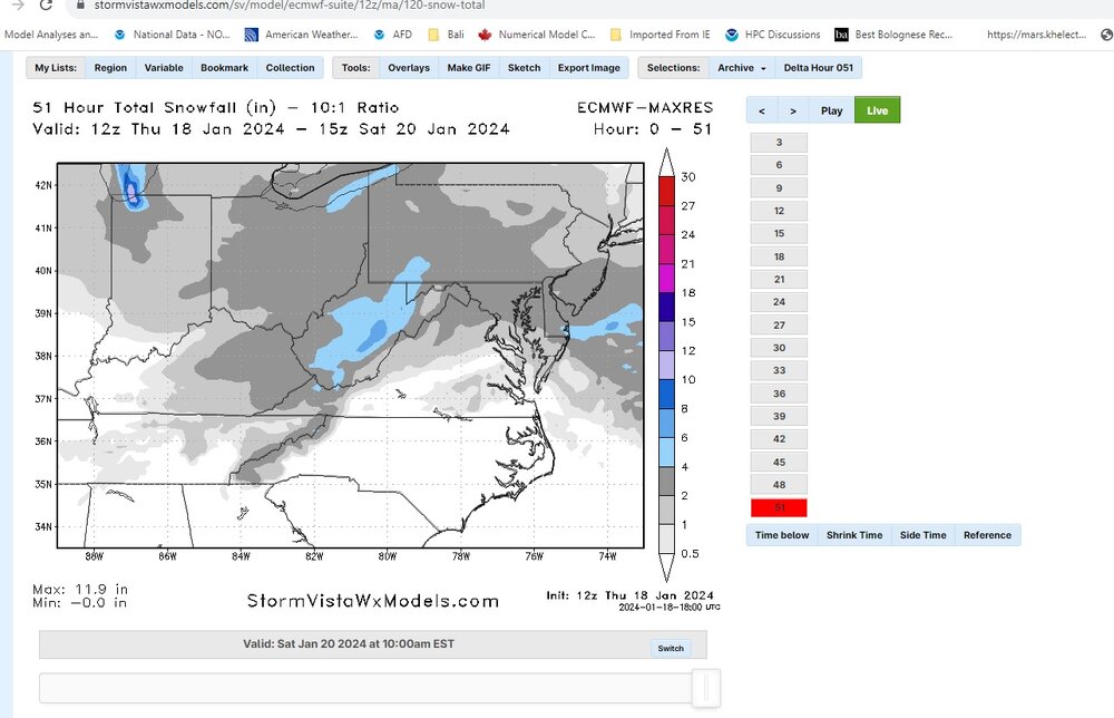
Now watch we have some clown ass wonky maps. Here's SV
-
nah. It's a slight change, but it is following the south trend