stormtracker
-
Posts
64,402 -
Joined
-
Last visited
Content Type
Profiles
Blogs
Forums
American Weather
Media Demo
Store
Gallery
Everything posted by stormtracker
-
 GFS has a lot going on with the H5 look around 141 hours and after
- 2,509 replies
-
- 3
-

-
- weenie fest or weenie roast?
- weenies got roasted
- (and 2 more)
-
The Weekend Rule? Saturday 2/17 - The Icon Storm
stormtracker replied to DDweatherman's topic in Mid Atlantic
$4,985. per month -
The Weekend Rule? Saturday 2/17 - The Icon Storm
stormtracker replied to DDweatherman's topic in Mid Atlantic

-
The Weekend Rule? Saturday 2/17 - The Icon Storm
stormtracker replied to DDweatherman's topic in Mid Atlantic
Ok, shift south with higher accums. 4-6 touch the southern tip of DC (heh) and everthing south through the northern neck...2 to 4 DC north -
The Weekend Rule? Saturday 2/17 - The Icon Storm
stormtracker replied to DDweatherman's topic in Mid Atlantic
moderate snow with a southward shift of the heaviest band now centered over....DC -
The Weekend Rule? Saturday 2/17 - The Icon Storm
stormtracker replied to DDweatherman's topic in Mid Atlantic
Precip arrives 3z Sat. Smidge colder -
The Weekend Rule? Saturday 2/17 - The Icon Storm
stormtracker replied to DDweatherman's topic in Mid Atlantic
Hmm, NAM kinda interesting with that gulf low...gonna get shunted out to sea tho. Anyway, nam is just beginning over us at 84. Got nothing to compare it to...but yeah -
The Weekend Rule? Saturday 2/17 - The Icon Storm
stormtracker replied to DDweatherman's topic in Mid Atlantic
Also, remember, 18z Euro stops at 90. Precip was still ongoing...so could be a bit more accums -
The Weekend Rule? Saturday 2/17 - The Icon Storm
stormtracker replied to DDweatherman's topic in Mid Atlantic
Not as wet vs 12z.precip is a bit more norther oriented, but nothing significant. 1 to 4" area wide -
The Weekend Rule? Saturday 2/17 - The Icon Storm
stormtracker replied to DDweatherman's topic in Mid Atlantic
light to mod over the area around 9z...temps at freezing dc n and west during that time -
The Weekend Rule? Saturday 2/17 - The Icon Storm
stormtracker replied to DDweatherman's topic in Mid Atlantic
Precip incoming on the Euro around 1 am Friday..only 2 more panels before until we reach the end of the show at 90 hours...I wish they would run it beyond that -
Damn, this is 120 minute CAPE right here.
- 2,509 replies
-
- 7
-

-
-
- weenie fest or weenie roast?
- weenies got roasted
- (and 2 more)
-
I don't even know what to say.
- 2,509 replies
-
- 11
-
-
-
- weenie fest or weenie roast?
- weenies got roasted
- (and 2 more)
-
The Weekend Rule? Saturday 2/17 - The Icon Storm
stormtracker replied to DDweatherman's topic in Mid Atlantic
It seems doable. I haven't really been paying super close attention to this until today after the debacle this morning. -
The Weekend Rule? Saturday 2/17 - The Icon Storm
stormtracker replied to DDweatherman's topic in Mid Atlantic
lol, it's really not that serious friend. You didn't even do anything to apologize for. If there's a chance to use FOLKS, i'm dedicating it to you -
The Weekend Rule? Saturday 2/17 - The Icon Storm
stormtracker replied to DDweatherman's topic in Mid Atlantic
We just gotta set our expectations right now. A big, phased up solution isn't happening. Get it out of your head now. Be reasonable...2 to 4 is our goal...4 to 6 is upside. If you realize this, we could have some real fun tracking. So to summarize...the goal is 2 to 4. If that ain't good enough for you, bye. Don't come in here shitting up this thread. -
The Weekend Rule? Saturday 2/17 - The Icon Storm
stormtracker replied to DDweatherman's topic in Mid Atlantic
You serious, Clark? -
The Weekend Rule? Saturday 2/17 - The Icon Storm
stormtracker replied to DDweatherman's topic in Mid Atlantic
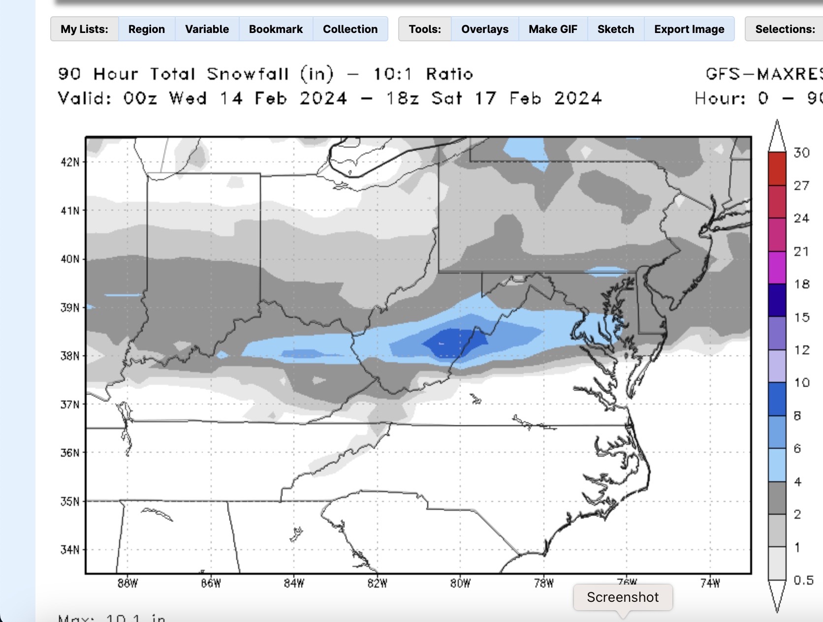
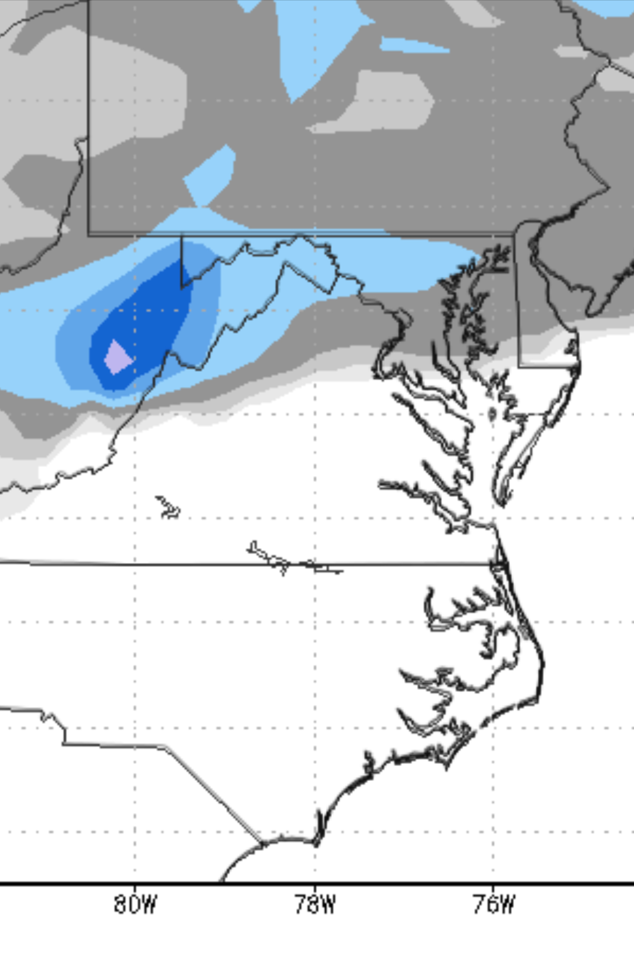
GFS is pretty nice (in context!!). Not a big one but 2-4 for most of us with 4-6 northern tier ETA: 4-6 covers a wider area up north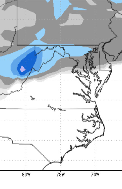
-
The Euro for PD3 (that night)
-
The Weekend Rule? Saturday 2/17 - The Icon Storm
stormtracker replied to DDweatherman's topic in Mid Atlantic
Outta here by 18z Saturday. That's it -
The Weekend Rule? Saturday 2/17 - The Icon Storm
stormtracker replied to DDweatherman's topic in Mid Atlantic
I wish I could -
The Weekend Rule? Saturday 2/17 - The Icon Storm
stormtracker replied to DDweatherman's topic in Mid Atlantic
2-4 just south and east from DC...1 to 3, including DC and N and W -
The Weekend Rule? Saturday 2/17 - The Icon Storm
stormtracker replied to DDweatherman's topic in Mid Atlantic
light to mod snow at 12z Sat...sub freezing DC N and W -
The Weekend Rule? Saturday 2/17 - The Icon Storm
stormtracker replied to DDweatherman's topic in Mid Atlantic
Light snow approaching the area..on the door step on the door step at 6z Sat..ongoing at 9z....system appears to still be weak