stormtracker
-
Posts
64,391 -
Joined
-
Last visited
Content Type
Profiles
Blogs
Forums
American Weather
Media Demo
Store
Gallery
Everything posted by stormtracker
-

January Medium/Long Range: A snowy January ahead?
stormtracker replied to mappy's topic in Mid Atlantic
Again, who among us would be mad at an 8-12 Miller A forum wide? -
January Medium/Long Range: A snowy January ahead?
stormtracker replied to mappy's topic in Mid Atlantic
Not sure 10" is a folks for PSU, but ok. SV maps are shit, so prob could be more -
January Medium/Long Range: A snowy January ahead?
stormtracker replied to mappy's topic in Mid Atlantic
It's definitely not as good/wet as 12z. Low just seemed like it couldn't get going good. Even up north in PHL-BOS it's less than 12z. At any rate, none of us would kick this out of bed -
January Medium/Long Range: A snowy January ahead?
stormtracker replied to mappy's topic in Mid Atlantic
It's nothing to sneeze at 8-12 for the forum...8 down DC way...12 up north near Bmore -
January Medium/Long Range: A snowy January ahead?
stormtracker replied to mappy's topic in Mid Atlantic
We get snow...but it's not a folks...it's less than 12z -
January Medium/Long Range: A snowy January ahead?
stormtracker replied to mappy's topic in Mid Atlantic
Thermals cool down,.heavy snow at 18z Sat -
January Medium/Long Range: A snowy January ahead?
stormtracker replied to mappy's topic in Mid Atlantic
So here's the deal...it looks like its gonna be closer...but flirting with danger with thermals -
January Medium/Long Range: A snowy January ahead?
stormtracker replied to mappy's topic in Mid Atlantic
Need a few more panels.... -
January Medium/Long Range: A snowy January ahead?
stormtracker replied to mappy's topic in Mid Atlantic
Phase is just a tad "sloppier" than 12z, but it appears to be getting the job done...just can't tell to what extent yet -
January Medium/Long Range: A snowy January ahead?
stormtracker replied to mappy's topic in Mid Atlantic
Snow approaching from the SW at 0z. Again, I'm conservative this far out and I'm not calling shit until I'm sure. I see the SFC map, but I go off of H5...still waiting -
January Medium/Long Range: A snowy January ahead?
stormtracker replied to mappy's topic in Mid Atlantic
Here's what I can say for certain....this won't be EUro like -
January Medium/Long Range: A snowy January ahead?
stormtracker replied to mappy's topic in Mid Atlantic
vort seems to be coming out in one piece...still strong northern stream vort dropping down. IMO, it actually looks a tad better than 12z? -
January Medium/Long Range: A snowy January ahead?
stormtracker replied to mappy's topic in Mid Atlantic
And away we go...at 78. vort is a bit further southwest than 12z. Still has a decent nrn vort signature so far -
January Medium/Long Range: A snowy January ahead?
stormtracker replied to mappy's topic in Mid Atlantic
Yes...it seems like it's in between the Euro and GFS at the end of its run. I dunno -
You know I like you right? One of my faves, And I say this respectfully. Deep, deep respect: If we get a storm this weekend, stay the fuck off the board and go snorkel your ass somewhere in a lagoon. You are going to be insufferable if you miss a big one. Gonna be pointing out a one mile move of the 534 line of a vort and hyping up a bad run of the 84 hour NAM. Might even drag out an old NOGAPS map. Your girlfriend needs you.
-
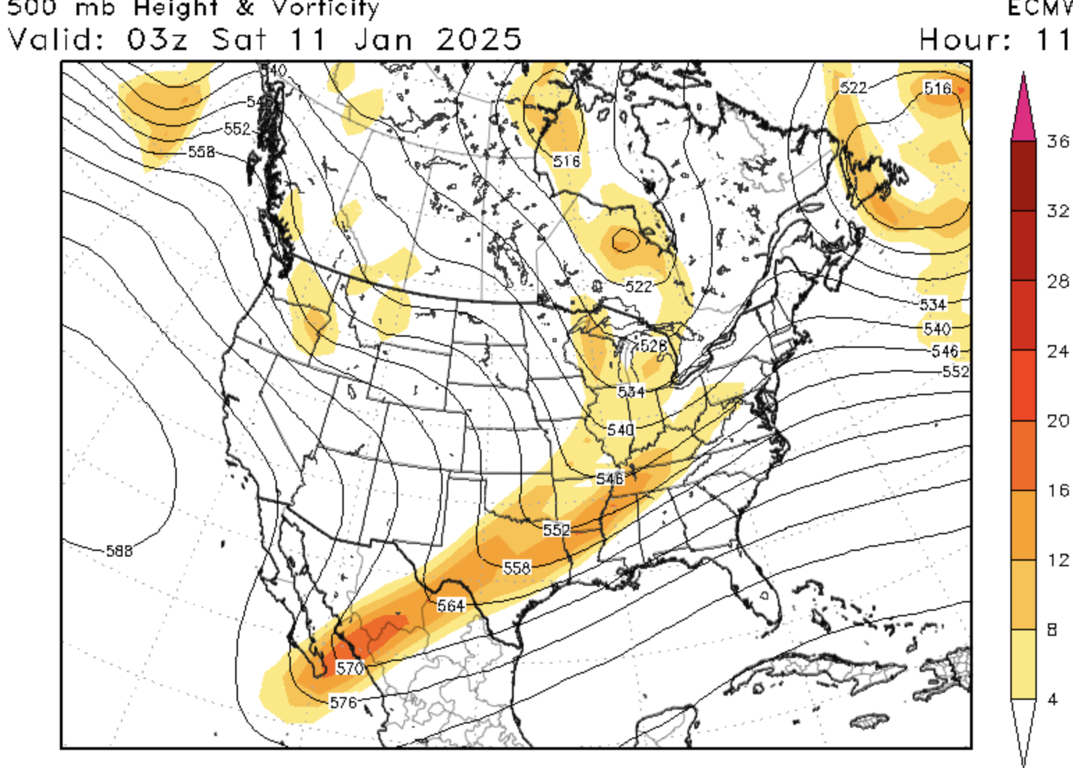
January Medium/Long Range: A snowy January ahead?
stormtracker replied to mappy's topic in Mid Atlantic

-
January Medium/Long Range: A snowy January ahead?
stormtracker replied to mappy's topic in Mid Atlantic
It's doing the weird "tail" thing...positively titled trof. Nothing like the GFS at H5 -
January Medium/Long Range: A snowy January ahead?
stormtracker replied to mappy's topic in Mid Atlantic
Both models were looking similar until they diverged at hour 72. Euro doesn't like the nrn stream vort like the GFS does. Weirdly enough the Euro is trying to recover. So let's see how this goes -
January Medium/Long Range: A snowy January ahead?
stormtracker replied to mappy's topic in Mid Atlantic
Yeah, its not gonna phase like the GFS..northern vort too far north and out of whack -
January Medium/Long Range: A snowy January ahead?
stormtracker replied to mappy's topic in Mid Atlantic
Actually kinda matches the GFS with the southern vort. Northern vort isn't as diggy and as far south tho at this time -
January Medium/Long Range: A snowy January ahead?
stormtracker replied to mappy's topic in Mid Atlantic
So doing a run to run comparison 12z GFS vs 12z Euro, they look fairly similar at H5 thru 42...doesn't mean much yet tho...just callin shot rn -
January Medium/Long Range: A snowy January ahead?
stormtracker replied to mappy's topic in Mid Atlantic
If I were a betting man, I'd say the Euro will still be on some shit -
January Medium/Long Range: A snowy January ahead?
stormtracker replied to mappy's topic in Mid Atlantic
Don't worry, I'll be consistently terrible. So there's that. -
January Medium/Long Range: A snowy January ahead?
stormtracker replied to mappy's topic in Mid Atlantic
I think the main takeaway is that the GFS has some support..maybe not the nuke it produced, but with the phasing out west -
January Medium/Long Range: A snowy January ahead?
stormtracker replied to mappy's topic in Mid Atlantic
Trof SEEMS a little too positively tilted to make a run at I-95 like the GFS did