
Moonhowl
-
Posts
648 -
Joined
-
Last visited
Content Type
Profiles
Blogs
Forums
American Weather
Media Demo
Store
Gallery
Posts posted by Moonhowl
-
-
Glad Zeta from where I am sitting was not remotely as bad as Ivan or Opal and despite the very active season the mountains in general have not had the horrible tropical season that was in 2004.
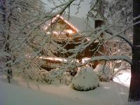
Hopefully done with the tropics but not counting on it (something brewing out there now); looking forward to seeing some snow.
Happy Halloween
-
 1
1
-
-
Just had the strongest gust so far; still think it was below 40 mph
-
1
-
-
So far max at KAVL has been 33 mph.
-
1 minute ago, Rainforrest said:
82 mph gust reported in cashiers
Holy cow!
I still don't think I have topped 30 mph IMBY and hope it stays that way.
-
Duke Energy outage map
-
So far the wind has not been bad down here in the valley (famous last words); fortunately the rain is starting to slack off. About 3.3" IMBY.
-
1 minute ago, Rainforrest said:
Wind sounds like a freight train.
I don't like the sound of that (yes, bad humor)
-
22 minutes ago, strongwxnc said:
What kind of wind are you getting?
I am guessing gusts around 25 mph so not looking good for the power when it increases.
Per Duke Energy there is an outage relatively close to me which I am sure is related to the power blinking I was experiencing.
-
Power blinking and about 2" of rain so far including yesterday. Hope the trees stay off of everyone's homes.
-
1
-
-
57 minutes ago, Sw NC weather said:
To bad we can’t time them up together. LOL
Well, we did have something like that in March 1993

-
1 hour ago, BretWx said:
Up to 105mph now. I'm guessing we'll probably see some gusts over the 40mph they're wrote. Finally some interesting weather!
Yea, a little too interesting; how about nice 6 or 7 inch snowstorm instead. We will see what happens...definitely a middle of the night alarm clock will be set to get up and check the weather.
-
2
-
 1
1
-
-
40 minutes ago, cold air aloft said:
Those of us who were around these parts in 1995 remember what high elevation tree damage tree damage Opal did. I sure hope we don't see a repeat of that but be safe out there y'all.
I remember attempting to sleep through Opal; that was a lost cause. Recall hearing the wind gusts approaching like a freight train.
Wife and I sat on the porch and watched the trees whip back and forth during Ivan.
-
1
-
-
Once again getting rain well out ahead of the main event. Just took the leaf blower to my very steep and potentially slick driveway; trying to beat the rain but ended up doing half of it while getting rained on. Was not expecting it this early. Probably not getting much sleep tonight.
-
1 hour ago, Hvward said:
Some very strong winds showing up on most models Thursday afternoon around WNC. Euro latched on to this solution yesterday and it appears that all other have fallen suite. Looks like the core of Zeta moves right through WNC. Anyways, batten down the hatches!
Given the current NHC track I was concerned about the wind around here. We would have had a chance to actually get a bit of a dry spell this Fall if it were not for the tropics; at least it keeps fire season in check. Those poor folks on the Gulf coast have been hammered; at least this one will be a little east of the last two in the region.
-
1 hour ago, Met1985 said:
Enjoy the warm weather. Its going to last for a while.
I know it isn't popular in these parts but especially after staying winter until mid-May I don't mind this bit of Indian summer. This Fall has been great compared to the scorch fest last year!
-
1
-
-
6 hours ago, eyewall said:
Here is the video. I did make some minor adjustments to match real world conditions (cameras naturally dull images/vids a bit).
Fantastic video!
-
1
-
-
52 minutes ago, eyewall said:
One more for now (still a few to go through):
Thanks for sharing the photos; absolutely perfect weather to be checking out the leaves.
-
1
-
-
57 minutes ago, Maggie Ace said:
37 was my low in Maggie with frost.
Same IMBY; it is glorious to have a stretch of cool, DRY, sunny weather; enjoy it everyone!

Plan to get out for some camping in the near future.
-
2
-
-
57 minutes ago, Buckethead said:
I've been stuck in the fog and clouds all day and only made it to 54 and hour ago...back down to 53 now with a good breeze.
Wow that is a bit chilly, sun came out down here in the low lands of the French Broad valley; made it to 68 F IMBY. Very nice day and glad not to be in the roaster like last year.
-
2
-
-
47 minutes ago, BlueRidgeFolklore said:
If this verifies and we can ride this pattern into mid-October, there's a good chance we could see our first flakes flying in the higher elevations in less than a month. I've seen it a few of times in my lifetime here.

Excuse me while I go wax my skis

-
Only about 0.7 inches IMBY so far...
-
If we can get past Sally, I did like seeing this in the GSP forecast discussion:
The payoff from this late week unpleasantness will be our first
taste of fall over the weekend into early next week, when sprawling
cool/dry high pressure is forecast to overspread the East. Forecast
temps and dewpoints for Sat-Mon are more typical of mid-October than
mid-September.
-
3
-
-
Love this weather! Hope everyone is enjoying it on this holiday weekend and for tomorrow, happy Labor Day folks!
-
The Laura forecast track is inching back in our direction; don't want any part of it.
-
2
-
2020/2021 Fall/Winter Mountain thread
in Southeastern States
Posted
Bottomed out at 27 F IMBY.