Go Kart Mozart
-
Posts
2,655 -
Joined
-
Last visited
Content Type
Profiles
Blogs
Forums
American Weather
Media Demo
Store
Gallery
Posts posted by Go Kart Mozart
-
-
23 minutes ago, Sey-Mour Snow said:
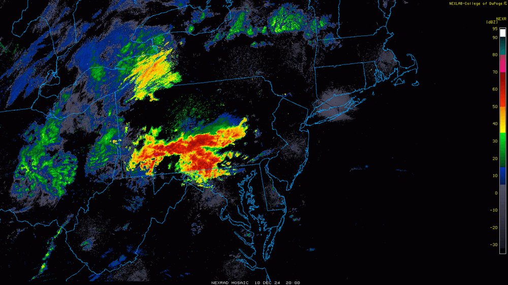
DIX radar giving the bullish guidance some credence.. That stuff is headed straight for Western areas and points east
That's a drone swarm, not precip.
-
 2
2
-
-
Even BDR has a 25f dewpoint right now. I don't think stickage will be a big problem here.
-
32 minutes ago, ORH_wxman said:
Feb 24-25, 1989 was the first massive bust I remember and you could see it coming in real time even as a young elementary school weenie. The snow was originally supposed to start that Friday night or predawn Saturday morning. I was watching the evening news and they said it was only snowing on parts of LI and the immediate NJ shore but that we should eventually get into the heavy snow during the day on Saturday. That was the first “hint” that things weren’t exactly going as originally planned.
Then I wake up Saturday morning to overcast but it was kind of thin. You could see the disc of the sun at times. The local noontime broadcast showed snow on the Cape. It was snowing lightly with a few inches there but we have bare ground still. Then Barry Burbank comes on at noontime weather segment and says the snow might not start until late afternoon. This is when I started getting that pit in my stomach.
I think I stared at the spotlight out back for almost two hours straight between 6-8pm without seeing a flake in the beam of light. Then I finally saw a few weenie flakes before bed around 830-9pm. It snowed all night and finally stopped about mid morning. The storm still ended up a bust but at least we didn’t get shutout like many others I would learn only years later. We finished with about 4” of arctic sand after the original forecast on Friday had been 1-2 feet. Parts of the cape verified with double digits.
I actually drove to the Cape with a few friends for that one. 10" in Chatham with a lot of drifting, as I recall.
-
8 minutes ago, RUNNAWAYICEBERG said:
Ray is spanking
-
 2
2
-
-
6 minutes ago, MJO812 said:
I'm all in
0z Models will be great
The most important runs of the last five years.
-
 1
1
-
-
Thank God I was super busy at work this afternoon. Didn't get caught up in this,
-
1 hour ago, Sey-Mour Snow said:
6z GFS is a monster qpf producer into cold air for RT 2 north Christmas Eve night through Boxing Day..
Yeah, there seem to be hints of a monster -NAO....holiday magic?
-
 1
1
-
-
2 minutes ago, ORH_wxman said:
I was actually thinking yesterday about how if this was going to make a move, it would prob be the 72-84h mark because that’s when the shortwave is coming onshore. Should be mostly Onshore 12z tomorrow but we’re already getting the front end of it tonight.
If we get a reversion back SE tonight, then that’s a very good indicator given the better sampling…and just the fact we’re closer and the solution got worse. Both of us know from statistics and just years of experience how trends that happen closer to the event are more likely to be real.
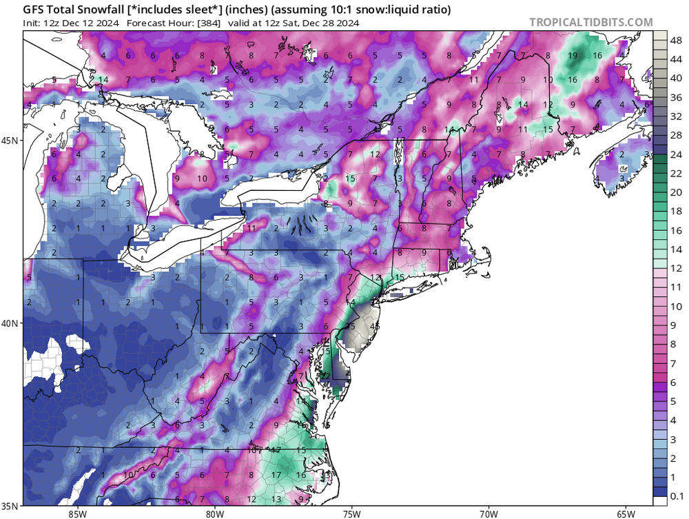
I wonder if we will revert to the 40" plus from NYC to ACY.
-
 1
1
-
 1
1
-
-
9 hours ago, 40/70 Benchmark said:
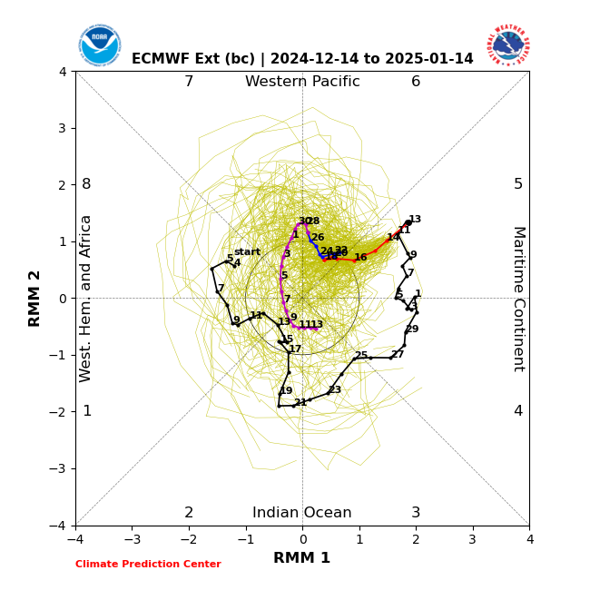
ECMFW sucks with the MJO.
Have you seen stats on that? Empirically, it seems to me the the GFS suite is usually too aggressive with high wave amplitude.
-
-
A lot of icon discussion here. The icon last scored a coup when the Lions won their last Superbowl.
-
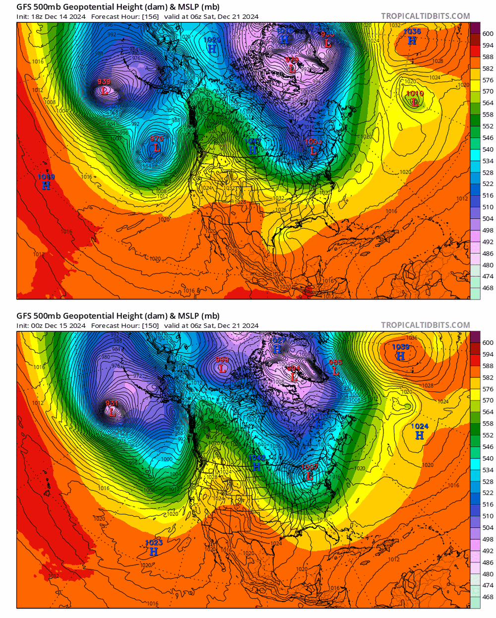
Tip's 576 line is in a much better space this run, but Geez, last night we had pronounced ridging pushing into eastern Greenland....today it's a deep low. IMO the PNA ridging is not as impressive as it was depicted a few days ago.
-
2 minutes ago, ineedsnow said:
nice 931mb low in the north pacific
Upon further reflection, the changes east of Greenland might be the most significant....edit...make that the disappearance of the TX Gulf coast trough.
-
 1
1
-
-
-
2 hours ago, tamarack said:
State's greatest snowfall, 34", was at Cape May (which has the lowest average snowfall of any NJ town). It was part of the Feb 1989 blast that also notched a -2 at Tallahassee, FL's only subzero temp.
That's nuts. Any idea if OES was involved?
-
On 12/11/2024 at 2:05 PM, WinterWolf said:
You mentioned that AI version is doing pretty well overall, right?
Sorry for the delayed response. Yes, it is doing well, but these are the very early returns...can't draw big conclusions yet.
-
 1
1
-
-
-
19 hours ago, Typhoon Tip said:
ha ... love the suggestion for repetitious cycling ...but that's way off
Yup, AI in particular is hitting on that.
-
5 minutes ago, RUNNAWAYICEBERG said:
Big winter incoming?
Brutal cold showing up on AI.
-
 1
1
-
-
6 minutes ago, Brian5671 said:
even the rain shifted east-models showed W CT with 2-3.5 inches yesterday we will have a hard time getting to an inch
Wow, that's bold. The current radar does not look like a 1" event to me.
-
4 hours ago, SouthCoastMA said:
Has the EC-AI shown any skill yet? That's the kinda evolution one could hope for if you don't want a grinch pattern around Christmas.
So glad you asked. I have been following it closely since the early fall, and so far, it is the best model. Granted, my analysis is for our little area only, and is entirely empirical. Here is a little anecdotal example:
I am also active on a Notre Dame football board, where I have installed myself as the weather nerd in-chief. About 5 days ago, it appeared likely that we would be hosting Alabama on the 20th. Of course, I went to the maps hoping for the most miserable cold possible for northern Indiana in December. At that time, gfs and euro showed a nationwide zonal flow, with temps far above normal for SBN. Euro AI on the other hand, had deep winter. I am not ready to spike the ball, since we are only on the 15 yard line, but AI has held fairly steady while the others are showing signs of capitulation. We'll see what happens!
I am ready to make this prediction: Next year at this time we will all be going to the AI models first...with occasional references to the "legacy models".
-
 2
2
-
-
-
12 minutes ago, CoastalWx said:
Had two, 0.3” snowy pre-dawns. Epicosity.
Survivable....if you had the prescience to stock up at the grocery store the nights before.
-
The 168hr storm shown on euro seems to be another windy little bugger, at least down here.


Converged on a 12/21/2024 coastal storm, however ... much higher than normal uncertainty relative to very shortterm. May need nowcast for impacting east/SE regions
in New England
Posted
When I look up DOX, I get Dongarra, Australia?