

Go Kart Mozart
-
Posts
2,334 -
Joined
-
Last visited
Content Type
Profiles
Blogs
Forums
American Weather
Media Demo
Store
Gallery
Posts posted by Go Kart Mozart
-
-
This may be all sound and fury signifying nothing, but there is a lot of talk on certain websites about the current solar cycle coming to an early peak. Any thoughts?
-
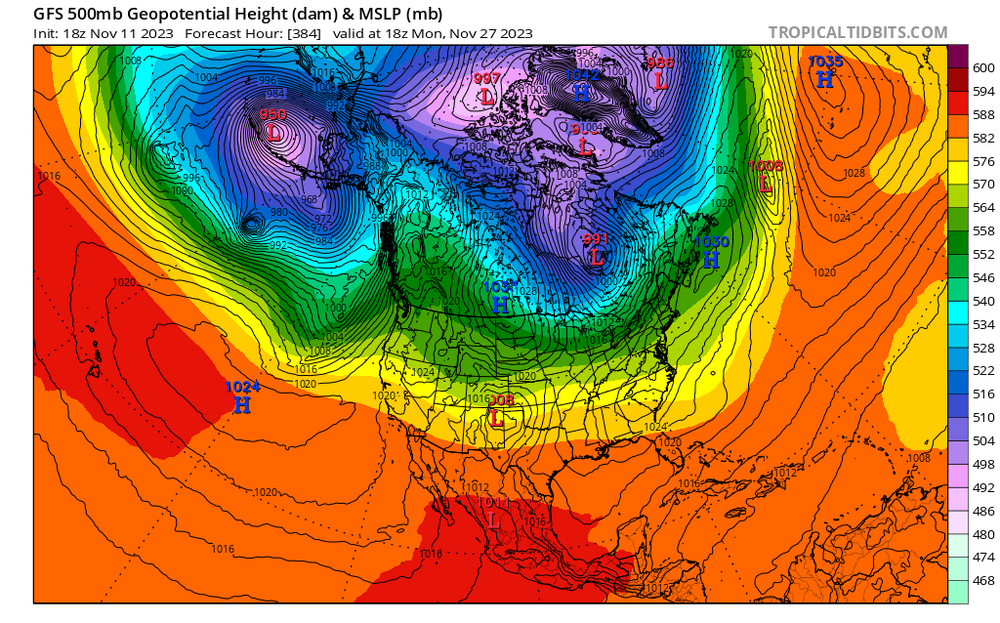
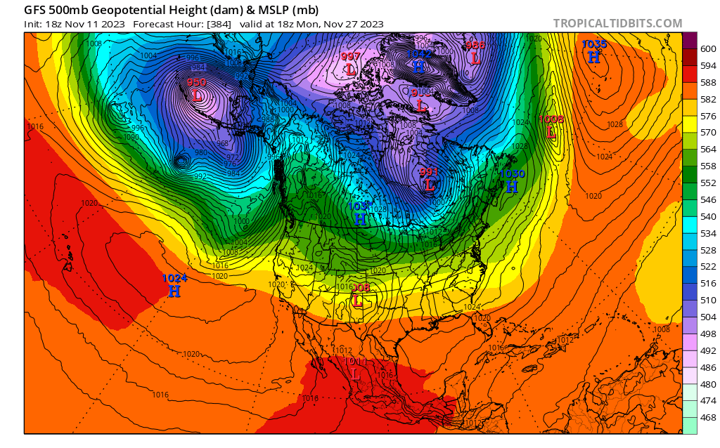
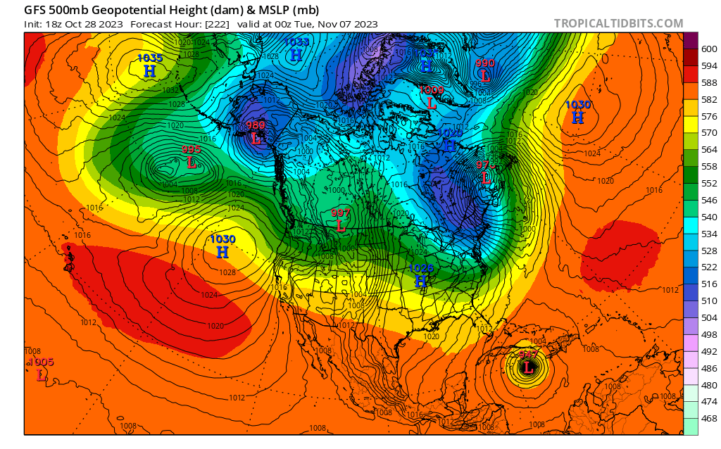
I post this 384 map as an academic exercise only....note the 1042 HP at the surface over Greenland, with very low heights. Normally, I would expect to see elevated heights with a 1042 high. Can a pro educate me....how can the atmosphere be so heavy and yet so cold aloft?
And for more fun, check out the 2m temps under that high. "Real cold".
-
 1
1
-
 1
1
-
 1
1
-
-
7 hours ago, OceanStWx said:
We all know about how Roger Williams was kicked out of the Mass Bay Colony after the great meltdown during winter 1635-36.
I thought he lost his fortune at the Wampanoag casino?
-
 8
8
-
-
1 hour ago, weatherwiz said:
Really interesting to see some potential for tropical activity within the next 10 days. This may be a long shot but there may be a system in the Gulf late weekend/early next week which could materialize into something and the GFS has been really hinting at a pretty power Caribbean storm later next week or next weekend. Now of course neither of these will have an impact on our sensible weather, but when looking at this from an atmospheric perspective and forcings...this could be a clue of how the pattern could evolve moving through the second half of the month.
Damn, that's close to a destructive storm. Maybe a half day faster with the TC, or slower with the trough.
-
2
-
-
1 hour ago, ORH_wxman said:
These recent GFS runs have had some awesome looks in clown range. Hopefully we can get something to setup resembling that.
Still some differences between EPS and GEFS for that period but they aren’t horribly far off.
Like this?


-
1
-
 1
1
-
-
2 hours ago, WinterWolf said:
Yup..was a good one here. Liked it.
9" in Trumbull, we were in kind of a sweet spot. Thank God a crew from Indiana had restored our power a couple of days earlier!
-
I think the 18z GFS days 16-19 would be hilarious.
-
1
-
-
A little piggish around day 10 or so?
-
14 minutes ago, ORH_wxman said:
Euro is intriguing for NNE for the 11/7-8 threat. Even flips SNE to snow after rain first....but that was one of the colder solutions in the past couple model cycles....still think something the following weekend in the 11/10-12 range would be a bit easier to get frozen out of (and clown range Euro does look interesting at the end of its run for that)
I was just thinking, I would have liked to see euro days 11 and 12, just for entertainment value.
-
On 10/29/2023 at 8:25 PM, weatherwiz said:
I apologize for providing a blog link here, but it would be a major pain to transfer everything here into a post, also with the number of images I have, I don't even think I have the upload capacity. I absolutely regret how lengthy this became and you'll see towards the end I just got much lazier. I started typing this up at the beginning of October but I have limited time where I can do blog work. I absolutely don't expect anyone to read through all of it.
https://weatherwiz.blogspot.com/2023/10/2023-2024-winter-outlook.html
Good work Wiz, lot's of interesting detail. I hope you-re right!
-
1 hour ago, ORH_wxman said:
Torchy for December. Kind of neutral for Tday period though.
The weeklies beyond week two have great utility:

-
1
-
3
-
-
1 hour ago, Spanks45 said:
That is some impressive cold air sitting to the north days 11-16 on the GFS. Hopefully it has a clue, definitely will be chances if that look sticks around as we head into that time frame.
Yes indeed. Question for the LR guys....does this year's set-up resemble 1989 at all?
-
I've heard of people referring the forum state as "crickets", but this time it really is crickets.
-
Fantasy Land, bit it beats a sharp stick in the eye:
-
1
-
-
11 hours ago, powderfreak said:
Best thread title in a while.
Thanks. I was trying to stay away from using "torch" or "mow". Those are getting a bit hackneyed.
-
To start the month It seems we have a series of waves diving out of far eastern Siberia into the GOA. As long as they crest at the longitude of Kodiak Island or west, we would seem to have some weather of interest heading our way. If they crest up tight against Juneau....keep the mower handy!
-
1
-
2
-
-
Who's gonna start the Weenievember thread? Don't make me do it....I'll ruin a promising month.
-
1
-
-
12 minutes ago, CoastalWx said:
Still 73 here. Get used to this folks.
Get used to this, ha ha!
-
5
-
1
-
1
-
-
This would be a fun forecast for a WVA met: "Snow mixing with then changing to rain. The snow could accumulate to 45" before the changeover...."
-
1
-
5
-
-
1 hour ago, Damage In Tolland said:
Don’t know what more Scooter wants to see. Acapulco will never rebuild. The city is decimated and uninhabitable. Hundreds of miles inland . This had gusts to 215mph at ground level.
https://x.com/accuweather/status/1717976505727303818?s=46&t=dhcbvkjmRcyBVQtDxJ3lRg
https://x.com/nerdy_addict/status/1717888316371062989?s=46&t=dhcbvkjmRcyBVQtDxJ3lRg
The cartels will rebuild. Big profits in a "legitimate" business". The American mob did this in Vegas.
-
1 hour ago, Damage In Tolland said:
All time Octorcher highs are within reach. Not a forecast but a distinct possibility
Trumbull schools early dismissal tomorrow due to extreme heat.
-
1
-
4
-
-
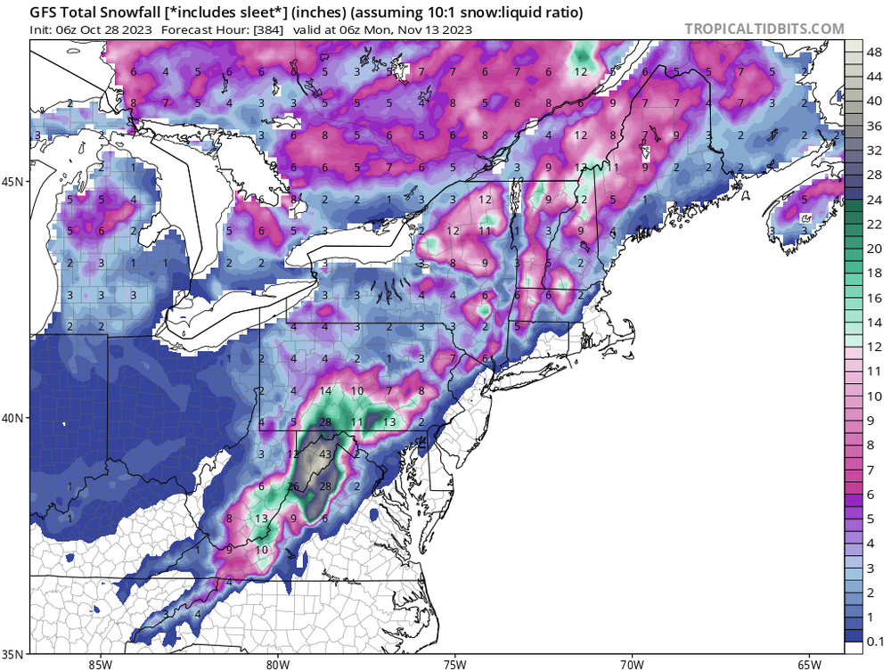
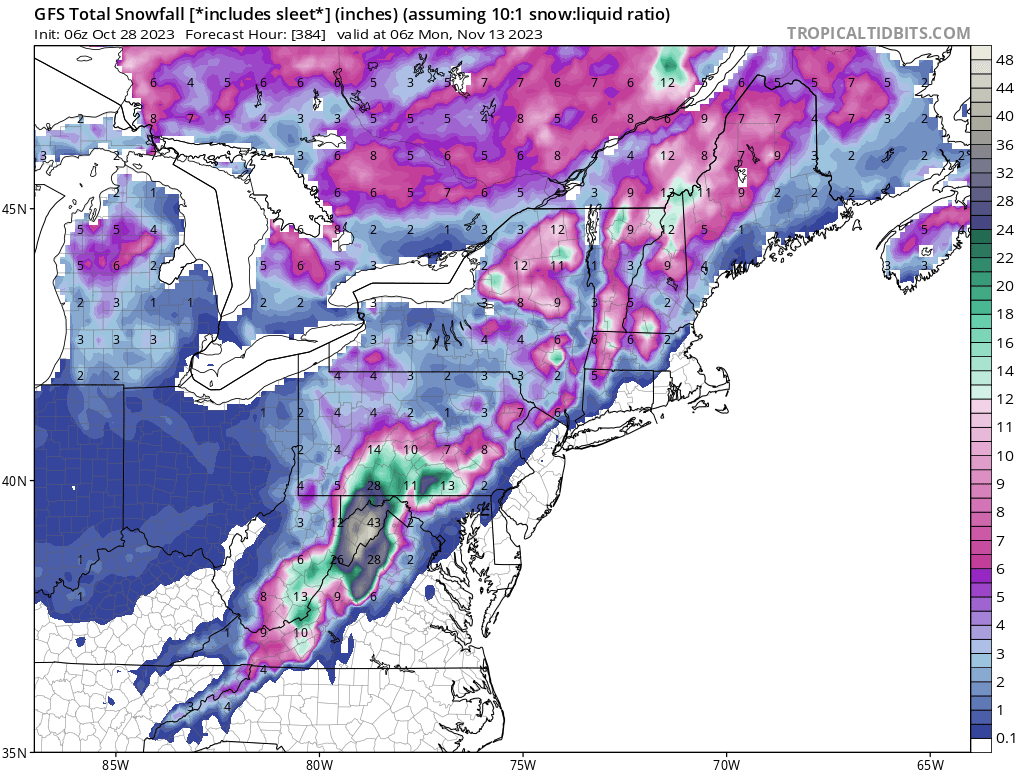
lol, look at the snowfall map from hour 324 to 330.
-
22 minutes ago, CoastalWx said:
That’s not his point.
Apparently this guy was thrown out of the military for threatening to "blow up the base". Was hospitalized for "hearing voices" recently. In this case, it appears to be mental health.
-
4 hours ago, Lava Rock said:
how's the pack up in canada thus far? avg, below, above?

Yesvember or November?
in New England
Posted
Gracias