madwx
-
Posts
2,362 -
Joined
-
Last visited
Content Type
Profiles
Blogs
Forums
American Weather
Media Demo
Store
Gallery
Everything posted by madwx
-
Estimating 4” or so outside right now. The heaviest band has set up just north of town
-
Snow starting here as a wall of 25 dBz reflectivities hit us. Moderate sized flakes right now
-
Dry air holding out here for now but slowly slowly losing the battle. Ceilings down to 1700 feet
-
Probably won't fully saturate here until 7 or so. Should be some good rates between 2-6 AM
-
if we get over 4" here the v16 GFS is the real winner. Was hammering the N trend for a while
-
Even the GFS has us getting 6+” in 24 hours. Have to imagine we’ll get at least an advisory with the overnight package
-
Can’t wait to luck ourselves into a warning criteria storm
-
Man that was the ultimate nut storm around here. Got about 18” at my house iirc
-
I for one am proud of starting a thread for a storm that’s gonna drop 2” max
-
Wagons north
-
It hasn’t been a completely classic La Niña winter but this is a classic hallmark as you head further East
-
lots of panicking here right now. take a deep breath everyone. Still a warning criteria snow for W of I39 and the lakeshore counties.
-
A little under 2” here overnight
-
The v16 GFS (para) is performing much better overall than the current operational GFS so far this winter
-
Snow started around 9 here. A dusting on the ground already
-
GFS continues to show a minor hit for the southern half of Indiana and Ohio
-
Could see us flirting with 6” here(2” from tonight’s wave and 4” from the main low) if the N drift continues
-
Got down to 0 here. Just like last year, waiting a long time to get that first below zero temp
-
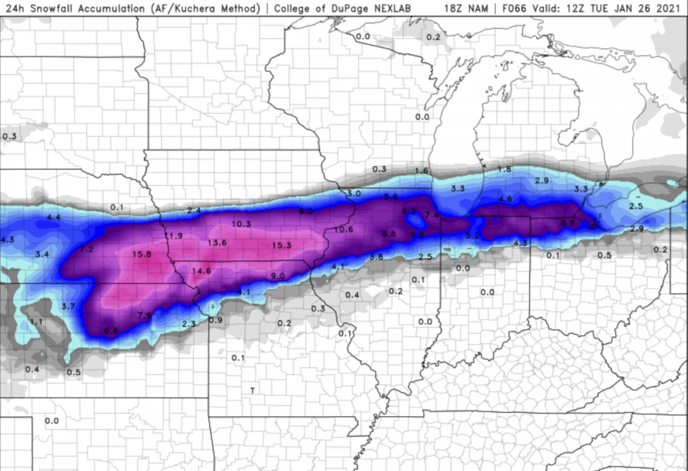
24 hour storm total on NAM ending Tuesday morning at 6. Snow still going from about Chicago eastward
-
heads up that about 2" of that on the NAM from Dekalb to the west and north is from the wave overnight
-
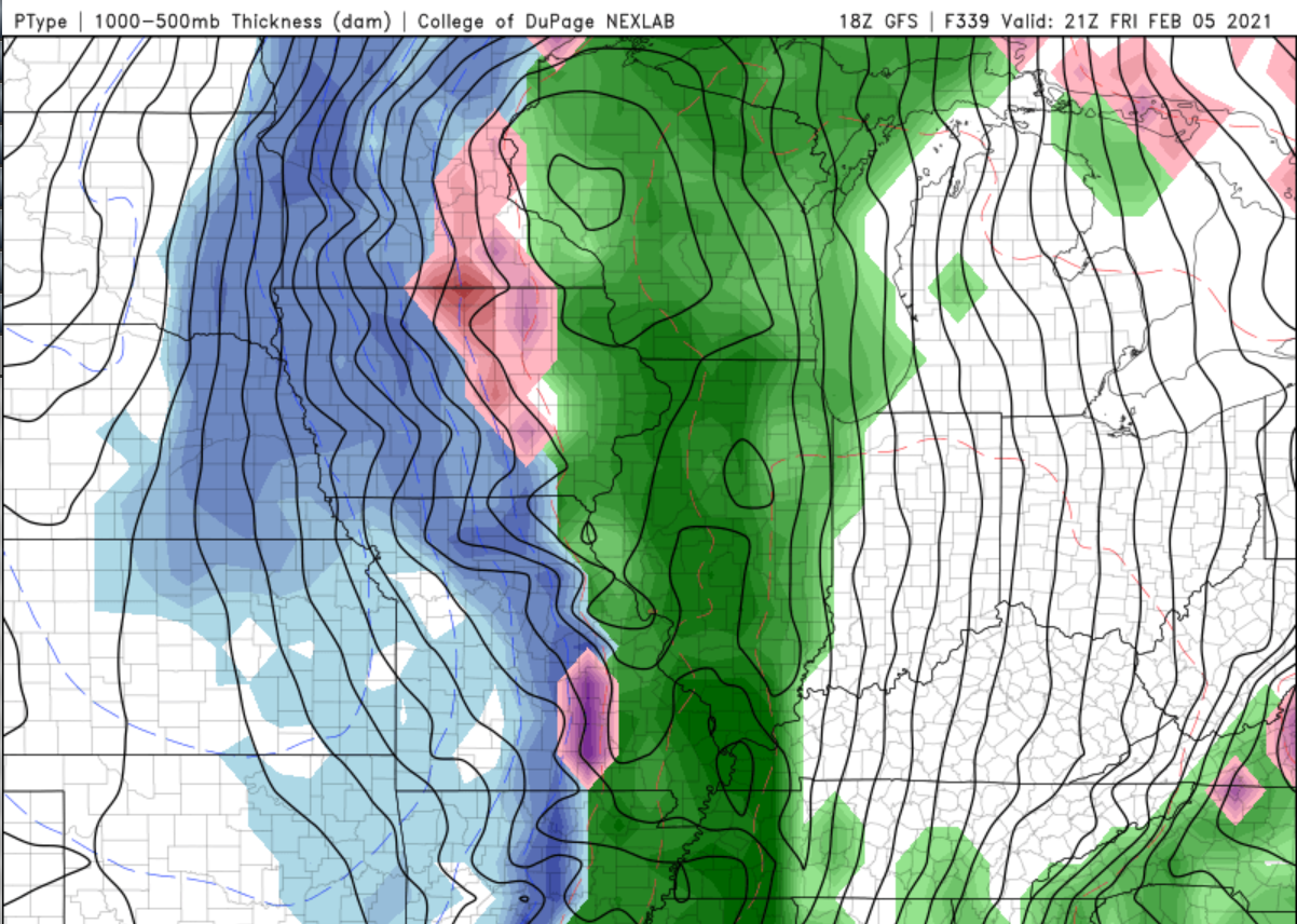
who wants 60s on Feb 5.

-
Right on the heels of the early week system another shortwave looks to eject from the SW. There are some hints this could be a notable storm as well, especially in the southern areas of the sub
-
lead wave looks to drop a solid 3" or 4" here. trending towards a narrow miss south with the main system.
-
Got a degree in meteorology but don’t currently work in the field
-
Hmm, feel like I've seen that image before