

Ottawa Blizzard
-
Posts
4,530 -
Joined
-
Last visited
Content Type
Profiles
Blogs
Forums
American Weather
Media Demo
Store
Gallery
Posts posted by Ottawa Blizzard
-
-
12 Z Canadian says "keep the faith Toronto".

-
 1
1
-
-
12 z Canadian says "keep the faith" Toronto.


-
Temperature up to 40 F here. A true heatwave after the temperatures we've had over the past month. The front can't come soon enough.
-
48 minutes ago, rochesterdave said:
HRDPS picking up on that third wave. Gonna be a big one boys.

I don't know...I'm still thinking 4" max for Toronto. Rain to snow scenarios rarely seem to work out for us.
-
1
-
-
Sticking with my 4" call for Toronto. At the moment, though, this is looking like a dud for us. Rain to snow scenarios rarely work out for us.
-
3
-
-
Just now, mississaugasnow said:
Ya, you guys got smoked. The storm total here was only about 10-13"
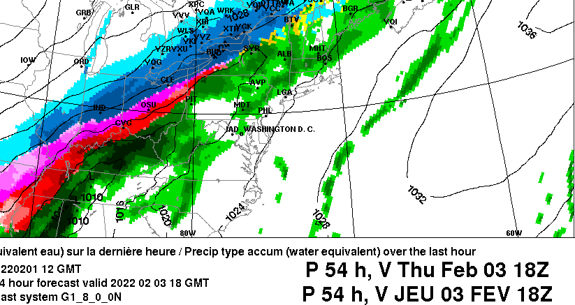
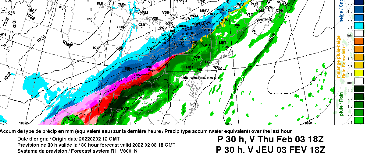
Yup, I measured 21" out of that storm. Pretty much the biggest one day storm total I've ever experienced...and I lived in Ottawa for 6 winters.
-
3
-
-
6 minutes ago, CNY_WX said:
Back in the 70s or 80s Quebec threatened to secede from the rest of Canada.
Yup. Two referendums. The first in 1980, the second in 1995. I remember the 1995 one- was a 50/50 result. A real nail biter.
-
Just now, mississaugasnow said:
Its more 5-8" on the ground here so after the warmth and rain I expect 2-5" left which will turn into a glacier
I've got about 10-12" still left in my back garden.
-
1
-
-
2 hours ago, 96blizz said:
Canadians are too nice for a coup.
Come now, have you heard of the trucker convoy that just went to Ottawa?
 Just kidding.
-
 2
2
-
-
57 minutes ago, mississaugasnow said:
Well you guys down in CNY reeled this in, congrats haha. I will be bowing and throwing in the towel on this storm as it looks like nothing more then a run of the mill 2-5" snow for the GTHA over
Bring on Spring! haha
You think they'll cancel the winter storm watch for Hamilton?
-
48 minutes ago, rochesterdave said:
GFS continues to subtly adjust north on the second wave. The snowfall maps didn’t change but I’m happy to see the suppression scenario stop
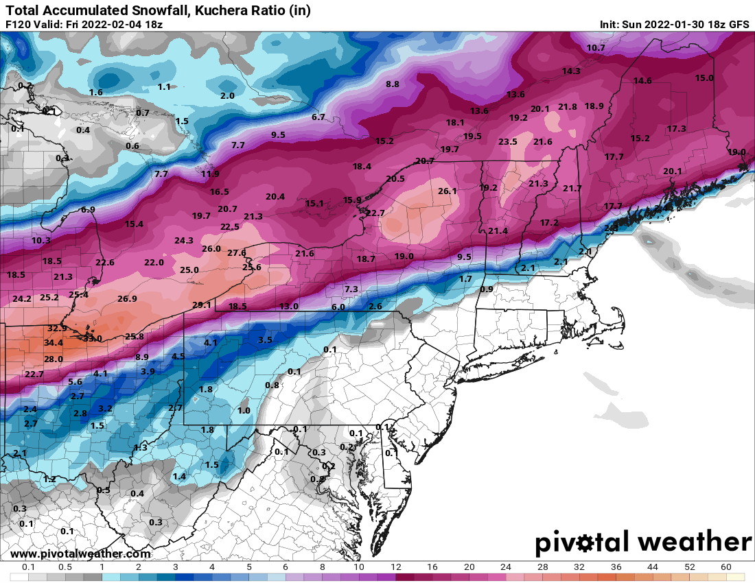
At this stage, I'd honestly count myself lucky if I got 6" in Toronto.
-
The latest run of the Canadian definitely shifted north for the Thursday event.
-
1
-
 1
1
-
-
The latest run of the Canadian model seems to bring heavier precipitation further northwest for the second wave on Thursday...

-
I'm going with a final call of 4" for Toronto. Tough for me to say that when there was once so much potential. Still, after the 21" I received on January 17th, I guess I can't really complain.
-
1
-
-
21 hours ago, WeatherMonger said:
Think this might be the first big winter storm where Bastardi has not been mentioned.
Apologies in advance if his name is forbidden here

Did he retire or get shamed off the intenet?
Really off topic, but he has just tweeted this morning that he lost both of his parents to covid, on the same day.
 Regardless of any differences we might have with him politically or with regard to the weather, that is an unimaginable tragedy.
-
1
-
1
-
-
My call for Toronto is now 4". I think we miss the main storm on Thursday, and the changeover from rain to snow is later than expected on Wednesday.
-
1
-
-
1 hour ago, snowstormcanuck said:
OB, your call might be closer to what will happen. Lot of things working against us: delayed changeover to snow, quicker shut off of accum. snow Thursday morning, possible whiff with the main storm.
There is a worst case scenario where we end up sub 4". Not saying thats happening but you sort of see the cracks in the ceiling developing.
I hope I end up being wrong. However, the 17th storm was an unusual event. Back to the usual Toronto snow shield now, I fear.
-
2 hours ago, BuffaloWeather said:

lol. Having lived in both Ottawa and Toronto, I can tell you that people in Ottawa take the snow and cold much more in stride.
-
1
-
1
-
-
2 hours ago, mississaugasnow said:
Im getting a bit more concerned with losing current snowpack and getting more rain. EC going nothing but rain for Tuesday night into Wednesday for me.
I have 7" OTG and didnt expect so much rain to be forecasted. Unlikely it all washes away, my guess is I lose 3-4" and the rest will turn into a glacier. Also getting a bit nervous Ill be on the lower end of the 4-6" minimum I mentioned haha. Might end up right back at 7" OTG by friday morning so if you slept from today and woke up friday the snow depth wouldnt change haha
If you're in Hamilton, there's a winter storm watch for you now - 10-12" of snow.
-
1
-
-
8 hours ago, mississaugasnow said:
Ya, weirdly im concerned about both. Wednesday has trended a bit warmer down here in the Hamilton-Niagara region. It will take a thread the needle event for 12" but im enjoying the tracking. I may be wrong but I think YYZ has 4-6" of new snow coming this week all but locked up. Issue for me is it just a winter weather travel advisory for 2-3" of slop Wednesday followed by 2-3" of powder Thursday.
Should also mention I enjoy retaining snow packs haha. So we went from thinking this week would bring first 50s to the region in a while and obliterate the snow pack to upper 30s Tuesday, some light rain to begin followed by more snow. This should help create a glacier that will become tougher to melt in the coming days/weeks
I'm starting to think 4" in total for Toronto. This thing looks to get really supressed. I guess I can't complain - January 17th was the storm of a lifetime.
-
Hoping Toronto can get at least 6" - the southeast trend on a couple of the models is concerning, though.
-
13 minutes ago, mississaugasnow said:
Cleveland and Buffalo have held off watches, I wonder if they add them this afternoon. Same for EC.
Locally the weather network and a few news stations are starting to say 8-16" over 48 hours is becoming possible.
I'm a bit concerned about the southeast trend on a couple of the models, though, including the GFS and the Canadian.
-
30 minutes ago, 96blizz said:

Wow, if Toronto gets a second storm of 15-20" in one season, it would be among the most historic seasons in decades for this region.
-
1 hour ago, snowstormcanuck said:
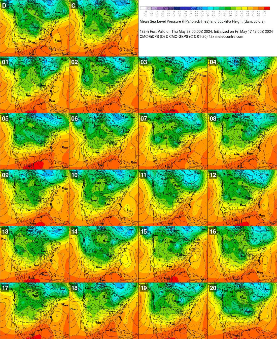
Mixed bag on the CMC ensembles. Some amplified, some strung out and weak. Eagerly awaiting what the EURO ensembles say.
Good to see you again. What are your thoughts for this one? At least 4-6" for Toronto?


Feb 1-3rd GHD III Part 3
in Lakes/Ohio Valley
Posted
Yup, taking forever for the front to arrive.