

WishingForWarmWeather
-
Posts
636 -
Joined
-
Last visited
Content Type
Profiles
Blogs
Forums
American Weather
Media Demo
Store
Gallery
Posts posted by WishingForWarmWeather
-
-
50 minutes ago, USCG RS said:
Unfortunately, this looks'good' compared to the western portion of the state and, of course, WNC. Some areas are literally just... Gone. There's no other way to put it. It's... Indescribable.
Yes, that definitely isn’t lost upon me. I guess I was trying to express that the devastation - regardless of level felt or perceived - is so widespread. I definitely didn’t mean it as a competition or anything.
-
 1
1
-
-
The impacts and devastation are just so widespread. Also I recommend going to that tweet and reading the entire thread. They continue on documenting how bad it was for them.
-
 2
2
-
-
7 hours ago, WxWatcher007 said:
Thanks for the question.
You’re incredibly welcome. Thank you for the thorough, in-depth, well thought out, knowledgeable, and empathetic response. I’ve learned a lot from you through the years and the trend continues today.
I don’t want to go point by point in what you’ve said, but I do want to quickly thank you for bringing up that behavior, comforting that family, and for the way you approach chasing professionally. As someone who went through Katrina in New Orleans it truly means a lot.
I also wanted to get your thoughts on something regarding the wind, especially knowing it’s one of your big fascinations.
I wanted to ask your thoughts regarding the gusts through Helene’s landfalling life. Why with this particular storm the gusts seemed to really be the bigger story… for example, double the sustained, maybe even triple the sustained or a little higher in some places. Maybe I’m just not remembering well exactly how storms in years past went but it feels like usually the gusts are more in the sustained + 20%ish range.
I’m interested in hearing your thoughts as to the sustained -vs- gusts, the seeming over performance of the gusts (or if that’s just in my mind), how far inland those huge gusts went (which is why they seem as though they’re overperforming to me I believe, as the sustained winds were tightly contained).
It was a big storm, yes - but was it also the SW/NE jet that influenced all of this? Is this gust:sustained ratio disparity (that maybe I’m making up) something that happens more with later in the season storms rather than the earlier ones?
Thanks ahead of time for your thoughts - or for anyone else who would like to chime in! I’m definitely still learning and would love to hear what anyone wants to say/teach me.
-
2
-
 1
1
-
 1
1
-
-
39 minutes ago, jburns said:
One thing Ryan does that I think local TV stations should copy is the way he gives out a location and future path of a tornado. Local news usually uses highway numbers and street names. You would be amazed at how many people know them name of the street they live on and that’s about it. It isn’t helpful for them if you say the tornado is moving across Highway 43 and will soon intersect Franklin St.
Ryan does say the same thing but then quickly follows it with, the tornado is about to move over Billy Bob’s car lot on Highway 43 and is headed toward the Walmart on Franklin St.. If you are near that area take cover now.
Yes exactly. I love that - I guess between him and Andy someone has Google street view or something overlaid and they are calling out local landmarks. You’re right there are so many people that only know their street name and everything else is “turn right after the DQ, 3 streets down make a left after the church next to the school”. It’s me. I’m people. I only function off landmarks so I’m so thankful they do that for people.
I also appreciate that it’s just fully aggregated all in one place. If there’s a system spanning 4 states, they’re calling out every single individual severe instance and it really is impressive. Especially when Andy is calling out storms that get missed with the severe warn or tor warn on it.
And I appreciate that they have so many resources around, so many boots on ground to go to.
I also appreciate that the aftermath is aggregated.
I just really appreciate the work they put into it and the untold lives they ultimately save because of it. When I first stumbled across them I was worried it would be sensationalist journalism at its best and I’m so happy to say I was wrong.
-
 1
1
-
-
27 minutes ago, WxWatcher007 said:
The chase went about as well as it could. Ended up in the center of the eye. I posted a few videos in the thread.
For the posts you have to paste the original link in another tab or window and substitute X for Twitter.
So for example:
If you paste the original link it’ll look like this
https://x.com/burgwx/status/1839785589241258454?s=46&t=Nn9Cx92_8118fPdhHPdJHw
If you change it in another tab and paste, it should automatically convert. You’ll know you’ve done it right if the tweet posts before you hit submit.
You’re the best, friend. Thank you.
Yes! I watched all your videos you posted. They were impressive. I was wondering - I saw chatter across the social media world in numerous places of people being “unimpressed” with the wind. Which, we both know, happens every single storm.
I know Laura is your benchmark and I remember how rattled you were after. How did this stack up, in your opinion? I know being any closer to the coast itself was impossible due to the location, what’s available for protection, and surge concerns. But do you believe, if it were possible to be closer to “ground zero” than Perry, that the wind and gusts would have been perceived as more impactful?
I can’t remember just how far Perry is - but I do know it’s a little bit of distance and many trees in between. Do you think the trees had any effect on the “disparity” (in quotes bc I fully understand we’re never going to get sustained winds matching official numbers) or simply just the distance?
-
1
-
-
Okay! Testing, testing, 1…2…3…
-
2
-
-
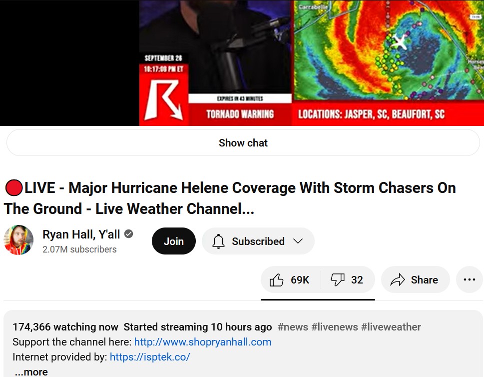
On 9/26/2024 at 9:18 PM, Chinook said:
It seems like a lot of people are watching
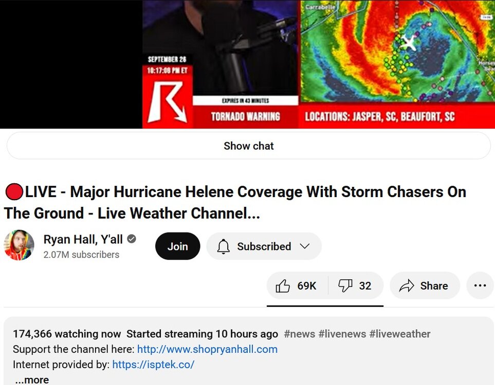
I honestly think it’s really cool that there are new mediums for solid coverage in severe weather situations.
It’s reminiscent to me of growing up and being incredibly obsessed with watching the wall-to-wall coverage on TWC when it used to be good.
What Ryan, and more importantly Andy, do for the weather community (and those just interested peripherally or happen to be affected in the moment and need knowledge/help they can trust) is amazing.
Just my .02 - I know you were just pointing something out but I had wanted to mention this during the storm and forgot.
-
On 9/25/2024 at 7:35 PM, lilj4425 said:
Turtles are slow.

-
1 hour ago, WxWatcher007 said:
Thank you for sharing. Reposting for people that may be hesitant to click a link.
Thank you so much for doing that. 007, how did your chase go for one? And for two, can you teach me how to post it like you did so I can do that in the future?
-
-
6 minutes ago, MattPetrulli said:
Latest VDM is closed eyewall. Off to the races now
If it holds this time, anyway. It keeps closing and opening. I think maybe 4 times now since yesterday it’s cycled between closed circular, open elliptical, and back. If it holds onto keeping it closed then we may get some prolific strengthening. If not I think it just remains on this steady state to slight strengthening route it’s been on.
-
4 minutes ago, MN Transplant said:
That's a wobble. This thing is headed to Apalachee Bay.
Idalia smacked around Valdosta pretty well last year and this looks like it could be worse.
Yeah - definitely is going to wobble especially as the VHTs circling circling and dragging that center all over. I just meant they weren’t seeing things - it’s on the east side of things right now. It’ll likely course correct back towards the west and on track!
those poor folks can’t catch a break in that area. So many in the past few years. And in model fantasy land there’s another behind Helene land falling in a very similar location.
-
52 minutes ago, cptcatz said:
I'm gonna get weenied here but satellite looks like it's making a significant northeast motion and making a bee line into the penninsula. I'm calling landfall around Cedar Key. If it doesn't turn more north, the surge in Tampa could be even worse than thought.
Nah. You’re not a weenie.
-
1
-
1
-
-
Just now, CoastalWx said:
That area from ATL to the N and NE are gonna get a shitload of rain. Big issues there I think especially foothills and mtns.
Yeah - places like the Blue Ridge Mountains are in trouble. Nantahala River area, Ocala River area…Yeesh. Feels like a recipe for disaster with mudslides.
-
2
-
-
1 minute ago, nvck said:
looks like the core of it should miss land, although it'll certainly be close
Definitely cutting it close. Might help tighten it up a bit for some frictional convergence but I definitely don’t think we see a technical landfall.
-
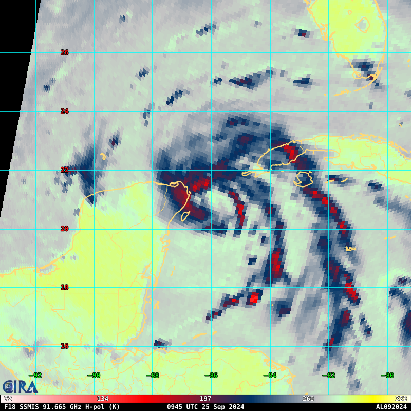
2 minutes ago, CoastalWx said:
Yeah was going to say, visible shows convection wrapping around, but IR kind of shows the illusion of the center closer to land and south. Microwave imagery helps here.
Core is kinda wild. Meat of it stretches nearly the entire Yucatán channel.
really feels like when an eye does clear it will be massive.
-
2
-
-
-
-
7 minutes ago, Stovepipe said:
On my excursion to Food City I saw one guy that made me proud. He was in a little late 80s Ford Ranger, loaded down with miscellaneous stuff in the back with CHAINS on the rear tires. My dude was also obeying the stop signs and traffic lights.

I know this truck I ain’t no stranger I know that truck it’s a FORD FUCKIN RANGER
-
3
-
 2
2
-
-
In Clarksville, in the snow hole, watching it snow all around me.

-
2
-
-
Hey y’all - where do I go to follow along with the models? Usually I only use tropical tidbits during hurricane season. But I’ve found myself now living about 45 min north of Nashville. I don’t typically follow winter weather. Which models to ignore for being weenied out always, which are best - and where do I find the best maps for following along the windshield wiping trends?
-
I’m definitely ready for fall weather. Tomorrow will be 79° but then low 90s for the foreseeable future. Wish I could change my username.
-
1
-
3
-
-
This gif on Twitter was too incredible not to share in here with you all.
-
9
-
-
2 minutes ago, canderson said:
Thanks! This will miss them to the NE yet again. Tyler tonight imo got incredibly lucky. Major population center had a tornado on radar overhead.
I'm really, really, really glad to hear that they got lucky again. Truly. Not just your parents but the entire city. I hope the luck continues through the whole season.
-
1
-
Major Hurricane Helene
in Tropical Headquarters
Posted
Ohhhh. No, that’s my fault, I thought it was more a response to me than a piggy back and wanted to make sure i clarified my thoughts.