

WishingForWarmWeather
-
Posts
636 -
Joined
-
Last visited
Content Type
Profiles
Blogs
Forums
American Weather
Media Demo
Store
Gallery
Posts posted by WishingForWarmWeather
-
-
57 minutes ago, Cheeznado said:
Heavy snow here, approaching 3"
I’m in love with the fern/leaf photos. Those are gorgeous.
-
3 minutes ago, dwagner88 said:
Just did a 10 mile run. First run in the snow in YEARS for me. Started out as tiny flurries, but by the time I finished the sidewalks were getting slick and everything was white. I'm at work now, but when I left the house it was snowing moderately at 25 degrees. Cranking right now at my office off VW drive. We will see if it stays.
We share a last name but man if we couldn’t be any more different.
-posted from under about 4011 blankets in a body who hasn’t run in…wait did you say rum?
-
 1
1
-
 1
1
-
-
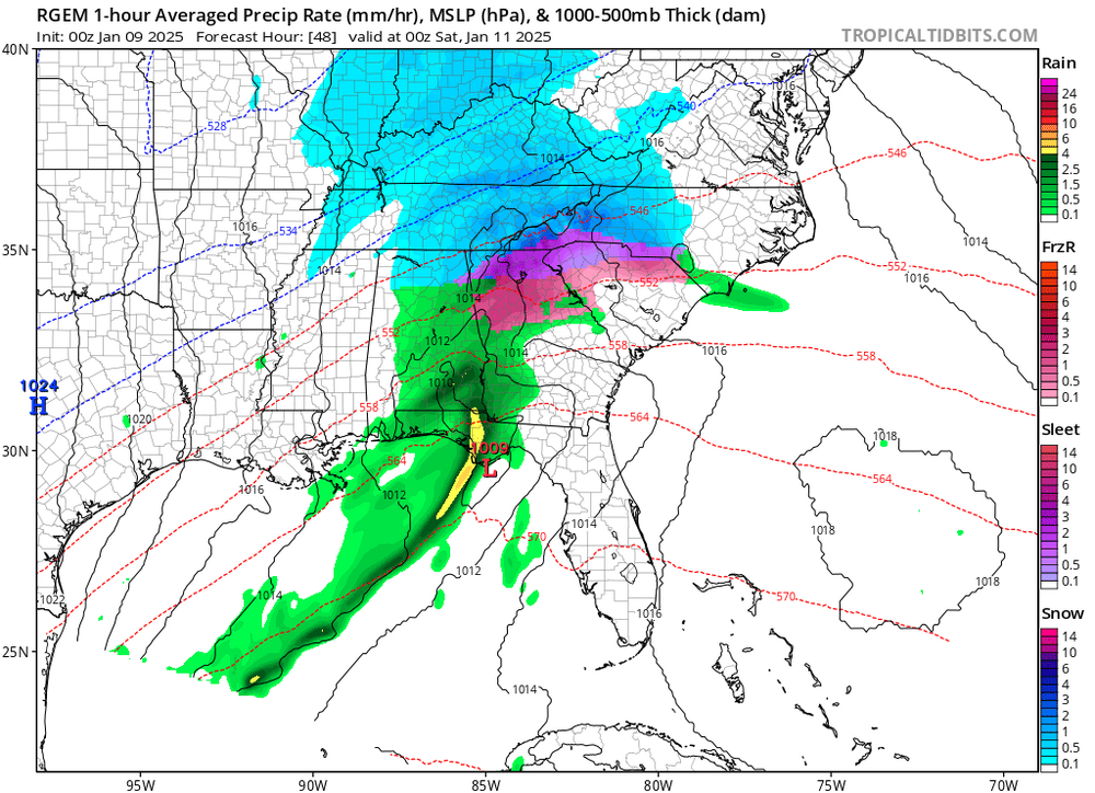
In Clarksville. Dime to nickel sized flakes and a lot of em. I’d say lighter side of moderate. Supposed to really ramp up in the afternoon hours. Maybe 1/2 inch but it farted around for a couple hours out there. Radar showed snow since like 3am but I’ll be damned if my eyes saw any until about 6.
29°, 91% humidity, 25° DP.
-
2
-
-
1 hour ago, Scottie16 said:

Another drop in temp.
.Interesting to me how evenly the temperature rises and how chaotic the decrease is.
Also,
Temp: 29°
DP: 18°
Clarksville, TN
-
1
-
-
6 minutes ago, 8283 El Nino Baby said:
Snow totals or these maps?
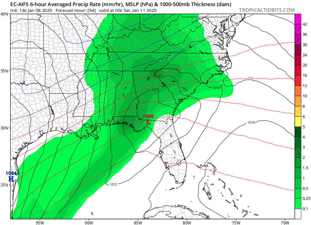
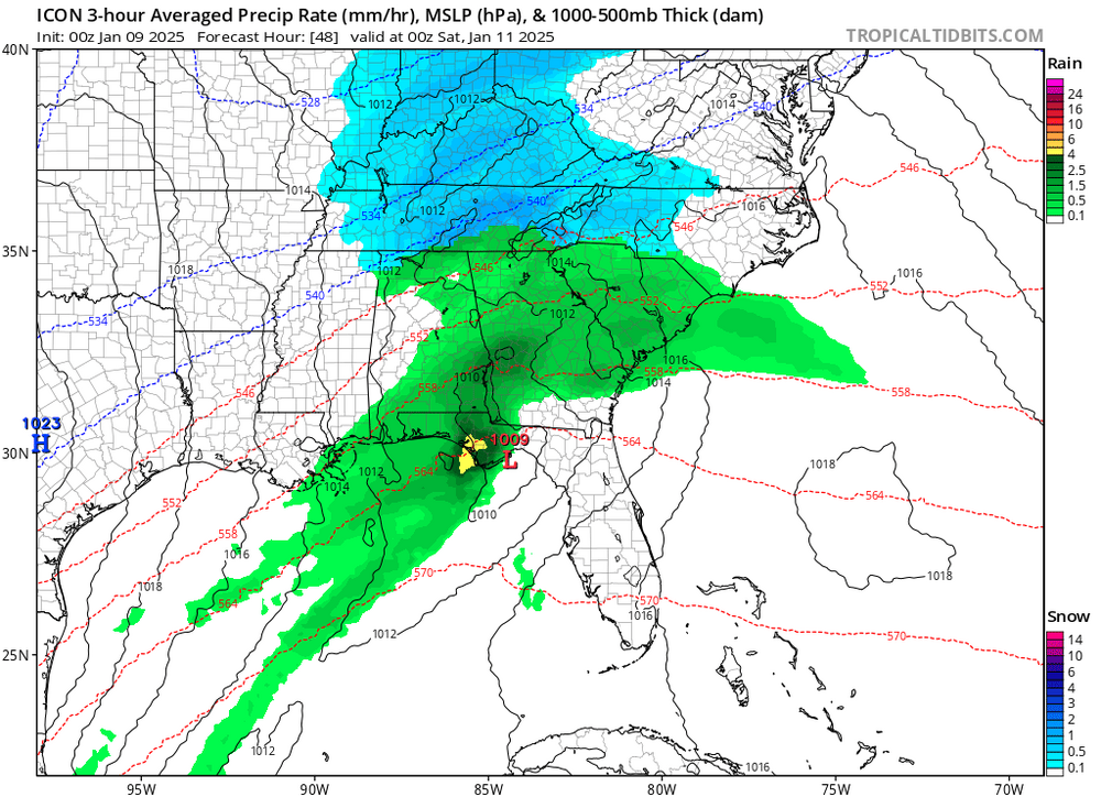
Totals would be amazing but this was nice too
")
-
1
-
-
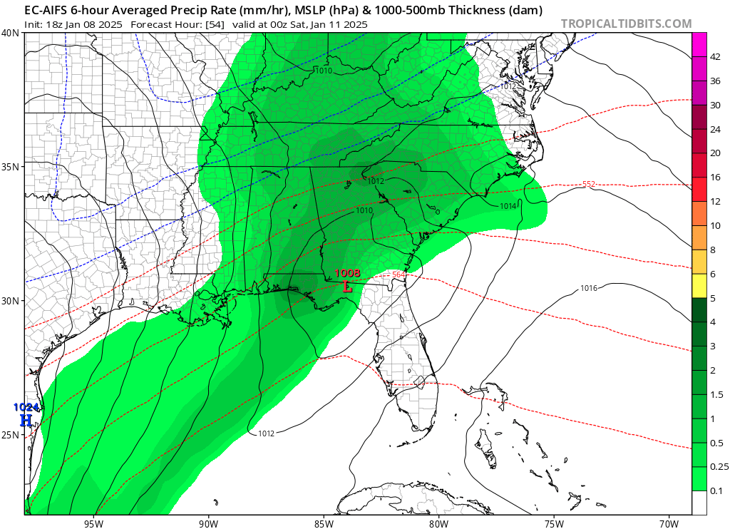
Any chance anyone can post the RGEM, ICON and if you’re feeling nice the AI Euro for me? I’m at work and unable to go digging through and only have time to scroll to see a few pictures. If not no worries! Thank you in advance if anyone is able to as I won’t be able to thank for a moment.
-
Here in Clarksville TN (almost Kentucky) - we had sleet and freezing rain on and off from about midnight through 5am. I fell asleep and between 5am to 9am it flipped over to pretty solidly rain, rain, rain. Every once in awhile it feels as though something a little more solid drops out the clouds but we are sitting at 34° at my house - though the small airport town the road says 37°. Ice is close to our north, maybe 30 miles away. Supposed to flip to snow at some point overnight. The high is ~supposed~ to make it to 46° today but it’s 2:30 and 34° so I just don’t see how that’s possible.
The kids are hoping for a snow day tomorrow, but I’m not sure if that happens.
-
2
-
 2
2
-
-
On 10/11/2024 at 12:05 PM, Hotair said:
US Mets face death threats after hurricane Milton, Helene misinformation
people are nuts and to think we share this world with them.
Not to mention FEMA is having to pull out of places in NC bc an armed militia is actively hunting them.
-
 1
1
-
-
-
-
Question for anyone who feels like responding -
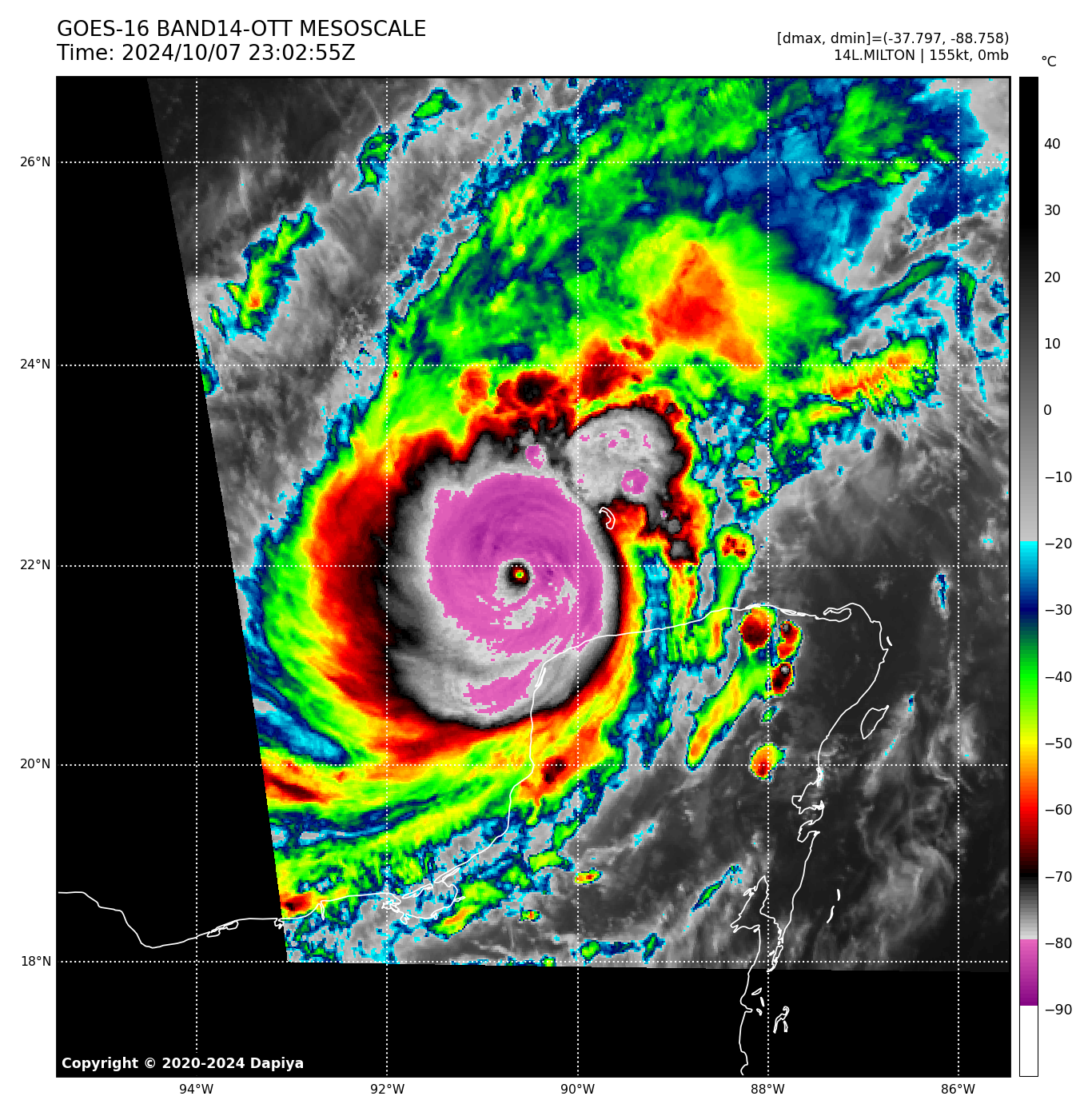
I guess I’m used to ERC from larger eyes, or ERC’s that are more disruptive instead of the meld that happened overnight - but I suppose I was expecting more wind expansion than we see.
Would you pontificate that’s more bc of the pinhole to not-pinhole-but-still-really-tiny eye, or bc of the meld, that the explanation was relatively “small” compared to what we’ve seen in the past.
Or is this more I am just not fully understanding the dynamics at play here? Or is this bc the storm was already so compact that a near double feels small? Mixture of these things?
-
1
-
-
Extreme times, extreme measures or something like that.
-
1
-
-
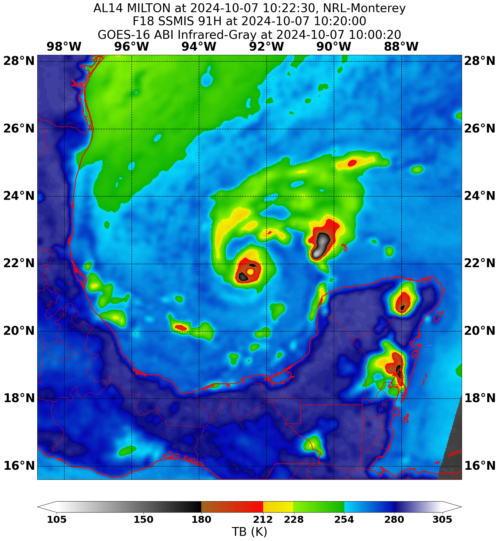
I have to believe the little oscillations I’m seeing in some of these loops is the precursor to an ERC.
Edit to add: who knows at this point. I honestly thought the radar out of Mexico earlier showed the beginning of the band that would start it but that solid inner eye has really held on. I just remember Rita? Or Wilma? One of them. Started oscillating around before the ERC.
-
2
-
-
-
2 minutes ago, ma blizzard said:
Very impressive how the eye has continued to warm the past hour on Sat .. Expecting another big drop in pressure on the next pass (15-20 mins ish)
IR showing positive temps.
-
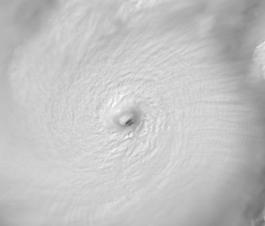
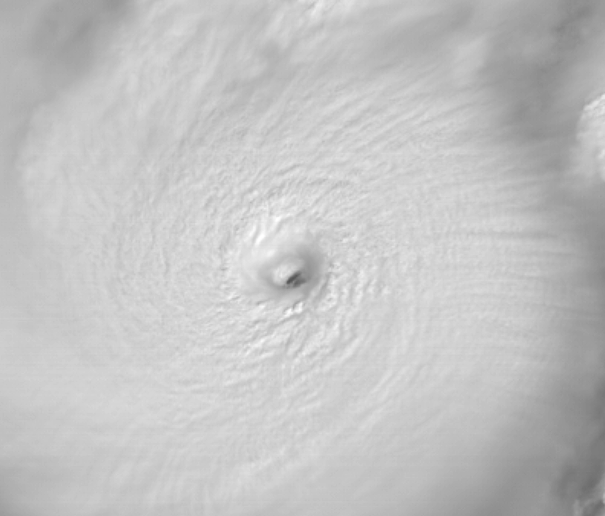
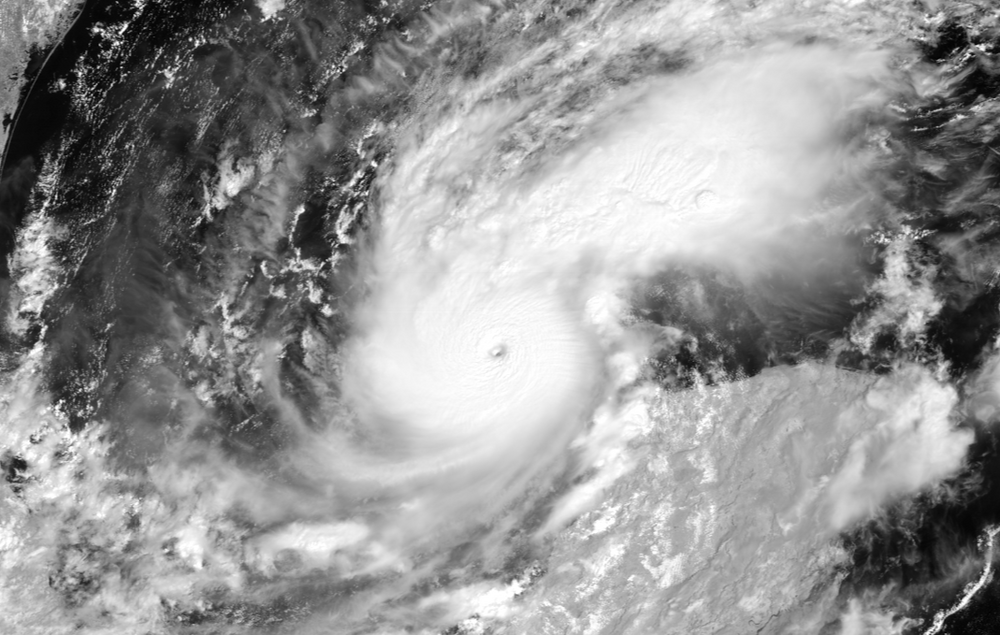 Can’t get over this. Inflow and outflow unreal. Pinhole eye, seeming stadium effect in it. It’s just humbling as hell that this was a teeny weeny baby storm yesterday morning.
-
5
-
-
 unreal.
-
4
-
1
-
-
It’s honestly bewildering and humbling to watch.
Watching the eye still rapidly warming even after that pass is…I don’t even have words.
-
924 extrap. 158 flight level. Lord bless it.
-
1
-
-
2 minutes ago, user13 said:
wow eye clearing
1 minute ago, Amped said:The organization is still improving on IR.
Just in time for that SW/NE pass.
-
1
-
-
28 minutes ago, Windspeed said:
Radar out of Sabancuy, Mexico. At that distance, the beam height is high, but Milton's eyewall is very defined and intense.

This radar shows the likely future new eye wall forming as well.
-
3
-
-
Dvorak having an incredibly difficult time keeping up, but raw T is at 7.1.
-
1
-
-
-
Please open tweet for his full thread of thoughts.


1-10-11-25 Western Whopper, Mid-state Masher, Foothills Finger? OBS/Pics
in Tennessee Valley
Posted
Awww! The pup!!
also, how north of Nashville? I’m in that area-ish too! Clarksville.