

WeatherMonger
-
Posts
715 -
Joined
Content Type
Profiles
Blogs
Forums
American Weather
Media Demo
Store
Gallery
Posts posted by WeatherMonger
-
-
1 hour ago, WeatherMonger said:
59 degree temp drop in 14 hours. High of 80 yesterday and currently sitting at 21.
Make that 61 degrees, dropped to 19 at the 7am update
-
 1
1
-
-
59 degree temp drop in 14 hours. High of 80 yesterday and currently sitting at 21.
-
4
-
-
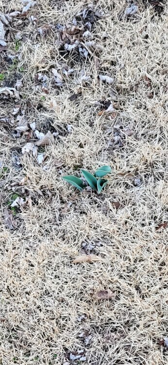
Feb 27th and tulips are emerging
-
4
-
-
1 hour ago, Chinook said:
anybody here see hail like this?
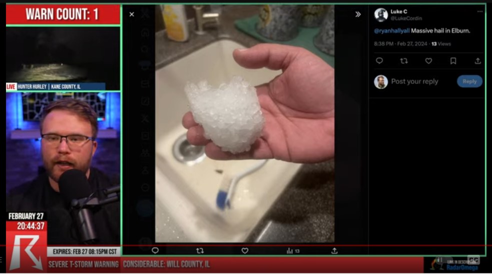
Looks like soft ice for fountain drinks that has been hand compressed.
Curl the fingers back and the curvature at the top of the "stone" matches the padding at the base of the thumb. Very similar to packing a snowball, then opening your hand before smoothing it out.
Should have shattered when it hit the ground, very soft looking "ice".....
-
16 degree temp drop last hour.
Forecast is for a 58 degree drop from todays high by morning.
-
Atkinson warned storm now has confirmed tornado
-
80/47 all time record high for February set. DP continues to plummet
-
Currently 78/54. Have tied the all time February high set back in 1930. Dewpoint has dropped 6 degrees the past few hours
-
Set for a 59 degree temp change if the forecast plays out. 80 degree high today with an overnight low of 21 tonight.
-
Quote
RECORD EVENT REPORT
NATIONAL WEATHER SERVICE LINCOLN IL
433 PM CST MON FEB 26 2024
...RECORD HIGH TEMPERATURE 76 SET AT SPRINGFIELD IL TODAY...
A RECORD HIGH TEMPERATURE OF 76 DEGREES WAS SET AT SPRINGFIELD IL AT
219 PM TODAY. THIS BREAKS THE OLD RECORD OF 74 DEGREES SET IN 1996.
THE NORMAL HIGH TEMPERATURE TODAY IS 45 DEGREES.
-
Have already surpassed the original forecast high of 75. Currently 76 and new forecast high of 78, crazy being Feb 26th.
-
1
-
 1
1
-
-
40 minutes ago, weatherbo said:
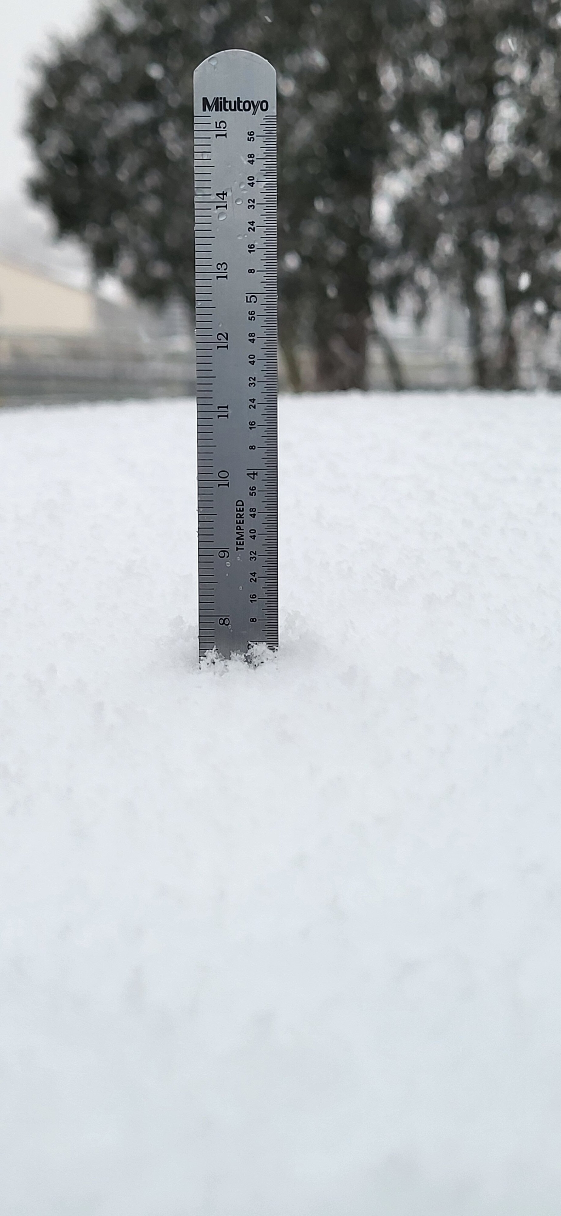
Your measuring stick reads 7". Did you have snow on the roof of your truck prior?
That's 70mm on that side. Inch on the other, 6"scale
-
1
-
-
Got right at 3" on the roof of my truck. No wind

-
 3
3
-
-
Started snowing here about 6:30am, been a steady accumulating rate since. AFD ssid it would start around 9am and clear the CWA by 6pm. Not sure if the early start meams an early end or not, if not would likely over achieve the 3-5 call. Have to be approaching 2 1/2 - 3" now if I had to guess. See if I can get a measurement in a bit.
-
Effing obese rodent will probably say 6 more weeks of winter tomorrow
If ever a sniper was needed.... Or at least a redneck with a healthy appetite....
-
Overperformed here. Went to bed with light snow about 10pm, forecast called for an inch or less. Woke up to about 3", maybe a tad more but the wind was blowing it around already.
-
3
-
-
Top 5 snow happening tonight, not saying much.....
-
 1
1
-
-
Aside from them getting the date wrong, about the most exciting thing to happen this winter here.
RECORD EVENT REPORT
NATIONAL WEATHER SERVICE LINCOLN IL
0215 AM CST MON JAN 16 2024
...RECORD COLD HIGH TEMPERATURE SET AT SPRINGFIELD IL...
A RECORD COLD HIGH TEMPERATURE OF -3 WAS SET AT SPRINGFIELD IL
YESTERDAY. THIS BREAKS THE OLD RECORD OF 5 SET IN 1888. -
Sleeting here at the moment
-
4 minutes ago, Radtechwxman said:
I'm sure that will be me here soon. I don't buy the hrrr output
You're on the edge of the possibilities


-
 1
1
-
-
12 minutes ago, Radtechwxman said:
I hope more precip blossoms south of this initial waa band like hrrr suggests. Otherwise not going to get much at all.
Thunderous dud here, early March feel to it.
-
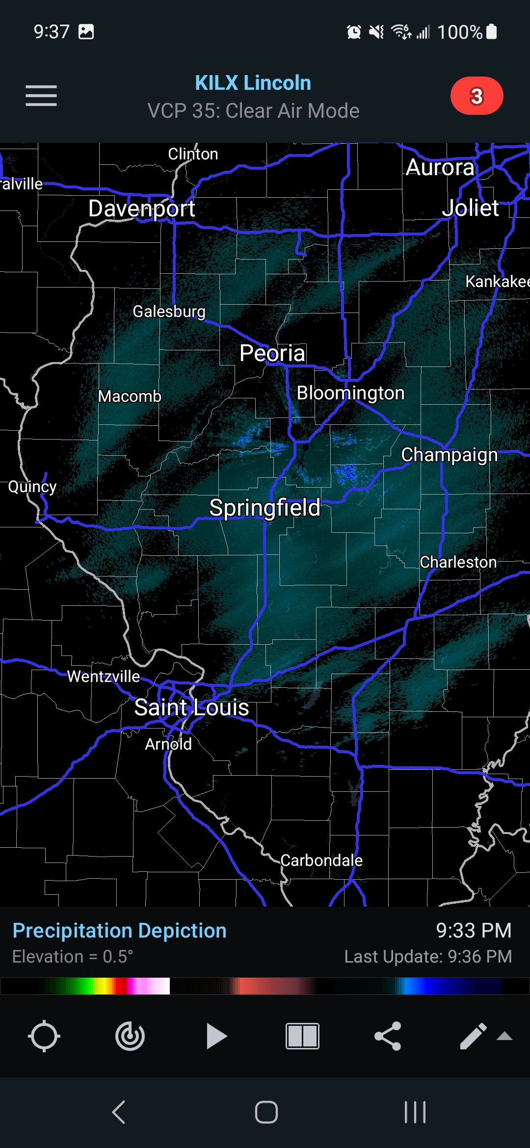
Getting steady rumbles of thunder here.....
Depressing for mid January
-
2
-
-
31 minutes ago, Radtechwxman said:
Of course a massive bubble of lower totals right where I'm at
")
I-74 is becoming the new I-72 of old as far as cut off line goes, be it severe weather or winter.
Should have seen this coming after the June 30 derecho, one event per year below the cut off line....
-
1
-
-
9 minutes ago, Radtechwxman said:
Gfs is remarkably consistent compared to the other models
I'm ready for another "Morch", give me dandelions in early to mid March. Over winter already
Overnight Thursday temps will rise to near 40, then below zero 3 days later with bare ground.
-
2
-


February 2024 General Discussion
in Lakes/Ohio Valley
Posted
Springfield,IL had it's 3rd warmest February on record. The 80 degrees reached Tuesday the 27th was both the warmest February high temp aend the warmest meteorlogical winter day on record.
The .51" precip for the month tied for the 6th driest February.