
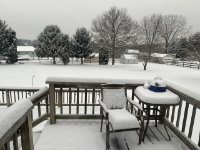
Deck Pic
-
Posts
26,928 -
Joined
-
Last visited
Content Type
Profiles
Blogs
Forums
American Weather
Media Demo
Store
Gallery
Everything posted by Deck Pic
-

The Weekend Rule? Saturday 2/17 - The Icon Storm
Deck Pic replied to DDweatherman's topic in Mid Atlantic
Lying to oneself, delusional thinking, and cognitive dissonance are often comorbid with the masochism that comes with being a mid-atlantic snow lover. -
The Weekend Rule? Saturday 2/17 - The Icon Storm
Deck Pic replied to DDweatherman's topic in Mid Atlantic
FINAL CALL 2-4" W of line from Leesburg to Westminster with 4-6" lollies 1-3" W of line Manassas to BWI T-2" ESE of that -
The Weekend Rule? Saturday 2/17 - The Icon Storm
Deck Pic replied to DDweatherman's topic in Mid Atlantic
we know where the meso bands will be (Parr's Ridge) No reason to wait. -
The Weekend Rule? Saturday 2/17 - The Icon Storm
Deck Pic replied to DDweatherman's topic in Mid Atlantic
Part of it is the duration. It's like a 5 hour storm. It would be nice to enhance QPF and duration -
The Weekend Rule? Saturday 2/17 - The Icon Storm
Deck Pic replied to DDweatherman's topic in Mid Atlantic
Euro is nice, just dry. 1-2" or so for most. The timing is still great midnight - 6 am -
The Weekend Rule? Saturday 2/17 - The Icon Storm
Deck Pic replied to DDweatherman's topic in Mid Atlantic
0z canadian is fine...just dry-ish -
The Weekend Rule? Saturday 2/17 - The Icon Storm
Deck Pic replied to DDweatherman's topic in Mid Atlantic
The timing on the GFS is perfect for max accumulation. Maybe a little wasted on the front. -
Looks like @DDweatherman already started it on the sly
-
Snow starts Friday PM. We're like 3.5 days away. If we wait until tomorrow, we'll barely have time for a 2nd thread.
- 2,529 replies
-
- 4
-

-

-
- weenie fest or weenie roast?
- weenies got roasted
- (and 2 more)
-
right...that's what this is going to blow up into...I'm manifesting it
- 2,529 replies
-
- 5
-
-
- weenie fest or weenie roast?
- weenies got roasted
- (and 2 more)
-
GFS has DC on southern edge again for PD3
- 2,529 replies
-
- 1
-
-
- weenie fest or weenie roast?
- weenies got roasted
- (and 2 more)
-
2024 Valentines Day Who the Hell Knows - Comeback Thread
Deck Pic replied to DDweatherman's topic in Mid Atlantic
I think this one was closer to a wash, but I can accept 3 for 3. We will continue the practice as needed. -
2024 Valentines Day Who the Hell Knows - Comeback Thread
Deck Pic replied to DDweatherman's topic in Mid Atlantic
we don't live in Jacksonville or New Orleans. Seeing non-accumulating sloppy wet flakes in the sky at 34 on February 13th is not a win -
2024 Valentines Day Who the Hell Knows - Comeback Thread
Deck Pic replied to DDweatherman's topic in Mid Atlantic
34, mostly snow. no stickage -
2024 Valentines Day Who the Hell Knows - Comeback Thread
Deck Pic replied to DDweatherman's topic in Mid Atlantic
36, Rain/Snow mix -
2024 Valentines Day Who the Hell Knows - Comeback Thread
Deck Pic replied to DDweatherman's topic in Mid Atlantic
42/41, Rain -
2024 Valentines Day Who the Hell Knows - Comeback Thread
Deck Pic replied to DDweatherman's topic in Mid Atlantic
I just want measurable. My records are dotted with 0.5", 0.75", 1". Some are storms like this. a T or 0.25" would be a bummer. -
2024 Valentines Day Who the Hell Knows - Comeback Thread
Deck Pic replied to DDweatherman's topic in Mid Atlantic
They ran the 0z 1.33k over us You can see the potential problem on the periphery. It really looks like 60-90 min of snow for DC that might accumulate an inch -
2024 Valentines Day Who the Hell Knows - Comeback Thread
Deck Pic replied to DDweatherman's topic in Mid Atlantic
only say things that are good for us -
2024 Valentines Day Who the Hell Knows - Comeback Thread
Deck Pic replied to DDweatherman's topic in Mid Atlantic
good point -
2024 Valentines Day Who the Hell Knows - Comeback Thread
Deck Pic replied to DDweatherman's topic in Mid Atlantic
0z RAP/HRRR has DCA falling to 34 during the snow. Huge bust potential here, but +SN at 33 would accumulate -
2024 Valentines Day Who the Hell Knows - Comeback Thread
Deck Pic replied to DDweatherman's topic in Mid Atlantic
really seems like 7-11-ish could be pretty sick for someone (probably far away from me) -
2024 Valentines Day Who the Hell Knows - Comeback Thread
Deck Pic replied to DDweatherman's topic in Mid Atlantic
My sister 20-25 miles NW of Philly is under a WWA for 3-5” but that’s kind of sudden. This storm is going to have some major busts in both directions. -
2024 Valentines Day Who the Hell Knows - Comeback Thread
Deck Pic replied to DDweatherman's topic in Mid Atlantic
This could still end up being something for people NW with a little elevation. +SN at 33-34 will stick. The period from say 6 am to 11 am could yield something. -
2024 Valentines Day Who the Hell Knows - Comeback Thread
Deck Pic replied to DDweatherman's topic in Mid Atlantic
hmmm
