

forkyfork
-
Posts
26,649 -
Joined
-
Last visited
Content Type
Profiles
Blogs
Forums
American Weather
Media Demo
Store
Gallery
Posts posted by forkyfork
-
-
i can't get over the difference between the no 1 and no 2 models at this timeframe
-
the legend of the swfe that trended south inside 48 hours
-
14 minutes ago, bluewave said:
Yeah, it helps. Seems like NYC has been too far west for the best rates and amounts throughout the season. Dec 09, Feb 13, Jan 15, Feb 17, Jan 18, Mar 18..,etc.
nyc would have gotten 12+ with a better airmass in place on march 7th
-
 1
1
-
 1
1
-
-
6 hours ago, bluewave said:
Yeah, wind gusts to 50 mph look likely with the potential for 60 mph or higher. This is our first 75 mb pressure gradient of 2019.
60 kts at the top of the mixed layer sunday night.

-
the hrrr keeps trending slightly colder at the surface
-
strong cad signal. wait until this is in the short range so the meso models can sort out the details

-
2
-
 1
1
-
-
orographic snow is cheating
-
1
-
 2
2
-
-
that's a nice high though. probably mostly frozen just inland
-
1
-
-
the eps has been showing a dream pattern since december. polar blocking with a pac jet undercutting the cold
-
3
-
2
-
-
my station's min this winter is 2 on 1/21. will be close tonight
-
-
what stormlover said
-
1
-
-
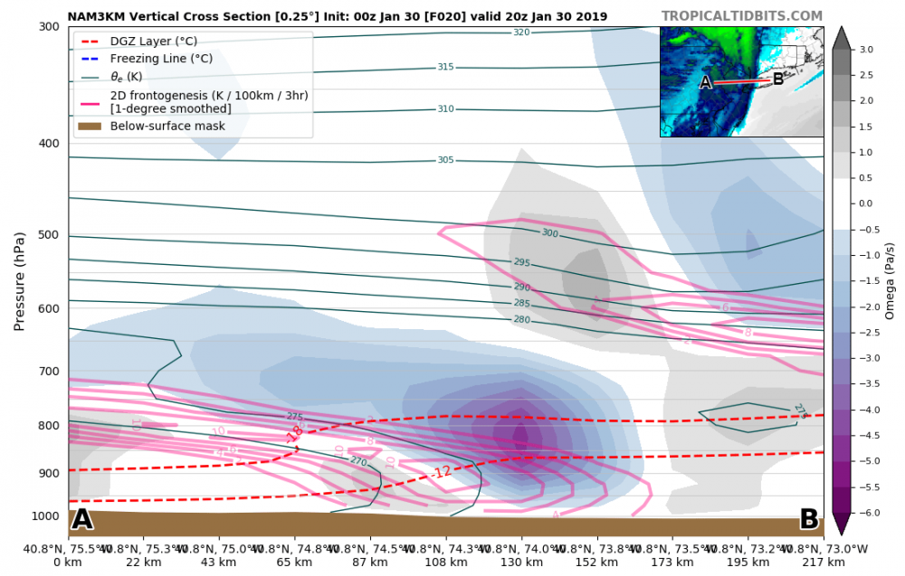
the nam shows the best lift from the snow squall intersecting the dgz
-
1
-
-
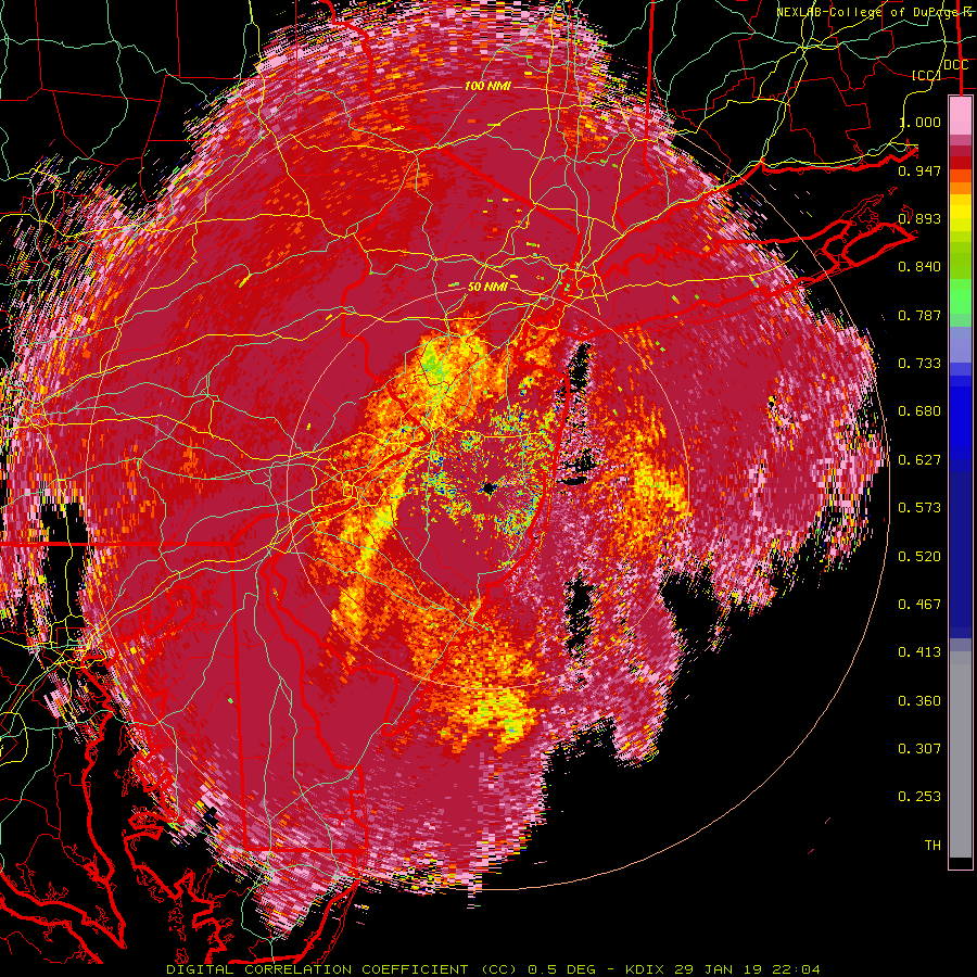
37 sad degrees and rain in springfield. the melting line is moving east on cc at least
-
1
-
-
tonight's forecast: 1/2 inch of salt
-
7
-
8
-
-
1 hour ago, purduewx80 said:
12Z NAM quicker w/ the cold air and has good forcing for a quick 1-3" tomorrow evening. Nice lift w/ that fronto band right in the DGZ. We'll see what other guidance shows. There should also be a brief squall with the true Arctic/Polar front midday Wednesday that could be good for an inch given good lapse rates through the DGZ and 500mb jet forcing.
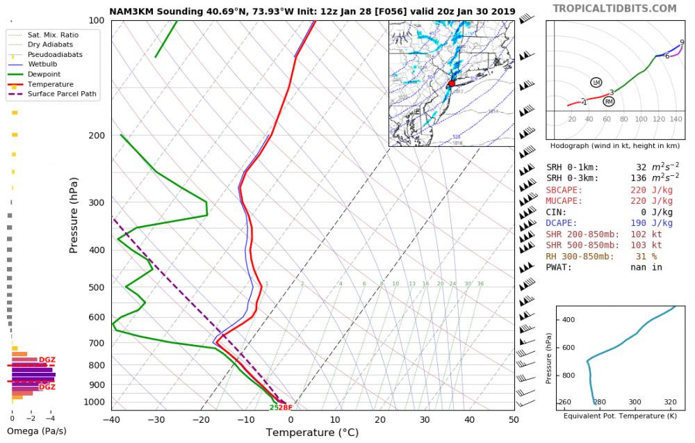
this is one of the most impressive snow squall soundings i've seen for this area
-
3
-
-
there's also march 05

-
since this is a gulf low the gfs is tossed until 12z the morning of the storm
-
2
-
4
-
-
the 0z eta run the night of friday 3/2/01
-
2
-
3
-
-
just a reminder that i can't stand crankyweatherguy
-
2
-
1
-
6
-
-
hope floats away
-
1
-
2
-
-
i have the gfs on ignore
-
2
-
-
why would trends suddenly stop at 84 hours? we have at least two days of watching to go
-
9
-
-
i can't make it


March, 2019
in New York City Metro
Posted
march is the new february