

forkyfork
-
Posts
30,335 -
Joined
-
Last visited
Content Type
Profiles
Blogs
Forums
American Weather
Media Demo
Store
Gallery
Posts posted by forkyfork
-
-
40 minutes ago, Stormlover74 said:
Lol of course
did labor day 1998 even happen
-
 2
2
-
-
does anyone have a link to any tide gauges in ocean county? i wonder if this caused a meteotsunami
-
on one hand i missed a derecho. on the other i missed a 5 day power outage
-
4
-
-
3 hours ago, Stormlover74 said:
Slight risk adjusted north

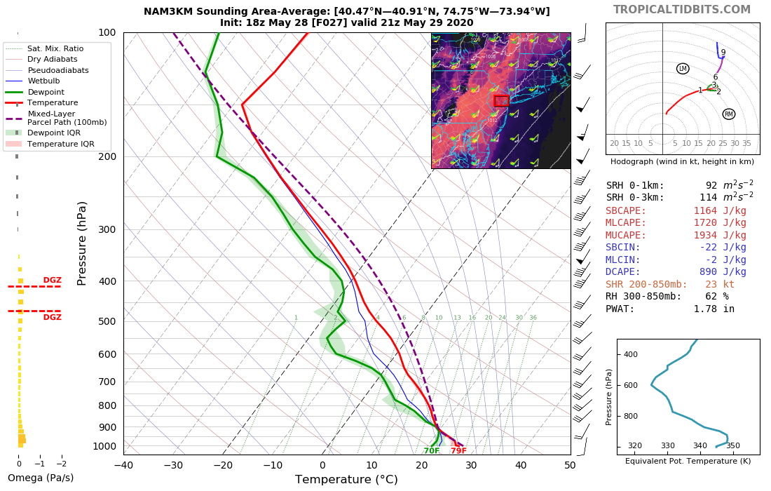
i'm pretty impressed by tomorrow's modeled soundings. legit EML with good shear. obviously the caveat is morning activity
-
wednesday looks pretty good for severe wx. nw flow with possible eml advection
-
3
-
-
26 minutes ago, Allsnow said:
Beautiful day! Can we do this all summer?
dry and boring. no thanks
-
1
-
 1
1
-
-
can't wait for the next 70 degree dewpoint
-
no 90 due to convection and now the line is falling apart. hooray
-
On 5/24/2020 at 8:07 AM, bluewave said:
These SST patterns can shift very quickly since they just respond to the surface and upper air patterns.
already making inroads with the cold pool
-
1
-
-
impressive ring of fire setup on the euro next week. we'll see if a trough ruins it

-
3
-
 1
1
-
-
87 in springfield
-
 1
1
-
-
i think we make a late run at 90 with these clouds starting to burn off
-
if organized storms can form along the prefrontal trough during the afternoon tomorrow evening will be interesting

-
2
-
-
dewpoint season starts friday.
") first 70 of the year
first 70 of the year
-
1
-
 1
1
-
-
On 5/25/2020 at 3:30 PM, Allsnow said:
@forkyfork good set up for rain this week on Friday and Saturday.

poof

-
3
-
-
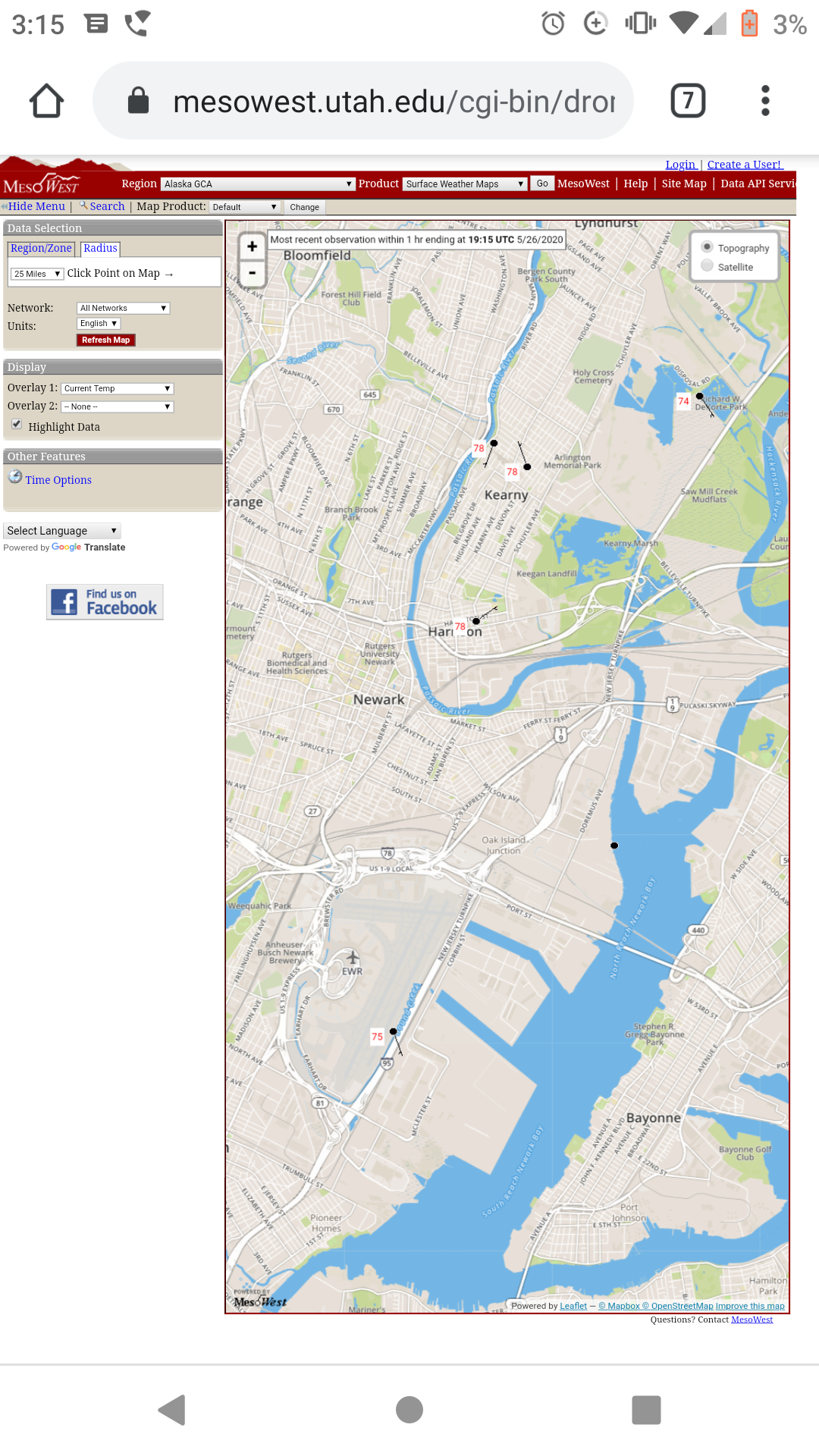
harrison/kearny are more representative of newark than the airport

-
maybe turf grass doesn't belong here and that's why it's so much work to keep it alive
-
even with the cooler pattern the models have under-mixed the low levels. i think friday can hit 90 if convective debris doesn't spoil it
-
2
-
1
-
-
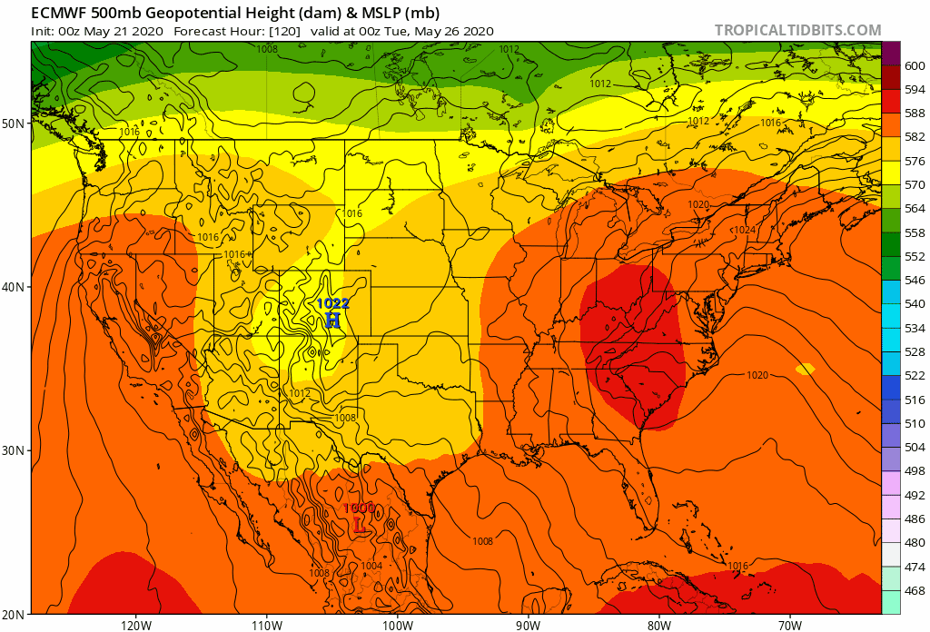
the cutoff finally delivers
-
1
-
1
-
-
.75" so far in springfield
-
it'll all be over soon

-
5
-
-
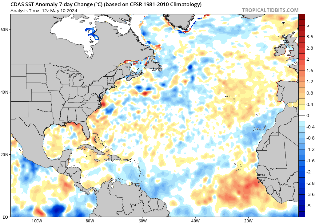
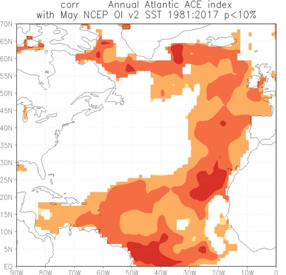
3 hours ago, bluewave said:
This cool pattern since early April really dropped the SST departures to our east. Unusual to see them colder than normal for a change.


that pattern is associated with active hurricane seasons
-
On 2/6/2020 at 5:11 AM, Weatherdude88 said:
Northern hemisphere snow cover is well below average this winter.

The snow water equivalent (the total volume) is significantly above the 1998-2011 average.

The higher latitude regions that have snow cover, have a lot of it.

As we approach the end of the 2019/2020 freezing season, we may have more ice and snow volume, in harder to melt areas at higher latitudes, than all years in the previous decade.
There has been significant focus on the lack of snow extent cover, at lower latitude and easier to melt regions, even though we have near record snow/ice volume in the more difficult to melt regions.
We may have an extended 2019/2020 freezing season. The 2020 northern hemisphere sea ice melting season may get off to a slow start.
oops
-
1
-
1
-
-
6 minutes ago, bluewave said:
Even with the record high dew points since 2016, the only wetter summer than average at Islip was 2018. The lower dew point summers from 2010 to 2014 were wetter. Go figure...
JJA average rainfall 11.68”
Time Series Summary for ISLIP-LI MACARTHUR AP, NY - Jun through Aug
Click column heading to sort ascending, click again to sort descending.YearTotal PrecipitationMissing Count2019 10.64 0 2018 12.94 0 2017 9.41 0 2016 5.25 0 2015 7.27 0 2014 18.82 0 2013 13.21 0 2012 18.54 0 2011 17.02 0 2010 7.67 0 maybe the WAR was too close for good rain?


June 2020 General Discussions & Observations Thread
in New York City Metro
Posted
ewr 88 so far