

BullCityWx
-
Posts
8,892 -
Joined
-
Last visited
Content Type
Profiles
Blogs
Forums
American Weather
Media Demo
Store
Gallery
Posts posted by BullCityWx
-
-
8 minutes ago, wncsnow said:
Think Wilkesdud is back..
some people cant take a hint.
-
 1
1
-
-
Nary a snowflake to be found on either the GFS(out to 16 days) or GEM(10 days).
-
7 hours ago, Red1976Red said:
I'm just happy the pattern looks active with potential. Whoever said Charlotte won't see 1" of snow by....may be eating their hat on this one.
It’s a rocking pattern for sure
-
1
-
-
Something maybe cooking in Texas at 186
-
HM just posted on Twitter that he’s doubtful of much of a thaw
-
3
-
-
6 minutes ago, WarmNose said:
Looks like GFS gave me some clipper love

Canadian has been showing something kinda similar in roughly that timeframe. If it digs that much, we could do okay.
-
2 minutes ago, Cold Rain said:
No way dude, don’t put that on the table. A good front end thump could lay that down no problem.
Given how the ensembles look, the general way winter is going and how the OPs look today, there's just no way.
-
I will delete my account if Charlotte gets an inch of snow before 2/1. It aint happening. Mark my words.
-
1
-
 1
1
-
-
2 minutes ago, Cold Rain said:
If I were 5000 ft tall, I guess my hair might be on fire in 15 days.

-
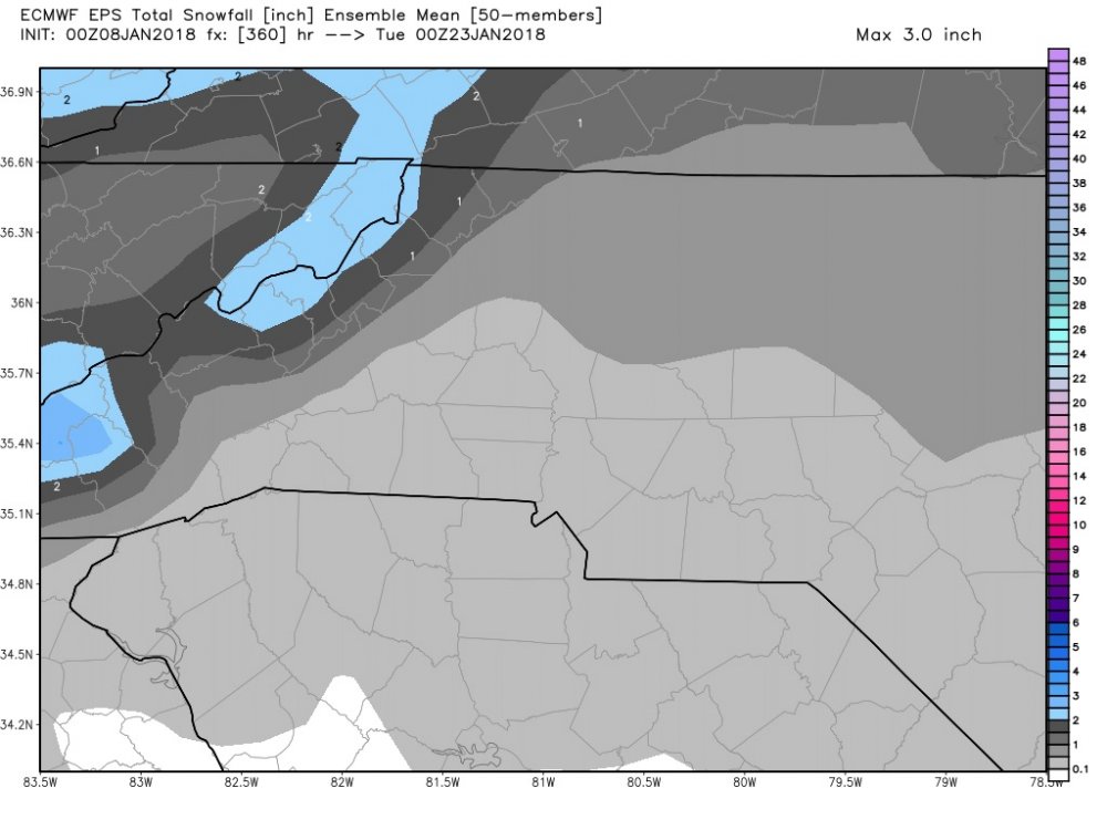
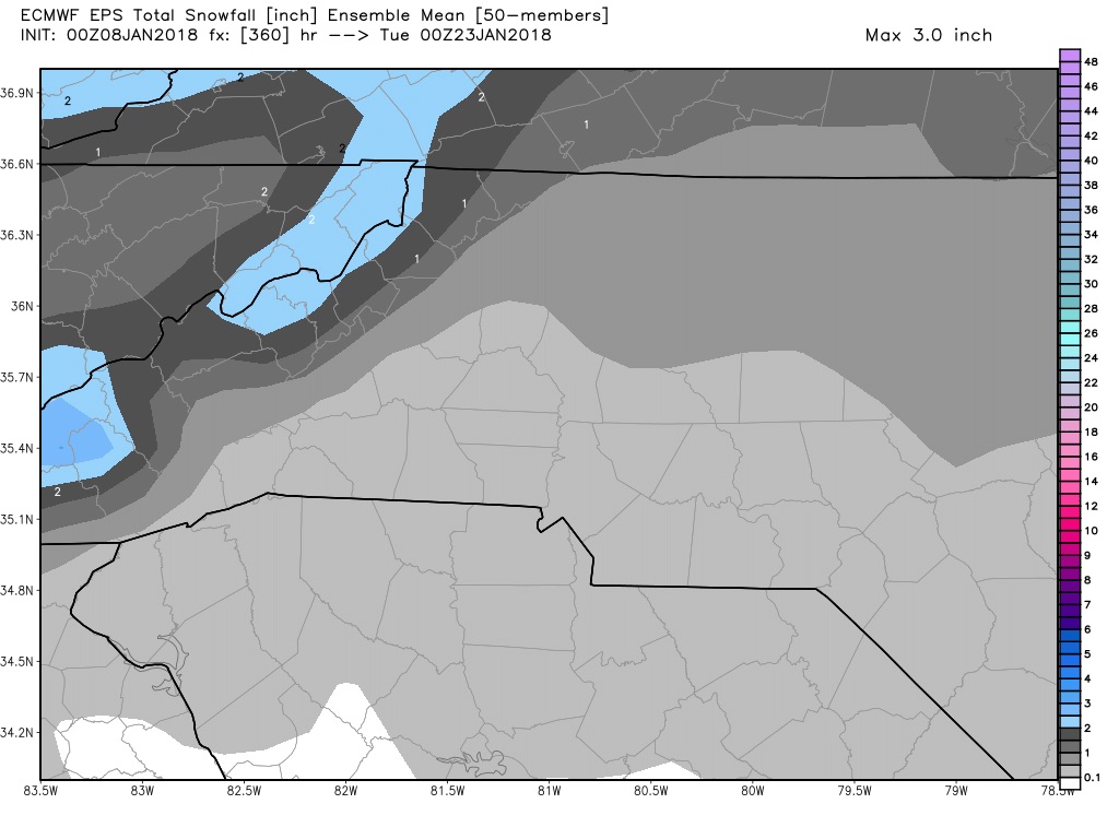
Also, there's a snow mean on the 12z euro ensemble of 0.1" for the next 15 days for much of the Piedmont in NC.
-
While that does look interesting at 144, there isnt a single member even close to bringing anything interesting. That is 0 for 51.
-
5 minutes ago, AfewUniversesBelowNormal said:
So this is 951mb... the strongest winterstorm on record since the 1800s. doesn't seem right. satellite, awesome. Outside, a completely different story. Quite obvious manipulation actually.
I kinda figured this was you, Wilkes.
-
1
-
-
My hope is that many of us have learned an important lesson with regard to crying bust before an event gets going.
-
13 minutes ago, mackerel_sky said:
Think the models are going to underestimate the temps. Not wishcasting, but solid snowpack down the east coast, and it would be stale, but true arctic air and probably really low DPs
We’re going to have it in place, I’m just worried about precip being way too light to bottom out.
-
Just now, Blue_Ridge_Escarpment said:
If I saw the ice accum map correctly, looked like .25-.50 of ice in CAD areas just east of blue ridge on 0Z Euro. That’s WSW criteria
Temps are warmer though, bordering 32, so that would mitigate accumulations. It would be one of those ZR events where the tree tops have a bit of a glisten but surface impacts would be negligible.
-
6z GFS was better but I wasnt impressed with the 0z euro at all.
-
3 minutes ago, Blue_Ridge_Escarpment said:
As cold as it’s been and is, .10-.20 would be no bueno.
Well no, it wouldn’t be good. It’s just not a major winter storm at this point is all. Looks like it develops a secondary in the piedmont.
-
1 minute ago, Blue_Ridge_Escarpment said:
CMC is still icy. GFS is too at the onset, just minimal qpf on the GFS
I’ll have to wait on the QPF but my guess is the CMC is also minimal. It didn’t look very impressive. Either way, it’s not the storm that’s been portrayed for the last 24-36 hours. Advisory level, at best.
-
Nope, gone on the 0z
-
Thinking both GEM and GFS are gonna be a no go for Monday.
edit: maybe just the GEM.
-
As usual, the people who cry bust for hours and hours and hours end up cleaning up.
-
3
-
-
It looks like we torch after our potential event next Monday. I'm becoming increasingly worried by the cold air being shown to abandon the entire continent in the LR. My biggest fear is it takes a month for us to get back to a favorable pattern and everybody knows your best events happen here before Valentines Day. We'll see but i'm afraid that CLT might get hung with yet another T.
-
1
-
-
This thing kicks off at the time and temperature the canadian thinks it will, the entire city is going to be a skating rink.
-
1
-
-
Just now, griteater said:
Jan to date plus 7 day GFS forecast

It's going to be really difficult to dig out of the hole we're going to create.
-
1
-
2018 Banter Thread
in Southeastern States
Posted
I give the Alabama gulf coast/Fl Panhandle at least a 25% chance in beating CLT with snow totals this winter.