

Big Jims Videos
-
Posts
2,872 -
Joined
-
Last visited
Content Type
Profiles
Blogs
Forums
American Weather
Media Demo
Store
Gallery
Posts posted by Big Jims Videos
-
-
Flipped to all snow grass becoming slushy here outside the Hunterdon county OEM office where we are doing live hits for the next hour or so. Elevation: 700ft.
-
 1
1
-
 1
1
-
-
I still see coastal Monmouth/northern ocean being extremely difficult to nail down until now time. 0-8 inches is a reasonable guess. What are the 12z models showing wind wise for coastal areas? I'm up in hunterdon now and we just flipped over to all snow as a side note.
-
5 minutes ago, Gravity Wave said:
2009-2010 had several storm that did that, December 18-19, February 5-6 and February 10-11 all had brutal northern cutoffs, although the cutoff line moved north each time.
Boxing day was the worst. Mom's house in Wall had 30 plus inches and my place had flurries.
-
I lived in Luzerne County during the early 2010s and remember many a storm giving NJ the snow and we smoked cirrus. Why would the gfs be right? What effect is the monster 950 low having on the high? I watched like 3/4 storms in a row blast southeast of Scranton/Wilkes Barre.
-
1 hour ago, MJO812 said:

How many times can LBI hit hurricane force gusts in a year? Coastal flooding at the 9 am high tide looks to be ugly.
-
1
-
-
We are having fun with this on Twitter at least. Splatter reports from Forked River to Freehold. Oh well.
-
 1
1
-
-
Snow is mixing in with the rain in Point Pleasant Beach right now.
-
1 hour ago, the ghost of leroy said:
shrimp people storm
Is this worse than swamp people storm?
-
Any mention of Sandy outside a tropical system making landfall somewhere between ocean city md and block island should necessitate an immediate 72 hour ban during storm mode. Please? One can hope?
-
2
-
-
2 minutes ago, forkyfork said:
all these twitter mets acting concerned. lol. root for a 160 mph landfall. nothing important is in the path
Does the one still have it as a 2 boarder line 3?
-
27 minutes ago, mappy said:
Couldn’t hack the math, shifted to cartography/gis instead. Still a weather nerd, even get to make weather related maps every so often.
Best of both worlds. I, too, couldn't deal with the math but still get to play outside in storms here and get paid, and once in awhile fill in (although it's been a few years)
-
1
-
-
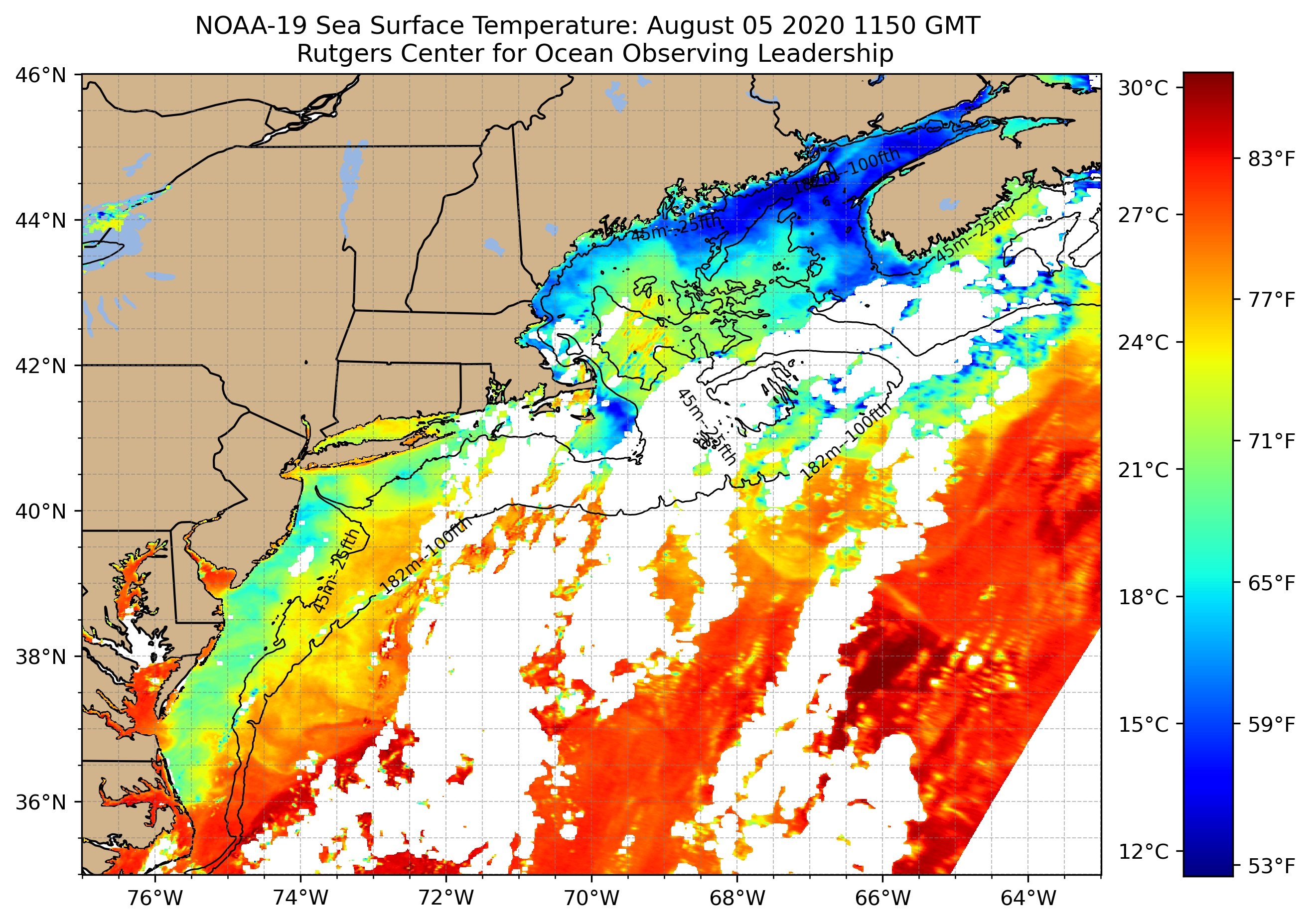
16 hours ago, purduewx80 said:
Isaias did a number on those previously-warm SSTs offshore:

Will be interesting to see how/if those recover in the next few weeks.
There was also a serious upwelling episode last weekend before the storm hit. Water went from 80-81 degrees into the 60s by Sunday night.
-
1
-
-
Amazing how many people came up to us between 6 and 9 am and said "fake storm".
Definitely the strongest sustained winds I've stood in with gusts in the mid 60s.
What stood out was the difference in temperature. Once the storm got going it was warm and humid then halfway through the temp dropped 10 degrees in a few minutes and when the winds shifted back to the west it rose again.
The freakiest thing and I mentioned this on air was the smell of trees and vegetation in the air. Since we were on the beach we didn't have a lot of vegetation around. But the winds out of the west brought the smell of trees all the way to the beaches, something I smelled only after Irene and Sandy and in tornado damage in Florida.
-
5
-
-
Winds gusting just under 20 mph at Manasquan inlet. That's up from calm when we first arrived at 5 am.
-
22 minutes ago, jm1220 said:
I wonder if this strengthening burst will be enough for hurricane warnings up further on the coast?
This doesn't deserve a weenie emoji. This is legit. I am concerned about wind damage at the Jersey Shore. We tried to talk up the potential for 70+ gusts today. Media has been all over this - but some folks I spoke with this morning for my reports didn't even know there was a storm coming.
-
2
-
-
4 hours ago, Sportybx said:
The worst part of this storm . Is going to be everyone who wasn’t prepared because no media coverage. Then tomorrow 2 hours before it hits everyone is running wild for supples
Are you kidding me no media coverage? We've been on this for days.
-
1 minute ago, NJwx85 said:
I was in Atlantic County after the 2010 derecho which we foolishly rode out in an RV. Was the scariest night of my life weather related. Complete war zone the next day.
A random 60 miles per hour wind gust is manageable. When you start getting in the 70s you have issues. I hope hope hope this is overdone but we will see.
-
1
-
-
From my eyes the storm looks about as good in satellite as it has in awhile yet. Those wind projections are eye opening for sure. especially considering last July when we had that thunderstorm Squall line move through the Jersey Shore with 75 mile an hour winds I think we had hundreds of thousands without power for at least a couple of days.
-
An 80 mph gust on LI and 70 on the Jersey Shore is a good possibility. I'll be covering this one from manasquan (as usual) and certainly emphasize the tornado threat.
-
That's Irene. This isn't an Irene.
-
1
-
-
Just got placed in a warning here in Wall for 80 mph wind gusts! - this is serious.
-
1
-
-
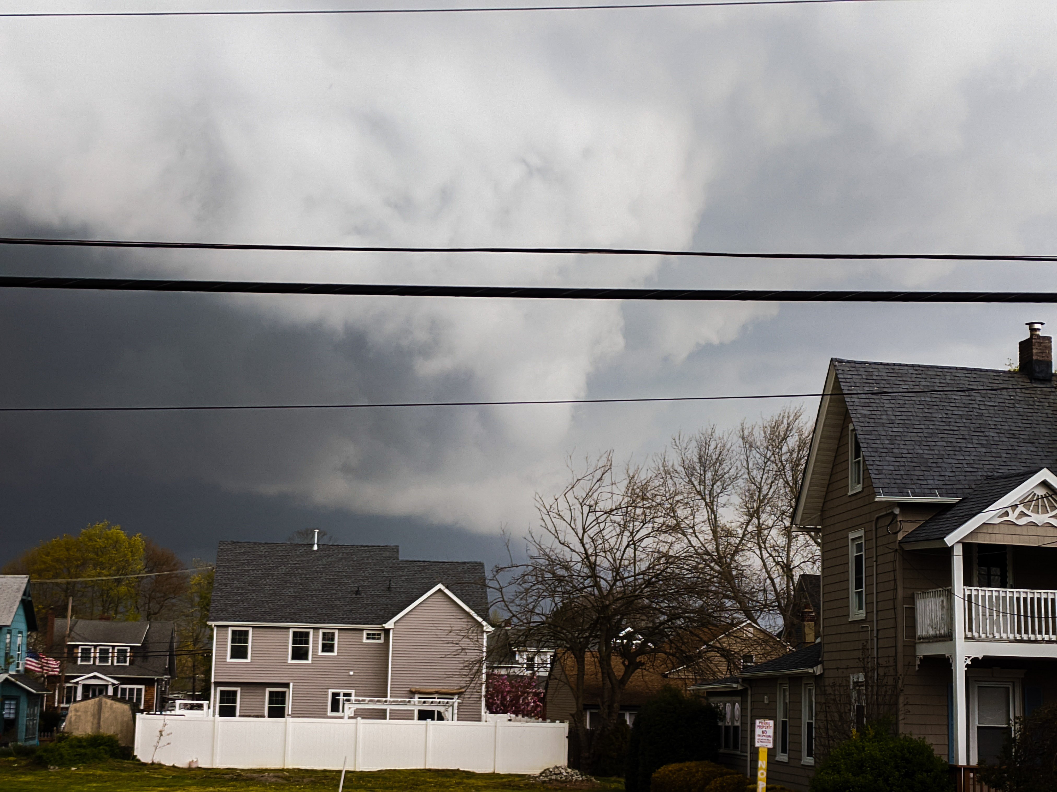
Fun storm. Great cloud formations from my front porch, but damage and trees all over just up the road.

-
5
-
-
12 minutes ago, KrazyKeyur said:
heavy flurries here..
Was out grilling some chicken and had wet snowflakes hitting me here in Point Pleasant Beach with a temp around 48.
-
We are about to changeover to sleet or freezing rain in the NW Philly burbs where I am now in Phoenixville. That line is rapidly advancing east. It's still about 25 degrees outside.

Major Nor'easter snow storm (possible top 20) Noon Wednesday-Noon Thursday Dec 16-17, 2020
in New York City Metro
Posted
Thank you. Allentown could have a foot. Belmar zilch.