

Big Jims Videos
-
Posts
2,870 -
Joined
-
Last visited
Content Type
Profiles
Blogs
Forums
American Weather
Media Demo
Store
Gallery
Posts posted by Big Jims Videos
-
-
Quite a bit of precipitation still to move through New Jersey where temperatures are cooling right now. Becoming a bit more concerned about areas in North Jersey. Luckily the cold air was slow to arrive or else it would have been a much different situation like they're seeing up in Ulster.
-
The trees in montvale began to get a slight glaze by the time I left about a half hour ago but really was expecting a little more up that way. Won't call it a non-event because I'm sure place is in Passaic and Sussex will have more but this is not the end of the world nothing to really get excited over for the majority of people
-
I am in Montvale waiting for any icing. So far nothing. Temp 33 and rain.
-
4 minutes ago, weatherpruf said:
A glazing is possible in the immediate suburbs at times and even this is hazardous; if it warms up then it's only a brief problem. But it can cause a lot of serious problems in the meantime.
It just happened a few weeks ago. 60 car pileups in Jersey, etc. That was a glaze at bad timing.
-
 2
2
-
-
Morning GFS is a big ole mess. If you like ice congrats.
-
Ac boardwalk 14 inches but some of that could be blowing. I did get 14 though with the yardstick in 3 areas.
-
2
-
-
Ac boardwalk 13 inches
-
1
-
-
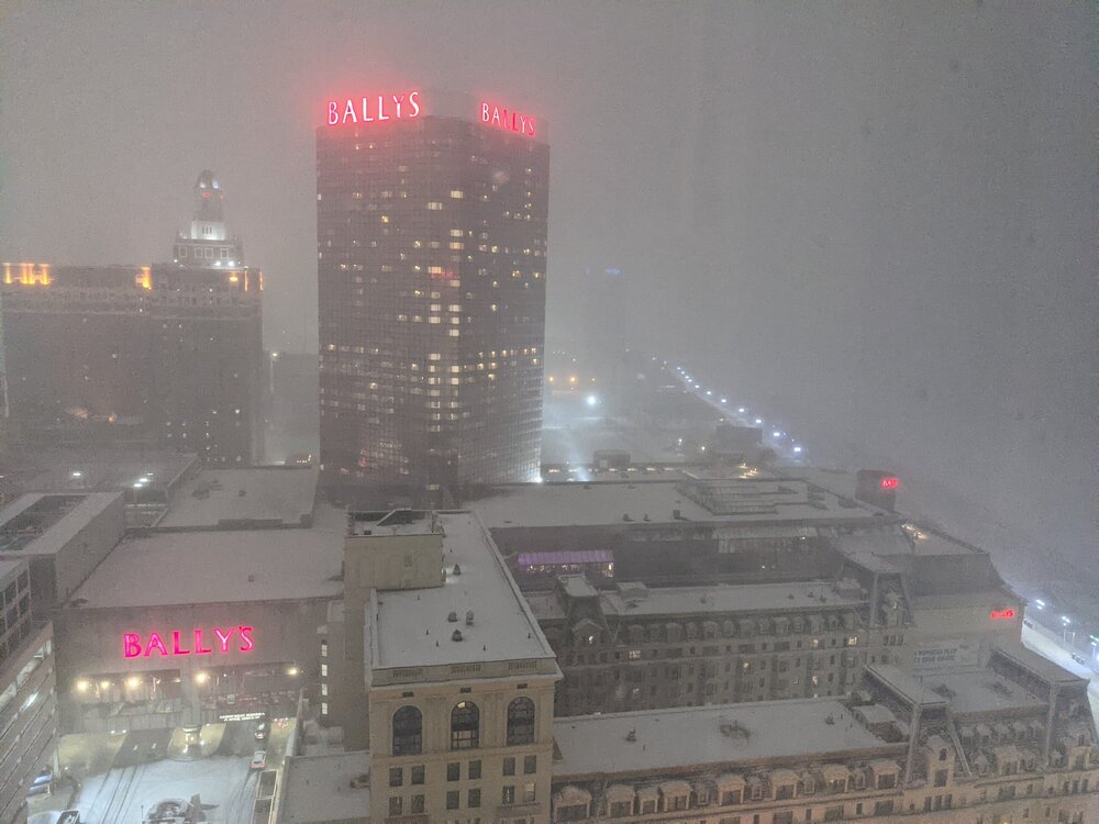
Getting crushed in Atlantic City. 1/4 mile visibility. Watching the snow streak past the window here on the 44th floor of Caesars. Hard Rock lights no longer visible.
-
6
-
-
In Atlantic City for this one, just popped outside the boardwalk at Boardwalk Hall nothing falling yet. Will be live from here all tomorrow morning. Hoping for a foot. Realistic expectations are lower but had to come to the new snow capital of NJ to see for myself.
-
1
-
 1
1
-
-
The Nam was worth waking up for. Amazing look. Everything shifts. 962 off Atlantic City south of Block Island. Good Lord.
-
5
-
-
I don't know if any model can nail this down until we start to follow radar trends. Someone can be in for a wicked heartache - both along the shore where we are expecting double digits and the northwest fringe zone where flurries or 3-4 inches could be a matter of 10 miles. I've been on sides of that equation. They hurt equally bad. The ceiling is still incredibly high for a bust in our favor as well - but when you're talking literally 30-50 mile difference we've all been burned in the past - 2015.
-
3
-
-
Here's to getting sucked back in like a bad Netflix sci-fi series.
We wait.
-
4
-
 2
2
-
-
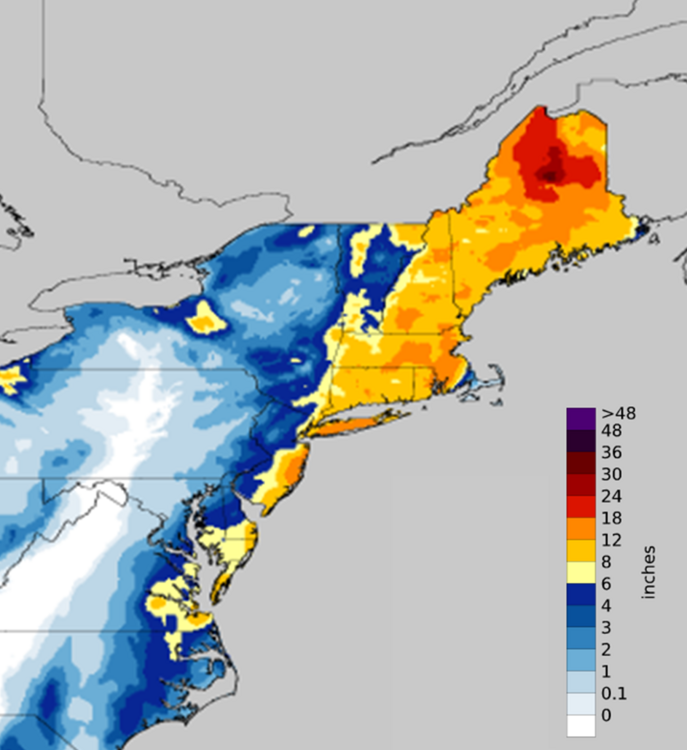
I'm getting January 2018 vibes from this. Certainly is a thread the needle look. Here are those sharp totals from what was an amazing event for the immediate coast
-
3
-
-
Decent Squall at the beach now here in point pleasant
-
3
-
-
Started as rain at the beach in Point Pleasant.
-
Luckily this is hauling a$$ - beaches will take a battering for 2/3 hours with those insane winds. Question is can we get 70+ along the immediate coast?
-
1
-
-
5.25 so far in Farmingdale Monmouth County got two inches since 5 am here.
-
2
-
-
Mt. Holly mentioning a narrow band dropping 2"/hr rates somewhere in CNJ/SNJ in an update this morning. Could be fun for a little bit tomorrow. For a narrow section of coast this could be our biggest storm in two years.
-
7
-
-
What a mess this morning. The alert went out at 3 pm yesterday which should have meant plenty of timing to get the roads pre-treated. I heard from so many folks today they didn't see any salt trucks out last night until the rain moved in.
-
I ended up with roughly an inch in Point Pleasant Beach. It was a bad bust by the nws for my area as they had us in 4-6 all day. The gradient got the sickest between toms river and manahawkin.
-
3
-
-
Mt Holly went with WSW all the way to Ocean County now.
-
3
-
-
Wonderful day to soak in an October tan, yesterday also was phenomenal but the biting flies were out in full force here.
-
Maximum Sustained Wind Overall (mph): 155
Maximum Sustained Wind at Landfall (mph): 140
Pressure at Landfall (mb): 940 mb
Landfall Location: Houma, LA
-
1
-
-
2 hours ago, SandySurvivor said:
In terms of impact this isn’t going to be nearly of severe impact of something like Sandy.
Im expecting impacts similar to Nate in 2017
Because shrimp people, right?


February 24/25 Potential Winter Storm
in New York City Metro
Posted
It's ugly on i-78 two flipped over tractor trailers watched the second one happen.