

Big Jims Videos
-
Posts
2,870 -
Joined
-
Last visited
Content Type
Profiles
Blogs
Forums
American Weather
Media Demo
Store
Gallery
Posts posted by Big Jims Videos
-
-
Walked to a phenomenal brunch on the lower east side today. Flurries. Second time I saw snow this "winter." GFS showing 5 cutters. Looking forward to my Florida and Caribbean adventures in February at this point.
-
 3
3
-
-
54 degrees in Clifton where I am now for work. This winter is trash.
-
1
-
-
Models performed well this past storm regards to wind. Top gust was a 51 I saw at Harvey Cedars. Lots of places in upper 40s along the beach. As long as there's not much easterly wind component to this system erosion hopefully won't be as bad as last Friday.
-
1
-
-
Point Pleasant just hit 82. Feels so amazing outside.
-
1
-
-
8 minutes ago, dseagull said:
Getting pummeled here in Barnegat. Coastal flooding is our biggest concern right now. Thank God this is occurring with half moon near tides. Much stronger and prolonged event than initially anticipated.
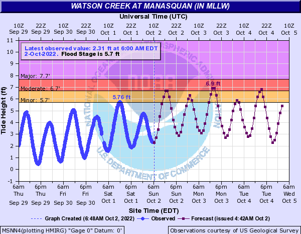
Yup. If it was a full moon add on another 8-10 inches of storm tide. That would have put many places into major. This is bad though. Beach erosion is significant here in Bay Head where I am covering this.
-
3
-
-
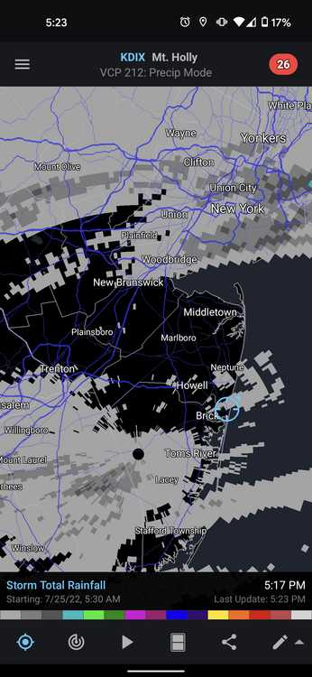
Parts of Forked River Ocean County showing up now on radar with 6 inches of rain totals.
-
Definitely drought busting rains for Monmouth and Ocean Counties. We are over 3 inches now for the event with a lot more to come onshore this morning.
-
1
-
-
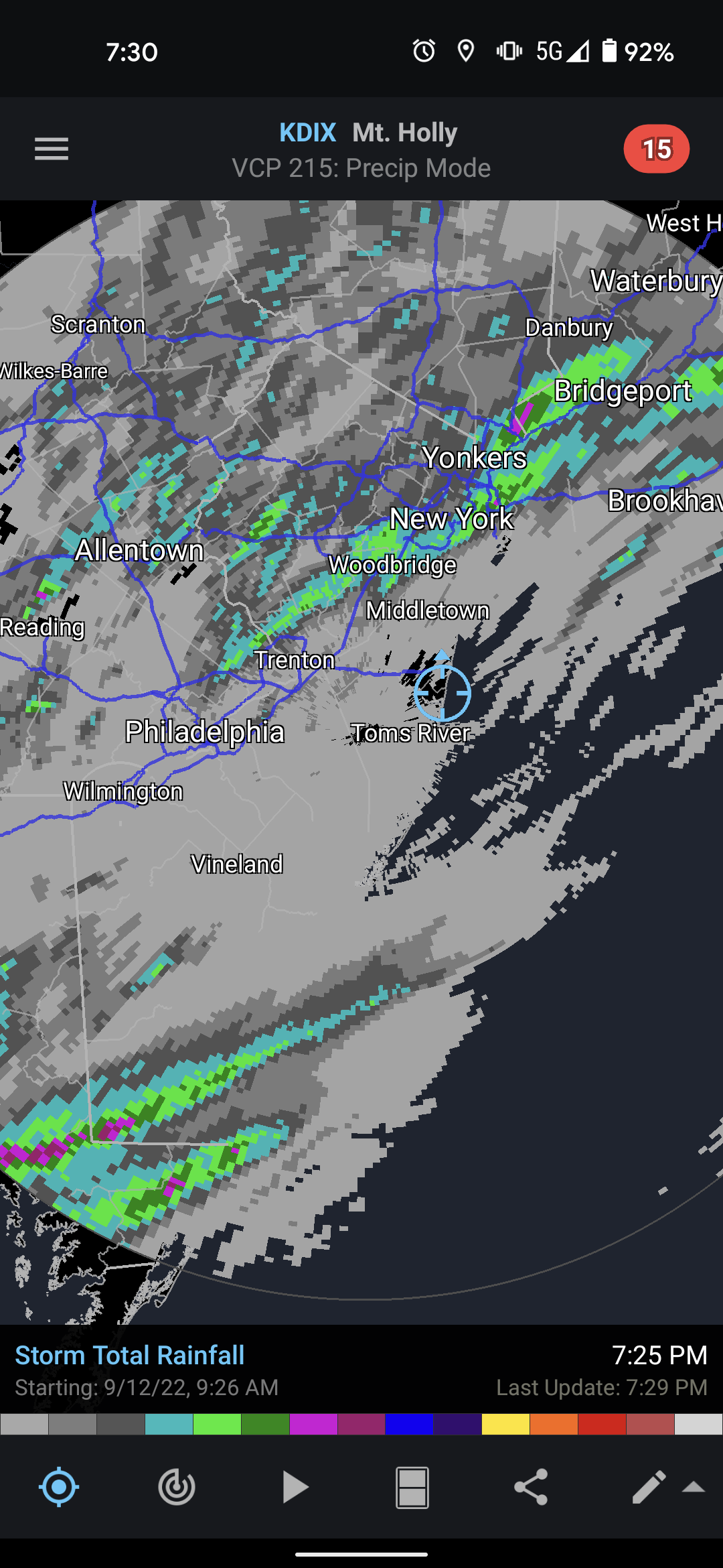
And now moderate coastal flooding likely
-
1
-
-
Gusting in the 40s this morning along Ocean County barrier islands.
-
1
-
-
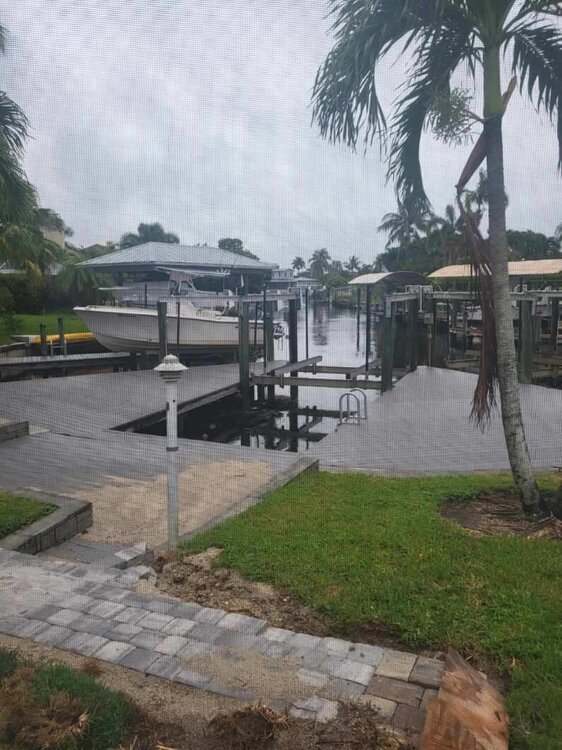
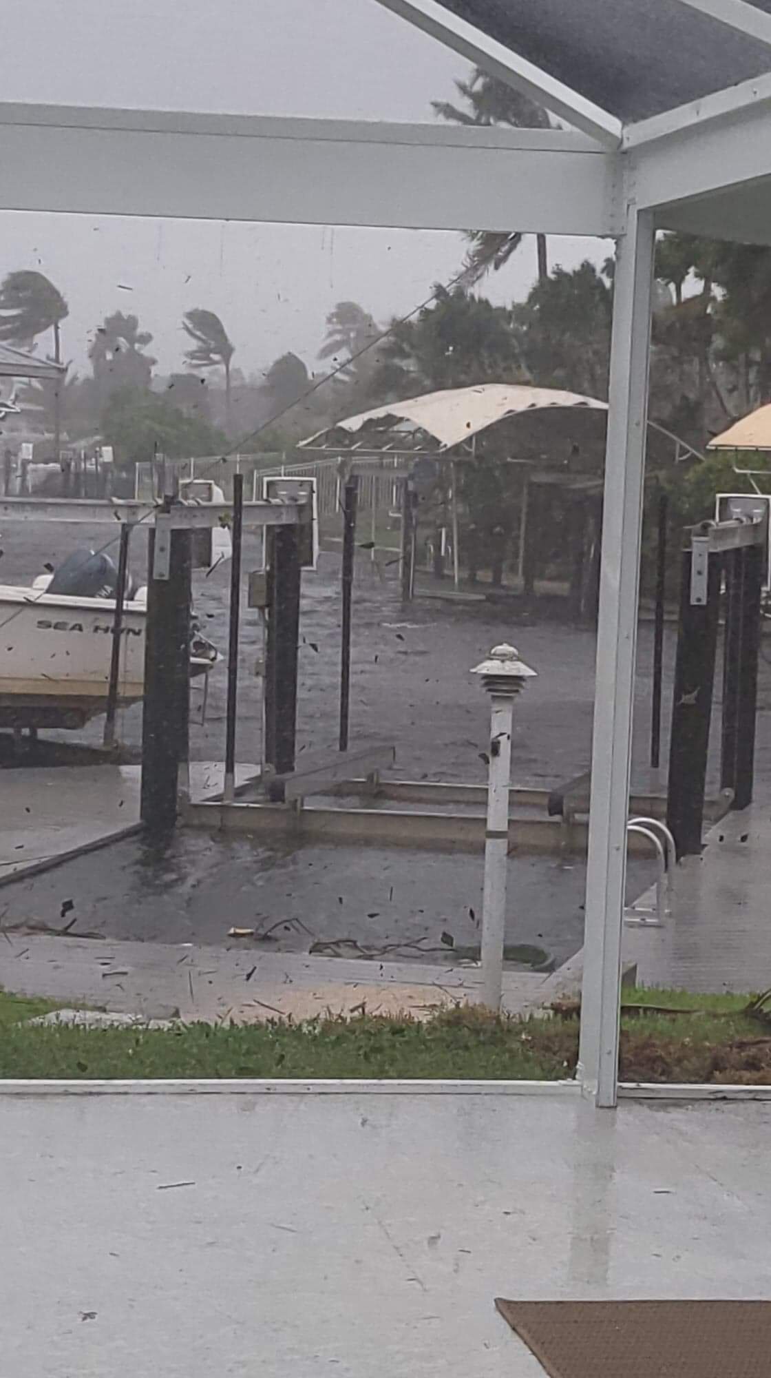
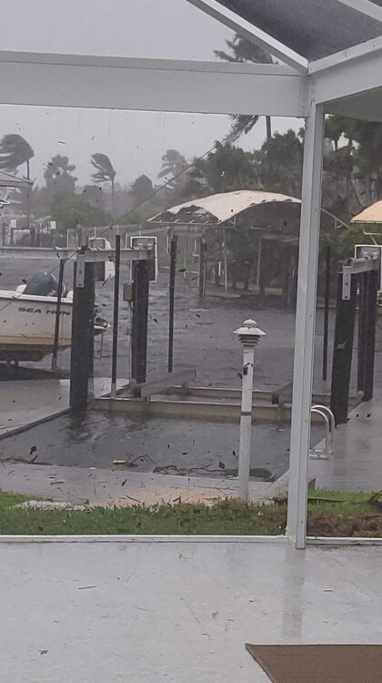 my cousin Denise did not evacuate McGregor Fort Myers, but she was able to send this still pic. Surge just starting to reach this area along the Caloosahatchee. She's still in the eyewall.
-
 1
1
-
-
Estero Island, 125 mph
-
My cousin is in the McGregor neighborhood of Fort Myers. I called and begged her to leave this morning. She said most of her neighbors are from the midwest and they all thought this was moving north and gonna dissipate. I hope that's just her clueless neighbors and not the general sentiment of this region. She's on a canal and says only one person moved their boat. I got her to go to a condo a mile more inland.
-
1
-
-
My friend is in Trinity and says no evacuation orders yet. Traffic is horrendous on a normal day there. This is concerning.
-
I'd call that a significant jump east on the GFS. Tampa evacuations should prepare like....tonight.
-
4
-
-
Lol
-
 1
1
-
-
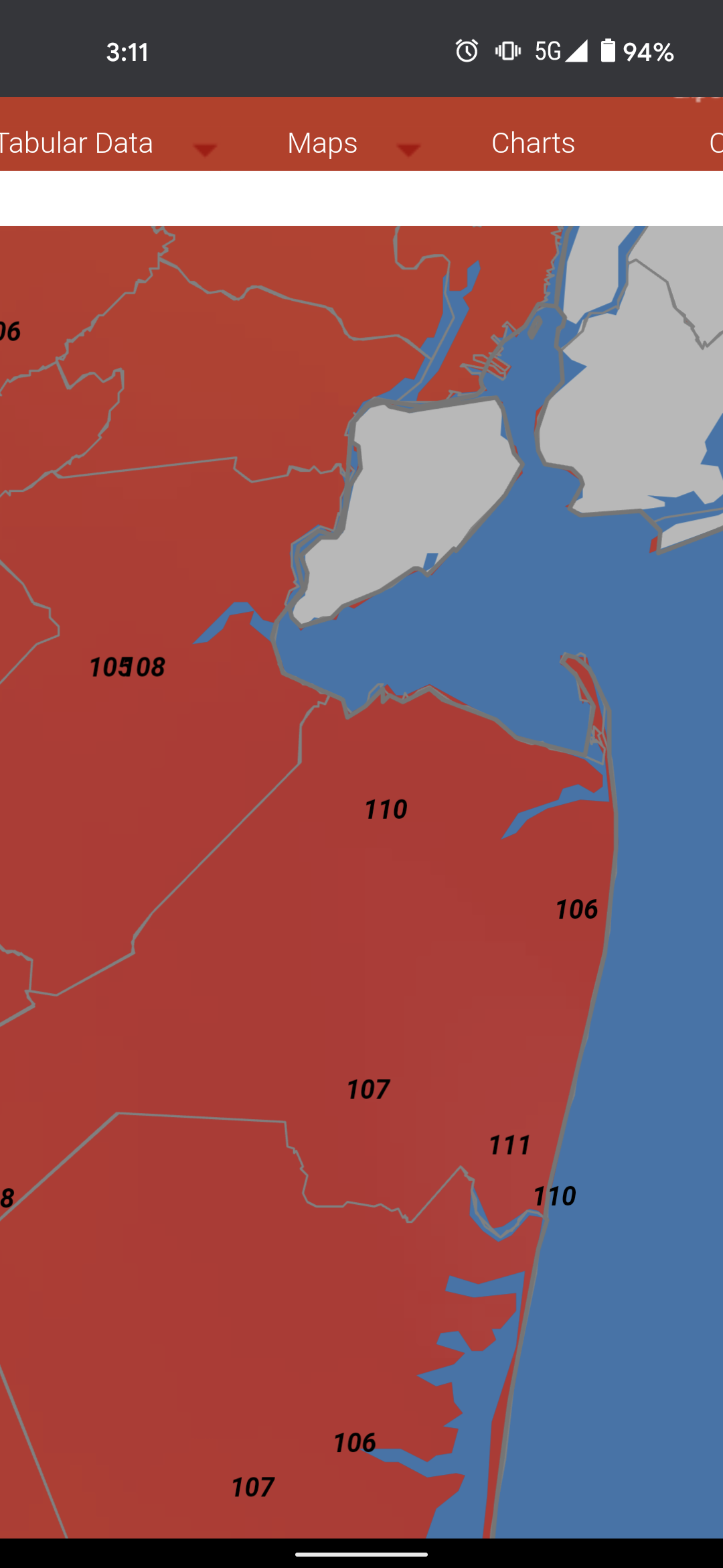
There are no heat advisories along the coast east of the Parkway. It's 99 with a heat index of 110 here.

-
I'm in Newark and it's the most uncomfortable day of the summer by far.
-
1
-
-
Lol the areas that needed the rain the worst got none
-
1
-
-
Driving around southern Monmouth northern Ocean it looks like the southern California hills minus elevation change.
I don't remember lawns and trees looking this dry in many many years.
Some short term models already show the storms missing central NJ tomorrow or splitting/falling apart as usual.
-
2
-
1
-
-
Mandatory water restrictions now in Monmouth and Ocean Counties for American Water customers. Voluntary restrictions in the 5 other central NJ counties.
-
Going as expected in Northern Ocean County


-
2
-
1
-
-
Got nothing this weekend, nothing this morning, and expecting nothing this evening. - northern Ocean County.
-
1
-
-
42 minutes ago, LongBeachSurfFreak said:
He’s actually correct for the Jersey shore assuming the flow was a little more SW. But you are correct for the island, strong south flow (Ambrose jet) events pile up the warm surface water. Nothing better then a late day body surf sesh in 6 foot wind chop with bathtub warm water!
Yeah your warm water was our 54 degree water over the holiday weekend.
-
Gonna be a big upwelling day along the beaches. Cold surf coming back? Dropped down into the 50s last time this happened.


February 2023
in New York City Metro
Posted
Thursday looks to have an insane temp gradient across pa/NJ more resembling an April day.