

Big Jims Videos
-
Posts
2,870 -
Joined
-
Last visited
Content Type
Profiles
Blogs
Forums
American Weather
Media Demo
Store
Gallery
Posts posted by Big Jims Videos
-
-
4 minutes ago, ForestHillWx said:
Stay safe. That river has tendency to flash. I think Bound Brook may have problems tomorrow; the Raritan watershed is filling up.
NWS MT HOLLY tweeted me said millstone expected to crest at 2 pm. That's a lot of time yet to rise unfortunately.
-
 1
1
-
 1
1
-
-
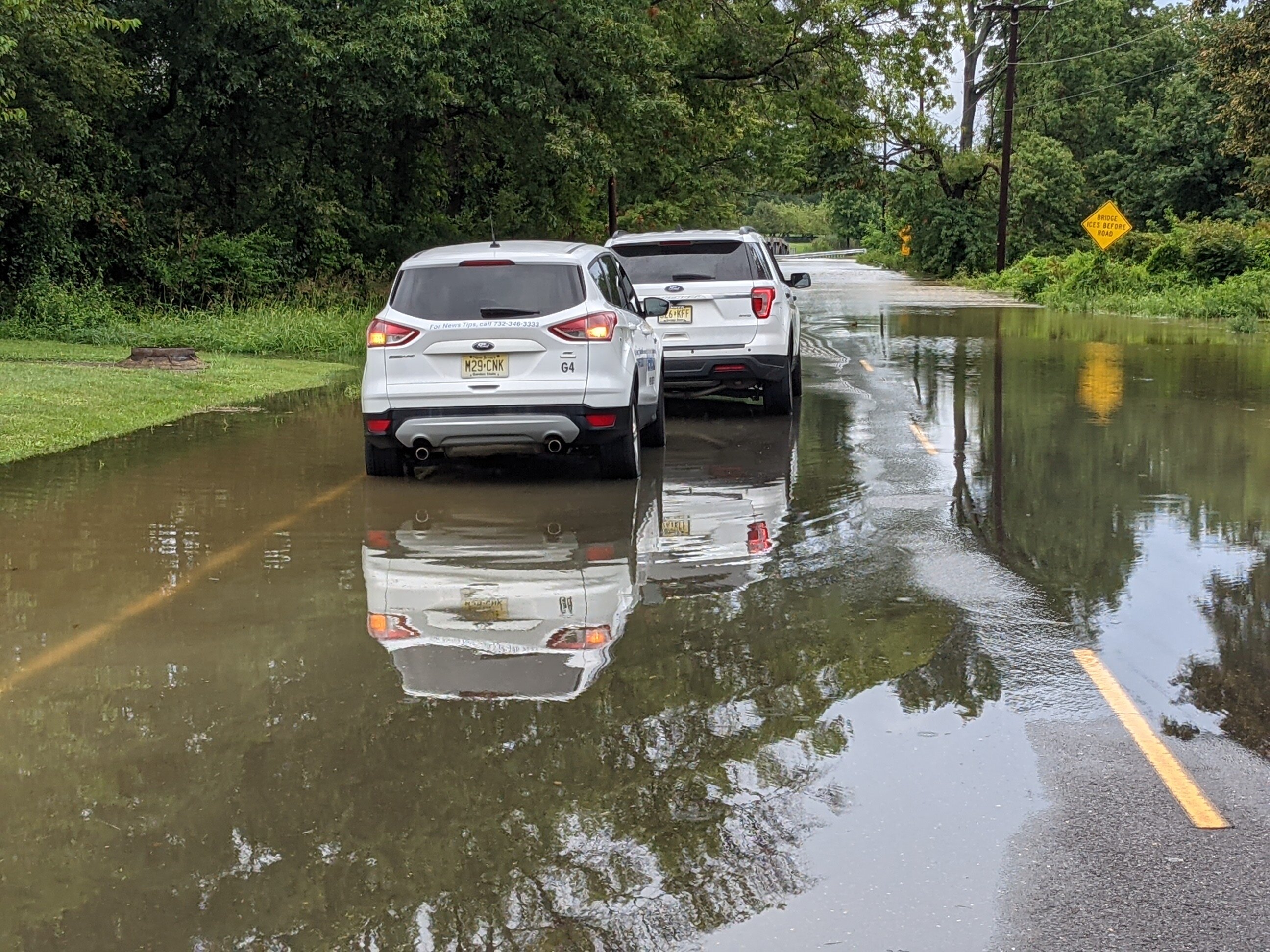
Millstone River in Mercer County
 West Windsor Twp Southfield Road - we parked here on dry ground and in 45 minutes had to move - continues to rise.
-
2
-
-
3 minutes ago, wdrag said:
Also, in addition to the D2 upgrade... 12z CMC coming up the coast with its weaker ELSA. Whether it does?
Have a day!
Nice job sniffing this threat out days ago
-
1
-
-
Such a disparity in forecasts for Friday/Saturday. From mid 80s to mid 60s depending on the outlet.
-
Damage in Neptune by Headliner. Roof blew off a motel. Windows knocked out of vehicles


-
3
-
-
Oz and 6z gfs worlds apart for next weekend and beyond 6z moves the low out in a hurry allowing for actual spring not horrible awful mist cold misery
-
1
-
 1
1
-
-
The 94 ice storm hit Monmouth County hard especially along the parkway near red bank . We had off school and it was the same day the San Fernando valley earthquake happened.
-
Mt. holly going a lot of rain for coast and drastically cut totals again for areas along/east of the GSP
-
1
-
-
34 minutes ago, crossbowftw3 said:
I know not many here would care about NASCAR but the original President’s Day blizzard did something very similar and many call it the reason it exists as it does now
You are exactly right. And what solidified that event were four words spoken by Ken squier on CBS. "and there's a fight". The coast is going to get slammed because I'm in Florida now for speed week happens every time I come down here
-
1
-
-
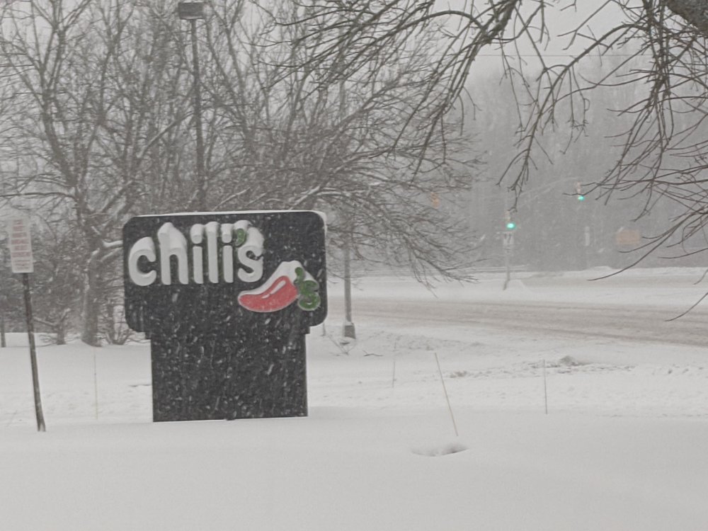
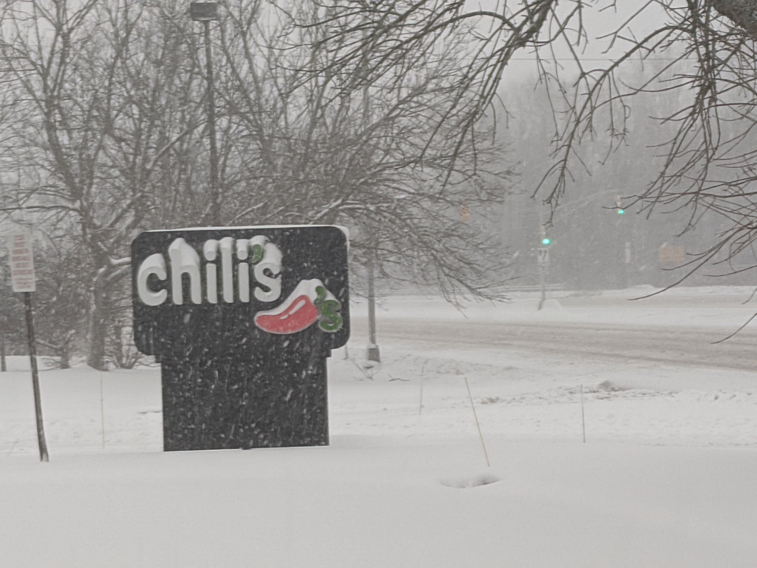
Getting crushed in Freehold. Between 7 and 8 inches with heavy snow continuing.
-
Plan on broadcasting from Freehold tomorrow through early afternoon, may adjust north west to englishtown/monroe if needed. Especially concerned About the 11 pm high tide by Manasquan to Sea Bright for moderate to potentially major flooding. Also somewhat concerned about dryslotting for some sections especially Philly areas. Radar trends will be key. Banding and subsidence will be prominent. Hope for the best. Prepare for the low end and be grateful for you in the high end totals.
-
Light snow aleady in Jim Thorpe Carbon County Pa. Gonna try and get back to the beach to beat this after a fun Saturday at Montage.
-
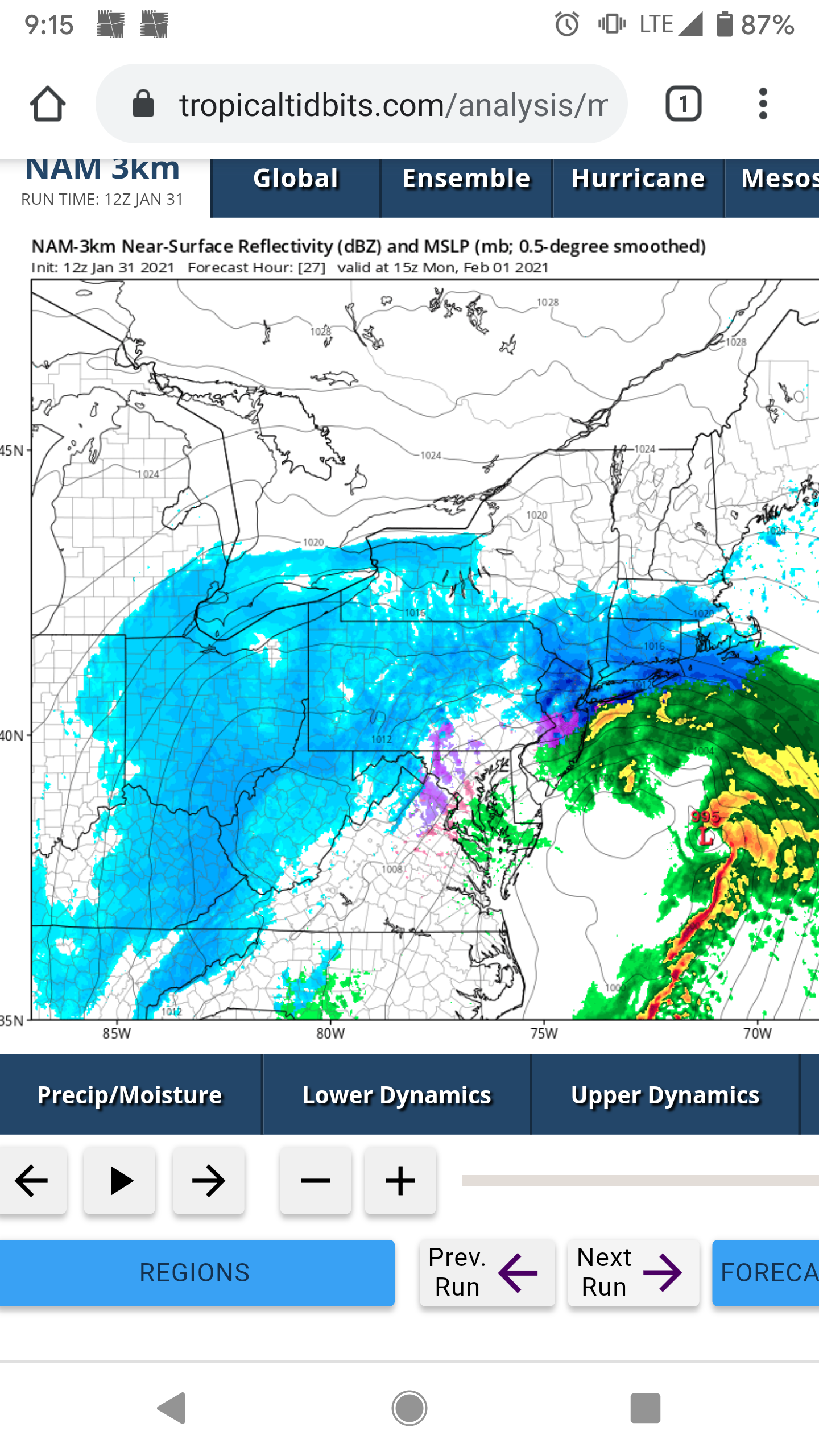
The new run of the nam is eye popping for Monmouth/Staten island around lunch time tomorrow. Incredible convection potential. If it stays all snow the rates look to be 2-4 inches an hour.

-
Englishtown to Princeton looks good in the morning euro.
-
Canadian is a mix of January 2018/boxing day for coastal sections. Yes please.
-
1
-
-
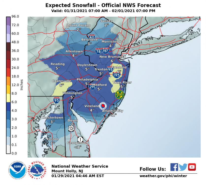
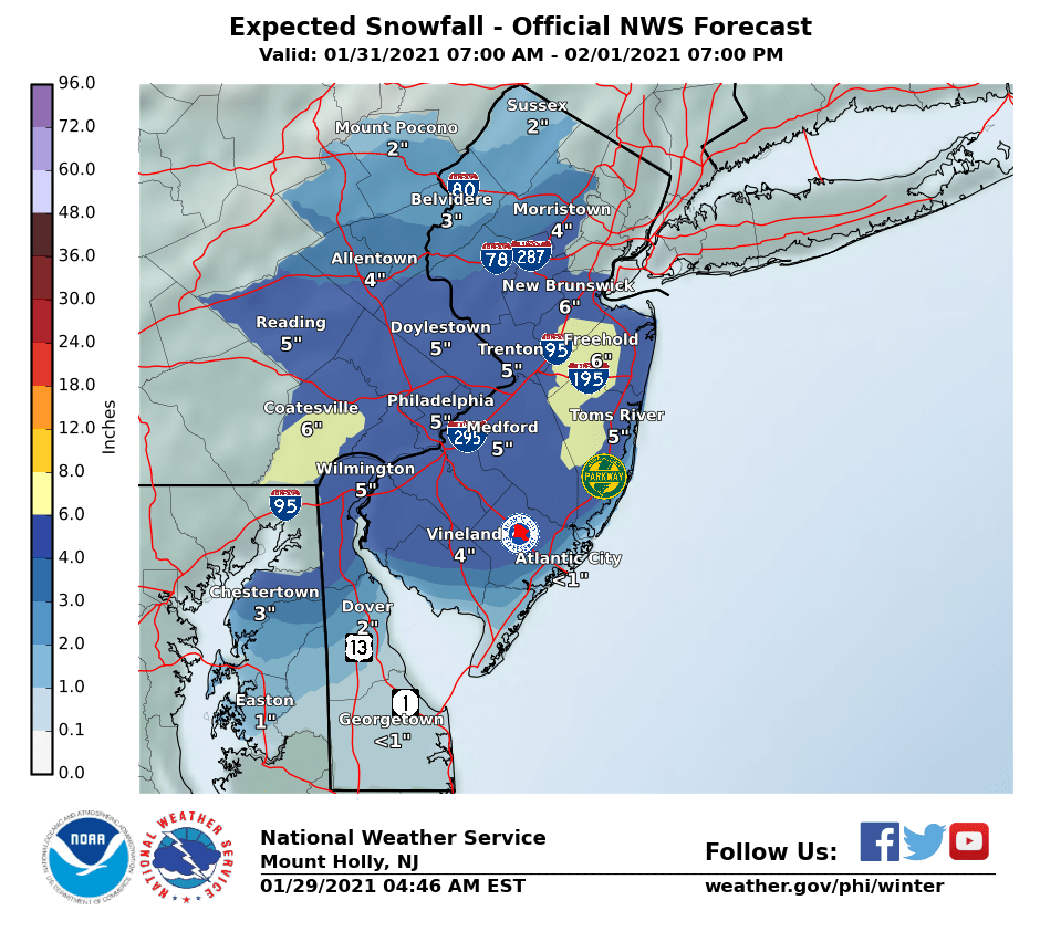
Mt Holly snow map. Focusing on Monmouth/Ocean for now
-
5 minutes ago, NJwx85 said:
If you live on the ocean you should expect mixing issues period. It comes with the territory.
May through September makes it all worthwhile living at the beach. Anyways, yes I am concerned about mixing or dryslotting with a low that tucked against Assateague Island as shown on the GFS despite it ticking south.
-
2
-
-
Windows just began to rattle here in Point Pleasant Beach 4 blocks in. Merry Christmas everyone. Hope you all have a safe night and let's hope it's not as bad as it can be.
-
3
-
-
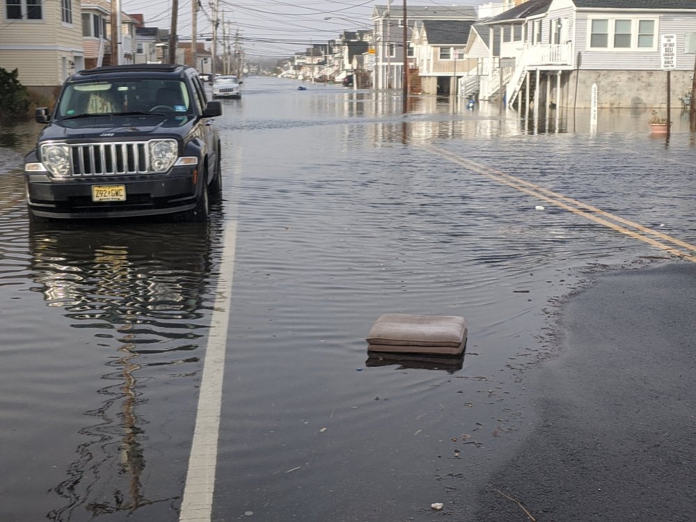
Just inches from moderate flood stage here in Manasquan.
-
2
-
-
Closing in on an inch in Wall southern Monmouth County
-
2
-
-
Light rain sleet and snow wall/Manasquan very very light mix.
-
1
-
-
18 minutes ago, Franklin0529 said:
U think the coastal Monmouth county see any accumulation
Highly doubt it unless there's a band at the end which lingers over Monmouth. But I do think a flip to snow tomorrow morning will happen for a time and the wind could make it look fun for a bit.
-
2 minutes ago, jm1220 said:
GFS has perhaps 50+ mph gusts for the NJ shore, but unfortunately for snow there the winds are onshore. Inland Monmouth towards I-95 may be worlds different from Asbury Park.
Thank you. Allentown could have a foot. Belmar zilch.
-
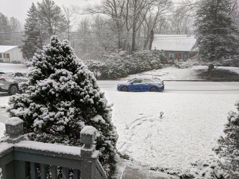
Flipped to all snow grass becoming slushy here outside the Hunterdon county OEM office where we are doing live hits for the next hour or so. Elevation: 700ft.
-
1
-
1
-


Henri: Moderate-Major impacts NYC subforum this weekend, possibly into Monday August 21-23, 2021
in New York City Metro
Posted
Lee came through before Irene which also led to historic flooding in NEPA.