

96blizz
-
Posts
2,530 -
Joined
-
Last visited
Content Type
Profiles
Blogs
Forums
American Weather
Media Demo
Store
Gallery
Posts posted by 96blizz
-
-
One thing we have to embrace here - for those of us from BUFF to SYR and on northeastward - this is one of the rare storms that trended positively into our laps at the exact right time. Rare as hell!!!
-
 3
3
-
-
The second wave was always the one we wanted!
-
1
-
-
Transition to snow has happened in skaneateles. Can feel the cold press happening too.
-
Inched upward…

-
1
-
-
2 minutes ago, Blue Moon said:
What is CCB? Conveyor belt?
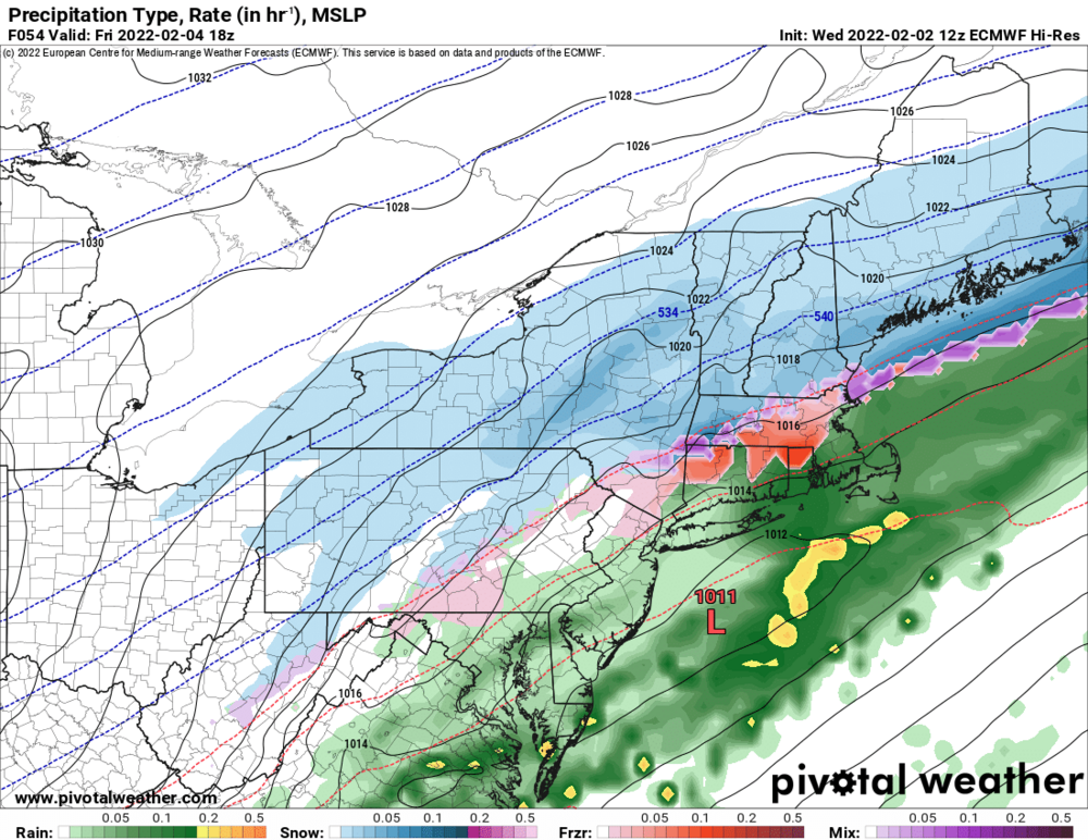
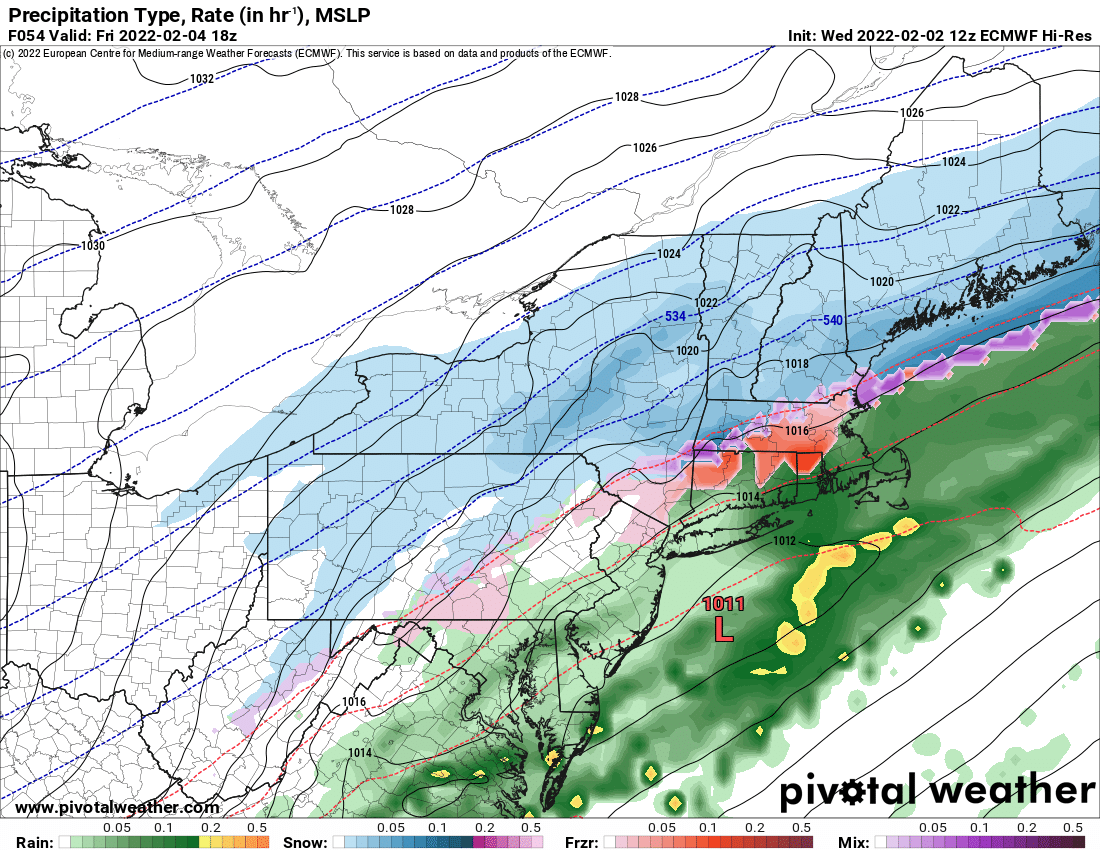
Yes. Usually much more pronounced on a deeper coastal storm but you can see it in the graphic above with the bands moving from NE to SW.
-
 1
1
-
-
I have officially no more models to look at. It is time to get the stretch bread for the fondue, cookies and brownies will be baked, coffee and hot chocolate galore and some takeout from the local skaneateles restaurants. I’m calling at least 6 Jebwalks as the over/under and half with my children. Definitely a football game in the middle of the best rates with me as the automatic QB and my two young boys
We have tracked. We have laughed. We have cried. We have religiously peed at 1AM so we can catch the Euro output after automatically getting up via some strange internal weenie alarm clock. We have posted Kuchera maps we know are patently ludicrous. We’ve argued and made up. We’ve learned more about weather and each other.
It’s go time you crazy muthaf*ckas. It’s been an honor to track with you all.
Good luck and Godspeed.
-
3
-
 3
3
-
-
3 hours ago, rochesterdave said:
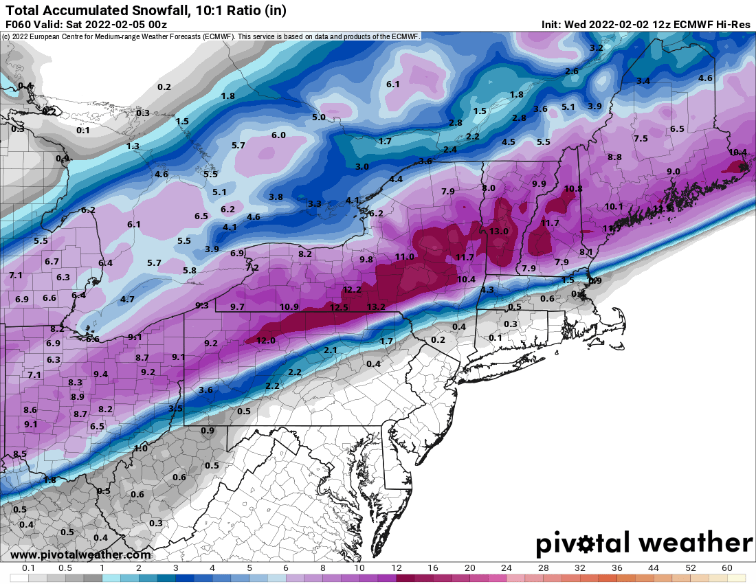
Look at that 18 by Skaneatles! This is 1:10!!

Pee break. F yes!!!!
-
1
-
-
Heading to bed boys. Resting up for the long haul.
(Who am I kidding I go to bed at this time every night)
-
1
-
2
-
-
17 minutes ago, Syrmax said:
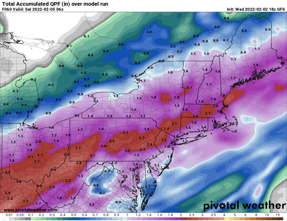
18Z NAM has us with about 1" of snow thru 4pm tomorrow, so expecting about 6-9 hrs of rain then "dryslotting" between waves here. About 4-6" afterwards over about 12-18 hrs. Basically, Advisory level event.
#Syrmin
-
2
-
-
6 minutes ago, LakeEffectKing said:
F that!!! I'm staying up for more model erotica!!!!
I love how “weather” makes this totally acceptable.
-
1
-
-
3 minutes ago, mississaugasnow said:
Lol not to be that Debbie but I’d be careful with those numbers. Detroits storm evaporated. Transition events in GL region is tough and normally slower. A lot riding on that 2nd wave. Detroit snowed all day and saw 2”

-
4
-
-
4 minutes ago, BuffaloWeather said:
A collection of new maps from KBUF. 40% chance of 12"+ is a pretty good storm for the area.
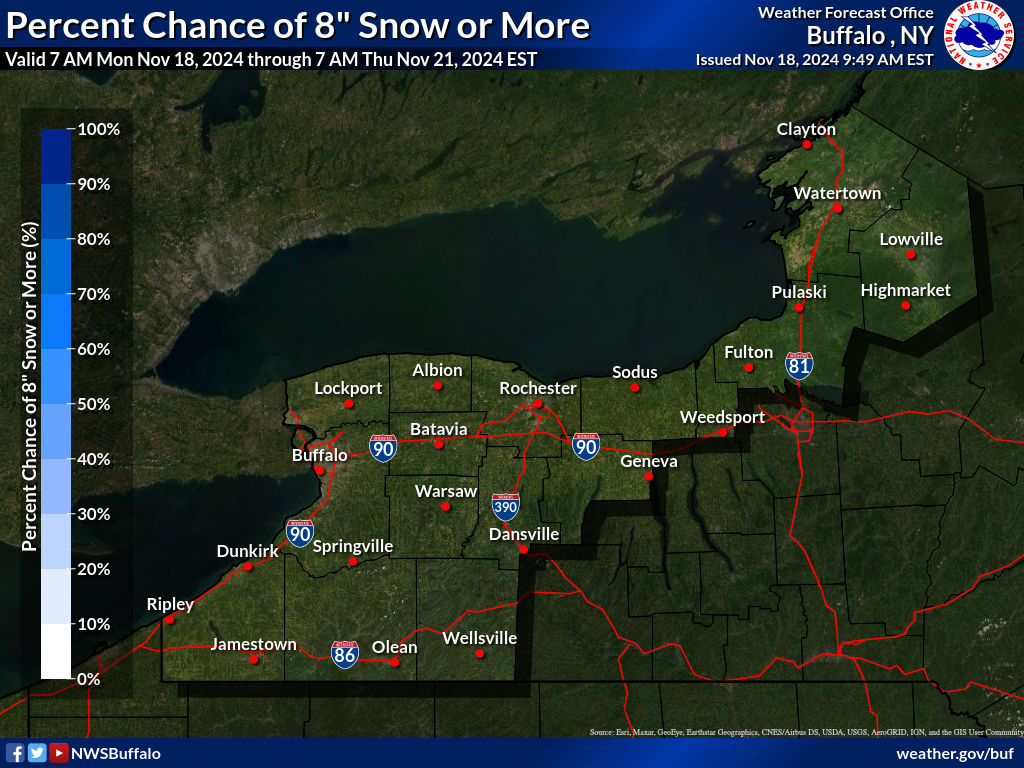
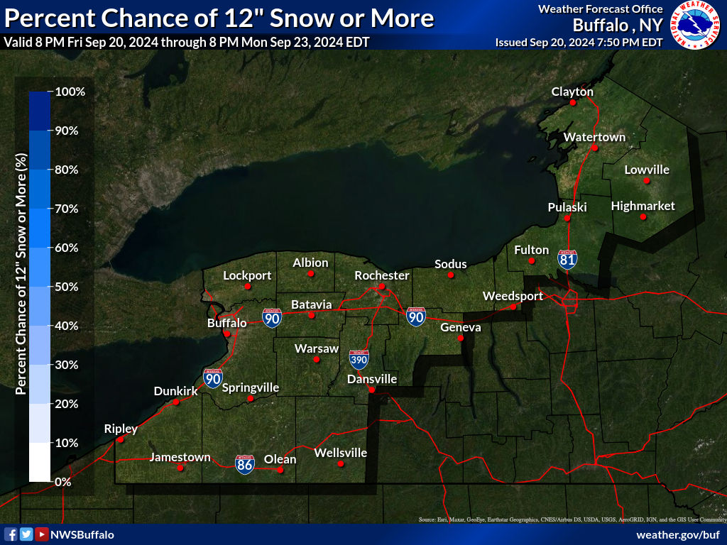
Note that these maps and BGM only go to 1PM on Friday.
Could be some extra backend stuff (that sounds naughty)
-
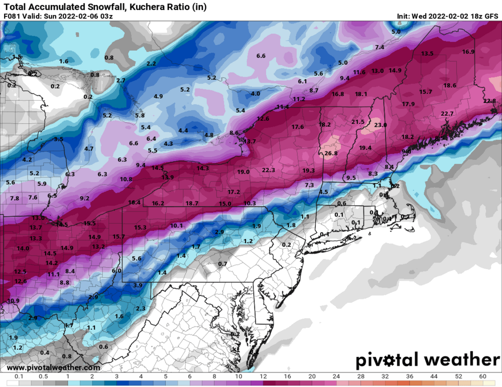
Just now, BGM Blizzard said:
18z gfs was a wet run. Wow.

.thumb.png.208c32dde78a4a2669db2075bd520094.png)
.thumb.png.0b2da13519b4b555811b276aebc1e0a7.png)
.thumb.png.f13aea13a0aee62223487e77a4f9047f.png)
It’s honestly just like the 12z GGEM
-
2 minutes ago, Syrmax said:
Divide that shit by 2.
Must you piss in our pre-storm, non realistic Cheerios?
-
5
-
-
Just now, wolfie09 said:
You can also look at Kuchera from the bottom of "winter weather"..

Oh cool. Didn’t know that. Thx man!
…also there was some cake topping for some areas with backend lake stuff. Fill GFS output for the weenies. In SYR matches closest to the GGEM!! @TugHillMatt here we go!!
-
2
-
1
-
-
1 minute ago, vortmax said:
How can one tell what average ratio Kuchera is applying?
Get the QPF output and divide.
e.g. SYR is 16.2 / 1.5 or 10.8 to 1

-
1
-
-
I’m humping the Canadians baby!
-
2
-
-
NAM is gonna hold
-
2
-
-
Me waiting for the 18z suite.

-
4
-
-
Just now, Thinksnow18 said:
The key is how fast the front can swing through while a good chunk of the moisture is still to our SW. If the moisture is moving too quickly and the front hangs up then snow totals go down further. A bit concerned.
Thing is - I think - the second wave is where it’s at. That’s what the NAM and GGEM show. The first wave is kinda meh but the second one can blitz us. Colder like the Euro and the heaviest snows sink just South of CNY.
The euro at 12z already seems to be busting too cold by a bit.
-
1
-
-
-
Euro redeems itself with the 3rd wave lingering snows!
-
1
-
-
Does look like it will snow lightly well into Friday.
-
Euro has been the most annoying and stubborn during this track. Boring AF too.
-
1
-


.png.d31fed741ce42dfceb5929e73773ef8f.png)
.png.57343315127a759ab157c8901b844de0.png)
.png.4cf4368f5a0fb3baa979189b9e587d12.png)


Feb 2-4th Snowstorm- Observation Thread
in Upstate New York/Pennsylvania
Posted
Think it's pack whitening mood flakes for most of the day - with perhaps a lull - and then the intensity gets exponentially more from early PM forward. That's when it gets really fun!