Birds~69
-
Posts
34,350 -
Joined
-
Last visited
Content Type
Profiles
Blogs
Forums
American Weather
Media Demo
Store
Gallery
Everything posted by Birds~69
-

E PA/NJ/DE Winter 2025-26 Obs/Discussion
Birds~69 replied to LVblizzard's topic in Philadelphia Region
Not only chirping but pecking in the grass. (Worms/insects) Hungry MoFo's...
-
E PA/NJ/DE Winter 2025-26 Obs/Discussion
Birds~69 replied to LVblizzard's topic in Philadelphia Region
Congrats! You will be held to a higher standard now. The peanut gallery will be on the lookout... 48F already, 10:55am, Sunny as can be... -
E PA/NJ/DE Winter 2025-26 Obs/Discussion
Birds~69 replied to LVblizzard's topic in Philadelphia Region
I'm downgrading to a B+ Damn people who rate this winter as an A+ are sinners I'll tell yah. Weenies! Damn it, I may start smashing stuff and junk ... -
E PA/NJ/DE Winter 2025-26 Obs/Discussion
Birds~69 replied to LVblizzard's topic in Philadelphia Region
I meant we went a month practically without snow. Jan 25th-Feb 22 in the heart of winter...so no +. -
E PA/NJ/DE Winter 2025-26 Obs/Discussion
Birds~69 replied to LVblizzard's topic in Philadelphia Region
It's still an "A" in my book. Going a month in the middle of winter without snow is a negative. I don't give two shits about monthly averages. Getting shut out for a month in the middle of winter has consequences. Even a couple of one two three inch clippers would have made a difference. The cold stretch was great but getting shut out in snow sucks. Very good winner but not a A+... -
E PA/NJ/DE Winter 2025-26 Obs/Discussion
Birds~69 replied to LVblizzard's topic in Philadelphia Region
It's no more than a "A" winter in my book. The drought of snow from Jan 23/25th to Feb 23/25th (Peak winter) with all that cold in place is why it will never be a A+. That is like your All Star batter belting .340 during the season then batting .250 during the playoffs. (Peak time) Sorry winter "A+" is for the elite...not failing at peak times. 28F @ 1:05PM/ Winds cranking a bit, colder than expected and thank God the Liquor store is open... -
Warminster...creative, it's a damn mailbox. Too bad we won't have the bitter cold so it could hang around. https://www.facebook.com/share/v/1b2yhZUJVs/
-
I see a 30incher in NNJ (30.7")! That's what I was looking for... congrats to them and I'm sure they'll receive some fine parting gifts.. 29f.
-
E PA/NJ/DE Winter 2025-26 Obs/Discussion
Birds~69 replied to LVblizzard's topic in Philadelphia Region
I would actually trade one of the upcoming nickel and dime events for another good cold shot. When it snows then hits the mid upper 30s w/sun it's a sloppy mess. Give me some low overcast skies w/highs in the low 20s after a nickel/dime event And throw in some winds and a lost random tumbleweed for good measure... 30f -
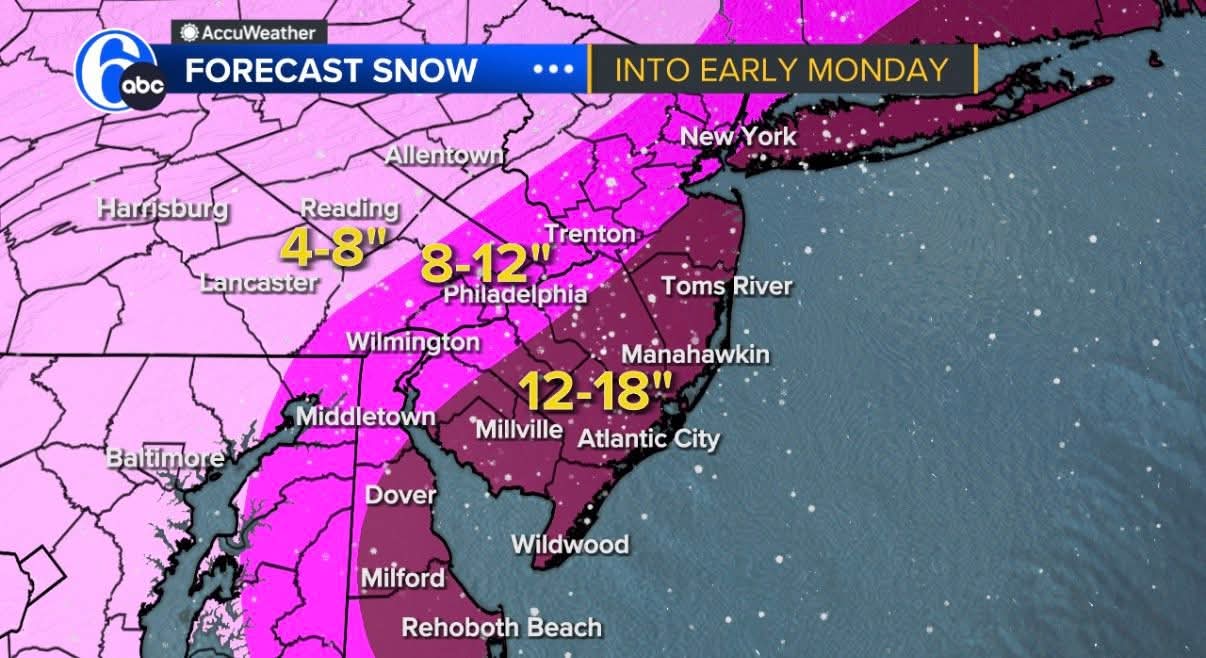
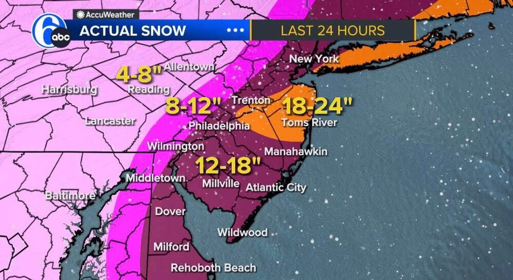
Comment under Cecily/Accu Weather totals. "22” in lower bucks by trained spotters. Langhorne area"
-
Accu-Weather "actual" snow totals seems low in several areas particular in lower Bucks... 31f
-
I thought I did till I overindulged and that was that. Probably just pick up a 6pack of something I never tried before...most likely an ale.
-
Yep, better gust today than any time yesterday...
-
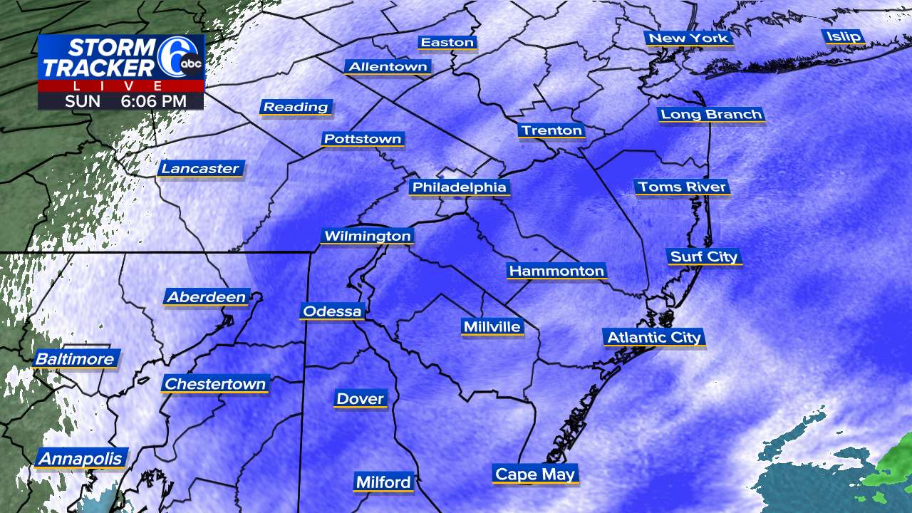
By far. I enjoyed the first storm quite a bit more than yesterday. This one is already kinda sloppy looking. Still cool to look at when it's happening but the lifespan is much shorter come late Feb heading into March... 36F/cloudy
-
Horrible news. Due to the snowstorm and for the safety of our customers and our staff, all Fine Wine & Good Spirits stores in Montgomery, Chester, Delaware, Bucks and Philadelphia counties are closed Monday, February 23. We appreciate your understanding and will share updates as conditions improve. Stay safe!
-
Fun stuff outside. No idea how much... A foot?
-
No idea. Someone reported it on YouTube live stream..
-
Thundersnow reported in SNJ...
-
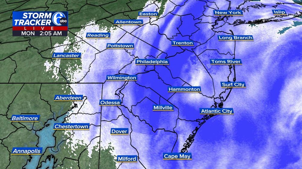
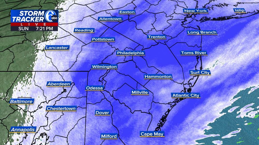
Ryan Hall live...people providing updated totals PA/NJ https://m.youtube.com/watch?v=XRix3Jlz2s4&pp=uAQw
-
-
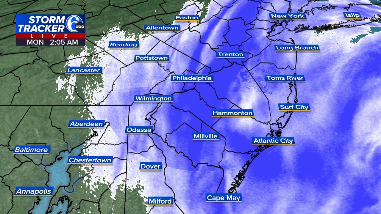
Yeah, I don't know? I think we may have 8 inches by midnight??
-
Probably many of the posters are as well... 30f/heavy duty snow
-
Coming Same. Sideways sheets of snow....