
BretWx
-
Posts
1,046 -
Joined
-
Last visited
Content Type
Profiles
Blogs
Forums
American Weather
Media Demo
Store
Gallery
Posts posted by BretWx
-
-
Any ideas about the winds w/ this weekend’s system?
To add, Jason on WLOS said we can expect a “solid 6-10 inches with many places over a foot” ...
-
 1
1
-
-
I’m trying to imagine even 2ft+ of (heavy wet) snow around Asheville and it’s unfathomable. Roofs would be collapsing left and right.
-
7 minutes ago, BlueRidgeFolklore said:
.thumb.png.60efa2bcccfac6fa589bf6350f240c54.png)
I don't recall ever seeing anything like this, for so many. Still a few days to go, but even half of that.. hell, a THIRD would be great.
-
Tempted to head to bed after leaving the office just to get to tomorrow's runs... LOL
-
1
-
-
Speechless.
.png.b95674cfc027514ddb52f7b1680d18f1.png)
-
1
-
-
The Euro map just posted in the main forum. Holy hell.
-
5 minutes ago, AsheCounty48 said:
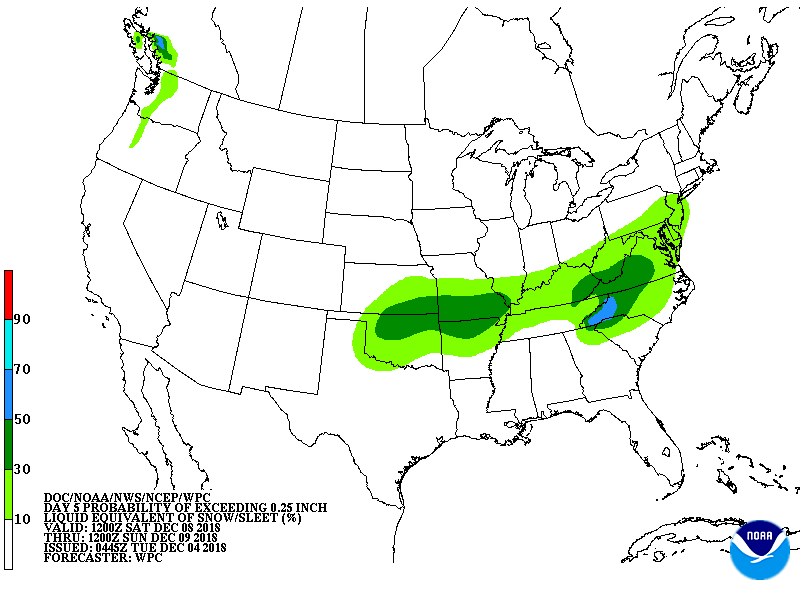
One thing to note. On the GEFS, the mean snowfall has yet to go down since the whole storm is in picture, the average has climbed every single run...
I keep waiting for something to fall through, but again, haven't seen this many models consecutively showing this. Wild.
-
1
-
-
KAVL mean ticked up to 12.01 (highest up to 33.26 - phew)
http://www.emc.ncep.noaa.gov/gc_wmb/tdorian/gefs/EMCGEFSplumes.html
-
1
-
-
Just now, BlueRidgeFolklore said:
At this point, is there any model not giving us a good thump?
Hell, even the ICON threw 10-16 inches our way.
-
It's looking like we'll be able to add another 12z FC3-GFS under our belt as well.
-
1 minute ago, BlueRidgeFolklore said:
Guys, piggy backing on HT, and I wouldn't dare post this in the storm thread, but us mountain folk need to start making preparations NOW! Especially if you live along the escarpment from Highlands to Hendersonville and on up through Old Fort to Blowing Rock, etc. This could be a monster.
After this run, I'm glad I pulled the trigger on getting a generator this morning.
-
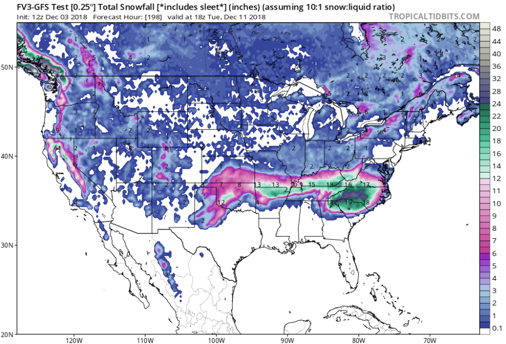
12z GFS, widespread 20-30 inches for all. Unbelievable. Won't buy in until it's showing this Thursday though... Don't remember seeing these totals run after run after run like this before...
-
Just now, AsheCounty48 said:
No need to post a pic since they are all over the main thread, but the 12z GFS created a few tears of joy. that was beautiful for us. *most*
Truly beautiful.
-
Looks like the 12z GFS is about to come in big for most of us...
-
-
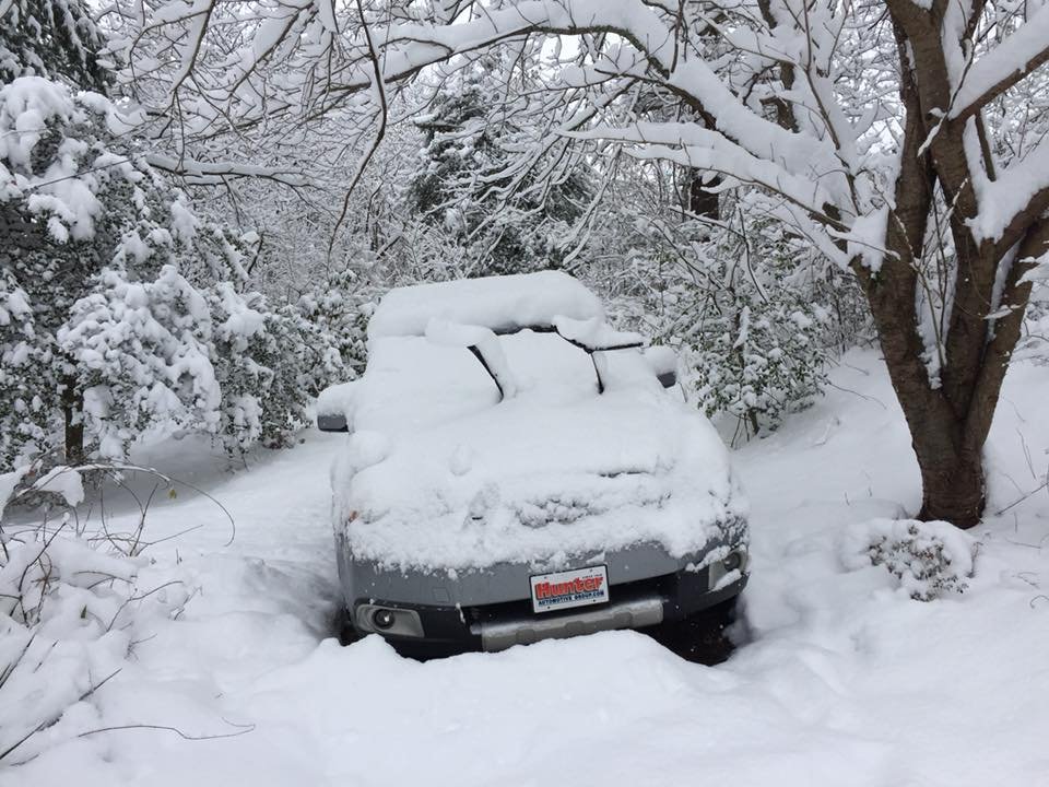
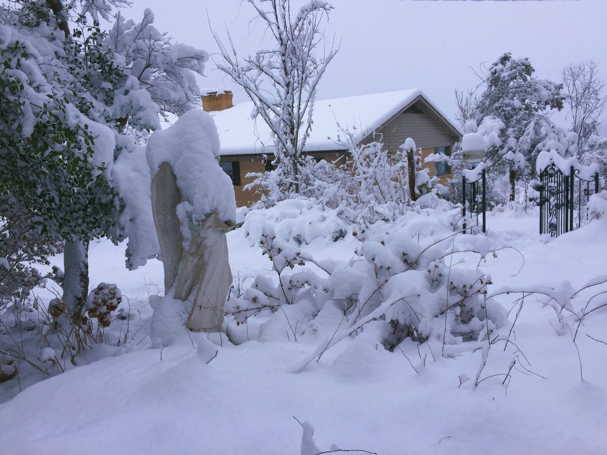
Just for fun, this is what it looked like here during last year's December storm.


-
1
-
-
31 minutes ago, BretWheatley said:
Euro and FV3-GFS both still show a sizable storm. I don't recall ever seeing this much agreement in modeling this far out, up until now.
Probably just jinxed it by buying a small generator, but last year's storm gave us about 10 inches and we lost power for 2 days. Didn't have one then and it was a mistake... Oh well!
-
Euro and FV3-GFS both still show a sizable storm. I don't recall ever seeing this much agreement in modeling this far out, up until now.
-
I know better than to get sucked in at this point, but hey, this is half (if not more) of the fun. Going to be a fun week.
-
1
-
-
Wow. Still not getting my hopes up.
-
1
-
-
Sweet Jesus.

-
2
-
 1
1
-
 1
1
-
-
Just now, Wow said:
FV3 is a monster
Right? I gasped a bit when those panels loaded.
-
FV3- GFS appears like it's going to be a monster for WNC (Southern Mnts especially).
-
1
-
-
Still looking good - kind of hard not to get hopes up. Of course, would love to have this look on Friday morning.
.png.1623f0dfc82840e789e1ffca4b1f55d8.png)


2018/2019 Mountains and Foothills Fall/Winter Thread
in Southeastern States
Posted
Yeah I just saw they updated the map to show the 18”... Ingles should be fun from now until then...