
JoshM
-
Posts
3,167 -
Joined
-
Last visited
Content Type
Profiles
Blogs
Forums
American Weather
Media Demo
Store
Gallery
Posts posted by JoshM
-
-
Canadian and GFS both came in colder, It's miller time! Seems like the Miller B has turned into a Miller A

0Z GFS holding onto some sub freezing temps in CAD areas now

-
Canadian coming in colder. Think it's time to start a thread
-
 3
3
-
-
and onto next weeks flood


-
25 minutes ago, wncsnow said:
GFS continuing the trend of South and weaker. I really think we might sneak an advisory level maybe even warning event above 3k north of 40. Inch or 2 of sleet and snow with .10-.25 ZR
We're getting close to something interesting...

-
1
-
-
44 minutes ago, BornAgain13 said:
I guess the question is now, how much ICE could the CAD areas get before it changes to rain?
Sent from my SM-N981U using Tapatalk
My guess would be a blend of Canadian and GFS, ~ 0.10 - .25 North and West of 85 and .25-.50 North of 40
-
1 hour ago, StantonParkHoya said:
Feels like a year where we keep saying “day 10 on looks good” until day 10 is March 15
This winter, by George RR Martin

-
 2
2
-
-
8 minutes ago, Met1985 said:
Euro with a great look for the second system.
Sent from my SM-G998U using Tapatalk
Looks like it's starting to see some better CAD, similar to Canadian
-
1
-
-
FWIW, Canadian is still holding the CAD in favored areas

-
1
-
-
-
-
-
North/West of 85 and definitely North of 40 I'll take my chances all day long with this look


-
2
-
-
0z GFS says....

-
2
-
-
-
Just now, Leesville Wx Hawk said:
Lock it in Josh!
with marginal cold, we better hope this thing doesnt amp up.
-
-
GFS still has New Years System, but this run just looks weird to me.


-
1
-
-
0z Euro says "Happy New Year!!!"


-
6
-
-
0z GFS is good too, IMO. Lots of energy flying around


-
4
-
-
3 hours ago, Chuck said:
Probably belongs in the banter but too good to pass up for here. Originally posted by Prince Frederick Wx in the MA thread in their aptly named Panic Room - Winter 23/24 Edition...
Thank you for calling the newly launched AmWx Hotline of Hope, providing support for delusional weenies at an affordable price. Please select from one of the following options; or, stay on the line to hear recordings of Joe Bastardi’s winter forecasts.
-To hear about SSW events, please press “1”
-Siberian snowcover, please press “2”
-MJO mumbojumbo, please press “3”
-Earth’s magnetic poles reversing, please press “4”
-To hear about how a giant asteroid impact would lead to additional snowfall in your backyard, please press “5”. Note that this option requires an additional fee.
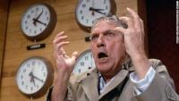
I called the 900 number, me and this girl talked about a banana high.
-
1
-
 1
1
-
4
-
-
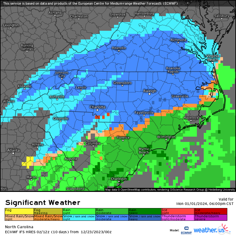
NC statewide flizzard alert on 0z GFS for Tuesday

-
7
-
-
1 hour ago, WinstonSalemArlington said:
And so begins the Polar Vortex hysteria

-
2
-
-
0z GFS even cooler... lower 50s


-
4
-
-
Planning to drive to Mount Mitchell park on Saturday, maybe I'll get a mercy flake of snow. Will share any photos
-
4
-
1
-


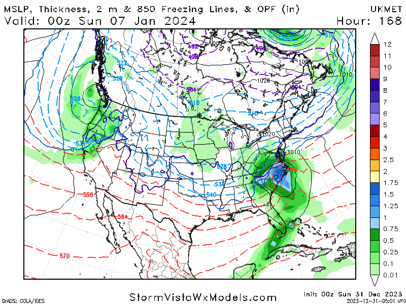


January 6 - 7 Storm Potential
in Southeastern States
Posted
GFS ZR Map, seeing some 0.25 down to ~ shelby, nc
Canadian says lights out