

LP08
-
Posts
3,087 -
Joined
-
Last visited
Content Type
Profiles
Blogs
Forums
American Weather
Media Demo
Store
Gallery
Posts posted by LP08
-
-
Lol....this is going to be quite different.
-
 1
1
-
-
Just now, CAPE said:
Just ignore the surface temps.
It's the only thing problematic on that GEFS run. Problem is its the most important.
-
1
-
-
-
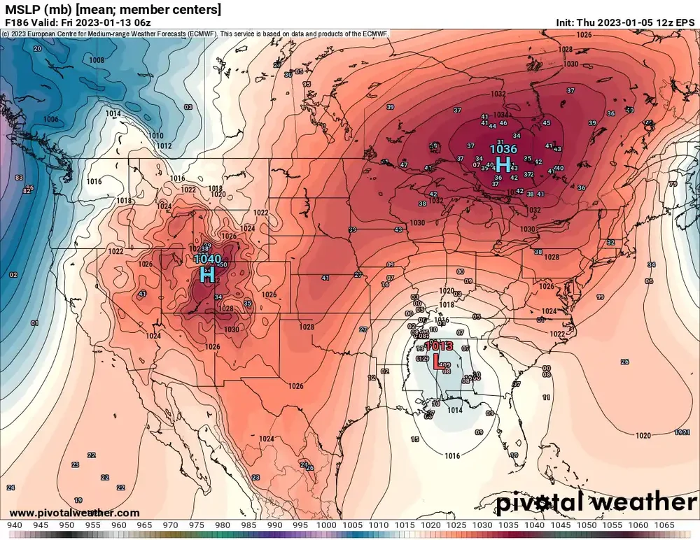
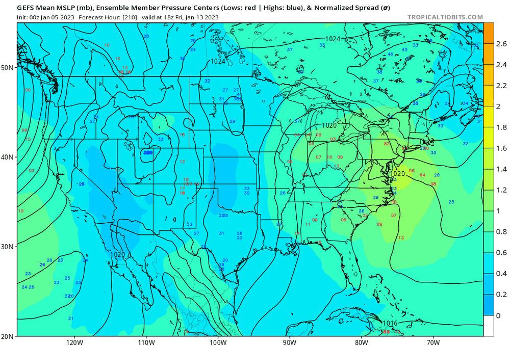
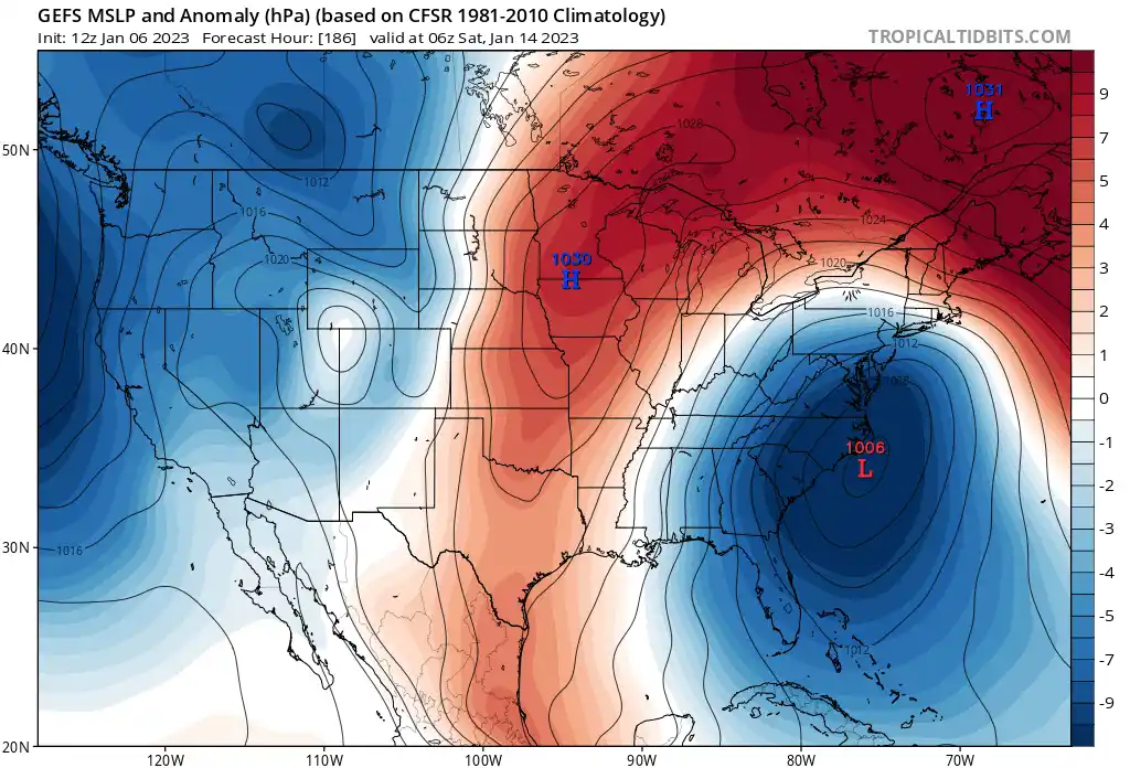
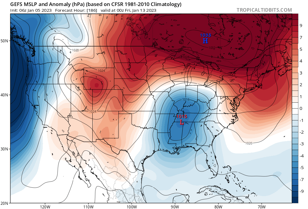
GEFS is a pefect track of some of out biggies, from N TN to off of the NC/SC border but temps again are just not great.
-
2
-
 1
1
-
-
 I sense a PSU post after this map
-
1
-
 2
2
-
-
Just now, stormtracker said:
I wanna post IT so bad. But I just can't tell where the GFS is going.
It's going to be close me thinks.
-
Through 138, I do see some positive changes on the GFS...Better confluence in the NE.
-
1
-
-
Just now, WxUSAF said:
Kaiser has some bootleg confluence rings pushes it south of its 0z solution. Not the pig 50-50 low we need here, but better.
Now...when i was looking through other stuff than just precip, i thought everyting did look better with more NS influence. So colder solution but terrible track.
-
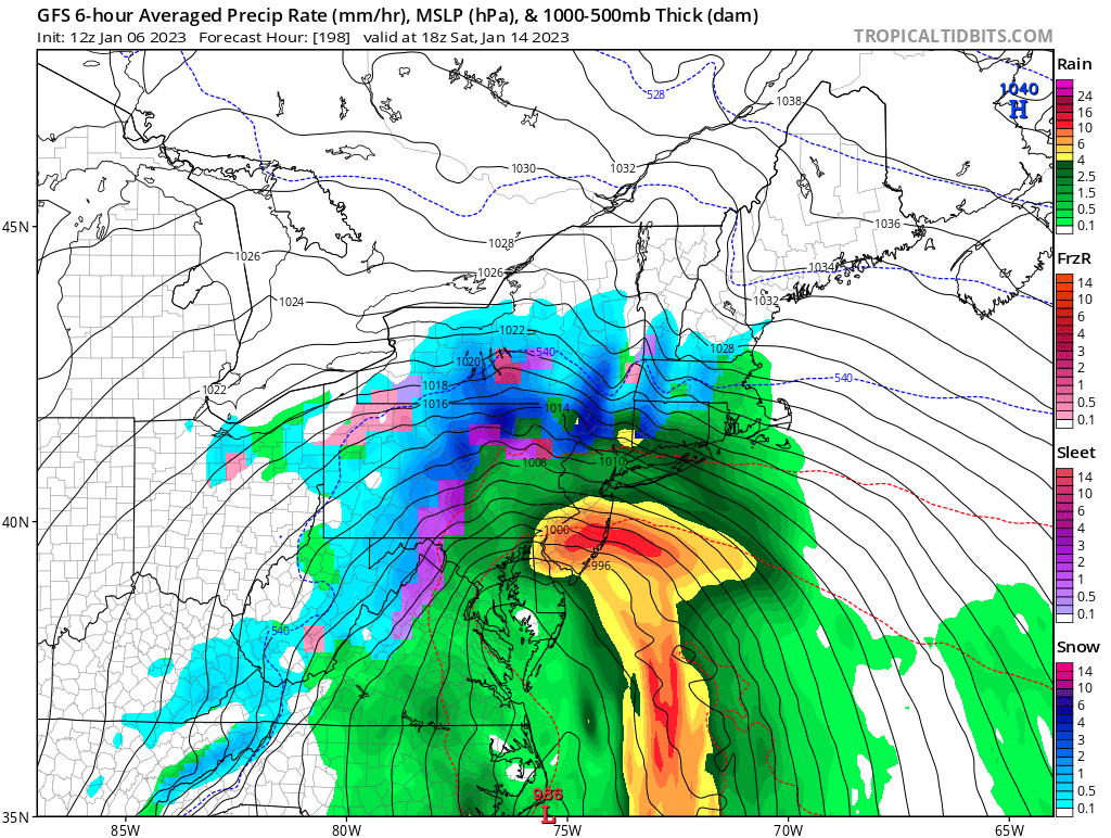
ICON has the 14th Low in Ohio. Maybe a mix of junk to start before heavy rain.
-
1
-
-
1 minute ago, brooklynwx99 said:
hehe

.png.13c5d8465863d961d644cbfb2c902b29.png)
Don't you dare (please do)
-
4
-
1
-
-
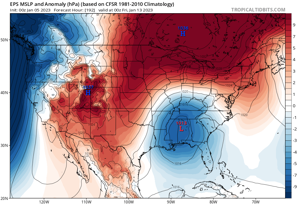
EPS at 186. I don't need to see the rest. I am sure there will be some stupid solutions in there.
-
4
-
 7
7
-
-
As others have stated, Night and day comparing that piece over northern New England compared to the GFS.
-
Just now, stormtracker said:
I believe the EURO may do what we need to be done. At least with the Ocean low?
Was just going to comment on that. At 144, a piece of the TPV is swinging down to phase with it.
-
Best look of the season. The two previous events were more thread the needle but this does have a little more cold available.


-
2
-
 1
1
-
-
Progress
-
4
-
-
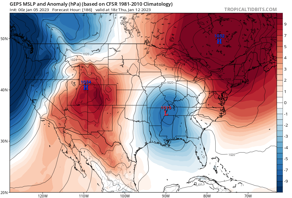
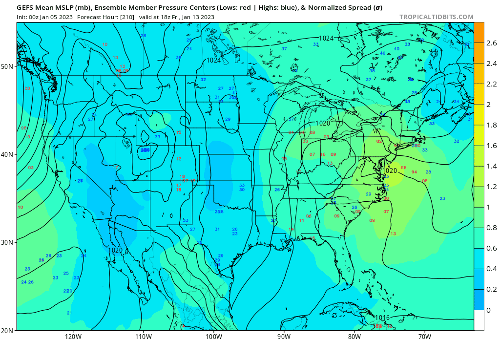
EPS Day 11...decent signal for a coastal track.
-
5
-
-
7 minutes ago, WxUSAF said:
Euro going the extra mile to piss us off. Better cold push, so shred that wave to nothing and wait for the cold to retreat before bringing in the precipitation.
HR 168 doesn't look like a terrible set up....lol

-
3 minutes ago, WxUSAF said:
Rather large changes for the weekend event on the euro. We’ll see where it goes.
Putting all the eggs into the 9th-10th basket, I don't know how that will work out.
-
3 minutes ago, WxUSAF said:
Above freezing layer is extremely shallow though which is good news.
Yes, plenty cold up above it seems. Hopefully it can become 32-33 snow before everything moves out. Still fantasy though but nice to see.
-
1
-
-
3 minutes ago, stormtracker said:
yes. SFC temps suck of course
Mid 30's to the Canadian border. Woof
-
1
-
-
Also the GFS looks better for the 10th...
-
1
-
-
2 minutes ago, Chris78 said:
Atleast no sun angle to worry about.
What about moon angle?
 Just now, WxUSAF said:
Little bit stronger low and a smidge farther south to blunt that weak southerly flow @tombo82685 pointed out yesterday.
Plus anything we can do to mitigate that brutal mid January sun angle!
Blue is blue...and we will all be up watching it in the porch lights.
-
2
-
2
-
-
Gotta love January evening/overnight 35 degree snow.
-
1
-
3
-
1
-
-
6 in Arlington
-
2
-


January Mid/Long Range Disco 2
in Mid Atlantic
Posted
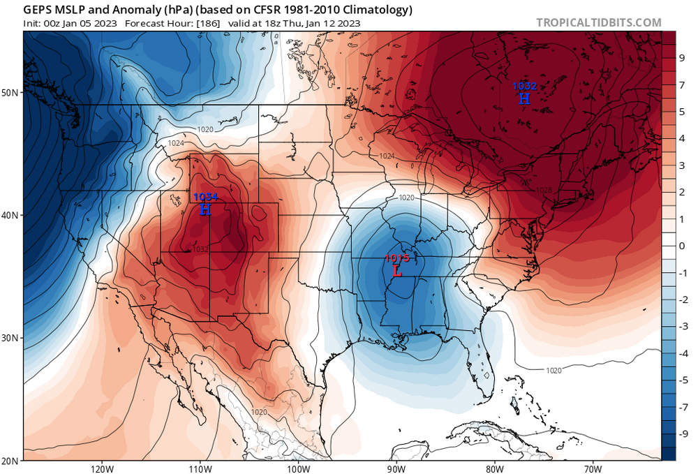
From the Gulf Coast to Indiana from 0z to 12z.