WestTennWX
-
Posts
89 -
Joined
Content Type
Profiles
Blogs
Forums
American Weather
Media Demo
Store
Gallery
Everything posted by WestTennWX
-
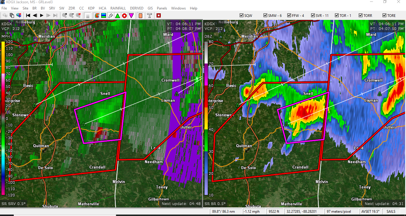
Decent couplet just south of Snell

-
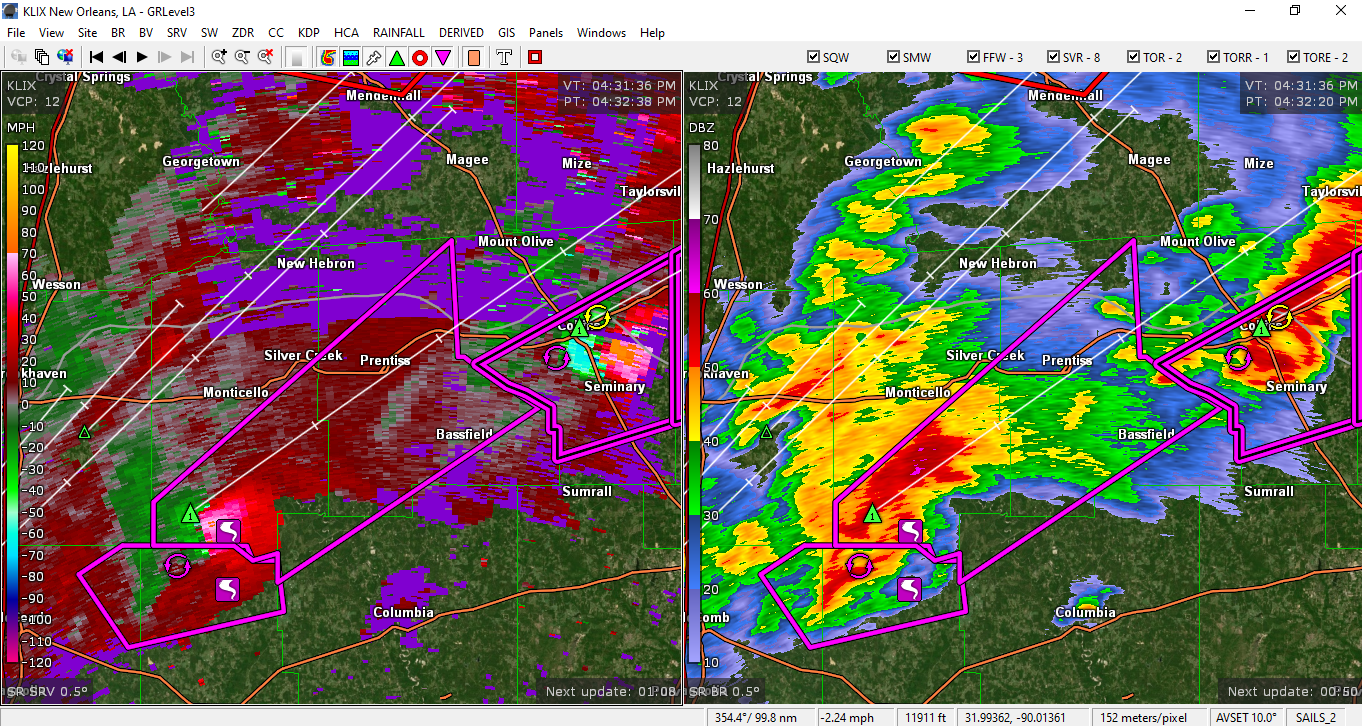
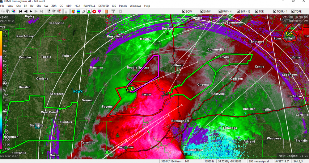
New tornado warning north of Birmingham now.
-
Overlapping Tornado Emergencies issued.....has this ever happened before?
-
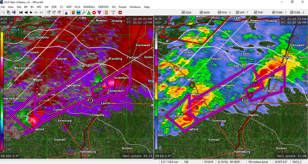
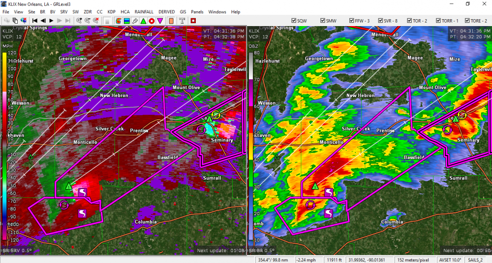
Circulation right on the heels of the Bassfield cell.
-
Is it available via placefile...etc on GRLevel3, or GR2 analyst only?
-
Some great links in there...I have been trying to learn more concerning model guidance and how to interpret it. So glad there is a TN valley forum now, I hope to contribute to it in any way I can! Here are a couple of links to Beau's website and social media- he is a bit north of the TN valley but still includes West Tn and Western Ky in his discussions, he offers some interesting analysis and has quite a large following over there. http://www.weatherobservatory.com/ https://www.facebook.com/beaudodsonweather