

nj2va
-
Posts
14,481 -
Joined
-
Last visited
Content Type
Profiles
Blogs
Forums
American Weather
Media Demo
Store
Gallery
Posts posted by nj2va
-
-
Round 4 going on now with steady moderate/heavy rain.
-
 1
1
-
-
Happy July and Happy Birthday America!
-
2
-
-
11 hours ago, CAPE said:
It's football season.. Training camp starts in a little over 2 weeks. Ravens first preseason game in 5 weeks.
I need football and hockey to start again. NBA needs to stop acting like people care about that league year round.

-
1
-
 2
2
-
-
My lawn, landscaping, and garden are very happy.
-
1
-
-
88/74 at 930p.
-
High of 101.1. Currently 95.5.
-
81 for the low, brutal. Currently 83/74.
-
High of 100 right on the nose, with a DP high of 78. Stifling.
-
9 hours ago, MillvilleWx said:
The humidity is really going to be a monster to overcome this week. Today was the "cooler" day of the heat wave and it was downright NASTY out this afternoon.
94/75 for the hi/low in my neighborhood. The dew point was able to breach 80 today in the middle of the afternoon with a majority of the time hovering around 77-79. Brutal
Ugh, not looking forward to this!
-
2
-
-
76 for the low. Already up to 85.
-
94 for the high. Currently 88
-
On 6/16/2025 at 7:05 AM, mdhokie said:
We have seen a bunch of green "inch" worms the last couple weeks. At least the lake is full with all the rain we've had, would be nice to get some warmer temps, haven't had the guts to jump in yet

Yep, thats the fall cankerworm. They will eventually turn black.
I saw people water skiing Memorial Day weekend…it was in the 40s/50s air temp wise, let alone the water temp lol
https://www.davey.com/insect-disease-resource-center/cankerworms/ -
Still pouring, yellows and oranges just rotating across NoVA.
-
2 hours ago, mdhokie said:
Yuck. Didn't something eat all the leaves last year too?
Yeah, there was an outbreak at Deep Creek State Park’s ridge but by early July those trees had leafed out and recovered. Should happen with the new outbreak areas this year too.
When we were sitting out on our deck Memorial Day weekend, I couldn’t believe how many of those caterpillars were covering our deck furniture. Now seeing the leaf damage, I get it.
-
Fall cankerworms have wreaked havoc on tree foliage here in Garrett County. Half of the trees on the ridge we’re on are bare. Foliage should leaf out later this month to mid July, hopefully.
-
 1
1
-
-
The French Open mens final today was one of the best tennis matches I’ve watched on TV. What a performance by both men, especially Alcaraz.
-
1
-
-
Picture perfect evening.
-
2
-
-
Down to 53. Impressive for June.
-
1
-
-
On 5/27/2025 at 8:02 AM, wxdude64 said:
Well, Carolina finally figured out how to score against Florida and didn't get swept, lol. Like the series to at least go 6, the more games played the better in my book.
The game tonight is fantastic. Love to watch this go 7.
-
14 minutes ago, snowfan said:
The nymphs are all over my neighborhood. And for those unaware, the nymphs look like little black bugs with white spots.
I’ve been keeping my eyes opened but haven’t seen any. Just a matter of time here though.
Kill those fckers!
-
38 for the low, currently 55 under sunny skies.
-
3
-
-
44 here. Heading for the upper 30s.
-
1
-
-
2 hours ago, Weather Will said:
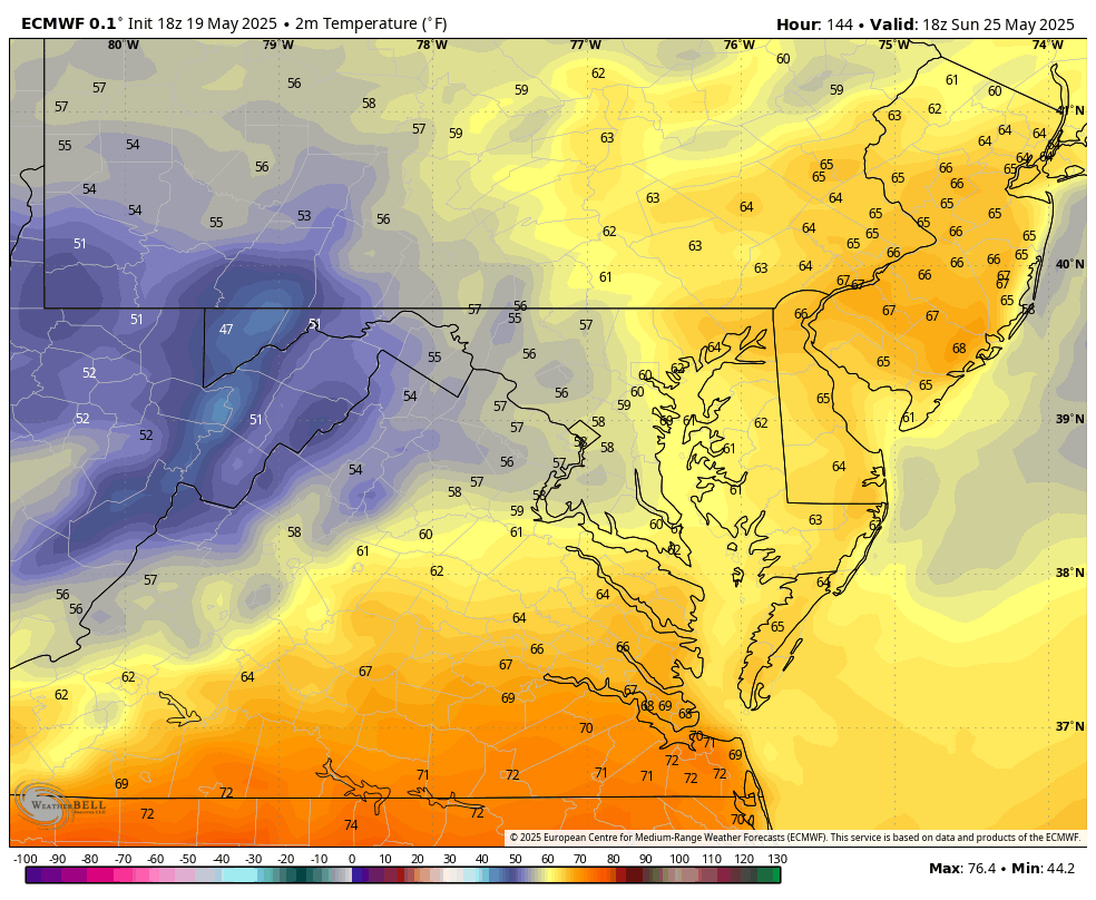
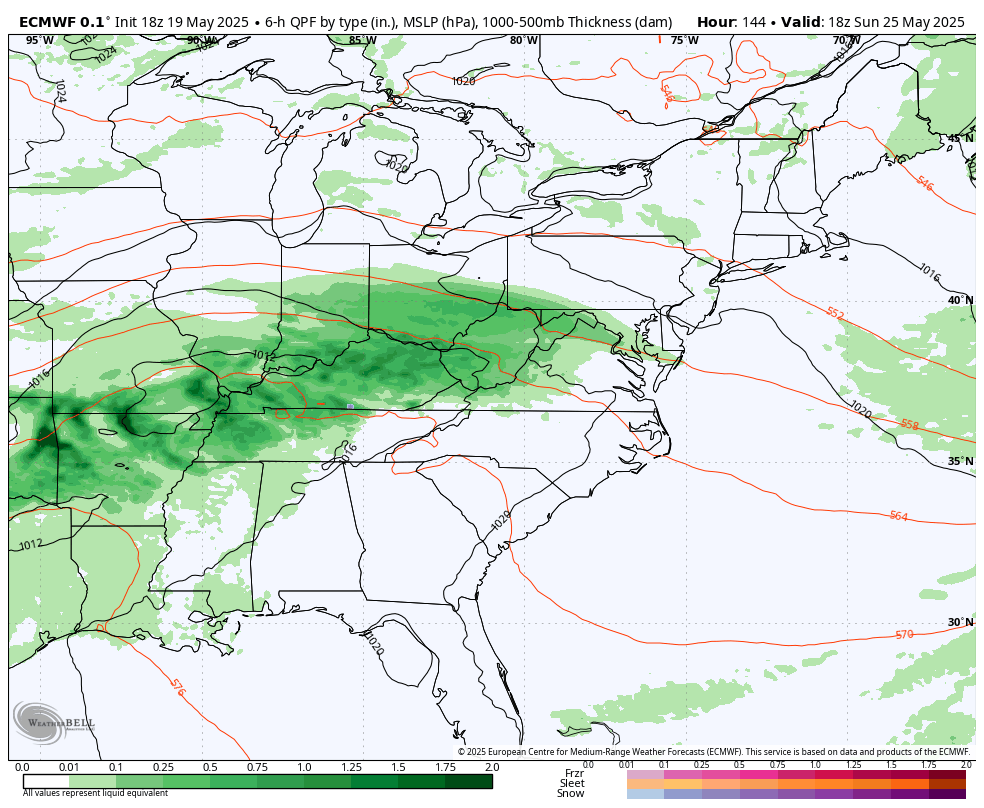
WB 18z EURO trying to introduce rain and upper 50s for Sunday....


Gross. 47 at Deep Creek? Cringe.
-
10/10 weather. Sitting in the backyard with a margarita watching the PGA championship. Scottie is a stud! What a turnaround on the back nine and Rahm (lol LIV) completely collapsed.
-
4
-
July Discobs 2025
in Mid Atlantic
Posted
Very pretty sunrise.