

nj2va
-
Posts
13,606 -
Joined
-
Last visited
Content Type
Profiles
Blogs
Forums
American Weather
Media Demo
Store
Gallery
Posts posted by nj2va
-
-
I don’t know if I’ve ever seen that many wind advisories on one map.
-
3 hours ago, MillvilleWx said:
This shift tonight was crazy busy. Here's all the thoughts on the rainfall and flooding risks over the next 3 days.
https://www.wpc.ncep.noaa.gov/discussions/hpcdiscussions.php?disc=qpferd
Enjoy any feedback on the write-ups")
Look for 330AM time stamp
Great summary and write-up!
-
 3
3
-
-
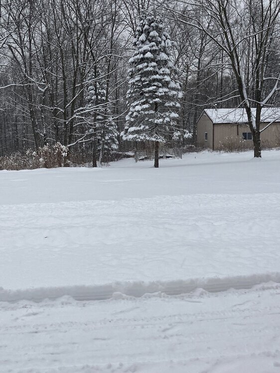
As I took down the Christmas lights today, I noticed some of my daffodils are poking up.
-
1
-
 3
3
-
-
Really good summary by LWX
A powerful storm system will impact the entire region Tuesday into Tuesday night. A highly amplified mid/upper trough over the Central Plains pushes eastward toward the MS Valley. A tremendous amount of upper diffluence will cause a surface low to develop and rapidly deepen as it tracks from the lee of the Rockies, across the Central Plains and central Great Lakes. A secondary wave of low pressure develops near the northern Gulf Coast, and is scooped up by the larger low to the north. As the entire complex pushes east, very strong WAA advection and an associated strong cold front are likely to bring significant impacts to our area. Temperatures ahead of this system shoot up to the 50s to low 60s east of I-81, although temperatures will likely follow a nondiurnal curve. Wintry Mix: A residual cold air mass ahead of this system will likely result in a wintry mix of snow and freezing rain for areas west of US-15 Tuesday morning. Some snow accumulation and ice accretion are possible, especially in the higher elevations along and west of the Blue Ridge. However, it`s possible some of the valleys stay cold enough for some accumulation as well. The strong synoptic forcing is going to help produce a quick burst of wintry precip, then strong WAA quickly transitions all p- type to rain by, although it may take until the afternoon in the typical cold pocket near the Allegheny Front around Cumberland. It`s possible these areas see higher end advisory amounts of ice and/or snow as a sizeable amount of QPF may fall before temperatures rise above freezing. Heavy Rain: A period of moderate to heavy rain is likely to overspread the area Tuesday afternoon and evening, with the heaviest rain along and east of the Blue Ridge. However, there will be added response from any remaining snowpack in western areas. Widespread rain amounts of 1.5-2.5 inches are currently forecast, though given the strong moisture flux, deep moist airmass, and strong diffluence, those totals could certainly end up higher. A heavier band of elevated convection Tuesday evening will likely result in the highest rain rates. This heavy rainfall could lead to urban, small stream, and river flooding. Strong Winds: There are several periods/areas of concern for strong winds. The first is earlier Tuesday into the daytime hours with strong southeast flow overtop of the residual cold pool. This looks to mainly be a downsloping issue west of the Eastern Continental Divide. However, some areas from western Garrett southward down the divide may need Wind Advisories for this period. Then toward evening, an exceptional low level jet (60+ knots or 5 sigma at 925 mb) will expand north along the coast. This is incredibly tricky as steady rainfall and warm air over the cool marine waters will likely result in a notable near-surface stable layer. Most model wind gust output is likely well overdone, although MOS guidance sustained winds of 15-25 kt could not be taking into account the anomalous nature of the event. With that said, winds could very well approach Wind Advisory levels for a time Tuesday evening before quickly subsiding overnight. The Blue Ridge could also be near advisory levels. This could lead to some sporadic wind damage, particularly with trees in increasingly saturated soils. The third period of stronger winds will come Wednesday (see long term section below).-
2
-
-
48 minutes ago, Fozz said:
I see some nice upslope potential for MLK weekend in the mountains @nj2va
Agreed, good signal as of now and nice timing with MLK weekend. The ski resorts will need it after Tuesdays cutter.
-
1 hour ago, str8liner said:
6-6.5 here so far depending in where I measure. Still snowing.
Beautiful.
-
2
-
-
Quite the finale with this heavy rain.
-
Steady, moderate rain. Another drought buster.
-
1
-
-
Heyyyoooo some sleet here in Alexandria.
-
4
-
-
Ripping at Deep Creek
-
5
-
-
Light rain. Glad that Alexandria brined!
-
5
-
-
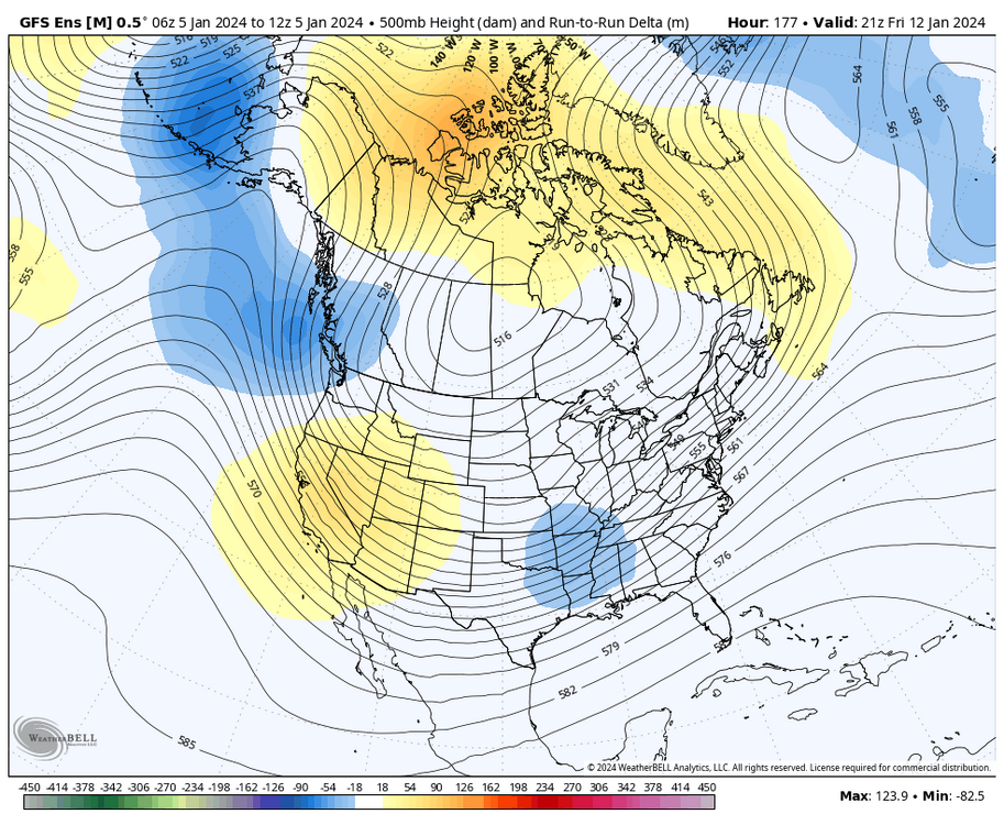
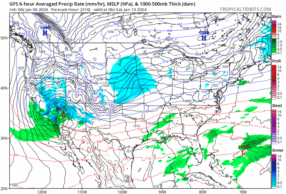
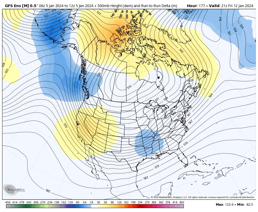
00z gfs now has the low next Friday down south over northern LA vs Midwest. Let’s see what happens in next few frames.
-
2
-
-
Just now, Terpeast said:
I’m in between 2 pws. 29 and 26
Round down to 26.
-
3 hours ago, WeatherShak said:
27 degrees. Posted up halfway between Hagerstown and Cumberland at around 1500 feet.

You’re in a great spot for this, enjoy!
-
2
-
-
3 PWS in our neighborhood are 29, 30, and 31. I’ll just go with the coldest at 29.

-
1 hour ago, NorthArlington101 said:
did we lose psu?
He’ll probably get a “surprise” 8” tomorrow.
-
2 minutes ago, Paleocene said:
Currently 12 degrees in downtown silver spring, expecting heavy snow and 6-12" accumulations
White out at times probably.
-
 1
1
-
-
1 hour ago, RIC_WX said:
26/16 DCL, 2595’. The valleys on the ride in this evening were 19-23 on the car thermometer.
The woodstove is ripping now too
Wish we were there this weekend. Enjoy it with the upslope too. 28 at 2800’ but sadly not that here at 150’.
-
 1
1
-
-
21 minutes ago, Alfoman said:
What would it take to bring this south and maybe turn it into a Miller B transfer in a favorable spot for the MA for next weekend?
The term Miller B is banned here.
-
1
-
-
10 minutes ago, DDweatherman said:
Checked a low of the locations in NW AR, a few that are 32-34 with snow & mix were forecasted for 38-39 and rain. Radar is juicy here early on. Nice plume of GoM moisture.

-
1
-
17
-
-
1 minute ago, clskinsfan said:
Its radar watching time now. Tons of moisture getting tapped out of the gulf right now. Probably why the GFS juiced up a little bit.
Good luck out there! I think these are the types of events that can surprise.
-
4
-
-
43 minutes ago, RickinBaltimore said:
Sadly, the Ravens have no control over that. Even if the Steelers lose, a Jacksonville loss and Denver win puts them in.
Ah, thanks! I hadn’t looked at their scenarios too closely.
-
Go south, yee low pressure
-
4
-
1
-
-
2 hours ago, CAPE said:
The Ravens signing of Dalvin Cook is interesting. Cant hurt, given the lack of depth at RB with the injuries. I could see them designing a few plays for him to get him out in space- maybe similar to Keaton Mitchell. Not saying he has that kind of speed, but he should have fresh legs after rotting on the bench all season with the Jets.
Just please beat the Steelers so they’re knocked out of the playoffs.
-
3
-

January 2024 Banter
in Mid Atlantic
Posted
Don’t worry, there’s plenty of things to make fun of you about, this included.