MotoWeatherman
-
Posts
2,294 -
Joined
-
Last visited
Content Type
Profiles
Blogs
Forums
American Weather
Media Demo
Store
Gallery
Everything posted by MotoWeatherman
-

2025-2026 Fall/Winter Mountain Thread
MotoWeatherman replied to Buckethead's topic in Southeastern States
Shade under 3 so far at 4650 on Beech. Meh... Temp is 9.7 -
2025-2026 Fall/Winter Mountain Thread
MotoWeatherman replied to Buckethead's topic in Southeastern States
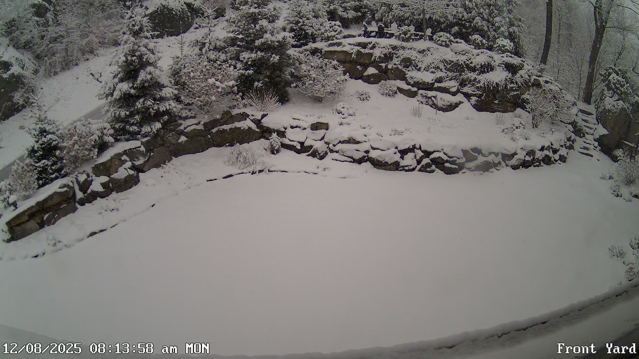
Solid 3 inches here at 4650 on Beech. Nice surprise amount!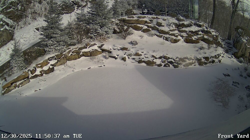
-
2025-2026 Fall/Winter Mountain Thread
MotoWeatherman replied to Buckethead's topic in Southeastern States
I have to admit I was fully expecting a ruler pic of 5+ inches on the board. In my opinion it underperformed for your location. -
2025-2026 Fall/Winter Mountain Thread
MotoWeatherman replied to Buckethead's topic in Southeastern States
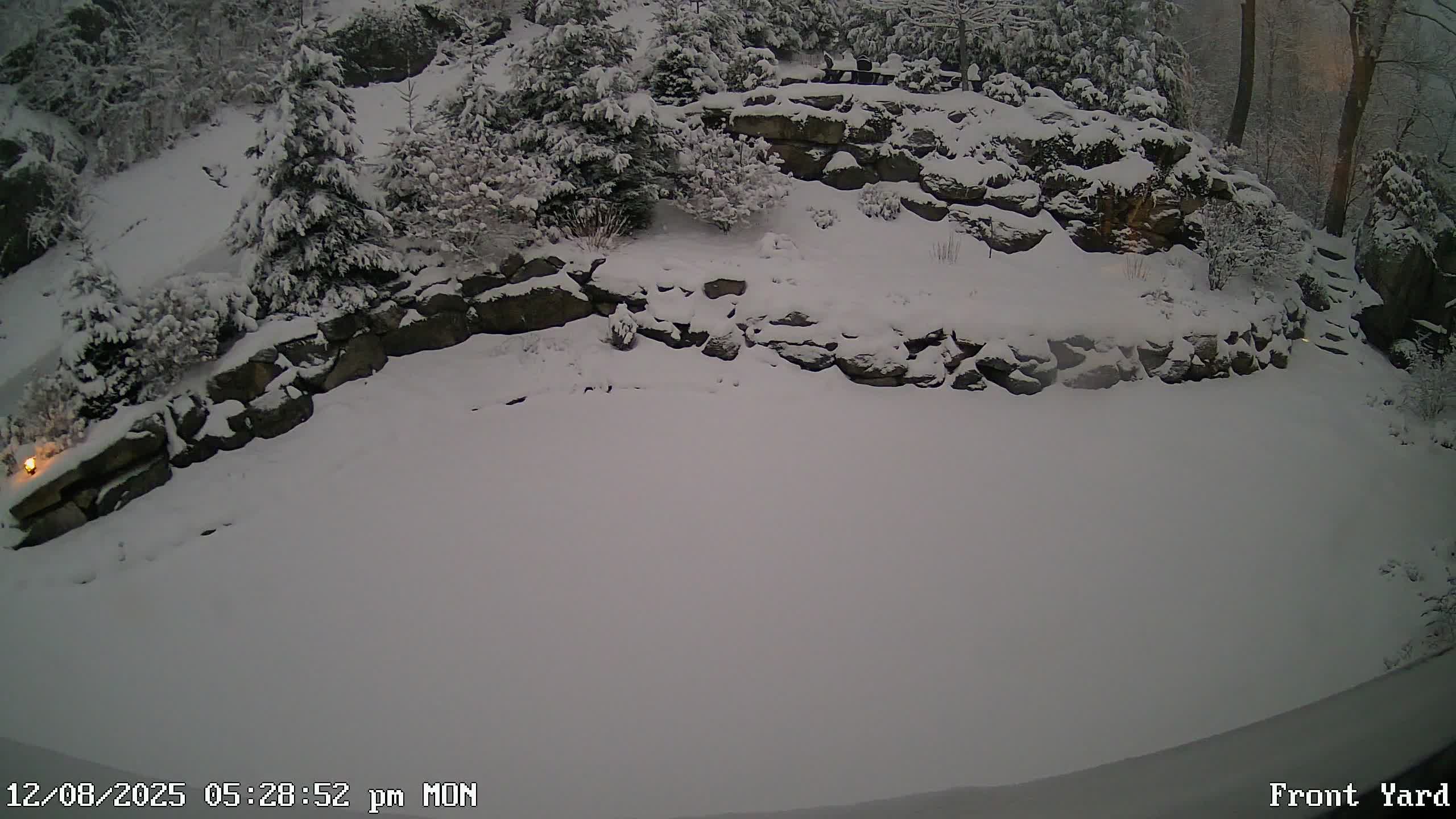
3-4 new inches at 4650 on Beech and the flow snow is still hanging on. CamWest-00-083038-083044.mp4 -
2025-2026 Fall/Winter Mountain Thread
MotoWeatherman replied to Buckethead's topic in Southeastern States
One other pic of the front yard area.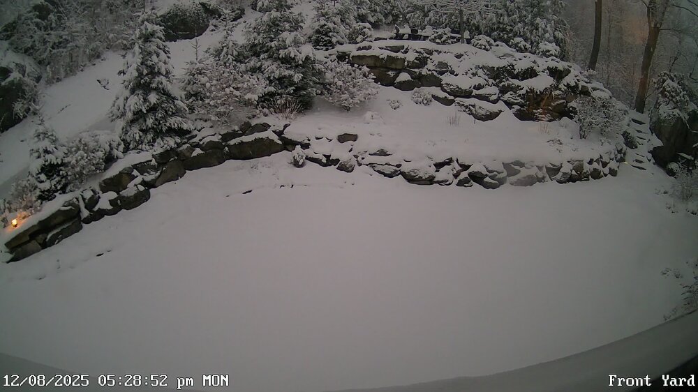
-
2025-2026 Fall/Winter Mountain Thread
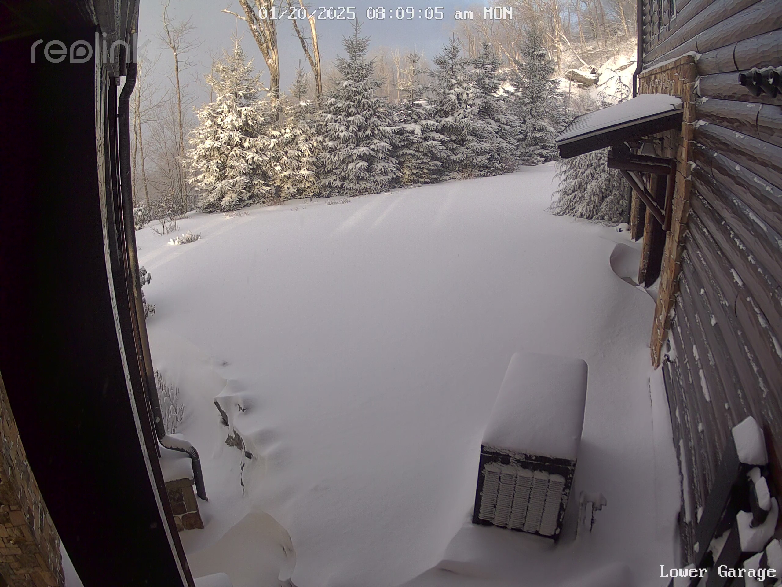
MotoWeatherman replied to Buckethead's topic in Southeastern States
At least 6+ here at 4650 on Beech. Winter wonderland. Another inch or two coming Wednesday night and maybe again on Friday.
-
2025-2026 Fall/Winter Mountain Thread
MotoWeatherman replied to Buckethead's topic in Southeastern States
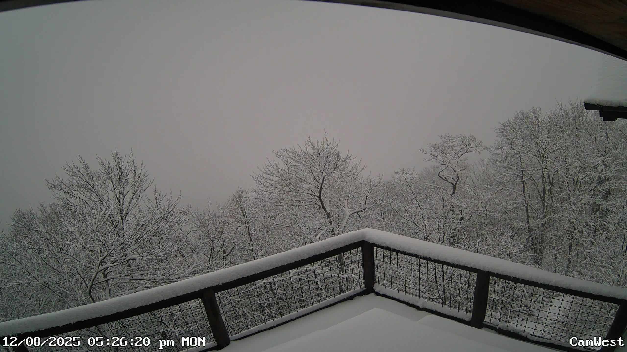
Another view from 4650 on Beech.
-
2025-2026 Fall/Winter Mountain Thread
MotoWeatherman replied to Buckethead's topic in Southeastern States
Almost 4 here at 4650 on Beech mtn. What a rare windless snowfall where everything just lays.
-
2025-2026 Fall/Winter Mountain Thread
MotoWeatherman replied to Buckethead's topic in Southeastern States
Finally getting a few random flakes here at 4650 on Beech. HRRR does not look promising to say the least. -
2025-2026 Fall/Winter Mountain Thread
MotoWeatherman replied to Buckethead's topic in Southeastern States
Yeah...can't say I don't have wind issues. LOL. I'm slightly exposed to the NW wind thinning things out. LOL -
2025-2026 Fall/Winter Mountain Thread
MotoWeatherman replied to Buckethead's topic in Southeastern States
Man I swear you spot is gold for snow and cold. I'm on Beech higher up and you just about always have higher totals and colder temps. Nuts. Perfect location!!! Makes me think about looking in your area. I'm at 13 as of 8pm and about 3 inches. -
2025-2026 Fall/Winter Mountain Thread
MotoWeatherman replied to Buckethead's topic in Southeastern States
Nothing so far at 4650 on Beech but rain. -
2024-2025 Fall/Winter Mountain Thread
MotoWeatherman replied to Buckethead's topic in Southeastern States
Easily 6+ here at 4650 on Beech.
-
2024-2025 Fall/Winter Mountain Thread
MotoWeatherman replied to Buckethead's topic in Southeastern States
Really coming down now on Beech. Flow looks set to last at least thru lunch.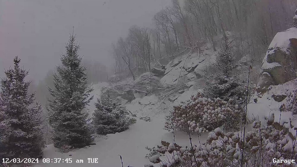
-
2024-2025 Fall/Winter Mountain Thread
MotoWeatherman replied to Buckethead's topic in Southeastern States
Wow...winner for sure. Only 1-2 here on Beech. It did show the best moisture focus on the mid to southern mountains but not that much moisture. Congrats!! -
2024-2025 Fall/Winter Mountain Thread
MotoWeatherman replied to Buckethead's topic in Southeastern States
Yeah GFS and EURO both look decent for another 1-2 inches tonight. Moisture thru 700mb until 1am or so. Plus 850's getting even colder which will only make the snow more dry and fluffy. -
2024-2025 Fall/Winter Mountain Thread
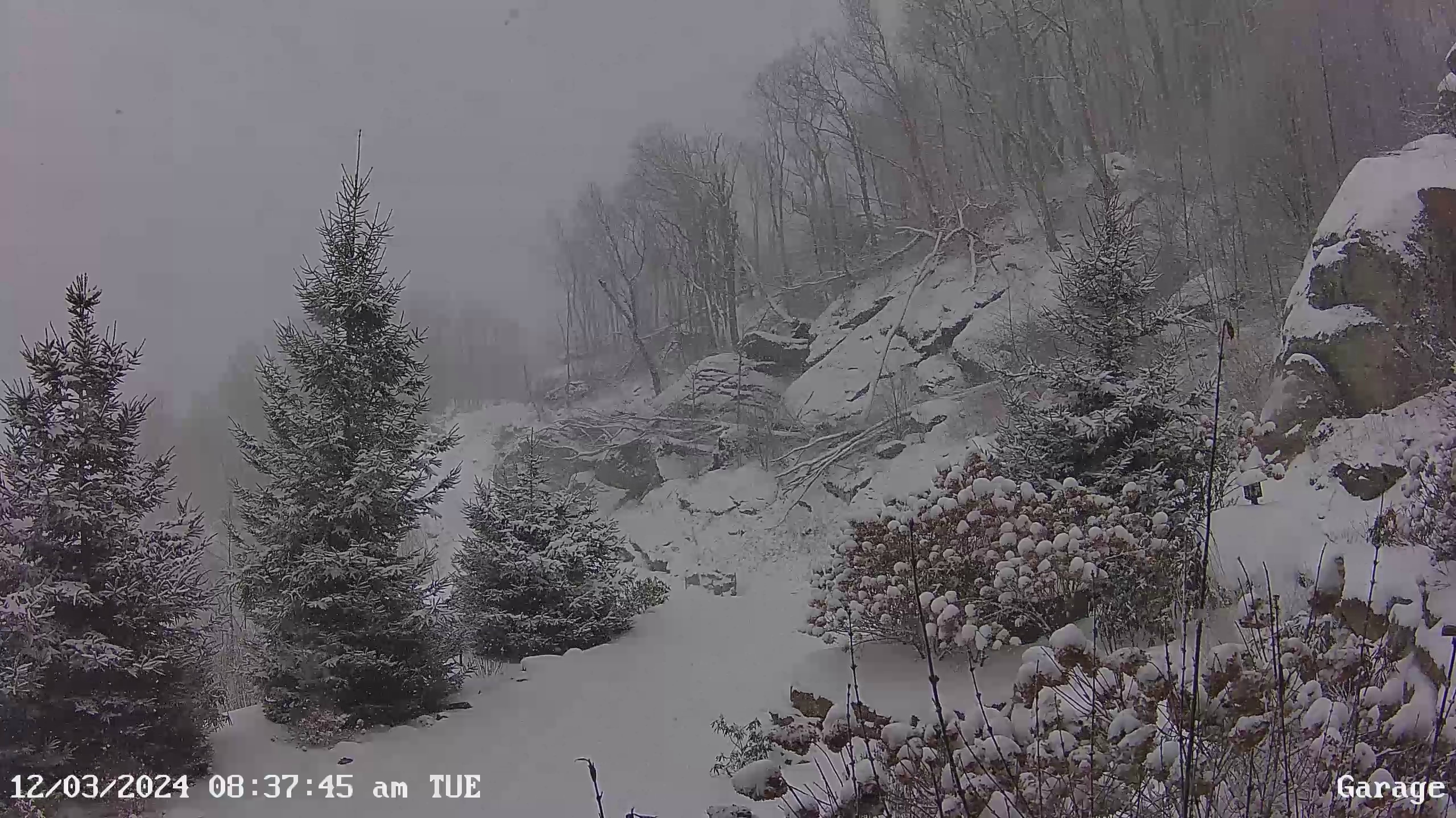
MotoWeatherman replied to Buckethead's topic in Southeastern States
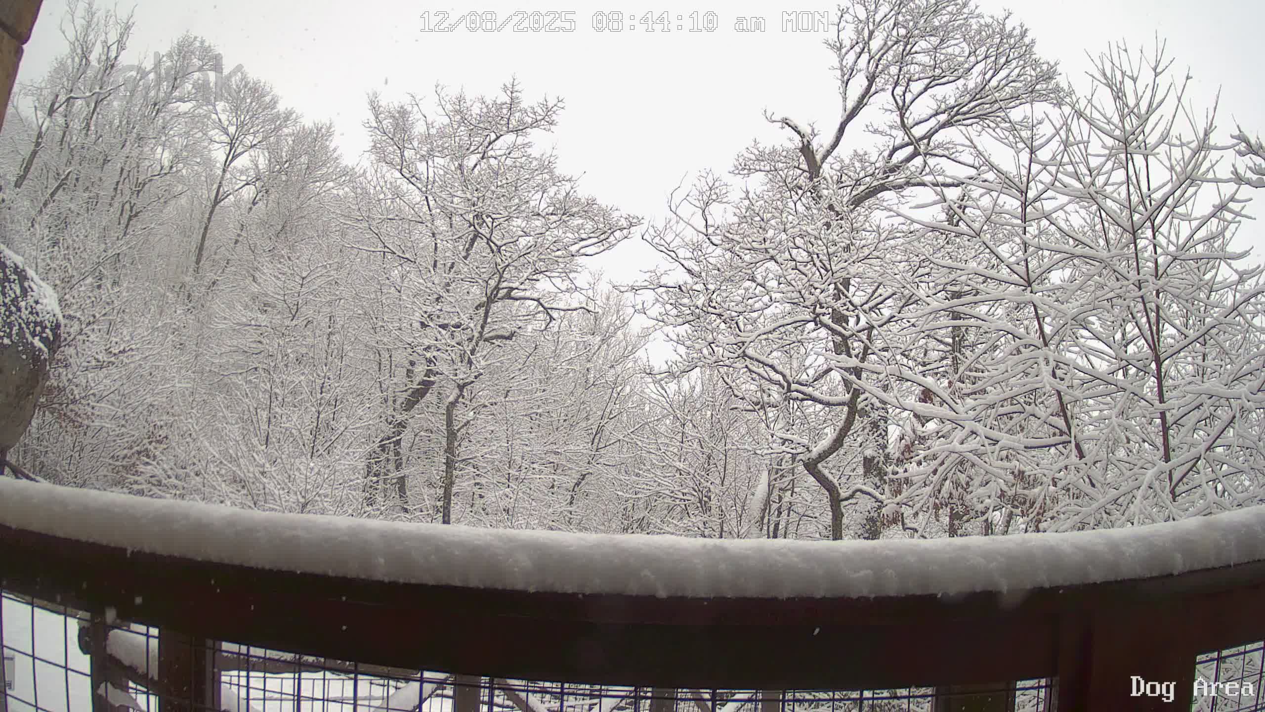
Still getting flurries at 4650 on Beech. For depth reference that table is 1 inch thick.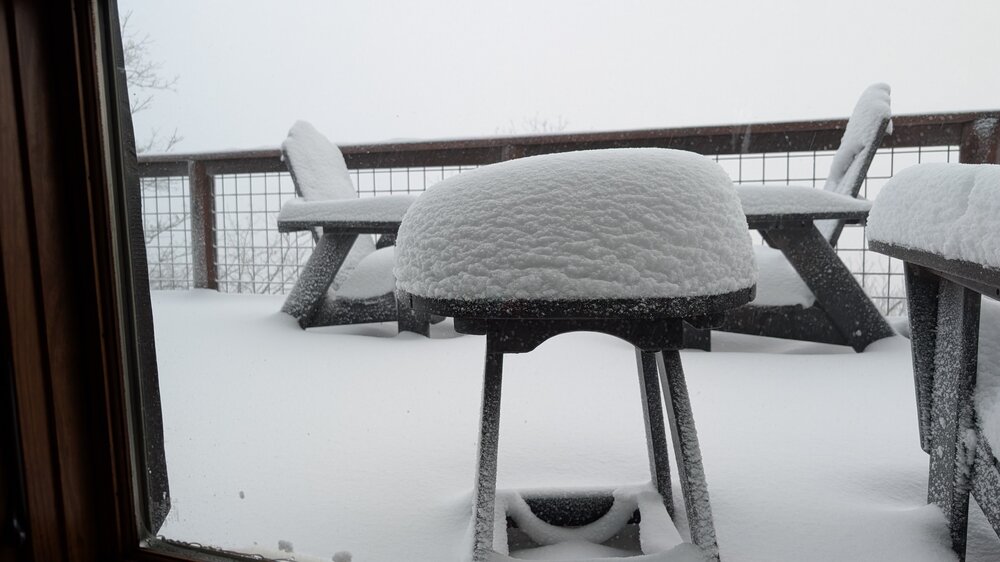
-
2024-2025 Fall/Winter Mountain Thread
MotoWeatherman replied to Buckethead's topic in Southeastern States
Incoming round for this evening for the northern mountains, especially. Another inch or so perhaps.
-
2024-2025 Fall/Winter Mountain Thread
MotoWeatherman replied to Buckethead's topic in Southeastern States
Actually off the western ridge of beech MTN past their emerald outback trails. -
2024-2025 Fall/Winter Mountain Thread
MotoWeatherman replied to Buckethead's topic in Southeastern States
Solid 2-3 and coming down here at 4650 on Beech. 5-6 total looking more likely. -
2024-2025 Fall/Winter Mountain Thread
MotoWeatherman replied to Buckethead's topic in Southeastern States
Solid inch or so at 4650 on Beech.
-
2024-2025 Fall/Winter Mountain Thread
MotoWeatherman replied to Buckethead's topic in Southeastern States
Steady snow at 4650 on Beech. 32.2 and everything is covered. Might be able to eek out an inch before all is said and done. Cam East-00-214727-214730.mp4 -
2024-2025 Fall/Winter Mountain Thread
MotoWeatherman replied to Buckethead's topic in Southeastern States
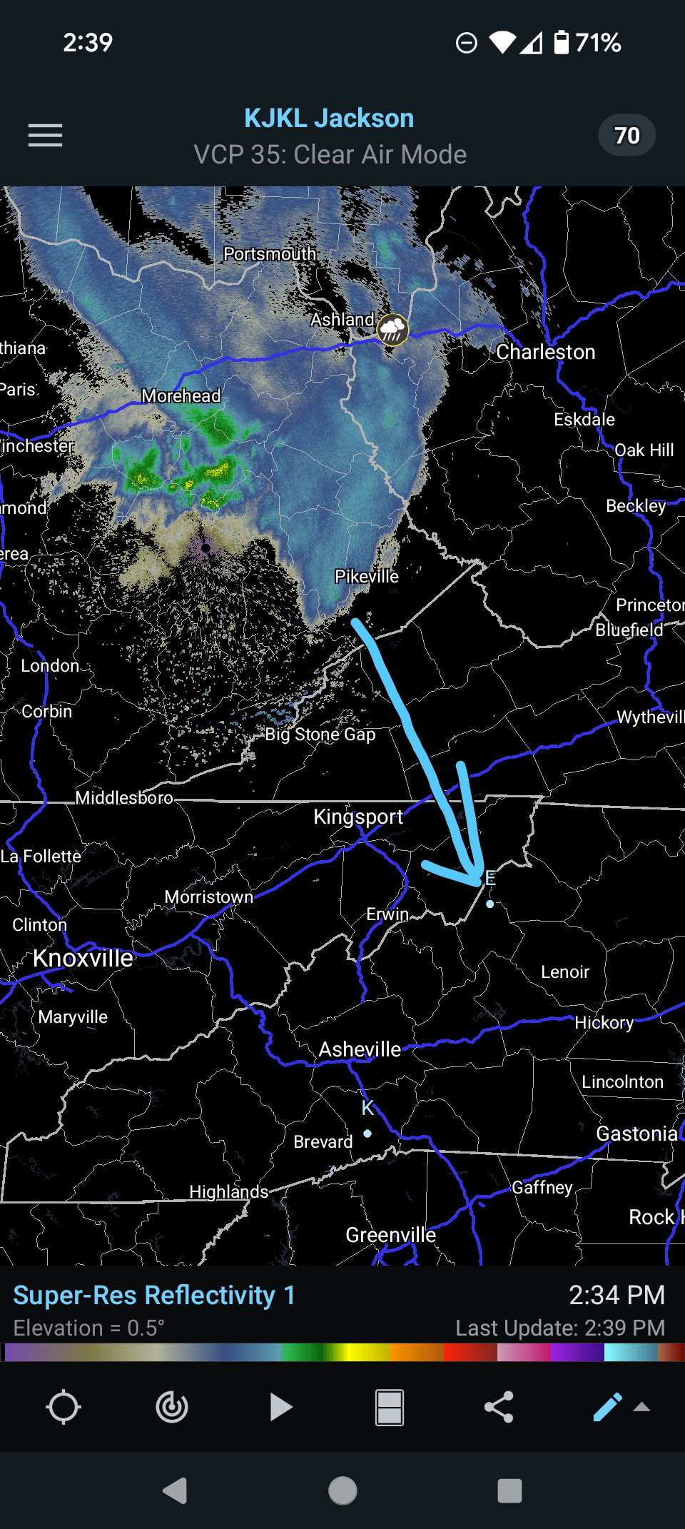
I think this looks pretty accurate. Based on what I'm seeing I would estimate a 6-8p Tuesday timeframe for showers to switch over to snow showers. Moisture will extend past 700mb in the beginning window of 8p-11p Tuesday. From there it's just 850mb moisture with cooling 850 temps in early AM Wednesday. -
2024-2025 Fall/Winter Mountain Thread
MotoWeatherman replied to Buckethead's topic in Southeastern States
Hope everyone is safe from Helene. Forgot to post this clip from the max of the storm. This was 850am Friday Sept 27th. At this point in time we were on generator power but still had fiber internet before that got all shut down 24 hours later. I recorded a max wind gust of 83 mph out of the East. Thankfully nothing fell on our place. After this the generator ran for 9 straight days before power came back on. My son was up there with his wife and friends as all this happened. They actually managed to get out Sunday morning the 29th and make it back to GA. CamWest-00-095010-095023.mp4 -
2023-2024 Fall/Winter Mountain Thread
MotoWeatherman replied to The Alchemist's topic in Southeastern States
Just over an inch here at 4650 on Beech. 30 degrees WX Station-00-222826-222830.mp4