CoastalWx
-
Posts
175,995 -
Joined
-
Last visited
Content Type
Profiles
Blogs
Forums
American Weather
Media Demo
Store
Gallery
Everything posted by CoastalWx
-
Bringing Kevin back to the days of when he walked into the boys room and caught kids smoking, and then got a swirly to make sure he doesn’t tell the teachers.
-
Of course there is luck, but you’re saying everything happens for a reason. Well true I guess. But let’s say you have an overall favorable pattern or a SSW for example. Maybe the cold goes to Europe instead. That’s bad luck in a way because you know those can be favorable here, but sometimes it’s the other side of the globe getting it. Same with a favorable pattern. Let’s say you have a nice big ridge out west. Normally a good thing. You then have a Scooter shit streak in Canada that’s just enough to keep the flow up there from buckling. Instead of a low curling up the coast, it’s out to sea. Those are the little minor things that sometimes happen. You can’t see them days in advance. I said this yesterday. People have no idea what it takes to get a good streak of winter weather going. The ennui as Ray would say is more common in winter around here. We don’t average a whole lot of snow overall. Get used to it. People have been spoiled by recent winters. Back to reality.
-
Also, how is this snowless through end of January? Are we getting a little dramatic here?
-
Nothing has changed too much. Just some bad luck and distinct disturbances you cannot forecast that may or may not occur. That’s how it goes sometimes. Persistence is the worst way to forecast.
-
A bolt of lightning!
-
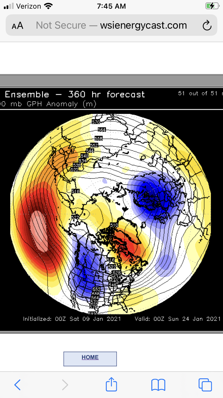
EPS tends to be the better guidance so therefore that is favored. However, that is not always the case, and a compromise can always happen. But the GEFS are less skillful.
-
I think anything is more next weekend and beyond. Quiet week.
-
Euro is an interesting look next weekend. Much better than before.
-
Nice storm day 9-10. With all the weenie stuff aside, something will pop. Still have good meridional flow along with the Atlantic.
-
Just mirrors and manginas.
-
Ray are you by yourself?
-
It’s like all or nothing with you guys lol.
-
Well that’s not hard to say lol. I don’t think people realize what needs to go right to get these epic stretches. Like, everything needs to be located and timed right, with some luck sprinkled in. Special stretches in winter aren’t because we have a +PNA or -NAO. Those features just help to have things go right. Special stretches are because everything was located and timed with precision.
-
For what? I didn’t say or call anything. In fact if the EPS is right, it certainly falls short of what I thought. But whatever. Maybe when we shake this mundane, mind numbing pattern, we can squeeze something in.
-
When is ‘10-‘11 coming? Asking for a friend.
-
Some light snows on Plymouth county. Poor James needs to realize the cape doesn’t get much OES.
-
No idea, but a friend of mine in the UK sent that to me. Pretty epic.
-
Ray last night.

-
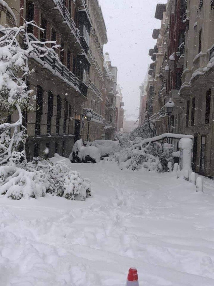
Yeah we’ll see. That wouldn’t be a quiet look anyways. And Christ look at Madrid.

-
Madrid had a hell of a snowstorm. Congrats Europe.
-
We regress. And the Pacific? Meh.

-
I have green flwr stems In sun torched spots coming up. It’s been happening like every year it seems.
-
Nice Bob. I think KTAN is a little warm During the day.