
allgame830
-
Posts
2,539 -
Joined
-
Last visited
Content Type
Profiles
Blogs
Forums
American Weather
Media Demo
Store
Gallery
Everything posted by allgame830
-
Lol…. Told him to wait it out…. Second low is delivering in big fashion!
- 1,529 replies
-
- 1
-

-
- hurricane
- tropical storm
- (and 1 more)
-
Ya I get it! But let the second play out first before saying it’s a bust…. That’s where the rain was mostly coming from anyway
- 1,529 replies
-
- 1
-
-
- hurricane
- tropical storm
- (and 1 more)
-
This omg it’s a bust is annoying the big rain wasn’t supposed to start until late tonight into tomorrow…. Let it play out folks!
- 1,529 replies
-
- 2
-
-
- hurricane
- tropical storm
- (and 1 more)
-
So clouds versus sun is an epic bust lol really????
-
Sun is out here hopefully that will get things going. Need that rain badly!
-
Do you think cells will start to fire off NW of the city we have been bone dry for weeks??
-
Thank you! So it seems to me there is still plenty of time for a nice line of storms to form which you can see that happening currently north of BGM. Guess have to see if the line fills in south to Williamsport. Correct?
-
Where is the front currently located?
-
 34 degrees now was 40 less than an hour ago with all snow
 -
Honestly your posts are ridiculous and all about your backyard. No wonder why you been 5 posted. @Rjay@BxEngine i know this is banter but please leave it
-
Its not meager 7 miles north of I-287 in Westchester........
-
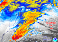
January 28/29 Blizzard Observations/Discussion/Nowcasting
allgame830 replied to Northof78's topic in New York City Metro
Please can someone post a good link for a radar? -
January 28/29 Blizzard Observations/Discussion/Nowcasting
allgame830 replied to Northof78's topic in New York City Metro
What’s the radar link to this? -
There were more recon out this afternoon right??
-
ya still thinking the same thing LOL... im sure you are but figured id ask
-
-
Yes true but like stated in the NE forum... we are in "grey" area now with models where we wait for the MESO models to kick in and help out with this... I think the RAP AND HRRR are becoming much more important to look at this point as well as the 3k NAM and etc.
-
a low consolidated further west
-
can someone post a map for the NAM.... I did not see one
-
@Joe4alb so sorry for your loss. My condolences and prayers to you and your family!
-
.... and so that makes it right LOL... it literally has NO model support at this time. It’s on its own island.
-
Now how does this compare to last run??
-
No the recon missions aren’t until tomorrow.
-
True... but its still fun to look at
-
Post a map for the hell of it LOL
