

Animal
-
Posts
6,320 -
Joined
-
Last visited
Content Type
Profiles
Blogs
Forums
American Weather
Media Demo
Store
Gallery
Posts posted by Animal
-
-
18z gfs was decent. 5-8 for the area.
storm feels legit....
-
 1
1
-
-
52 minutes ago, Newman said:

Archive this map!!
-
2
-
-
Canadian hammers the southern snow belt of philly metro!!
-
1 hour ago, Ralph Wiggum said:
EPS mean qpf VERY impressive with a 6" snowfall mean even in my central Bucks neighborhood.
Morning afd from mt holly.
Monday depending on track of 1st low rain...some snow may be possible northern perimeter.
wednesday - hedging bets rain south and a mix bag north.. need to check back frequently it was noted as the Monday storm track is still to early to call!!
-
I would be shocked if the storm hits as the euro &12z gfs indicated today.
very rare that a storm locks in 6-7 days out as modeled.
-
5 minutes ago, Ralph Wiggum said:
Could go either way, but with a -AO/-NAO tandem in place, I will take my chances. If the look up.top holds, I expect the CAD look to increase and the setup to slowly tick colder as the event gets closer. Good to see this type of setup tho. But before buying gas for the snowblower or 20 pounds of ice melt, need to remind myself this is 6 days out and much could change. But great to have an actual trackable event. Feeling somewhat optimistic on this one given the looks up top....if they hold.
Agree.
down in the south..we track rain...
any snow is a bonus.
-
15 minutes ago, Ralph Wiggum said:
Euro is a big hit, especially NW of the fall line.
Not much in the southern snow belt of philly..any ticks n&w its ova
-
2 hours ago, RedSky said:
First moderate snowfall potential on the ECM day 7
Mt Holly morning afd mentions it has to keep an eye on it...
-
5 hours ago, Birds~69 said:
Possibly a couple flurries early Wednesday? But what I'm really looking forward to are the 55-60F temps Sat...woo hoo!
28F @ 11:10pm
Mt Holly morning afd noted this.
would not be shocked if northern areas got a decent car topper or 1/2 inch.
-
Interesting piece of equipment.
how does it measure rain exactly.
***found the answer. Hepatic rain sensor.
mounting seems to be on a pole or fence post...not the best for measuring winds.
-
1 minute ago, PhineasC said:
6 inches, 31 degrees here in Millville, DE.
Your up for likely 20 when the flakes stop.
-
14 minutes ago, DotRat_Wx said:
This storm blows damn radar site
A good bust builds character.
DT posted last night that he was going low with snow totals. Dew points.
sorta surprised to read the berks got skunked!!
-
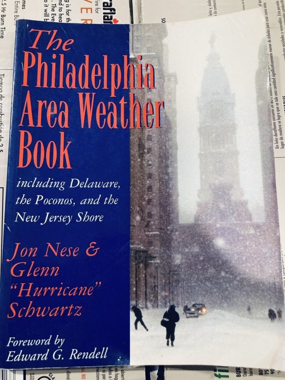
Final 1.12 of liquid.
had to dust off an old book I got years ago. needed to review the big events for the area and what occurred.
-
1
-
-
1.06 of liquid at 7 am
-
Been raining here this morning.
did not expect it start until late tonight..
-
Light snow in upper Chichester
-
Just now, Animal said:
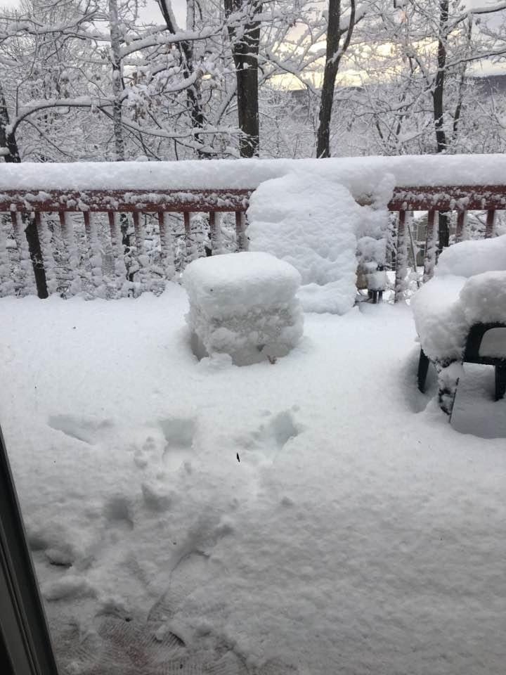
2016 snow dump higher terrain.
this day ....

8-9 inches..official was 9.3
-
2016 snow dump higher terrain.
this day ....
-
 1
1
-
-
16 minutes ago, RedSky said:
Yeah you may be missing out on all the little dink and dunk amounts but then there are those occasional death bands only areas closer to the coast get blasted with.
It always depends on the track of the storm. I never got the epic storm in highland lakes nj....biggest was 22 (7 urs)inches in a dump... phl airport gets the big tail right.
-
20 hours ago, ChescoPaWxman said:
Did you move back down? Is that outside of Marcus Hook near Delaware line?
The hook is 4-5 miles from my house.
Delaware home of tax free shopping is just down the road some.
5 hours ago, RedSky said:How grim, a ton less snow now for you
 buckets of rain at 33F
I am perched on a slight hill..not sure if this impacts the rain drop density.
All kidding aside, glad to be back in the metro area.
-
1
-
-
Greetings all,
just got back to the philly area after a long stay in our sister state.
located in the southern snow belt in Upper Chichester...booths corners is just down the road!!how much rain are we tracking this winter?
-
 1
1
-
-
3 hours ago, wdrag said:
I want to close with a few pieces of information, including graphics for Isaias-tropical connection.
Borrowed this written piece from Ramblin Red post on tropical forum:
Good article on the effects of the storm from the Wash Post.
78 mph: The wind gust clocked one mile southwest of Battery Park City in Manhattan and in Farmingdale, on Long Island. Numerous gusts reached around 70 mph in the New York City boroughs, including at JFK and La Guardia airports, both located in Queens.
Oak Island, N.C.: 87 mph
Cape May, N.J.: 75 mph
Ocean City, Md.: 74 mph
McClellanville, S.C.: 78 mph
Dewey Beach, Del.: 68 mph
Assateague, Va.: 68 mph
Wallops Island, Va.: 68 mph
Atlantic City, N.J.: 66 mph
Norfolk: 61 mph
Virginia Beach: 59 mph
Richmond: 51 mph
146 mph: The wind gust measured at the top of Mount Washington, N.H., the highest on record there in the month of August.
115: The number of tornado warnings the National Weather Service issued over the storm’s duration.
33: The number of tornado reports associated with Isaias that the National Weather Service Storm Prediction Center received Monday and Tuesday.
Nine inches: The rainfall in Sotterley, Md., in St. Mary’s County, less than 60 miles southeast of Washington. Widespread rainfall totals along Isaias’s path reached three to six inches, with localized amounts between six and nine inches. Some of the heaviest rain fell from eastern Virginia through Washington’s eastern suburbs in Maryland into eastern Pennsylvania and southern New York.
-------------
First image: Leftover power outages 48 hours after Isaias passed. Rainfall, departure from norm and percent departure from normal Aug 1-5 (ending 12z/5). Guidance was on the right track...just a bit too far east of the reality. No classic PRE occurred because no surface high north of us and not enough separation between the hybrid PRE late Monday-early Tuesday and Isaias. Finally, a little more detail in the last image with the NWS MARFC radar-platform integration of rainfall (7- near 10" in brown) Not much more I can add. I think 70 MPH gust event was pretty good for our coastal areas and that the HRRRX wind gust predictor while maybe 10 kt high at 24 hours was very accurate within 12 hours. 829P/6


Walt,
I am confident a twister hit highland lakes sweeping the tree tops.
my house lost 6 tree tops...I have photos. Micro burst or twister people nears my house lost tree tops ..tops of trees
-
1
-
-
On 8/5/2020 at 8:05 PM, Animal said:
Still around 800 meters no power in highland lakes .
Apparently crews from Pennsylvania are on site. Recording indicated hit hard with numerous telephone poles and trees down. Rt 515 still closed. Lots of tree damage.
It’s actually rough up here.
got photos of streetS when the storm hit.
Debris everywhere 1/4 mile area through the ridge
trees tops killed.
Straight line winds killed areas up here.no news etc
-
Feel confident that Highland Lakes on the ridge line has an extreme burst of mixing that hit 1/3 mile area by 3 miles.
my yard got thrashed with stuff..crows fly lots more.
photos to follow
-
 1
1
-


E PA/NJ/DE Winter 2020/2021 OBS Thread
in Philadelphia Region
Posted
Keep reading...it to warm to snow or it’s a white rain from the no it all’s.