

Ginx snewx
-
Posts
103,060 -
Joined
-
Last visited
Content Type
Profiles
Blogs
Forums
American Weather
Media Demo
Store
Gallery
Posts posted by Ginx snewx
-
-
37 minutes ago, dendrite said:
A little bit more and she can feel it
Your fired
-
17 minutes ago, WxWatcher007 said:
Not bad

Crushed

-
 4
4
-
-
6 minutes ago, CoastalWx said:
1.6” with most of that in 15 min. Avg near 5”/hr in that.
Crushed
-
1
-
-
5 minutes ago, Damage In Tolland said:
Nam south of here and HRRR north. At least we miss this one
18Z Euro has .8 here
-
35 minutes ago, powderfreak said:
It’s true, if you see a bear video on social media from a black bear doing something funny, it’s like either from VT or CT.
Theres a ton of bear content coming out of CT, mostly higher population and all with cameras now.
But yeah, I do notice it’s either VT or CT it seems like, and especially western CT into adjacent NY (like Columbia and Dutchess Counties).
I wish I could post videos on here. My buddy has one of a bear a couple weeks ago chewing on his Amazon package on his ring camera… another one has a bear rolling his grill off his deck.
Huge black bear in Willington at my buds campground .Vids and pics are crazy
-
1
-
-
11 hours ago, kdxken said:
I don't know about that. Beginning of next week looks pretty warm.
Talking about this weekend.
-
1
-
 1
1
-
-
No Stein No HHH . Perfect
-
1
-
 1
1
-
 1
1
-
-
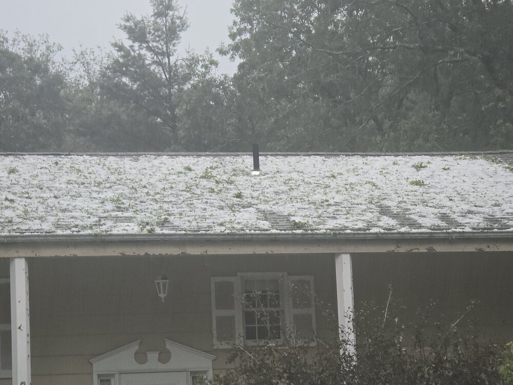
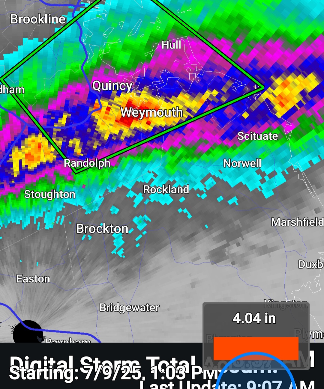
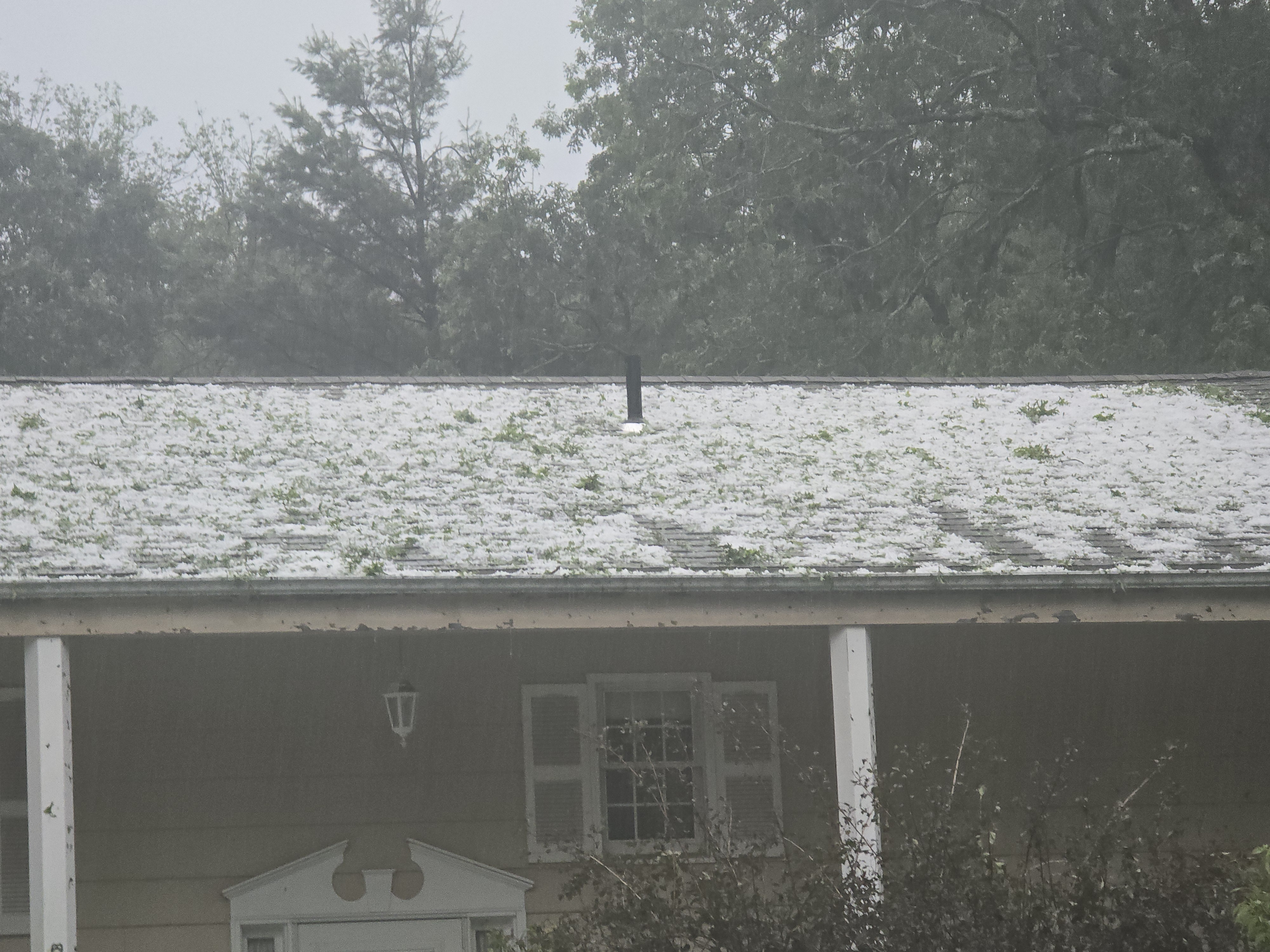
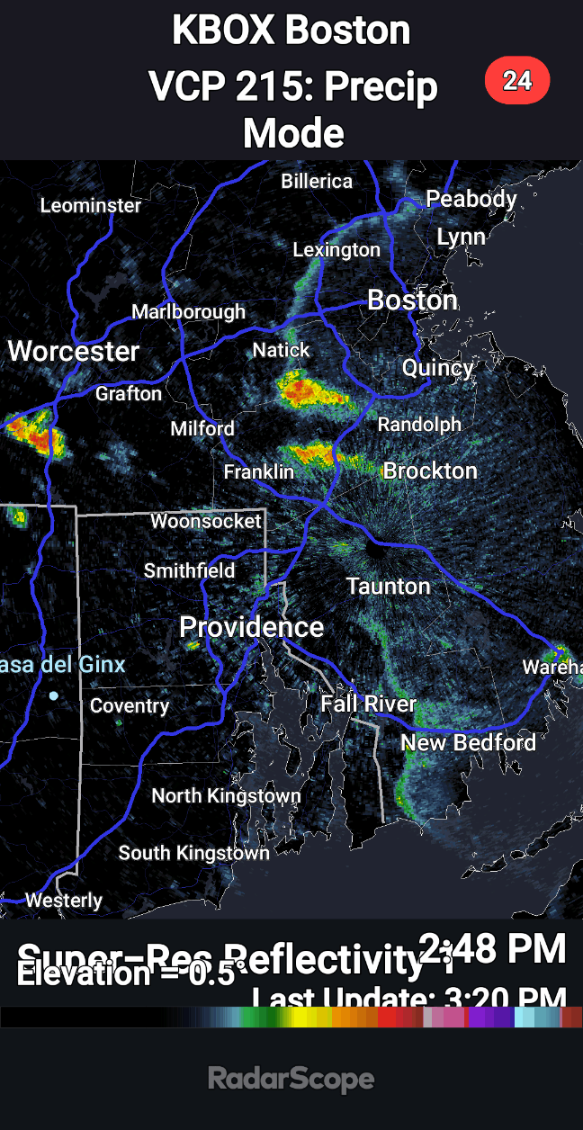
50 minutes ago, Modfan2 said:
Not sure if someone can look at the radar loop of the storm that came through E CT, thinking ping ping size hail or greater came through here
Golf balls reported
-
9
-
1
-
-
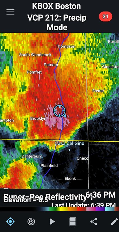
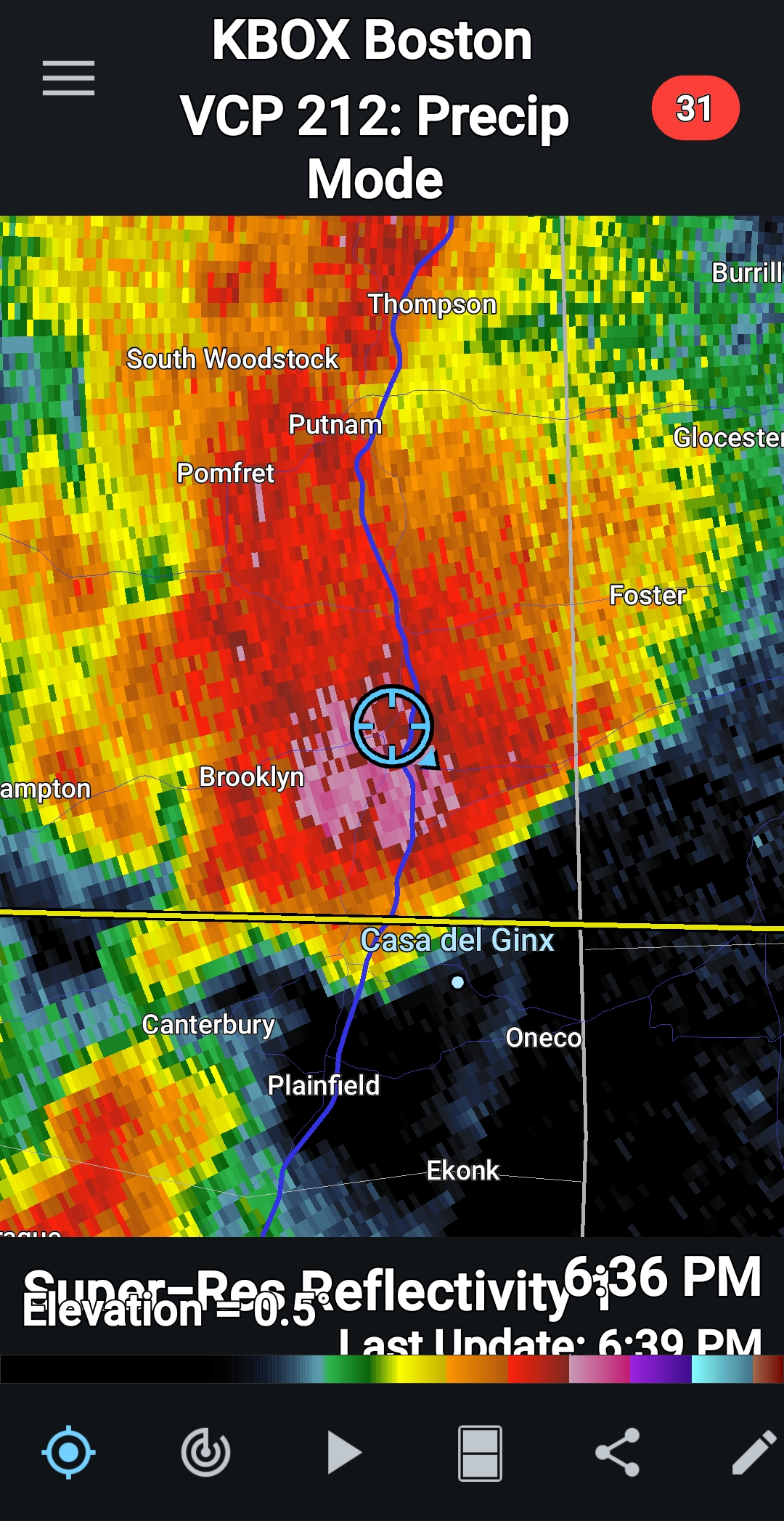
Just now, Modfan2 said:
Getting destroyed here not too far from you
Right under the core. Danielson FD just pulled out
-
6
-
1
-
-
Super intense storm at work in Danielson Ct
-
4
-
1
-
-
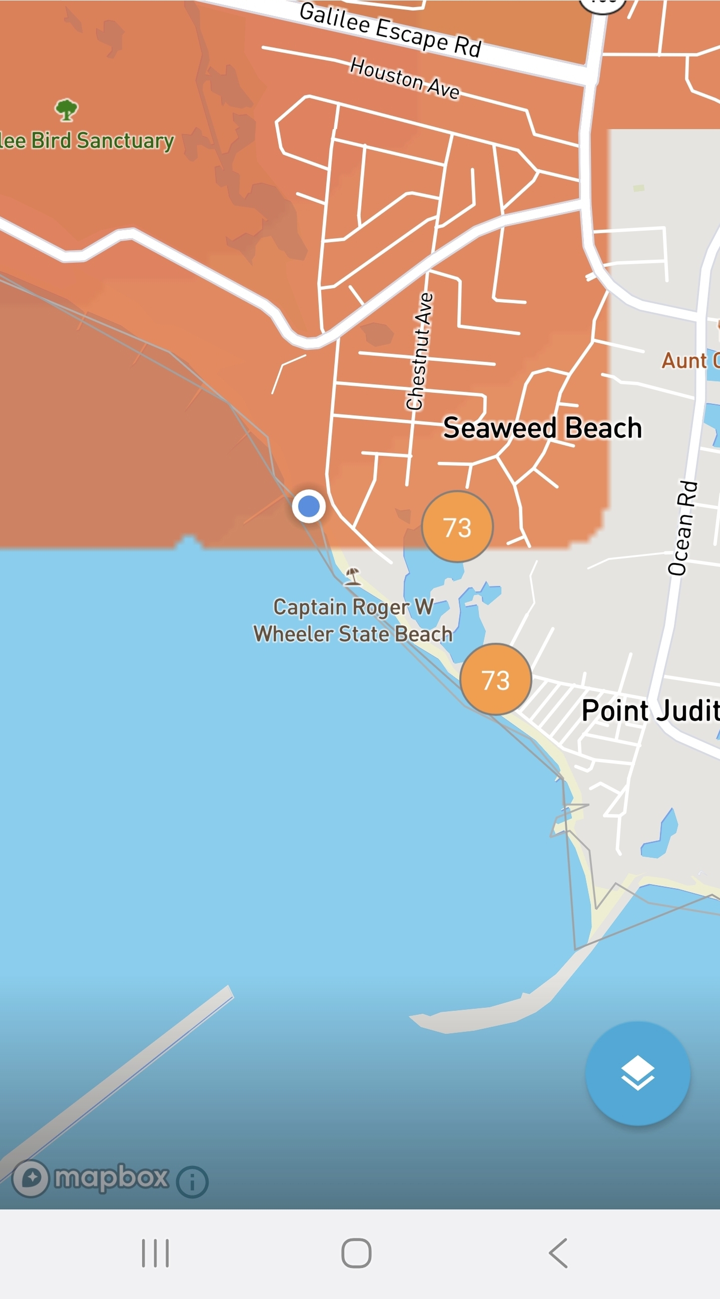
2 hours ago, BrianW said:
This is the spot for the ACATT crew. Been 73-75 here most of the day at Roger Wheeler Beach/ Pt Judith in RI.
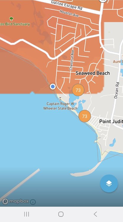
Why we love SRI
-
1
-
-
3 hours ago, CoastalWx said:
After such a wet May, he’s back with vengeance.

Lol isolated. Had .35 yesterday alone
-
 1
1
-
-
COC day
-
2
-
1
-
-
What is the June record 24hr temp drop for
-
1
-
-
Deluge
-
-
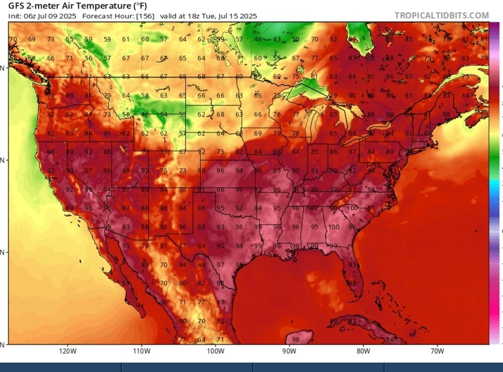
So so many big time heat waves end with a bang its unusual when they dont.
-
1
-
-
15 minutes ago, CoastalWx said:
Will struggle for 70 tomorrow lol.
AWT
-
1
-
2
-
-
53 minutes ago, dendrite said:
93.7/71
I think this is my warmest since 95.0F on 7/22/2011.
Now this is a real torch none of that bougie stuff the torch twins used to try to sell.
-
Last one?
-
33 minutes ago, dryslot said:
Lol

32 or 110 HI we are outside peeps

-
13
-
-
12 minutes ago, Jenkins said:
5 minutes obs at 99/65 for PVD. Can we get another degree?
Non tarmac sites in Warwick where PVD is confirms 100
-
These cold rain shots drop the water temp for days. Let's get a real streak of summer.
-
2
-
1
-
-
10 hours ago, powderfreak said:
BOS at 75/37 for 25% RH after 10pm is awesome. That’s a warm, dry, well-mixed breezy vibe. Mediterranean.
It's been a COC week with fans house is perfect
-
3
-


July 2025 Obs/Disco ... possible historic month for heat
in New England
Posted
1/48