

dendrite
-
Posts
67,959 -
Joined
Content Type
Profiles
Blogs
Forums
American Weather
Media Demo
Store
Gallery
Posts posted by dendrite
-
-
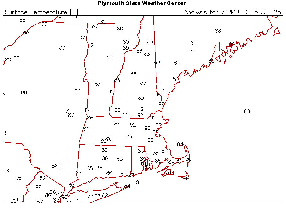
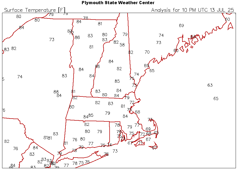
Widespread low 90s in the typical warm spots north of Pike.
Nary a cloud. What a day.
-
59 minutes ago, CoastalWx said:
Cuz big ticks up your ass is bad for your health?
Don’t hate the tick, hate the disease.
-
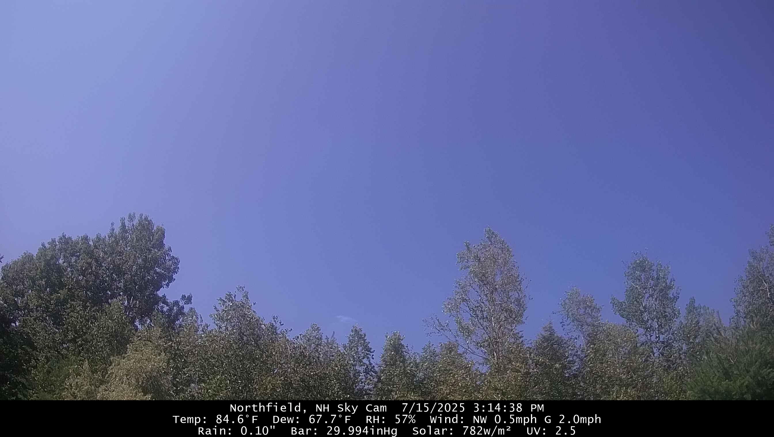
84.5/67
Should tickle 90° in S NH.
-
Ticks are relatively slow and take awhile to find a spot they like to latch into you.
Just gotta check yo self before you wreck yo self.
-
 2
2
-
 1
1
-
-
I’m well aware of the spraying. I just think I’d be shocked at how many actually do it…skeeters, ticks, grubs, etc.
If I find a tick inside I take it outside and set it free. That’s how I roll. lol
-
 1
1
-
1
-
 1
1
-
 2
2
-
 1
1
-
-
People spray for ticks too? Terrible. Let’s just kill everything.

Not scolding anyone here…I just hate what we’re doing to the environment and insects.
-
3
-
-
19 minutes ago, weatherwiz said:
You know its a hot pattern when a "trough" for us is still defined by heights ~5850 m
The troughs will be lower than that. You have 51 members in there.
-
1
-
-
29 minutes ago, HoarfrostHubb said:
First clear morning in a while here. Much better
Ditto. Kinda surprised after the rain last night.
-
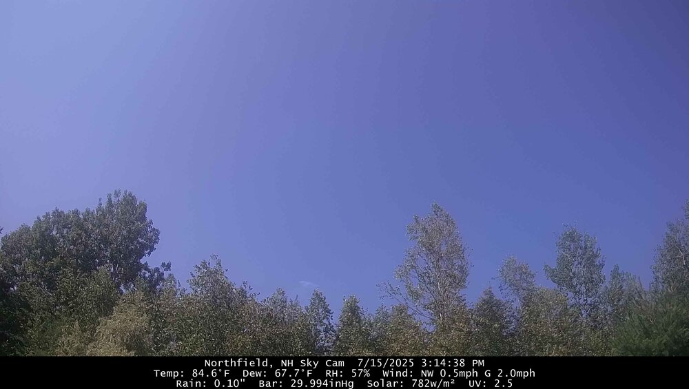
65.4°
Should be another warm one.
Euro and gfs both bring lower dews in the extended.
-
3
-
1
-
-
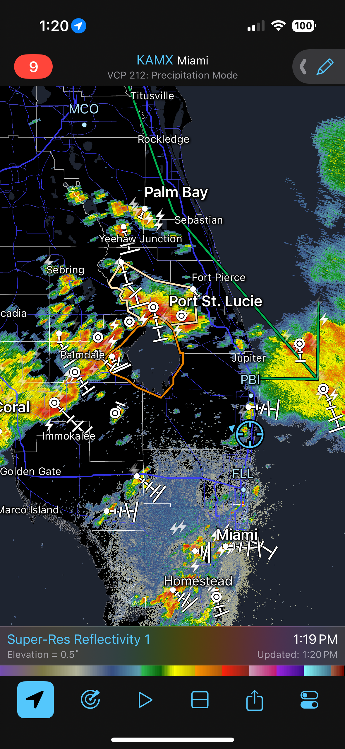
Tipper is plugged again. Finished with 0.69”.
-
69° +RA
Pouring. Needed this.
-
3
-
-
13 minutes ago, Torch Tiger said:
I respect it. Stein strong
Just him and his hydrangeas.
-
Nah he’s currently grizzly. Looks like he’s about to move off the grid to 3rd Lake and live off the land.
-
3
-
-
1 hour ago, Spanks45 said:
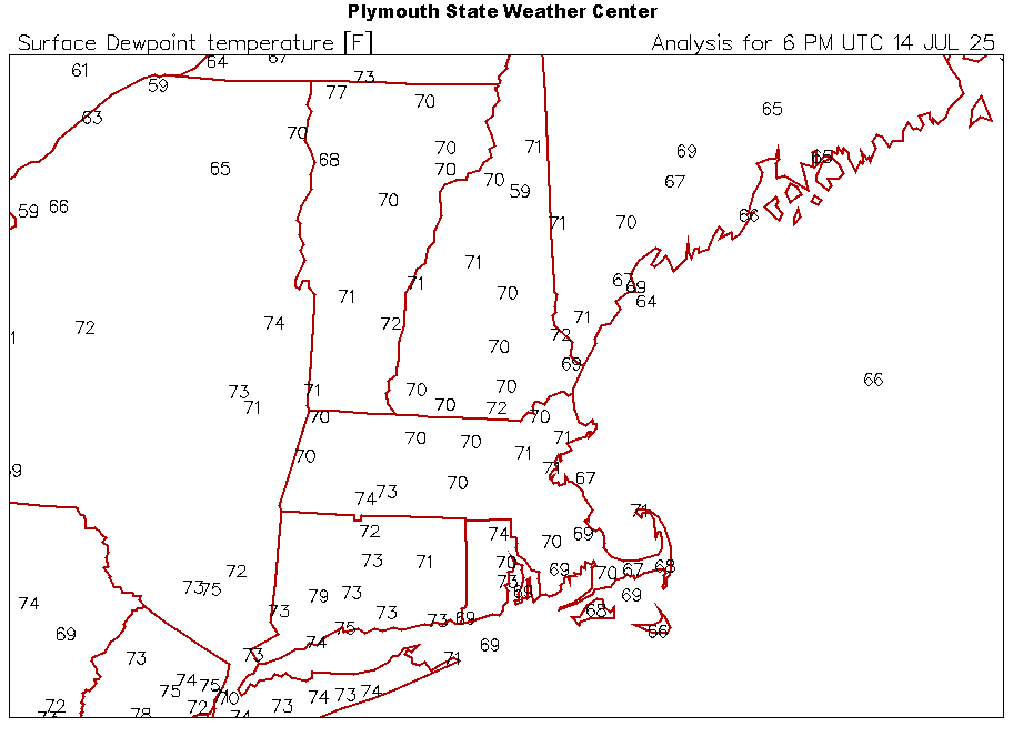
Running high for sure, my Davis after 1" of rain is only 74
Quite a bit of drift the last few months
-
1
-
-
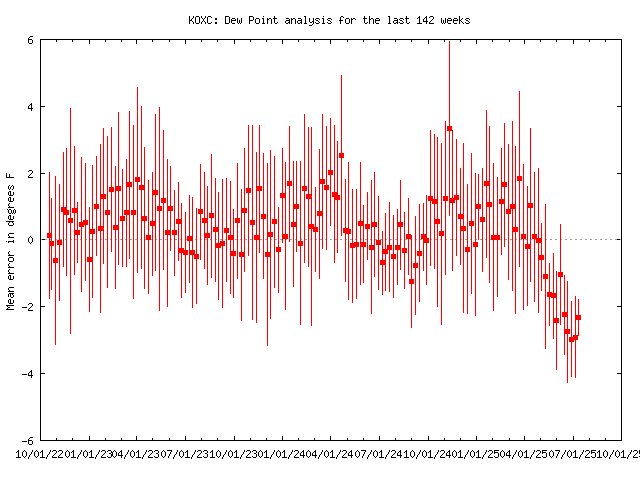
Toss those OXC dews for the foreseeable future.
-
8 minutes ago, weatherwiz said:
This is looking promising
Enjoy the daily rain and lightning.
-
1
-
-
24 minutes ago, RUNNAWAYICEBERG said:
LFG:
-
3
-
-
3 minutes ago, CoastalWx said:
Back broken

-
5
-
-
Just shocked. Shocked I tell you

-
2
-
-
Another ho-hum torched min.
68.3°
-
1
-
-
5 minutes ago, kdxken said:
Please, come to Boston for the summertime. Concord ain't your kind of town...
Cambridge 86, Southie 83, and Northeastern 83 today. Only a few seagulls live at Logan.
-
1
-
-
We have everything right now...skeeters, black flies, noseeums, deer flies, you name it. I think they may have mutated into a single optimus prime like species.
-
1
-
4
-
-
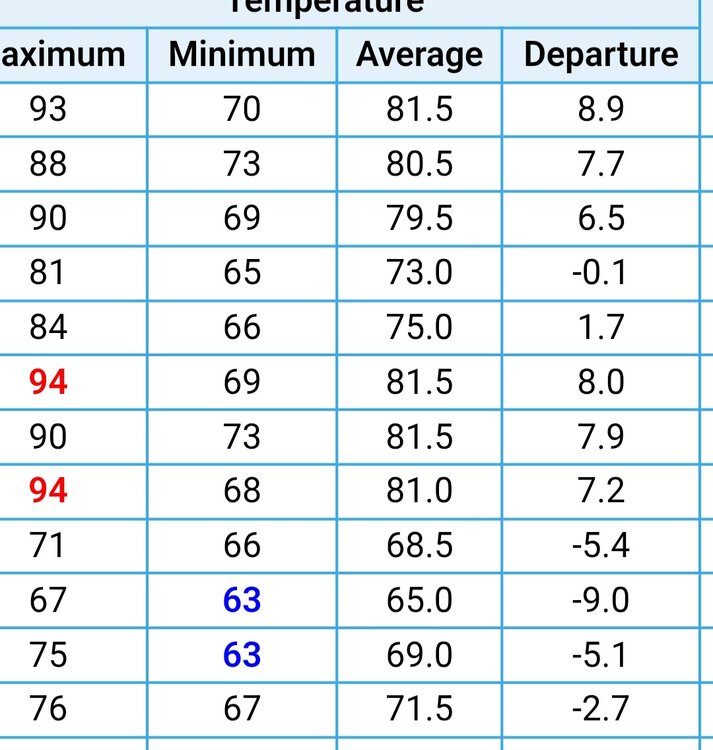
BDL has 2 days BN this month and that's with the sensor fixed. ORH and CON both with only 3.
CON had a min of 49F one day and the day was only a -4F :lol:. That goes to show how hard it is to get BN these days.
-
3 hours ago, jbenedet said:
Beautiful out. Wonderful cool breeze off the gulf of Maine.
I want days and days of this.
Sounds horrible. Glad we inland and 80s.

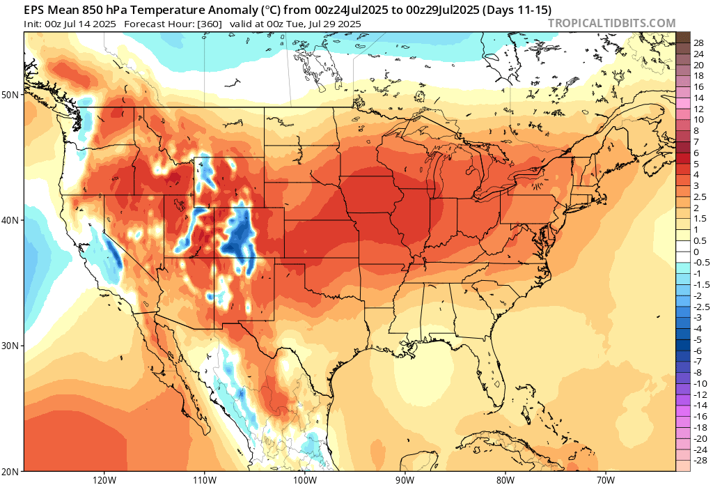

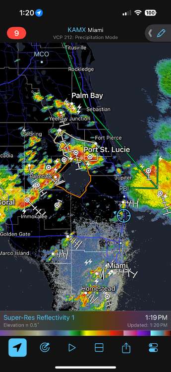
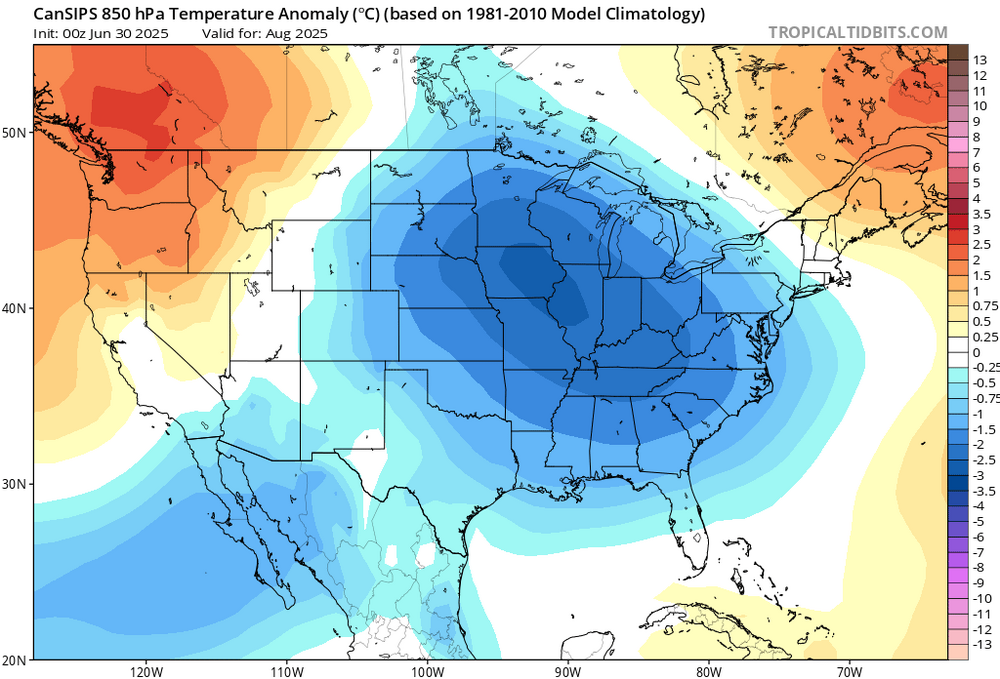
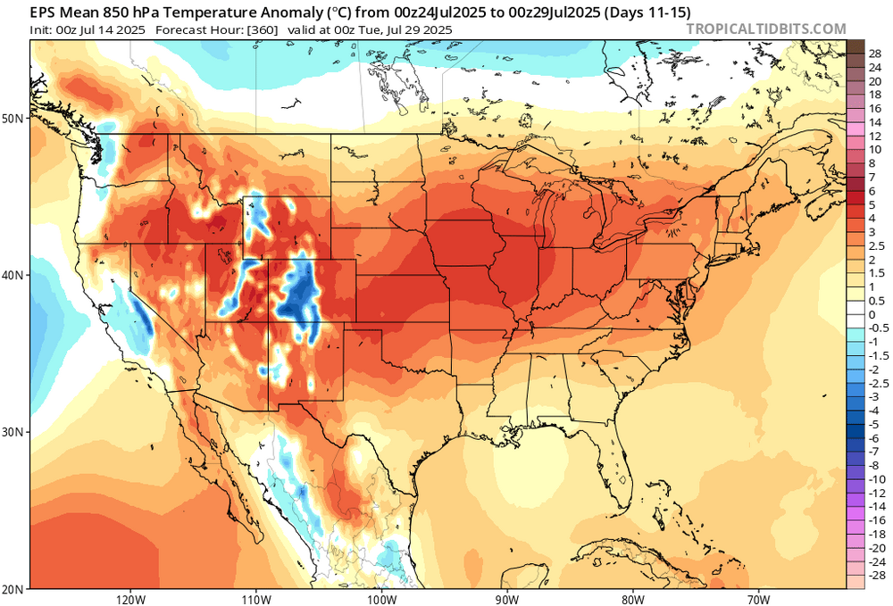
July 2025 Obs/Disco ... possible historic month for heat
in New England
Posted
I’m not sure I’ve seen my chickens eat a tick. They will devour the beetles like crack though.